Photo Interpretation Key
A Guide to Photo
Interpretation of the Florida Land Use, Cover and Forms Classification
Sytem (FLUCCS)
PREFACE
CREDITS USER GUIDE
Classification List - Links to the PI Key
Pages
* Classes marked with an asterisk are not used for classification in this
dataset.
*1000 URBAN AND BUILT UP
*1100
Residential, Low Density
1110
Fixed Single Family Units
1120 Mobile Home Units
1130
Mixed Units, Fixed and Mobile Home Units
1180 Rural Residential
1190 Low Density under
Construction
*1200
Residential, Medium Density
1210
Fixed Single Family Units
1220 Mobile Home Units
1230
Mixed Units, Fixed and Mobile Home Units
1290 Medium Density under Construction
*1300
Residential, High Density
1310
Fixed Single Family Units
1320 Mobile Home Units
1330 Multiple Dwelling Units, Low
Rise
1331 Duplexes
1332 Triplexes
1333 Quadraplexes
1334 Apartments
1335 Townhouses
1336 Patio Houses
1340
Multiple Dwelling Units, High Rise
1341 Apartments
1342 Townhouses
1343 Condominiums
1344 Mixed Units
1350
Mixed Units, Fixed and Mobile Home Units
1390 High Density under
Construction
1400
Commercial and Services
*1410
Retail Sales and Services
1411 Shopping
Centers
1412 Service Stations
1413 Banking Facilities
1414 Convenience Stores
1415 Restaurants
1416 Builder’s Supply
1417 Petroleum (Fuels)
1418 Mixed
*1420
Wholesale Sales & Services
1421 Warehouses
1422 Mini-Warehouses
1423
Wholesale Sales & Services - Junk Yards
1424 Farmers Markets
1425 Other
1430
Professional Services
*1440
Cultural and Entertainment
1441 Theaters
1442 Museums
1443 Open Air Theaters
1444 Amphitheater
1445 Amusement Parks
1446 Art Galleries
1447 Libraries
1448 Other
*1450 Tourist
Services
1451 Hotels
1452 Motels
1453 Travel Trailer
Parks
1454 Campgrounds
1455 Other
1460 Oil and Gas Storage - not
Industrial or Manufacturing
1461 Crude Oil
1462 High Octane Fuels
1463 Liquefied Gases
1464 Petroleum Fuels
1465 Motor Lubricants
1470 Mixed Commercial and Services
1480 Cemeteries
1490 Mixed Commercial and Services
under Construction
1500 Industrial
1510 Food
Processing
1511 Citrus
1512 Sugar
1513 Seafood
1514 Meat Packaging
1515 Poultry and Eggs
1516 Grains and Legumes
1520 Timber Processing
1521 Sawmills
1522 Plywood and Veneer
Mills
1523 Pulp and Paper
Mills
1524 Pole Peeler and
Treatment
1525 Wood Distillation
1526 Log Home
Fabrication
1527 Wood Yards
1530 Mineral
Processing
1531 Clays
1532 Phosphate
1533 Limerock
1534 Magnesia
1535 Heavy Minerals
1540 Oil
and Gas Processing
1541 Gasoline
1542 Jet Fuel
1543 Fuel Oil
1544 Liquefied Gases
1545 Asphalt
1550 Other
Light Industry
1551 Boat Building and Repair
1552 Electronics
Industry
1553 Furniture Manufacturers
1554 Aircraft Building and Repair
1555 Container
Manufacturers
1556 Mobile Home
Manufacturers
1560
Other Heavy Industrial
1561 Ship Building and Repair
1562 Pre-Stressed
Concrete Plants
1563 Metal Fabrication
Plants
1564 Cement Plants
1590
Industrial under Construction
1600 Extractive
1610 Strip mines
1620 Sand
and Gravel Pits
1630 Rock
Quarries
1640 Oil and
Gas Fields
1650 Reclaimed
Lands
1660 Holding Ponds
1700
Institutional
1710
Educational Facilities
1711 Universities or Colleges
1712 Vocational Schools
1713 High Schools
1714 Middle Schools
1715 Elementary
1720 Religious
1721 Parochial Schools
1722 Churches/Synagogues
Only
1730 Military
Installations
1731 Air Force
1732 Army
1733 Navy
1734 Marines
1735 Coast Guard
1736 National Guard
1740
Medical and Health Care
1741 Hospitals
1742 Nursing Homes
1743 Clinics
1750 Governmental
1751 City Halls
1752 Courthouses
1753 Police Stations
1754 Fire Stations
1755 Office Buildings
1756 Maintenance Yards
1757 Post Offices
1758 Other
1760 Correctional
1761 State prison
1762 Federal Prison
1763 Juvenile Centers
1764 Road Prisons
1765 Municipal Prisons
1770 Other
Institutional
1780
Commercial Child Care
1790
Institutional Under Construction
1800 Recreational
1810 Swimming
Beach
1820 Golf Course
1830 Race Tracks
1831 Automobile
1832 Horse
1833 Dog
1840
Marinas and Fish Camps
1841 Marinas (Basins)
1842 Fish Camps
1850 Parks and
Zoos
1851 City Parks
1852 Zoos
1860 Community Recreational
Facilities
1861 Baseball
1862 Basketball
1863 Football/Soccer
1864 Tennis
1870
Stadiums: Not Academic
1880
Historical Sites
1890 Other
Recreational
1891 Riding Stables
1892 Go-Cart Tracks
1893 Skeet Ranges
1894 Rifle/Pistol Ranges
1895 Golf Driving Ranges
1896 Other
1900 Open Land
1910
Undeveloped Land within Urban Areas
1920
Inactive Land with Street Pattern
1930
Urban Land in transition without activity indicators
1940 Other Open
Land
*2000 AGRICULTURE
*2100
Cropland and Pastureland
2110 Improved
Pastures
2120 Unimproved Pastures
2130 Woodland Pastures
2140 Row Crops
2150 Field Crops
2160 Mixed Crops
*2200 Tree Crops
2210 Citrus
Groves
2220 Fruit Orchards
2230 Pecan Groves
2240 Abandoned
Groves
2300 Feeding
Operations
2310
Cattle Feeding Operations
2320 Poultry Feeding Operations
2400
Nurseries and Vineyards
2410 Tree
Nurseries
2420 Sod Farms
2430 Ornamentals
2500 Specialty
Farms
2510 Horse Farms
2520 Dairies
2540 Aquaculture
*2600
Other Open Lands - Rural
2610 Fallow
Cropland
*3000 UPLAND NONFORESTED
3100
Herbaceous (Dry Prairie)
3200 Upland Shrub and Brushland
3220 Coastal
Shrub
3300 Mixed
Rangeland
*4000 UPLAND FORESTED
4100
Upland Coniferous Forests
4110 Pine
Savannah
4200
Upland Hardwood Forest
4280 Cabbage Palm
*4300
Upland Hardwood Forests, Continued
4340
Hardwood - Conifer Mixed
4400 Tree
Plantations
4410
Coniferous Plantations
4420 Hardwood Plantations
4430 Forest Regeneration Areas
*5000 WATER
*5100
Streams and Waterways
5110
Natural River, Stream, Waterway
5120 Channelized Waterways,
Canals
5200 Lakes
5210 Lakes larger than 500 acres
5220 Lakes larger than 100 acres
5230 Lakes larger than 10 acres
5240 Lakes less than 10
acres
5300 Reservoirs
5310 Reservoirs larger than 500 acres
5320 Reservoirs larger than 100 acres
5330 Reservoirs larger than 10 acres
5340 Reservoirs less
than 10 acres
*5400 Bays and Estuaries
5410
Embayments Opening Directly to Gulf or Mobile Bay
5420 Embayments Not Opening
Directly to Gulf or Mobile Bay
5430 Enclosed Salt Water Ponds
Within Salt Marsh
*5700 Bay and
Gulf
5710 Gulf of
Mexico
5720 Mobile Bay
*6000 WETLANDS
6100
Wetland Hardwood Forests
6110 Bay Swamps
6170 Mixed Wetland Hardwoods
6200
Wetland Coniferous Forest
6210 Cypress
6250
Wet Pinelands Hydric Pine Flatwoods
6300
Wetland Forested Mixed
*6400 Vegetated Non-Forested
Wetlands
6410
Freshwater Marshes / Graminoid Prairie - Marsh
6420
Saltwater Marshes / Halophytic Herbaceous Prairie
6430 Wet Prairies
6440 Emergent Aquatic Vegetation
6500
Non-Vegetated Wetland
6510 Tidal Flats
6530
Intermittent Ponds
*7000 BARREN LAND
7100
Beaches Other Than Swimming Beaches
7200
Sand Other Than Beaches
7300 Exposed Rock
7400 Disturbed Land
7420 Borrow Areas
7430 Spoil Areas
*8000 TRANSPORTATION,
COMMUNICATION & UTILITIES
8100
Transportation
8110 Airports
8120
Railroads and Railyards
8140 Roads and Highways
8150 Port Facilities
8200
Communications
8300 Utilities
8310
Electrical Power Facilities
8320 Electrical Power
Transmission Lines
8330 Water Supply Plants -
Including Pumping Stations
8340 Sewage Treatment
8350 Solid Waste Disposal
8360 Other Treatment Ponds
MODIFIERS
Vegetation
Modifiers
Impact Modifiers
Species Modifiers
Preface
GUIDE TO
USING THIS WEB PAGE
Users can
access the "Classification System" page, point and click on a
selected code and access the "FLUCCS Photointerpretation Key" page
which describes the selected code.
Aerial
images were clipped from the original digital imagery used for the
photointerpretation. These Digital Ortho Quadrangle (DOQ) image clips are
displayed on each key page. Ground level field pictures, representing each
classification type, are also included on each key page.
Each FLUCCS
Photointerpretation Key page describes a unique FLUCCS code. The following
sections are included on each page of the key:
- CLASSIFICATION CODE: Indicates the entire
four-digit FLUCCS code as applied during photointerpretation.
- LEVEL: Lists each level within the
four-digit FLUCCS code.
- DESCRIPTION: This is the description of
the classification code as it is used by Baldwin County in this dataset.
Classification codes are based on the Florida Land Use, Cover, and Forms
Classification System; Department of Transportation, State Topographic
Bureau, Thematic Mapping Section; January 1999 Edition. They are
modified as needed by the County to meet their mapping objectives.
- KEYS TO
PHOTOINTERPRETATION: These are descriptions which
consist of the typical characteristics of each class. Features which are
associated with the class and which are visible on the imagery are
described. The apparent signature (colors, tones, textures, etc.) of the
class on the imagery may be described as well as its typical location
within the landscape.
- CONTEXT: This section describes the
context within which each class is typically found. It briefly describes
(where applicable) one or more of the following characteristics: Landscape
Position, Vegetation, Soils, and Hydrology.
- SIMILAR CLASSES: Other FLUCCS classes which
may share one or more of the same characteristics as the classification
code being described are indicated in this section.
- SPECIAL MAPPING CONVENTIONS: Describes the
photointerpretation or mapping rules established to address the
particular classification code. This section also describes differences
between the original FLUCCS system, as defined by the Department of
Transportation (DOT), and the Baldwin County system, which has been
modified from the original DOT system.
- DUAL CODING CONVENTIONS: This section describes the
Land Cover/Land Use code combinations as applied to each class.
Generally, the Land Cover code (LCCODE) and the Land Use code (LUCODE)
are the same. However, instances where they are different are noted
here.
Note: There are also PI Key pages
for MODIFIERS: These are added to LCLU codes to denote types of vegetation
or impact that are not classified under a particular FLUCCS code.
BACK TO CLASSIFICATION LIST
*1000 URBAN AND BUILT UP
Urban and Built-Up - FLUCCS Code 1000
This Level 1 class is not
used in the actual map - a more specific subclass must be selected. The Level 2
subclasses are:
1100 Residential, Low Density
1200 Residential, Medium Density
1300 Residential, High Density
1400 Commercial and Services
1500 Industrial
1600 Extractive
1700 Institutional
1800 Recreational
1900 Open Land
The following is a general
description that applies to all the classes in the 1000 category.
Background: Included in this very general
category are cities, towns, villages, residential developments, malls, shopping
centers, industrial and commercial complexes, institutions and mining
operations. Some of the 1000 categories are not truly urban in nature- in
particular, the Extractive, or mining classes. But all of the 1000 classes
define the land use, as opposed to cover. In several of the classes
(1180, 1650, 1670, 1900 and 1920) a separate land cover code must also be
assigned to each polygon.
The Urban and Built-Up
classes are Land Use classes. For most of the 1000 classes
the land use takes precedence when the criteria for more than one class are
met. For example, residential areas that have sufficient tree canopy cover to
satisfy the 4200 Upland Forest criteria will still be classified
as Residential, not forest. The exception to this is with 1180 Rural
Residential, for which a land cover code is also required.
Residential land uses range
from high-density urban housing developments to low-density rural areas. The
variation extends from the multi-family apartment complexes generally located
in larger urban centers to single-family houses with lot sizes of more than two
acres.
MAPPING CONVENTIONS:
If a residential area is
under construction and the ultimate land use is discernible, it should be
classified as 1190, 1290, or 1390, depending on density. For example, a
medium density residential development under construction should be coded 1290.
If other built-up land uses (1500 through 1800) are under construction, they
are classified as though the construction were complete. The exception to this
rule is 1490 Commercial and Services Under Construction, which is classified
separately.
Minimum mapping units: The minimum mapping unit
(MMU) for all uplands classes, including the 1000 class, is 1 acres.
Differentiating
subclasses:
Residential classes are differentiated based on the average density of
dwellings in each mapping unit. It is not the intent of this map to
precisely break out every possible change in density - rather, a reasonable
grouping of homogeneous properties into larger mapping units is required.
Many of these polygons will include some dwellings with larger or smaller
acreage, but the density is based on an average. Note that property boundaries
are not visible on photography, and groupings are to some extent arbitrary.
Photointerpreters (PI's) attempt to delineate the polygons to be as non-linear
and compact in shape as possible. This produces a useable model of
the landscape without excessive complexity. For higher resolution maps of
land use the county parcel maps should be used.
The drawing below
illustrates how the residential classes are differentiated by density. Note
that the relationship is far from linear. The top numbers indicate the
number of dwellings per acre, while the lower numbers indicate the acreage per
dwelling.
Notes on differentiating subclasses for
the other built-up categories are included in the general descriptions for
1400, 1500, 1600, 1700, and 1800.
Dual coding
convention: All
of the 1000 classes are Land Use classes. The LUCODE and the LCCODE are
the same except for the following, which require a separate Land
Cover code: 1180 Rural Residential, 1650 Reclaimed Mine Land, 1670 Abandoned Mine Land, 1900 Open Land, and 1920 Inactive Land with Street Pattern.
SIMILAR CLASSES:
Classes in the Urban and
Built-Up categories can be confused with those from other categories. The
definitions have been constructed with the intention that only one set of Land
Cover and Land Use codes should fit for any given location. See the
notes under "Similar Classes" in each of the individual PI keys to
help resolve potential conflicts.
Residential sections may
occur as components of other land uses, such as institutions, farms, parks,
airports and businesses. In those cases the dwellings are usually
included in the surrounding use rather than coded as residential For
example, in the Institutional category residential units may be found on
military bases in the form of barracks, apartments, dormitories or homes and on
college and university campuses in the form of apartments and dormitories in
close proximity to instructional buildings. Agricultural field operations and
resort facilities commonly provide temporary lodging for their employees and
these areas should be classified under Agriculture and Commercial and Services
respectively. Look to specific PI keys for guidance in each case.
BACK TO CLASSIFICATION LIST
*1100 Residential, Low Density
Residential, Low Density - FLUCCS Code 1100
This Level 2 class is
not active in the map itself - a more specific subclass must be selected.
The subclasses include:
1110 Fixed Single Family
Units
1120 Mobile Home Units
1130 Mixed Units, Fixed and Mobile Home Units
1180 Rural Residential
1190 Low Density, Under Construction
For details on each active
subclass, see the respective PI Key description. The following general
description applies to all subclasses.
Background: The 1100 class is reserved for Low
Density Residential areas that have from 1/2 to 2 acres for each dwelling unit
and areas with parcels averaging more than 2 acres per dwelling, which are
classified as 1180 Rural Residential.
Areas of very low intensity
residential land use (over five acres per dwelling), such as farmsteads will be
incorporated into the surrounding land use, and the residential component
ignored. Mapping units that have less than five acres per dwelling are
considered residential, even though forest or open areas may be present.
Boundaries between new
housing developments and agricultural areas tend to be distinct. Conversely,
the boundaries may be vague and difficult to discern in areas with mixed or
rural land uses when housing develops in smaller isolated units over an
extended period of time. Polygon boundaries are determined by average housing
densitites and the relationship to the total urban complex.
Low Density Residential
areas can be found throughout the County. They are often located in newly
established sections of large urban areas or on the urban-rural fringe.
MAPPING CONVENTIONS:
Minimum mapping units: The minimum mapping unit is
always 1 acre for the 1100 classes.
Differentiating
subclasses:
The specific types of residential areas that are 1100 subclasses are not
difficult to differentiate from each other. See the respective PI Key pages for
more detailed information.
The drawing below
illustrates how the residential classes are differentiated by density. Note
that the relationship is far from linear. The top numbers indicate the number
of dwellings per acre, while the lower numbers indicate the acreage per
dwelling.
Dual coding
convention: All
1100 classes are land use classes that do not require separate land cover
coding except 1180 Rural Residential. The LUCODE 1180 always
requires a different LCCODE.
SIMILAR CLASSES:
Some Residential classes
may be confused with classes in other categories such as 1400 Commercial and
Services. The individual PI key pages provide details about how to
differentiate these similar classes.
For those areas that have a
mixture of residential and other such uses, where each land use is below MMU
criteria, the PI must determine the predominant use and code accordingly.
For more information:
See the PI keys for each of
the subclasses for more details and graphic examples.
BACK TO CLASSIFICATION LIST
1110 Fixed Single Family Units
1110 - Fixed Single Family Units
LEVEL 1: 1000 Urban and Built-Up
LEVEL 2: 1100 Residential, Low Density - less than two
dwelling units per acre
LEVEL 3: 1110 Fixed Single
Family Units
DESCRIPTION:
Mixed single-family
structures are usually easily identified by their sizes, shapes, and the
character of the associated developed area. Residential areas include the main
houses, garages and other out-buildings, and the developed portions of the lot
(lawns, gardens, mowed areas, fenced land, drives and paths, etc.). In some areas
swimming pools are common, usually appearing as small flat rectangles, dark in
tone on CIR film (unless not filled with water -- in which case they often
appear light blue). Structures are commonly rectangular, ranging from 25' x 40'
in size to 60' x 60'. Structures smaller or larger than this, but having
general residential characteristics must be closely examined. Barns and sheds
are usually distinguished from houses by their locations away from a main road,
and by having few breaks in the roof line. Older structures are often
differentiated by referring to a topographic map, where dwellings are shown as
solid, while barns are open rectangles.
In poor rural areas, debris
is noticeable around the houses and roof materials may be light-toned on one
part of the house and dark-toned on another. Houses with dark roofs may be
missed altogether due to significant tree cover; look for driveways and other
signs of activity. Lawns and woody vegetation are dark magenta on winter CIR
photography if the leaf area index is high; as vegetation becomes sparser, soil
tones appear and the magenta fades to a light grayish-pink. Bare dry soil shows
greenish-gray tones. Clay tile roofs also show greenish-gray tones, which may
cause the interpreter to miss houses with clay tile roofs against a background
of bare or nearly-bare soil.
Older subdivision
developments are most often low-density areas, with a regular, rectilinear
pattern of rectangular lots fronting the subdivision streets. Houses are
usually set in the middle or toward the rear of the lot. Densities generally
range from 1.0 D.U. per acre (1-acre lots) to 0.1 D.U. per acre (10-acre lots)
or less. This category also includes the estates of wealthy landowners, where
the developed portion of the lot includes employee residences as well as a
considerable amount of natural vegetation. In wealthier areas, what were once
large single-family structures may have been converted into group residences or
trade/service establishments (e.g., a small, private school). Typically, automobile
parking areas associated with these converted structures are much larger than
parking areas for private residences.
Areas of very low-density
housing (between 2 and 5 acres for each dwelling), which may include some
amount of woodland, grassland, or orchard) are classified as 1180 Rural
Residential if the primary use is residential (e.g., suburban
"ranchettes").
KEYS TO
PHOTOINTERPRETATION:
Relatively small buildings, with garages and driveways present.
Large yards and open areas between houses, with pools and other outdoor
structures.
Well watered or maintained lawns, with a moderate amount of trees and
shrubs.
Absence of large parking areas or large structures.
CONTEXT:
Landscape Position - Dwellings of this density can be found
throughout the County. They are often located in newly-established sections of
large urban areas, or on the urban-rural fringe. In exurban areas these
structures tend to aggregate as linear "strip developments" along
roads or shorelines; they are mapped as residential areas when
residential structures predominate. With increasing densities in peri-urban
areas, sub- division and street patterns are encountered in housing
developments (or "housing estates"); very few non-residential uses
occur in these denser areas.
SIMILAR CLASSES:
1180 Rural Residential - residential density is 2 to 5 acres per dwelling unit
SPECIAL MAPPING
CONVENTIONS:
The polygon boundary should
encompass the active residential area, corresponding to the "operational
boundary" of Commercial or Industrial land uses. Non-residential features
should be excluded, to the extent practicable, from this polygon. Open
areas, such as pastures and forests, that are adjacent to the residential area
should be classed with the land cover value, and not dual-coded. All
features that are inside the residential area are coded 1110, including
gardens, lawns, fields, pools, stables, garages, out-buildings, etc.
Polygon boundaries may not necessarily coincide with ownership boundaries.
The PI is not required to replicate collateral property data, and should err on
the side of land cover and environmental function.
Priority classes such as
water bodies, wetlands, golf courses and cemeteries are always broken out if
they meet minimum size criteria.
Dual coding convention: This is a Land Use
class. The LUCODE and LCCODE are the same. A separate land cover code is not
required.
DOQQ Image
Field Picture
BACK TO
CLASSIFICATION LIST
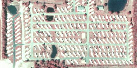
1120 Mobile Home Units
1120
- Mobile Home Units
LEVEL 1: 1000 Urban and Built-Up
LEVEL 2: 1100 Residential, Low Density
LEVEL 3: 1120 Mobile Home
Units
DESCRIPTION:
Mobile homes are rectangular and
light-toned, from 8' to 12' wide and 30' to 50' long.
They may or may not be on permanent foundations. Any similar structure less
than 30' long and 8' wide is assumed to be a travel trailer. In some
cases, pull-out sections and awnings alter the basic rectangular shape,
although the flat-roofed, rectangular body is still evident upon close
inspection.
Mobile home parks (or areas of at
least five acres) where each unit occupies a lot of over 0.5 acre are
relatively rare. Mobile home parks are usually developed as medium- and
high-density areas, with the units usually arranged as regular arrays with
their narrow dimension fronting the streets. At high densities, very
closely-spaced units may be placed at an angle to the street.
New mobile-home parks appear very
similar to new high-density fixed-unit single-family developments, including
the use of storm-drainage ponds as water bodies integral to the development.
The mobile homes, as a group, will show narrower, more rectangular shapes.
Mobile home parks often have
associated storage areas for use by park residents for boats and travel
trailers/campers/RVs. These storage areas should be mapped with the park. If
ponds and storm water retention areas are present and can be connected to
create a two acre or greater area, then these water bodies are mapped as 5300
Reservoirs.
A mobile home sales lot could be
mistaken for a mobile home park unless it is noted that the mobile homes are
much closer together and parked in a much more regular pattern in a sales lot
than in a mobile home park. The sales lot will show no signs of landscaping.
Groups of travel trailers may be parked closely together in these sales lots,
too. The interpreter should also beware of office trailers parked at or near
construction sites.
KEYS TO PHOTOINTERPRETATION:
Relatively small buildings
Narrow, rectangular shapes
Distinctive, regular pattern clearly distinguished from surrounding uses
CONTEXT:
Landscape Position - Mobile home residential areas are found
almost anywhere that fixed-unit single-family residential areas are found. They
occur in rural areas, at the urban fringe (often as infill among older,
lower-density residential areas), and in medium- and high-density residential
areas (often either adjacent to or incorporated within the newer subdivision
developments or "housing estates"). In most instances, mobile home
areas have clear boundaries which abut other residential areas, open areas,
agricultural areas, limited-access highways, and large water bodies
SIMILAR CLASSES:
1110 Fixed Single Family Units - these will generally be larger structures
SPECIAL MAPPING CONVENTIONS:
This class should only be used for
areas of less than 2 mobile home units per acre.
The polygon boundary should
encompass the active mobile home area, corresponding to the "operational
boundary" of commercial or industrial land uses. Non-residential features
should be excluded, to the extent practicable, from this polygon. All
features that are inside the mobile home area are coded 1120, including
gardens, lawns, fields, pools, garages, out-buildings, etc.
Priority classes such as water
bodies and wetlands are always broken out if they meet minimum size criteria.
Dual coding convention: This is a Land Use
class. The LUCODE and LCCODE are the same. A separate land cover code is not
required.
DOQQ Image
BACK TO
CLASSIFICATION LIST
1130 Mixed Units, Fixed and Mobile Home Units
1130
- Mixed Units, Fixed and Mobile Home Units
LEVEL 1: 1000 Urban and Built-Up
LEVEL 2: 1100 Residential, Low Density
LEVEL 3: 1130 - Mixed
Units, Fixed and Mobile Home Units
DESCRIPTION:
The description and keys to
interpretation for mobile homes and fixed-units at the three different
densities have been covered in the class descriptions for each type.
These "Mixed Units"
classes will be used when: (1) there is a consistent mixture of both types of
units; and (2) the only way possible to meet the five-acre minimum requirement
for a residential area is by mixing both types of units.
KEYS TO PHOTOINTERPRETATION:
Fixed and Mobile Home Units appear intermixed
Separate delineation would result in linear or overly complex polygons
Separate delineation would result in polygons below the Minimum Mapping
Unit (1 acre).
CONTEXT:
Landscape Position - In exurban areas these structures tend to
occur scattered among fixed-unit single-family detached structures in linear
"strip developments", either along highways or fringing water bodies.
They also occur in suburban areas as small sites set aside for mobile homes
within a large high-density subdivision of fixed-unit single-family units.
SIMILAR CLASSES:
1110 Fixed Single Family Units - dominated by fixed dwelling
1120 Mobile Home Units - dominated by mobile homes
SPECIAL MAPPING CONVENTIONS:
The polygon boundary should
encompass the active residential area, corresponding to the "operational
boundary" of commercial or industrial land uses. Non residential features
should be excluded, to the extent practicable, from this polygon. Open
areas, such as pastures and forests, that are adjacent to the residential area
should be classed with the land cover value, and not dual-coded. All
features that are inside the residential area are coded 1130, including
gardens, lawns, fields, pools, stables, garages, out-buildings, etc.
Polygon boundaries may not necessarily coincide with ownership
boundaries. The PI is not required to replicate collateral property data, and
should err on the side of land cover and environmental
function.
Priority classes such as water
bodies, wetlands, golf courses and cemeteries are always broken out if they
meet minimum size criteria.
Dual coding convention: This is a Land Use
class. The LUCODE and LCCODE are the same. A separate land cover code is not
required.
DOQQ Image
BACK TO
CLASSIFICATION LIST
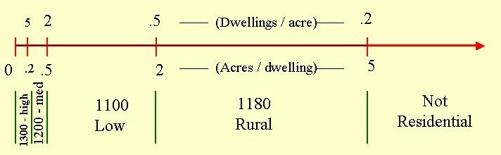
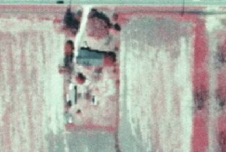
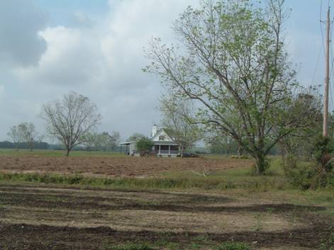
1180 Rural Residential
1180
- Rural Residential
LEVEL 1: 1000 Urban and Built-up
LEVEL 2: 1100 Residential, Low Density - less
than two dwelling units per acre
LEVEL 3: 1180 Rural
Residential
DESCRIPTION:
This new subclass of 1100 is a Baldwin County addition to the FLUCCS system.This
classification refers to farmsteads and isolated residences in rural areas
whose property area meets the 1 acre minimum mapping unit.
Housing may be mixed in with
other land covers and uses with no clear spatial pattern. Boundaries may
not be distinct.
KEYS TO PHOTOINTERPRETATION:
Isolated rural residences typically associated with agricultural areas.
Open or natural areas are patchy and too small (<2 acres) to be
broken out separately from dwellings.
Open areas reflect activities (cutting, digging, grazing, fencing) of
many small landowners in close proximity. There may be a lack of general
pattern or order.
Large parking areas or pavement are typically absent.
CONTEXT:
Landscape Position - Dwellings of this density can be found
throughout the County, mostly in a rural context, or on urban-rural fringes.
SIMILAR CLASSES:
1110 Fixed Single Family Units
- will have more of a 'neighborhood' appearance, not rural.
2000, 4000 - Agricultural or Forested areas usually show a broad spatial
pattern related to the landform, vegetation or cropping.
SPECIAL MAPPING CONVENTIONS:
1180 is an Baldwin County modification to the FLUCCS system.
The lowest density FLUCCS class is 1100 Residential Low Density, with over 1/2
acre per dwelling.
The polygon boundary should
encompass the active residential area. All features that are inside the
residential area are coded 1180, including gardens, lawns, fields, pools,
stables, garages, out-buildings, etc. Polygon boundaries may not
necessarily coincide with ownership boundaries. The PI is not required to
replicate collateral property data, and should err on the side of
capturing land cover and environmental function.
Priority classes such as water
bodies, wetlands, golf courses and cemeteries are always broken out if they
meet minimum size criteria.
Dual coding convention: This is a Land Use
class. A separate Land Cover code is always required.
DOQQ Image
Field Picture
BACK TO
CLASSIFICATION LIST
1190 Low
Density Under Construction
1190
- Low Density Under Construction
LEVEL 1: 1000 Urban and Built-up
LEVEL 2: 1100 Residential, Low Density - less
than two dwelling units per acre
LEVEL 3: 1190 Low Density
Under Construction
DESCRIPTION:
This class refers to low density
residential areas that are in the process of construction. When completed
they will be placed in the 1100 class, with more than 1/2 and less than 2
acres per dwelling. The existing infrastructure and construction at time
of photography indicate the intended pattern and density, and show that the
development is likely to be completed. Some of the dwellings are usually
present already. If more than two thirds (67%) of the area is constructed, and
work is in progress, the area should be coded with the appropriate Level 3
code, as though complete.
Future construction may be fast or
slow - there is no time limit set on completion. However,
if the in-fill process is indefinitely stalled, the code 1920
Inactive Land with Street Pattern is used
instead. Progress is indicated by cleared, un-vegetated areas, construction
equipment, infrastructure such as roads, driveways and utilities, and by
surrounding patterns of land use.
KEYS TO PHOTOINTERPRETATION:
Infrastructure such as roads, driveways, utilities is present.
The infrastructure shows the intended street patterns and housing
density for most of the delineated area.
Space for houses, roads, utilities, has been cleared, leaving a bright
(unvegetated) signature.
Surrounding land uses show growth is occurring. This may include
new schools and malls, new or expanded roads, and other changes.
CONTEXT:
Landscape Position - Dwellings of this density can be found
throughout the County. They are often located in large urban areas, or on the
urban-rural fringe.
SIMILAR CLASSES:
1290 Medium Density Under Construction
- 2 to 5 dwellings per acre
1110 Fixed Single Family Units - no evidence of current construction apparent
1920 Inactive Land With Street Patterns but without structures - no evidence of
current construction apparent
SPECIAL MAPPING CONVENTIONS:
Housing may be in a pre-construction
state, with development appearing imminent - one indication is prepared
lands adjacent to newly built subdivisions. Surrounding development densities
may be used as a guide to assign appropriate density (1190, 1290, or 1390);
however 1190 may be used as the default in areas in which it is impossible to
determine the ultimate density. Areas that have had no recent activity, or are
indefinitely stalled, should be coded 1920 - Inactive Land With Street Patterns
but without structures.
In transitional areas where species
specific wetland and upland polygons are below the appropriate MMU some
aggregation may be justified. In these cases intermixed community classes will
be assigned and mapped at a larger unit.
Dual coding convention: This is a Land Use
class. The LUCODE and LCCODE are the same. A separate land cover code is not
required.
DOQQ Image
BACK TO
CLASSIFICATION LIST
*1200 Residential, Medium Density
Residential, Medium Density - FLUCCS Code 1200
This Level 2 class is not
active in the map itself - a more specific subclass must be selected. The
subclasses include:
1210 Fixed Single Family
Units
1220 Mobile Home Units
1230 Mixed Units, Fixed and Mobile Home Units
1290 Low Density, Under Construction
For details on each active
subclass, see the respective PI Key description. The following general
description applies to all subclasses.
Background: The 1200 class is reserved for
Medium Density Residential areas that have from 2 to 5 dwelling units per acre.
Rural and recreational
types of subdivisions will be included in the Residential category since this
land is almost entirely committed to residential use even though forest or open
areas may be present also.
Boundaries between new
housing developments and agricultural areas tend to be distinct. Conversely,
the boundaries may be vague and difficult to discern in areas with mixed or
rural land uses when housing develops in smaller isolated units over an
extended period of time. Polygon boundaries are determined by average housing
density and the relationship to the total urban complex.
Dwellings of this density
can be found throughout the County. They are often located in large urban areas
or on urban-rural fringe.
MAPPING CONVENTIONS:
Minimum mapping units: The minimum mapping unit is
always 1 acre for the 1200 classes.
Differentiating
subclasses:
The specific types of residential areas that are 1200 subclasses are not
difficult to differentiate from each other. See the respective PI Key pages for
more detailed information.
The drawing below
illustrates how the residential classes are differentiated by density. Note
that the relationship is far from linear. The top numbers indicate the number
of dwellings per acre, while the lower numbers indicate the acreage per
dwelling.
Dual coding
convention: All
1200 classes are Land Use classes. The LUCODE and LCCODE are always the
same. A separate land cover code is not required.
SIMILAR CLASSES:
Some Residential classes
may be confused with classes in other categories such as 1400 Commercial and
Services. The individual PI key pages provide details about how to
differentiate these similar classes.
For those areas that have a
mixture of residential and other such uses, where each land use is below MMU
criteria, the PI must determine the predominant use and code accordingly.
For more information:
See the PI keys for each of
the subclasses for more details and graphic examples.
BACK TO CLASSIFICATION LIST
1210 Fixed Single Family Units
1210
- Fixed Single Family Units
LEVEL 1: 1000 Urban and Built-Up
LEVEL 2: 1200 Residential, Medium Density - two to
five dwelling units per acre
LEVEL 3: 1210 Fixed Single Family
Units
DESCRIPTION:
Two to five single-family structures
per acre meet density requirements for this class. Fixed single-family
structures are usually easily identified by their sizes, shapes, and character
of the associated developed area. Structures range from square, 50' x 50', to
rectangular, 25' x 40', or somewhat smaller. The roof area appears to cover
less than half of the lot area.
The overall pattern of many of these
areas is an open mosaic of light-roofed structures against a magenta background.
The mosaic may be a regular, rectilinear array of roofs, or a curving pattern,
with streets readily visible within the pattern. When ponds or lakes are
integral to the subdivision, if the water is connected by canal to navigable
waterways, many of the waterfront lots will have piers, and boats will be
docked there. If canals are present and connected to another water body, they
would be mapped as 5120 Channelized River, Stream, Waterway. If ponds and
storm water retention areas are present and can be connected to create a two
acre or greater area (minimum wetland mapping unit), then these water bodies
are mapped as 5300 Reservoirs.
In some areas swimming pools are
common, appearing either as small flat rectangles or small elevated, circular
tanks, usually dark in tone on CIR unless not filled with water. (Swimming
pools may appear light blue if dry.) The area of the house lot not covered by
the roof is usually light magenta (grass) or dark magenta (shrubs). The roofs
cast deep black shadows. (Skylight reflected from shaded areas is not caught on
CIR film.) Roofs are generally white or light-toned.
Occasionally a dark-toned roof
occurs. These, or roofs with irregular outlines, combined with the black
shadows and the occasional black-toned swimming pool or evergreen shrub, can
create a somewhat confusing image. If the interpreter gives such an area a
cursory glance, some of the houses may be "lost" in the background
"noise", giving the area lower apparent density than the actual density.
KEYS TO PHOTOINTERPRETATION:
Relatively small buildings, with garages and driveways present.
Large yards and open areas between houses, with pools and other outdoor
structures.
Well watered or maintained lawns, with a moderate amount of trees and
shrubs.
Absence of large parking areas or large structures.
CONTEXT:
Landscape Position - Medium-density housing areas occur within
urban and suburban areas- anywhere that sub-division or urban street patterns
are encountered; very few non- residential uses occur in medium-density
fixed-unit single-family housing areas. Newer subdivision developments or
"housing estates" commonly occur at the urban fringe, often as infill
among older residential areas. New medium-density developments generally have
clear boundaries abutting lower-density residential areas, agricultural areas,
limited-access highways, or large water bodies. They may surround golf courses
and include other recreational amenities. However, many residential areas
within older urban lands are also medium-density. Here, boundaries may be vague
and difficult to discern when development is sporadic and occurs in isolated
units over an extended period of time, especially in areas which abut mixed
land uses.
SIMILAR CLASSES:
1110 Fixed Single Family Units - Some Low Density Residential areas may appear
similar.
1310 Fixed Single Family Units - Some High Density Residential areas may appear
similar.
SPECIAL MAPPING CONVENTIONS:
The polygon boundary should
encompass the active residential area, corresponding to the "operational
boundary" of commercial or industrial land uses. Non residential features
should be excluded, to the extent practicable, from this polygon. Open
areas, such as pastures and forests, that are adjacent to the residential area
should be classed with the land cover value, and not dual-coded. All
features that are inside the residential area are coded 1210, including
gardens, lawns, fields, pools, stables, garages, out-buildings, etc.
Polygon boundaries may not necessarily coincide with ownership
boundaries. The PI is not required to replicate collateral property data, and
should err on the side of land cover and environmental
function.
Priority classes such as water
bodies, wetlands, golf courses and cemeteries are always broken out if they
meet minimum size criteria.
Dual coding convention: This is a Land Use
class. The LUCODE and LCCODE are the same. A separate land cover code is not
required.
DOQQ IMAGE
BACK TO CLASSIFICATION LIST
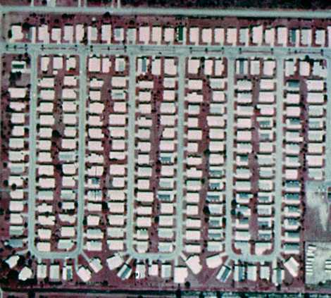
1220 Mobile Home Units
1220
- Mobile Home Units
LEVEL 1: 1000 Urban and Built-Up
LEVEL 2: 1200 Residential, Medium Density
LEVEL 3: 1220 Mobile Home
Units
DESCRIPTION:
Mobile homes are rectangular and
light-toned, from 8' to 12' wide and 30' to 50' long.
They may or may not be on permanent foundations. Any similar structure less
than 30' long and 8' wide is assumed to be a travel trailer. In
some cases, pull-out sections and awnings alter the basic rectangular shape,
although the flat-roofed, rectangular body is still evident upon close
inspection.
Mobile home parks (or areas of at
least five acres) where each unit occupies a lot of over 0.5 acre are
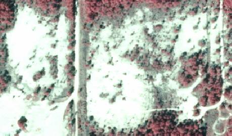
relatively rare. Mobile home parks are usually developed as medium- and
high-density areas, with the units usually arranged as regular arrays with
their narrow dimension fronting the streets. At high densities, very closely-spaced
units may be placed at an angle to the street.
New mobile-home parks appear very
similar to new high-density fixed-unit single-family developments, including
the use of storm-drainage ponds as water bodies integral to the development.
The mobile homes, as a group, will show narrower, more rectangular shapes.
Mobile home parks often have
associated storage areas for use by park residents for boats and travel
trailers/campers/RVs. These storage areas should be mapped with the park. If
ponds and storm water retention areas are present and can be connected to
create a two acre or greater area, then these water bodies are mapped as 5300
Reservoirs.
A mobile home sales lot could be
mistaken for a mobile home park unless it is noted that the mobile homes are
much closer together and parked in a much more regular pattern in a sales lot
than in a mobile home park. The sales lot will show no signs of landscaping.
Groups of travel trailers may be parked closely together in these sales lots,
too. The interpreter should also beware of office trailers parked at or near
construction sites.
KEYS TO PHOTOINTERPRETATION:
Relatively small buildings
Narrow, rectangular shapes
Distinctive, regular pattern clearly distinguished from surrounding uses
CONTEXT:
Landscape Position - Mobile home residential areas are found
almost anywhere that fixed-unit single-family residential areas are found. They
occur in rural areas, at the urban fringe (often as infill among older,
lower-density residential areas), and in medium- and high-density residential
areas (often either adjacent to or incorporated within the newer subdivision
developments or "housing estates"). In most instances, mobile home
areas have clear boundaries which abut other residential areas, open areas,
agricultural areas, limited-access highways, and large water bodies
SIMILAR CLASSES:
1210 Fixed Single Family Units - these will generally be larger structures
SPECIAL MAPPING CONVENTIONS:
This class should only be used for
areas consisting of 2 to 5 mobile home units per acre.
The polygon boundary should
encompass the active mobile home area, corresponding to the "operational
boundary" of commercial or industrial land uses. Non-residential features
should be excluded, to the extent practicable, from this polygon. All
features that are inside the mobile home area are coded 1220, including
gardens, lawns, fields, pools, garages, out-buildings, etc.
Priority classes such as water
bodies and wetlands are always broken out if they meet minimum size criteria.
Dual coding convention: This is a Land Use
class. The LUCODE and LCCODE are the same. A separate land cover code is not
required.
DOQQ Image
BACK TO CLASSIFICATION LIST
1230 Mixed Units, Fixed and Mobile Home Units
1230
- Mixed Units, Fixed and Mobile Home Units
LEVEL 1: 1000 Urban and Built-Up
LEVEL 2: 1200 Residential, Medium Density
LEVEL 3: 1230 - Mixed
Units, Fixed and Mobile Home Units
DESCRIPTION:
The description and keys to
interpretation for mobile homes and fixed-units at the three different
densities have been covered in the class descriptions for each type.
These "Mixed Units"
classes will be used when: (1) there is a consistent mixture of both types of
units; and (2) the only way possible to meet the five-acre minimum requirement
for a residential area is by mixing both types of units.
KEYS TO PHOTOINTERPRETATION:
Fixed and Mobile Home Units appear intermixed
Separate delineation would result in linear or overly complex polygons
Separate delineation would result in polygons below the Minimum Mapping
Unit (1 acre).
CONTEXT:
Landscape Position - In exurban areas these structures tend to
occur scattered among fixed-unit single-family detached structures in linear
"strip developments", either along highways or fringing water bodies.
They also occur in suburban areas as small sites set aside for mobile homes
within a large high-density subdivision of fixed-unit single-family units.
SIMILAR CLASSES:
1210 Fixed Single Family Units - dominated by fixed dwelling
1220 Mobile Home Units - dominated by mobile homes
SPECIAL MAPPING CONVENTIONS:
The polygon boundary should
encompass the active residential area, corresponding to the "operational
boundary" of commercial or industrial land uses. Non residential features
should be excluded, to the extent practicable, from this polygon. Open
areas, such as pastures and forests, that are adjacent to the residential area
should be classed with the land cover value, and not dual-coded. All
features that are inside the residential area are coded 1230, including
gardens, lawns, fields, pools, stables, garages, out-buildings, etc.
Polygon boundaries may not necessarily coincide with ownership
boundaries. The PI is not required to replicate collateral property data, and
should err on the side of land cover and environmental
function.
Priority classes such as water
bodies, wetlands, golf courses and cemeteries are always broken out if they
meet minimum size criteria.
Dual coding convention: This is a Land Use
class. The LUCODE and LCCODE are the same. A separate land cover code is not
required.
DOQQ Image
BACK TO
CLASSIFICATION LIST
1290 Medium Density Under Construction
1290
- Medium Density Under Construction
LEVEL 1: 1000 Urban and Built-up
LEVEL 2:1200 Residential, Medium Density -
between two and five dwelling units per acre
LEVEL 3: 1290 Medium
Density Under Construction
DESCRIPTION:
This class refers to medium density residential
areas that are in the process of construction, with between two and five
dwellings per acre when completed. The existing infrastructure and
construction at time of photography are sufficient to show the intended pattern
and density, and to conclude that the development is likely to be
completed. In most cases, some of the dwellings are already present. If
more than two thirds (67%) of the area is constructed, and work is in progress,
these areas should be coded with the appropriate Level 3 code, as though
complete.
There is no time limit set on
completion of the areas under construction - progress may be fast or
slow. However, if the in-fill process is indefinitely
stalled, the code 1920 Inactive Land With Street Pattern is used instead.
Progress is indicated by cleared, non-vegetated areas, construction equipment,
infrastructure such as roads, driveways and utilities, and by surrounding
patterns of land use.
KEYS TO PHOTOINTERPRETATION:
Infrastructure such as roads, driveways, utilities is present.
The infrastructure shows the intended street patterns and housing
density for most of the delineated area.
Space for houses, roads, utilities, has been cleared, leaving a bright
(non-vegetated) signature.
Surrounding land uses show growth is occurring. This may include new
schools and malls, new or expanded roads, and other changes.
CONTEXT:
Landscape Position - Dwellings of this density can be found
throughout the County. They are often located in large urban areas or on the
urban-rural fringe.
SIMILAR CLASSES:
1190 Low Density Under Construction - Some Low Density UC Residential areas may
appear similar.
1390 High Density Under Construction - Some High Density UC Residential areas
may appear similar.
1920 Inactive Lands with Street Pattern - No evidence of current construction
are visible.
SPECIAL MAPPING CONVENTIONS:
Housing may be in a pre-construction
state, with development appearing imminent - one indication is prepared lands
adjacent to newly built subdivisions. Surrounding development densities may be
used as a guide to assign appropriate density (1190, 1290, or 1390); however
1190 may be used as the default in areas in which it is impossible to determine
the ultimate density. Areas that have had no recent activity, or are
indefinitely stalled, should be coded 1920 - Inactive Lands with Street
Pattern.
To reduce mapping costs, areas that
have different housing densities may be aggregated, and the average density
assigned to the polygon. Polygon shapes should be compact if possible,
avoiding linear or convoluted shapes.
Dual coding convention: This is a Land Use
class. The LUCODE and LCCODE are the same. A separate land cover code is not
required.
DOQQ Image
BACK TO
CLASSIFICATION LIST
*1300 Residential,
High Density
Residential, High Density - FLUCCS Code 1300
This Level 2 class is not
active in the map itself - a more specific subclass must be selected. The
Level 3 subclasses are:
1310 Fixed Single Family
Units
1320 Mobile Home Units
1330 Multiple Dwelling Units, Low Rise
1340 Multiple Dwelling Units, High Rise
1350 Mixed Units, Fixed and Mobile Home Units
1390 High Density Under Construction
For details on each active
subclass, see the respective PI Key description. The following general
description applies to all subclasses.
Background: The 1300 class is reserved for High
Density Residential areas that have more than 5 dwelling units per acre.
Rural and recreational
types of subdivisions will be included in the Residential category since this
land is almost entirely committed to residential use even though forest or open
areas may be present also.
Boundaries between new
housing developments and agricultural areas tend to be distinct. Conversely,
the boundaries may be vague and difficult to discern in areas with mixed or
rural land uses when housing develops in smaller isolated units over an
extended period of time. Polygon boundaries are determined by average housing
density and the relationship to the total urban complex.
Dwellings of this density
can be found throughout the County. They are often located in large urban areas
or on urban-rural fringe.
MAPPING CONVENTIONS:
Minimum mapping units: The minimum mapping unit is
always 1 acre for the 1300 classes.
Differentiating
subclasses:
The specific types of residential areas that are 1300 subclasses are not
difficult to differentiate from each other. See the respective PI Key pages for
more detailed information.
The drawing below
illustrates how the residential classes are differentiated by density. Note
that the relationship is far from linear. The top numbers indicate the number
of dwellings per acre, while the lower numbers indicate the acreage per
dwelling.
Dual coding
convention: All
1300 classes are Land Use classes. The LUCODE and LCCODE are always the same.
A separate land cover code is not required.
SIMILAR CLASSES:
Some Residential classes
may be confused with classes in other categories such as 1400 Commercial and
Services. The individual PI key pages provide details about how to
differentiate these similar classes.
For those areas that have a
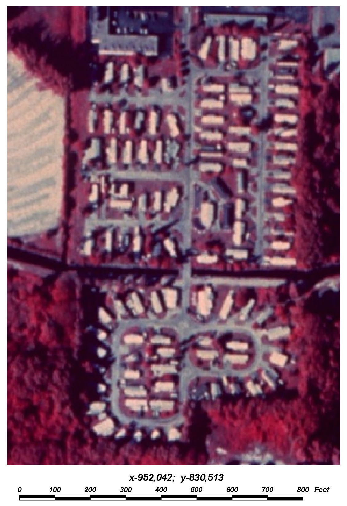
mixture of residential and other such uses, where each land use is below MMU
criteria, the PI must determine the predominant use and code accordingly.
For more information:
See the PI keys for each of
the subclasses for more details and graphic examples.
BACK TO CLASSIFICATION LIST
1310 Fixed Single Family Units
1310
- Fixed Single Family Units
LEVEL 1: 1000 Urban and Built-Up
LEVEL 2: 1300 Residential, High Density - six or more
dwelling units per acre
LEVEL 3: 1310 Fixed Single
Family Units
DESCRIPTION:
Six or more single-family structures
per acre meet density requirements for this class. Fixed single-family
structures are usually easily identified by their sizes, shapes, and character
of the associated developed area. Structures range from square, 50' x 50', to
rectangular, 25' x 40', or somewhat smaller. The roof area appears to cover
more than half of the lot area. Roads, small recreational areas, and small
public spaces serving the development are included; small water supply and
"package" sewage treatment plants are not included if they can be
mapped separately.
The overall pattern of most of these
areas is a tight mosaic of light-roofed structures against a light background.
The mosaic may be a regular, rectilinear array of roofs, or a curving pattern,
with streets showing as fine white lines within the pattern. The areas
generally have a crisp, "clean" appearance. When ponds or lakes are
integral to the subdivision, if the water is connected by canal to navigable
waterways, many of the waterfront lots will have piers, and boats will be
docked there. If canals are present and connected to another water body, they
would be mapped as 5120 Channelized River, Stream, Waterway. If ponds and
storm water retention areas are present and can be connected to create a two
acre or greater area (minimum wetland mapping unit), then these water bodies
are mapped as 5300 Reservoirs.
The newest subdivision developments
are most often high-density areas, or a mix of high- and medium-density areas.
Maximum densities in these new residential developments are usually high enough
to include them in this class.
Occasionally a dark-toned roof is
visible. These, or roofs with irregular outlines, combined with the black
shadows and the occasional black-toned swimming pool or evergreen shrub, can
create a somewhat confusing image. If the interpreter gives such an area a
cursory glance, some of the houses may be "lost" in the background
"noise", giving the area lower apparent density than the actual
density.
KEYS TO PHOTOINTERPRETATION:
Relatively small buildings, with garages and driveways present.
Large yards and open areas between houses, with pools and other outdoor
structures.
Well watered or maintained lawns, with a moderate amount of trees and
shrubs.
Absence of large parking areas or large structures.
CONTEXT:
Landscape Position - High-density housing areas occur within
urban and suburban areas- anywhere that sub-division or urban street patterns
are encountered; very few non- residential uses occur in high-density
fixed-unit single-family housing areas. Newer subdivision developments or
"housing estates" commonly occur at the urban fringe, often as infill
among older residential areas. New high-density developments generally have
clear boundaries abutting lower-density residential areas, agricultural areas,
limited-access highways, or large water bodies. They may surround golf courses
and include other recreational amenities. However, many residential areas
within older urban lands are also high-density. Here, boundaries may be vague
and difficult to discern when development is sporadic and occurs in isolated
units over an extended period of time, especially in areas which abut mixed
land uses.
SIMILAR CLASSES:
1210 Fixed Single Family Units - Some Medium Density Residential Areas may
appear similar.
SPECIAL MAPPING CONVENTIONS:
The polygon boundary should
encompass the active residential area, corresponding to the "operational
boundary" of commercial or industrial land uses. Non residential features
should be excluded, to the extent practicable, from this polygon. Open
areas, such as pastures and forests, that are adjacent to the residential area
should be classed with the land cover value, and not dual-coded. All
features that are inside the residential area are coded 1310, including
gardens, lawns, fields, pools, stables, garages, out-buildings, etc.
Polygon boundaries may not necessarily coincide with ownership
boundaries. The PI is not required to replicate collateral property data, and
should err on the side of land cover and environmental
function.
Priority classes such as water bodies,
wetlands, golf courses and cemeteries are always broken out if they meet
minimum size criteria.
Dual coding convention: This is a Land Use
class. The LUCODE and LCCODE are the same. A separate land cover code is not
required.
DOQQ Image
BACK TO CLASSIFICATION LIST
1320 Mobile Home Units
1320
- Mobile Home Units
LEVEL 1: 1000 Urban and Built-Up
LEVEL 2: 1300 Residential, High Density
LEVEL 3: 1320 Mobile Home
Units
DESCRIPTION:
Mobile homes are rectangular and
light-toned, from 8' to 12' wide and 30' to 50' long.
They may or may not be on permanent foundations. Any similar structure less
than 30' long and 8' wide is assumed to be a travel trailer. In
some cases, pull-out sections and awnings alter the basic rectangular shape,
although the flat-roofed, rectangular body is still evident upon close inspection.
Mobile home parks (or areas of at
least five acres) where each unit occupies a lot of over 0.5 acre are
relatively rare. Mobile home parks are usually developed as medium- and
high-density areas, with the units usually arranged as regular arrays with
their narrow dimension fronting the streets. At high densities, very
closely-spaced units may be placed at an angle to the street.
New mobile-home parks appear very
similar to new high-density fixed-unit single-family developments, including
the use of storm-drainage ponds as water bodies integral to the development.
The mobile homes, as a group, will show narrower, more rectangular shapes.
Mobile home parks often have
associated storage areas for use by park residents for boats and travel
trailers/campers/RVs. These storage areas should be mapped with the park. If
ponds and storm water retention areas are present and can be connected to
create a two acre or greater area, then these water bodies are mapped as 5300
Reservoirs.
A mobile home sales lot could be mistaken
for a mobile home park unless it is noted that the mobile homes are much closer
together and parked in a much more regular pattern in a sales lot than in a
mobile home park. The sales lot will show no signs of landscaping. Groups of
travel trailers may be parked closely together in these sales lots, too. The
interpreter should also beware of office trailers parked at or near
construction sites.
KEYS TO PHOTOINTERPRETATION:
Relatively small buildings
Narrow, rectangular shapes
Distinctive, regular pattern clearly distinguished from surrounding uses
CONTEXT:
Landscape Position - Mobile home residential areas are found
almost anywhere that fixed-unit single-family residential areas are found. They
occur in rural areas, at the urban fringe (often as infill among older,
lower-density residential areas), and in medium- and high-density residential
areas (often either adjacent to or incorporated within the newer subdivision
developments or "housing estates"). In most instances, mobile home
areas have clear boundaries which abut other residential areas, open areas,
agricultural areas, limited-access highways, and large water bodies
SIMILAR CLASSES:
1310 Fixed Single Family Units - these will generally be larger structures
SPECIAL MAPPING CONVENTIONS:
This class should only be used for
areas consisting of 6 or more mobile home units per acre.
The polygon boundary should
encompass the active mobile home area, corresponding to the "operational
boundary" of commercial or industrial land uses. Non-residential features
should be excluded, to the extent practicable, from this polygon. All
features that are inside the mobile home area are coded 1320, including
gardens, lawns, fields, pools, garages, out-buildings, etc.
Priority classes such as water
bodies and wetlands are always broken out if they meet minimum size criteria.
Dual coding convention: This is a Land Use
class. The LUCODE and LCCODE are the same. A separate land cover code is not
required.
DOQQ Image
BACK TO CLASSIFICATION LIST
1330 Multiple Dwelling Units, Low Rise
1330
- Multiple Dwelling Units, Low Rise
LEVEL 1: 1000 Urban and Built-Up
LEVEL 2: 1300 Residential, High Density
LEVEL 3: 1330 - Multiple Dwelling
Units, Low Rise
DESCRIPTION:
Low-Rise Multiple Dwelling Units
include two-story town houses, one- or two-story "garden apartments"
and duplexes.
Two-story detached structures in
neighborhoods with densities less than two structures per acre are generally
single-family structures, unless other evidence points to the contrary, such as
abnormally large automobile parking areas. In older neighborhoods with urban
street patterns, two-family houses may occur in areas of one- or two-story
detached structures (which are usually single- family houses). The two-family
houses may sometimes be identified by a division line in the back yard or by
some duplication of features, such as walkways and driveways.
Newer low-rise units often occur in
groups, and show a regular or symmetrical geometric arrangement of structures
within clearly-defined landscaped grounds, including parking areas and
recreational amenities (swimming pools, etc.), associated with the units.
Single- and multiple-story town houses and garden apartments generally have one
dwelling unit per twenty feet of length; the dwelling units estimated this way
should correspond to the number of front walkways or private back yards.
Off-street parking may give an
indication of the number of units, since there should be roughly as many spaces
(from 2/3 to 1-1/2) as dwelling units.
KEYS TO PHOTOINTERPRETATION:
often occur in groups
show a regular or symmetrical geometric arrangement of structures
some duplication of features such as walkways or driveways
CONTEXT:
Landscape Position - Most of the low-rise residential areas are
newer developments. They commonly occur at the urban fringe, often as infill
developments among older, lower-density residential areas. In most instances
the low-density housing developments have clear boundaries which abut other
residential areas, agricultural areas, limited-access highways, and large water
bodies, etc.
SIMILAR CLASSES:
1310 Fixed Single Family Units - dominated by single family dwellings
1320 Mobile Home Units - dominated by mobile homes
1340 Multiple Dwelling Units, High Rise - units of more 3 or more stories
SPECIAL MAPPING CONVENTIONS:
The polygon boundary should
encompass the active residential area, corresponding to the "operational boundary"
of commercial or industrial land uses. Non residential features should be
excluded, to the extent practicable, from this polygon. Open areas, such
as pastures and forests, that are adjacent to the residential area should be
classed with the land cover value, and not dual-coded. All features that
are inside the residential area are coded 1330, including gardens, lawns,
fields, pools, stables, garages, out-buildings, etc. Polygon boundaries
may not necessarily coincide with ownership boundaries. The PI is not required
to replicate collateral property data, and should err on the side of land
cover and environmental function.
Priority classes such as water
bodies, wetlands, golf courses and cemeteries are always broken out if they
meet minimum size criteria.
Dual coding convention: This is a Land Use
class. The LUCODE and LCCODE are the same. A separate land cover code is not
required.
DOQQ Image
BACK TO CLASSIFICATION LIST
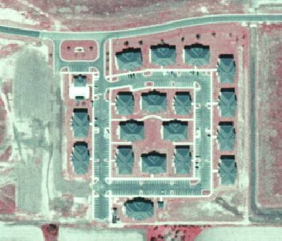
1340 Multiple Dwelling Units, High Rise
1340
- Multiple Dwelling Units, High Rise
LEVEL 1: 1000 Urban and Built-Up
LEVEL 2: 1300 Residential, High Density
LEVEL 3: 1340 - Multiple
Dwelling Units, High Rise
DESCRIPTION:
High-Rise Multiple Dwelling Units
include town houses, apartments and condominiums of three stories or more.
Subsidiary parking, recreational, and open landscaped areas are included; small
water supply and "package" sewage treatment plants are not included if
they can be mapped separately.
In older urban areas of detached
three-story units, multi-family structures are assumed at densities of six
multi-story structures per acre or greater, with two dwelling units per story.
In newer developments, multi-story
apartment buildings in suburban / urban areas on the average have one dwelling
unit per 1,000 square feet of floor area per story, with correspondingly large
parking areas. They often occur in groups, and show a regular or symmetrical
geometric arrangement of structures. They are often cross-shaped, or with wings
and ells which permit a large amount of window area per apartment. High rise
units are generally located on clearly-defined, landscaped grounds, including
the parking areas and recreational amenities (swimming pools, etc.), associated
with the development.
Single (isolated) high-rise
residential structures may be distinguished from commercial or industrial
buildings by their association with residential neighborhoods, and because
their roofs, although usually flat, are without large roof-mounted
air-conditioning or ventilating units. (Each apartment will usually have its
own unit.) The structures may have off-street parking areas, but lack the
loading docks of commercial or industrial buildings.
KEYS TO PHOTOINTERPRETATION:
often appear as groups of cross-shaped structures
show a regular or symmetrical geometric arrangement of structures
generally located on well-landscaped grounds
parking areas and recreational facilites often visible
using stereoscopic comparison to adjacent trees or garages for height
reference could be helpful in defining height requirement
CONTEXT:
Landscape Position - Most of the high-rise residential areas are
newer developments. They commonly occur within high-density areas of detached
single-family housing and low-rise residential structures. They are often
adjacent to shopping centers, commercial strip developments, and downtown
commercial areas. In some instances groups of high-rise developments have clear,
but irregular boundaries, with other intensive land uses, but equally often,
they occur as scattered developments with a well-defined boundary for only a
single building or a small group of buildings. This is common with newer
developments.
SIMILAR CLASSES:
1310 Fixed Single Family Units - dominated by single family dwellings
1320 Mobile Home Units - dominated by mobile homes
1330 Multiple Dwelling Units, Low Rise - units of 2 stories or less
SPECIAL MAPPING CONVENTIONS:
The polygon boundary should
encompass the active residential area, corresponding to the "operational
boundary" of commercial or industrial land uses. Non residential features
should be excluded, to the extent practicable, from this polygon. Open
areas, such as pastures and forests, that are adjacent to the residential area
should be classed with the land cover value, and not dual-coded. All
features that are inside the residential area are coded 1340, including
gardens, lawns, fields, pools, stables, garages, out-buildings, etc.
Polygon boundaries may not necessarily coincide with ownership
boundaries. The PI is not required to replicate collateral property data, and
should err on the side of land cover and environmental
function.
Priority classes such as water
bodies, wetlands, golf courses and cemeteries are always broken out if they
meet minimum size criteria.
Dual coding convention: This is a Land Use
class. The LUCODE and LCCODE are the same. A separate land cover code is not
required.
DOQQ Image
BACK TO CLASSIFICATION LIST
1350 Mixed Units, Fixed and Mobile Home Units
1350
- Mixed Units, Fixed and Mobile Home Units
LEVEL 1: 1000 Urban and Built-Up
LEVEL 2: 1300 Residential, High Density
LEVEL 3: 1350 - Mixed
Units, Fixed and Mobile Home Units
DESCRIPTION:
The description and keys to
interpretation for mobile homes and fixed-units at the three different
densities have been covered in the class descriptions for each type.
These "Mixed Units" classes
will be used when: (1) there is a consistent mixture of both types of units;
and (2) the only way possible to meet the five-acre minimum requirement for a
residential area is by mixing both types of units.
KEYS TO PHOTOINTERPRETATION:
Fixed and Mobile Home Units appear intermixed
Separate delineation would result in linear or "gerrymandered"
polygons
Separate delineation would in polygons below the Minimum Mapping Unit (1
acre).
CONTEXT:
Landscape Position - In exurban areas these structures tend to
occur scattered among fixed-unit single-family detached structures in linear
"strip developments", either along highways or fringing water bodies.
They also occur in suburban areas as small sites set aside for mobile homes
within a large high-density subdivision of fixed-unit single-family units.
SIMILAR CLASSES:
1310 Fixed Single Family Units - dominated by fixed dwelling
1320 Mobile Home Units - dominated by mobile homes
SPECIAL MAPPING CONVENTIONS:
The polygon boundary should
encompass the active residential area, corresponding to the "operational
boundary" of commercial or industrial land uses. Non residential features
should be excluded, to the extent practicable, from this polygon. Open
areas, such as pastures and forests, that are adjacent to the residential area
should be classed with the land cover value, and not dual-coded. All
features that are inside the residential area are coded 1230, including
gardens, lawns, fields, pools, stables, garages, out-buildings, etc.
Polygon boundaries may not necessarily coincide with ownership
boundaries. The PI is not required to replicate collateral property data, and
should err on the side of land cover and environmental
function.
Priority classes such as water
bodies, wetlands, golf courses and cemeteries are always broken out if they
meet minimum size criteria.
Dual coding convention: This is a Land Use
class. The LUCODE and LCCODE are the same. A separate land cover code is not
required.
DOQQ Image
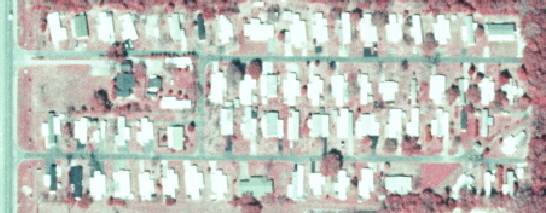
BACK TO CLASSIFICATION LIST
1390 High Density Under Construction
1390
- High Density Under Construction
LEVEL 1: 1000 Urban and Built-up
LEVEL 2: 1300 Residential, High Density - more
than 5 dwelling units per acre
LEVEL 3: 1390 High Density
Under Construction
DESCRIPTION:
This class refers to high density
residential areas that are in the process of construction. The existing
infrastructure and construction at time of photography are sufficient to show
the intended pattern and density, and to conclude that the development is
likely to be completed. In most cases, some of the dwellings are already
present. If more than two thirds (67%) of the area is constructed, and work is
in progress, these areas should be coded 1300, as though complete.
There is no time limit set on
completion of the areas under construction. However, if the in-fill
process is indefinitely stalled, the code 1920 Inactive Land With
Street Pattern is used instead. Progress is indicated by cleared, non-vegetated
areas, construction equipment, infrastructure such as roads, driveways and
utilities, and by surrounding patterns of land use.
KEYS TO PHOTOINTERPRETATION:
Houses are dense, usually in very regular pattern and orientation.
Houses tend to be of similar design and appearance.
Infrastructure such as roads, driveways, utilities is present.
The infrastructure shows the intended street patterns and housing
density for most of the delineated area.
Space for houses, roads, utilities, has been cleared, leaving a bright
(non-vegetated) signature.
CONTEXT:
Landscape Position - Most high-density residential areas are new
subdivision developments. They commonly occur at the urban fringe, often as
infill developments among older, lower-density residential areas. In most
instances the high - density developments have clear boundaries which abut
lower-density residential areas, agricultural areas, limited-access highways,
and large water bodies, etc.
SIMILAR CLASSES:
1290 Medium Density Under
Construction - Some Medium Density UC Residential Areas may appear similar.
1190 Low Density Residential Under Construction - Some Low Density UC
Residential Areas may appear similar.
1920 Inactive Land with Street Patterns - No current
construction activity is visible.
SPECIAL MAPPING CONVENTIONS:
Housing may be in a pre-construction
state, with development appearing imminent-one indication is prepared lands
adjacent to newly built subdivisions. Surrounding development densities may be
used as a guide to assign appropriate density (1190, 1290, or 1390); however
1190 may be used as the default in areas in which it is impossible to determine
the ultimate density. Areas that have had no recent activity, or are indefinitely
stalled, should be coded 1920 - Inactive land with street patterns but without
structures.
To reduce mapping costs, areas that
have varying housing densities may be aggregated together, assigning the
average density to the polygon. Polygon shapes should be compact if
possible, avoiding linear or convoluted shapes.
Dual coding convention: This is a Land Use
class. The LUCODE and LCCODE are the same. A separate land cover code is not
required.
DOQQ Image
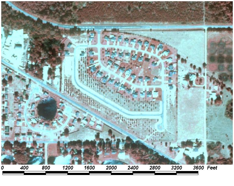
BACK TO CLASSIFICATION LIST
1400 Commercial and Services
1400 - Commercial and Services
LEVEL 1: 1000 Urban and Built-Up
LEVEL 2: 1400 Commercial and
Services
DESCRIPTION:
This is an active Level 2
class that includes a broad range of uses which can be difficult to
differentiate individually. This broad class includes many operations
providing diverse products and services which often occur in complex mixtures.
Subclasses include retail and wholesale, professional, cultural and
entertainment, and tourist services, as well as others. There are about
40 level 3 and level 4 subclasses listed in the FLUCCS Handbook in the
1400 general class - for a complete listing see the Handbook. The 1400
class also includes commercial resorts catering to tourists and
vacationers. Resorts are difficult to identify on aerial photography and
often contain recreational facilities such as swimming pools and ball
courts. Also included in the 1400 class are warehouses, campgrounds and
amusement parks.
The 1400 mapping unit
should include all secondary structures associated with an enterprise in
addition to the main building and integral areas assigned to support the base
unit. Included are sheds, warehouses, office buildings, driveways, parking lots
and landscaped areas. Also within the mapping units there are likely to be
inclusions of other uses, such as light industrial and residential, that are
below minimum mapping criteria.
This class can be difficult
to differentiate from similar classes. Ancillary land use data (i.e.
parcel maps) should be used if available.
KEYS TO
PHOTOINTERPRETATION:
The 1400 polygon often contains a diversity of commercial land uses, as
well as non-commercial inclusions. Facility sizes may vary significantly.
Commercial advertising signs or their shadows may be evident.
Parking facilities will be located near structures to give patrons easy
access to service. Parking geometry reflects easy access for passenger
cars to each building.
Sites are usually lacking natural vegetation, trees, or open space but
may be nicely landscaped. Lots are generally well kept.
There is an absence of heavy machinery, raw materials or fences.
Larger facilities may show trucking or other transportation services for
accepting shipment of goods or supplies.
CONTEXT:
Landscape Position - This land use is not limited to a particular
area of the County, but can be found in almost any urbanized or relatively
built-up areas.
Vegetation - Most is not natural, but a result of landscaping.
SIMILAR CLASSES:
1100 to 1300 Residential
- residential strips may look similar; parking is more dispersed and
uniform in residential strips
1500 Industrial - tends to lack vegetation or planned landscaping
1700 Institutional- tends to have large lawns and planned landscaping
1800 Recreational (indoor activities)- may require ancillary data to determine
SPECIAL MAPPING
CONVENTIONS:
Baldwin County maps all Commercial and Services to
the appropriate level based on the land use information in the parcel
data. This decision was based on error
assessments which indicated a high degree of difficulty in accurately
differentiating between the various Commercial and Services subclasses.
If an urban area is under
construction and the ultimate land use is discernible as commercial, it should
be classified as 1490 - Commercial and Services Under Construction.
Dual coding convention: This is a Land Use class. The LUCODE and LCCODE are the
same. A separate land cover code is not required.
BACK TO CLASSIFICATION LIST
*1410 Retail Sales and Services
Retail Sales and Services - FLUCCS Code 1410
Background: This land use is
comprised of varying size and shape buildings with attendant parking facilities
for customers. Buildings are often single detached structures, for uses such as
drug stores or grocery stores. Flat roofs are common for the larger buildings,
and parking areas (public or private) are generally small in comparison with
structure areas.
MAPPING CONVENTIONS:
Minimum mapping units: The minimum
mapping unit (MMU) for all 1400 Commercial and Services classes is 1
acre.
Differentiating
subclasses: Retail Sales and Services areas, as defined above, are difficult
to distinguish from other land uses in central business districts on aerial
photography, especially when the central business district includes large
office buildings.
Most land uses in these
business areas will therefore be mapped at the more general Level 2 class 1400
Commercial and Services.
These areas ill be
mapped to the appropriate level as represented on the land use code of the
Parcel Data.
SIMILAR CLASSES:
1100 to 1300 Residential
- residential strips may look similar; parking is more dispersed and
uniform in residential strips
1500 Industrial - tends to lack vegetation or planned landscaping
1700 Institutional- tends to have large lawns and planned landscaping
1800 Recreational (indoor activities)- may require ancillary data to determine
Dual coding
convention: All of the 1400 classes are Land Use classes. The LUCODE
and LCCODE are the same. A separate land cover code is not required.
BACK TO CLASSIFICATION LIST
1411 Shopping Centers
1411
- Shopping Centers
LEVEL 1: 1000 Urban and Built-Up
LEVEL 2: 1400 Commercial and Services and
Services
LEVEL 3: 1410 Retail Sales and
Services
LEVEL
4: 1411 Shopping Centers
DESCRIPTION:
This land use is comprised of
varying size and shape buildings with common parking facilities for customers,
having the structures arranged around the parking area. Buildings may be made
up of single structures with multiple units (strip stores), single structures
for a single unit (such as a department/ discount store), or multiple
unconnected buildings for multiple units (upscale "bungalow" or
"cottage" units).
Parking areas are large in
comparison with structure areas. The structures in a given shopping center are
often are uniform in size and arrangement. Many of the larger structures have
loading docks on the side of the building away from the main parking area -- as
do most light manufacturing plants. Store managements make their employees park
at the far end of the parking lot, giving customers the spaces closer to the
stores. At industrial sites, no such concern exists. If the photography were
taken on a weekend, it may differentiate the empty parking lot of a light
manufacturing plant from the active parking lot of a shopping center.
KEYS TO PHOTOINTERPRETATION:
Large flat roofs are the rule in shopping centers.
Shopping centers usually have a unique "bi-modal" parking
pattern which distinguishes them from light manufacturing plants.
CONTEXT:
Landscape Position - This land use type is found in urban and
suburban settings throughout the project area, especially along major highways
and at highway and road intersections. These land uses (especially smaller
shopping centers) may also abut or be within residential areas. The boundaries
of shopping centers with adjacent land uses are usually regular and distinct.
SIMILAR CLASSES:
1550 Other Light Industrial -
Loading docks and trucks may be visible.
1560 Other Heavy Industrial - These are usually large sites with large, complex
buildings.
SPECIAL MAPPING CONVENTIONS:
Those areas that are not clearly
related to the functions of the facility are not included. Adjacent land cover areas,
such as pastures and forests, are assigned the appropriate land cover value,
and not dual-coded. Only those features that are inside the operational
boundaries are coded 1411.
Priority classes such as water
bodies and wetlands are exceptions to the above. If these features meet their
minimum size criteria they are always broken out, even if located within the
1411 mapping unit.
Dual coding convention: This is a Land Use class. The LUCODE
and LCCODE are the same. A separate land cover code is not
required.
DOQQ Image
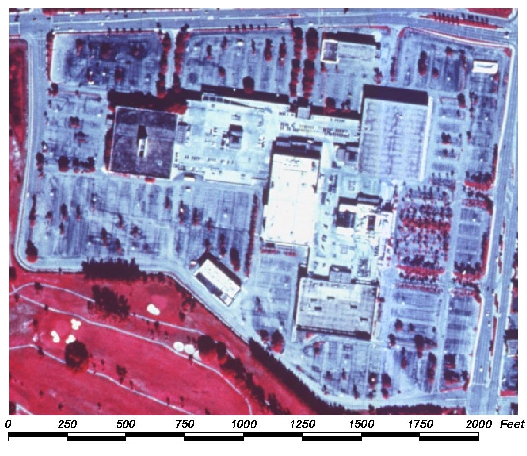
BACK TO CLASSIFICATION LIST
*1420 Wholesale Sales & Services
Wholesale Sales and Services - FLUCCS Code 1420
Background: This category is
reserved for those land uses associated with the storage and wholesale
distribution of products and materials, except for the storage of products and materials
subsidiary to an industrial operation. The primary structures associated with
this category are identified by their characteristic size, shape and adjacent
features. Normally, these structures are large, one- or two-stories, box-like
in shape, designed to hold large quantities of products. Active access roads
(dark and well-defined on CIR photography), rail spurs, piers and conveyors, or
other signs of materials movement should be evident. Loading docks may not be
present if roads or rail spurs appear to enter the structure.
Wholesale Sales and
Services are often associated with industrial areas or within commercial strip
developments. Industrial areas and commercial strips commonly occur near urban
areas, but may be found in suburban or rural areas adjacent to airports or in
relatively open country. Look for Wholesale Sales and Services activities in
any of these contexts.
MAPPING CONVENTIONS:
Minimum mapping units: The minimum
mapping unit (MMU) for all 1400 Commercial and Services classes is 1
acre.
Differentiating
subclasses: Wholesale Sales and Services areas, as defined above, are
difficult to distinguish from other land uses in central business districts on
aerial photography, especially when the central business district includes
large office buildings.
Most land uses in these
business areas will therefore be mapped at the more general Level 2 class 1400
Commercial and Services.
See the PI key for the
Level 4 class 1423 for indicators that assist in differentiation.
Dual coding convention:
All of
the 1400 classes are Land Use classes. The LUCODE and LCCODE are the
same. A separate land cover code is not required.
SIMILAR CLASSES:
1100 to 1300 Residential
- residential strips may look similar; parking is more dispersed and
uniform in residential strips
1500 Industrial - tends to lack vegetation or planned landscaping
1700 Institutional- tends to have large lawns and planned landscaping
1800 Recreational (indoor activities)- may require ancillary data to determine
SPECIAL MAPPING CONVENTIONS:
Baldwin County maps all Commercial and Services to
the appropriate level based on the land use information in the parcel
data.
BACK TO CLASSIFICATION LIST
1423 Wholesale Sales & Services - Junk
Yards
1423
- Junk Yards
LEVEL 1: 1000 Urban and Built-Up
LEVEL 2: 1400 Commercial and Services
LEVEL 3: 1420 Wholesale
Sales and Services
LEVEL
4: 1423 Junk Yards
DESCRIPTION:
Junk yards include all commercial
scrap yards. Automobile junk yards are the most common, and are identified by
irregular rows of cars in lots usually screened from public view by high
fences. Look for the fence shadows, and a small office building near the
street-side entrance to the lot, either inside or outside of the fence. Cars
are visible, massed very close together, and sometimes piled atop one another.
Commercial scrap yards storing metals and other materials for industrial use
will appear somewhat similar, but without the rows of junked cars.
In addition, to qualify as a junk
yard, an area must contain more than twenty junked automobiles or pieces of
equipment; some fields may contain scattered pieces of equipment and old cars,
but are not junk yards.
Areas having the general appearance
of junkyards, but in remote locations, must be examined closely for signs of
commercial activity (an office and a perimeter fence) and activity in the yard
(distinct roads and paths). If these activity indicators are missing, the area
should be mapped as 8350 Solid Waste Disposal.
Scrap yards adjacent to an
Industrial land use, used for storage of raw materials for the industrial
operation, are mapped as part of that operation, and not included in this
class.
KEYS TO PHOTOINTERPRETATION:
Distinctive signature of cars massed together is a distinguishing
feature.
Vegetation, if present, appears unmanaged.
CONTEXT:
Landscape Position - Junk yards (scrap yards) are often associated
with industrial areas or within commercial strip developments. Auto junk yards
are especially common along major highways, extending back form the road for a
considerable distance.
SIMILAR CLASSES:
1550 Other Light Industrial -
Loading docks and trucks may be visible.
1560 Other Heavy Industrial - These are usually large sites with large, complex
buildings.
SPECIAL MAPPING CONVENTIONS:
Those areas that are not clearly
related to the functions of the facility are not included. Adjacent land cover areas,
such as pastures and forests, are assigned the appropriate land cover value,
and not dual-coded. Only those features that are inside the operational
boundaries are coded 1423.
Priority classes such as water
bodies and wetlands are exceptions to the above. If these features meet their
minimum size criteria they are always broken out, even if located within the
1423 mapping unit.
Dual coding convention: This is a Land Use class. The LUCODE
and LCCODE are the same. A separate land cover code is not
required.
DOQQ Image
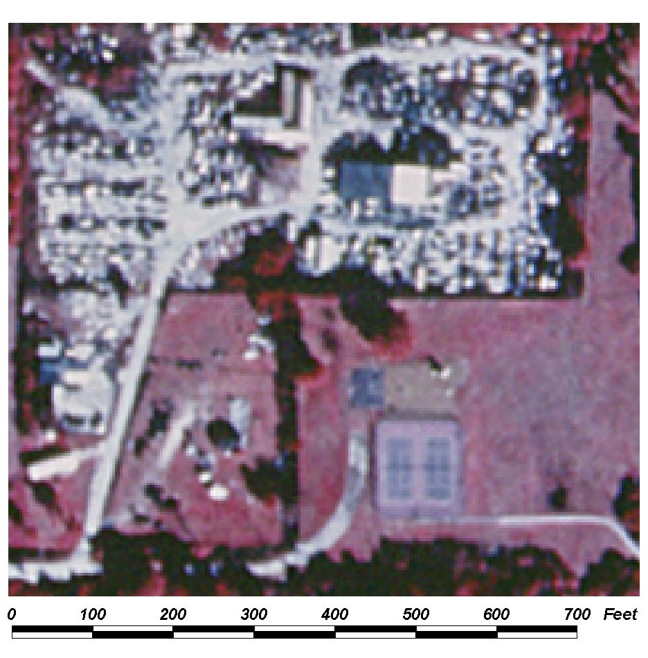
BACK TO CLASSIFICATION LIST
1430 Professional Services
LEVEL 1:
1000 Urban and Built-Up
LEVEL 2: 1400 Commercial and Services
LEVEL 3: 1430 Professional Services
Professional Services - FLUCCS Code 1430
DESCRIPTION:
This land use is comprised of
varying size and shape buildings with attached parking facilities. Examples of this land use category include
law offices, consulting firms, medical and dentist offices, veterinary clinics
and various Office Buildings. Typically
this land use is found in areas with higher concentrations of commercial activities
although some converted residential areas may now be used for Professional
Services. In commercial areas this land
use is distinguishable by larger than average building height and large
surrounding parking areas typically not in a bi-modal pattern with workers
parking mainly towards the front of the building nearest an entrance. In residential areas they can be separated
from homes by the presence of parking areas.
Typically parking will focus towards
the main entrances and will be very sparse on weekends.
KEYS TO PHOTOINTERPRETATION:
Parking areas are in proportion with structure areas and are not in a
bi-modal pattern.
Typically office buildings are higher than the surrounding buildings.
CONTEXT:
Landscape Position - This land use type is found in urban and
suburban settings throughout the project area, especially in urban areas along
main streets. These land uses may also abut or be within residential areas. The
boundaries of Professional Services property with adjacent land uses are
usually regular and distinct.
SIMILAR CLASSES:
1550 Other Light Industrial -
Loading docks and trucks may be visible.
1560 Other Heavy Industrial - These are usually large sites with large, complex
buildings.
1330 and 1340 Low rise and High rise multiple dwelling units – Parking is
usually less dense during typical business hours.
SPECIAL MAPPING CONVENTIONS:
Those areas that are not clearly
related to the functions of the facility are not included. Adjacent land cover areas,
such as pastures and forests, are assigned the appropriate land cover value,
and not dual-coded. Only those features that are inside the operational
boundaries are coded 1430.
Priority classes such as water
bodies and wetlands are exceptions to the above. If these features meet their
minimum size criteria they are always broken out, even if located within the
1430 mapping unit.
Dual coding convention: This is a Land Use class. The LUCODE
and LCCODE are the same. A separate land cover code is not
required.
DOQQ Image:
BACK TO CLASSIFICATION LIST
1440 Cultural and Entertainment
LEVEL 1:
1000 Urban and Built-Up
LEVEL 2: 1400 Commercial and Services
LEVEL 3: 1440 Cultural Entertainment
Cultural Entertainment - FLUCCS Code 1440
DESCRIPTION:
This category includes both indoor
and open air theatres of all kinds, as well as museums. Typically these areas are comprised of a
large central structure with large radiating parking facilities. These structures are found typically in
commercial districts of cities although some large open-air theatres may be
found in rural areas. This land-use is
associated with large parking facilities paved or unpaved. Often movie theatres are attached to malls or
shopping centers
KEYS TO PHOTOINTERPRETATION:
Large parking areas surrounding a large central structure.
Larger than average size buildings unless attached to a Shopping Center.
CONTEXT:
Landscape Position - This land use type is found in urban and
suburban settings throughout the project area, especially in urban areas along
main streets. These land uses may also abut or be within residential areas. The
boundaries of Cultural Entertainment property with adjacent land uses are
usually regular and distinct.
SIMILAR CLASSES:
1860 Community Recreational
Facilities – These are usually adjacent to residential areas and contain sports
fields or courts.
1411 Shopping Centers – These are typically larger and are more spread out over
a large area.
SPECIAL MAPPING CONVENTIONS:
Those areas that are not clearly
related to the functions of the facility are not included. Adjacent land cover areas,
such as pastures and forests, are assigned the appropriate land cover value,
and not dual-coded. Only those features that are inside the operational
boundaries are coded 1440.
Priority classes such as water
bodies and wetlands are exceptions to the above. If these features meet their
minimum size criteria they are always broken out, even if located within the
1440 mapping unit.
Dual coding convention: This is a Land Use class. The LUCODE
and LCCODE are the same. A separate land cover code is not
required.
BACK TO CLASSIFICATION LIST
1450 Tourist Services
LEVEL 1:
1000 Urban and Built-Up
LEVEL 2: 1400 Commercial and Services
LEVEL 3: 1450 Tourist Services
Tourist Services - FLUCCS Code 1450
DESCRIPTION:
This category includes all primary
and secondary facilities that can be identified as supporting overnight
tourist/travel lodging. Hotels and
Motels are comprised of a central structure with large parking facilities focused toward a main
entrance and comprised of extraneous parking to along the edge of the building
with motels being single or double story and rectangular and Hotels being
multiple story facilities. Usually found
along major Highways or in Urban areas.
Travel trailer areas and campgrounds
are typically unpaved and have little to no parking except at each individual
site. Although Travel trailer areas can
be found in residential areas or along highways, these areas typically are
found in rural areas or within parks.
KEYS TO PHOTOINTERPRETATION:
Hotels and Motels are found near highways or urban areas and have parking
focused toward a main entrance with and continued along the edge of the main
structure.
Travel trailer parks and campgrounds usually have little to no parking
except where lodging is taking place and are spread across the property.
CONTEXT:
Landscape Position – Hotels and motels are typically found in
urban areas and along main highways.
Travel trailer parks and campgrounds tend to be found more in rural
areas or within park boundaries.
SIMILAR CLASSES:
1860 Community Recreational
Facilities – These are usually adjacent to residential areas and contain sports
fields or courts.
1411 Shopping Centers – These are typically larger and are more spread out over
a large area.
SPECIAL MAPPING CONVENTIONS:
Those areas that are not clearly
related to the functions of the facility are not included. Adjacent land cover areas,
such as pastures and forests, are assigned the appropriate land cover value,
and not dual-coded. Only those features that are inside the operational
boundaries are coded 1440.
Priority classes such as water
bodies and wetlands are exceptions to the above. If these features meet their
minimum size criteria they are always broken out, even if located within the
1440 mapping unit.
Dual coding convention: This is a Land Use class. The LUCODE
and LCCODE are the same. A separate land cover code is not
required.
BACK TO CLASSIFICATION LIST
1460 Oil and Gas Storage - not Industrial or Manufacturing.
1460
- Oil and Gas Storage
LEVEL 1: 1000 Urban and Built-Up
LEVEL 2: 1400 Commercial and Services
LEVEL 3: 1460 Oil and Gas
Storage; not attached to industrial or manufacturing facilities
DESCRIPTION:
This class identifies storage
facilities used in the retail and wholesale sales of petroleum, oil, and
lubricating type products. The storage facilities may be in or near an
industrial or manufacturing area but are not directly associated with such a
facility. The 1460 mapping unit will include tanks, spill enclosures,
internal roads, railroads, spurs, piers, embankments, supervisory and
maintenance facilities, and all open areas associated with those features.
Non-petroleum products such as soybean oil may be stored also. Heavy viscosity
products may require steam-generating plants.
KEYS TO PHOTOINTERPRETATION:
Large cylindrical tanks, appearing as circular shapes.
Extensive pumping and transport facilities, including pipeline systems,
service roads, piers, railroads, spurs.
Revetments (spill prevention enclosures with embankments) usually
enclose storage areas. Evidence of spills may be present. Water may be ponded,
and treatment/stormwater lagoons may be present.
Vegetation tends to be sparse in tank areas. Landscaping is controlled.
CONTEXT:
Landscape Position - These facilities
are often associated with industrial areas or may exist separately in open
areas, where they have distinct, well-defined revetment boundaries with
extensive land uses (agricultural, forest lands, etc.) or water. The industrial
areas commonly occur near urban areas, but may be found in suburban or rural
areas adjacent to airports or in relatively open country.
SIMILAR CLASSES:
1550 Other Light Industrial -
Loading docks and trucks may be visible.
1560 Other Heavy Industrial - These are usually large sites with large, complex
buildings.
1540 Oil and Gas Processing - These have extensive industrial operations on
site.
1640 Oil and Gas Fields - These will not have major storage facilities.
SPECIAL MAPPING CONVENTIONS:
Those areas that are not clearly
related to the functions of the facility are not included. Adjacent land cover areas,
such as pastures and forests, are assigned the appropriate land cover value,
and not dual-coded. Only those features that are inside the operational
boundaries are coded 1460.
Priority classes such as water
bodies and wetlands are exceptions to the above. If these features meet their
minimum size criteria they are always broken out, even if located within the
1460 mapping unit.
Dual coding convention: This is a Land Use class. The LUCODE
and LCCODE are the same. A separate land cover code is not
required.
DOQQ Image
BACK TO CLASSIFICATION LIST
1470 Mixed Commercial and Services
LEVEL 1:
1000 Urban and Built-Up
LEVEL 2: 1400 Commercial and Services
LEVEL 3: 1470 Mixed Commercial and Services
Mixed Commercial and Services - FLUCCS Code 1470
DESCRIPTION:
This class includes all 1400 classes
that cannot be separated by the minimum mapping unit and are comprised of more
than 1 level 3 or 4 1400 code classification.
This class can be difficult to differentiate
from other Commercial and Services classifications. Ancillary land use
data (i.e. parcel maps) should be used if available.
KEYS TO PHOTOINTERPRETATION:
See descriptions for all other Commercial and Services Classification
codes.
This land use requires more than 1 1400 code level 3 or 4 categories
that are smaller than minimum mapping unit and cannot be collected separately.
CONTEXT:
Landscape Position – Typically found in urban areas with small
lot sizes. Use primarily when minimum
mapping unit is too large to separate properties that are not connected in a shopping center.
SIMILAR CLASSES:
1411 Shopping Centers – These are
typically connected by a common parking lot or large building.
SPECIAL MAPPING CONVENTIONS:
Those areas that are not clearly
related to the functions of the facility are not included. Adjacent land cover areas,
such as pastures and forests, are assigned the appropriate land cover value,
and not dual-coded. Only those features that are inside the operational
boundaries are coded 1440.
Priority classes such as water
bodies and wetlands are exceptions to the above. If these features meet their
minimum size criteria they are always broken out, even if located within the
1470 mapping unit.
Dual coding convention: This is a Land Use class. The LUCODE
and LCCODE are the same. A separate land cover code is not
required.
BACK TO
CLASSIFICATION LIST
1480 Cemeteries
1480
- Cemeteries
LEVEL 1: 1000 Urban and Built-Up
LEVEL 2: 1400 Commercial and Services
LEVEL 3: 1480 Cemeteries
DESCRIPTION:
This class includes all burial
grounds of any age and type. This is a diverse group, which includes both human
and pet cemeteries; old, inactive cemeteries covered by dense canopy; brand new
facilities with open expanses of lawn that are not yet "
populated;" and all combinations in between. Recognition of older
cemeteries may be aided by collateral data .
KEYS TO PHOTOINTERPRETATION:
Cemeteries are usually identified on topographic maps by point symbols.
Newer facilities may have relatively smooth and even-textured land with
well-maintained, irrigated lawns, and paved roads.
Newer facilities may have few or scattered trees. Older ones may
be under dense canopy.
There may be small to medium-sized structures (e.g. mausoleums)
dispersed about the facility.
Road pattern and landscaping may have a formal, aesthetic
appearance reflecting the religious functions. Roads may curve and wind through
the site. There is usually a formal landscaped entrance.
The headstones and their shadows may form a checker board pattern, or
one of closely-spaced rows of white dots.
Boundaries with adjacent land uses are usually distinct.
CONTEXT:
Landscape Position - Cemeteries may be found throughout the
County, but are usually closer to populated areas. Their size tends to
correlate to the size of the surrounding communitites, with larger cemeteries
near major urban areas. Small cemeteries are often located next to churches,
and should be coded as cemeteries if greater than the 5 acre MMU.
SIMILAR CLASSES:
1700 Institutional - often have many
smaller structures, including on-site residences
1900 Open Land - does not have enough indication of a land use to assign
another code
3000 Upland Non-Forested - vegetation may be diverse in type, texture and
pattern
SPECIAL MAPPING CONVENTIONS:
Cemeteries are a priority class and should
always be broken out if they meet MMU criteria of 1 acre. Ancillary data
should be used, if available, to locate and confirm the presence of cemeteries.
Dual coding convention: This is a Land Use class. The LUCODE and
LCCODE are the same. A separate land cover code is not required.
DOQQ Image
BACK TO CLASSIFICATION LIST
1490 Commercial and Services Under Construction
1490
- Commercial and Services Under Construction
LEVEL 1: 1000 Urban and Built-up
LEVEL 2: 1400 Commercial and Services
LEVEL 3: 1490 Commercial
and Services Under Construction
DESCRIPTION:
This class includes all 1400 classes
that are in the process of construction. It includes 1400 Commercial and Services,
1411 Shopping Centers, and 1423 Junk Yards. For a detailed description of those
classes see the PI key pages for each one.
This class can be difficult to
differentiate from similar classes, especially when under construction.
Ancillary land use data (i.e. parcel maps) should be used if available.
KEYS TO PHOTOINTERPRETATION:
See descriptions for 1400, 1411 and 1423.
Much of the land surface is likely to be un-vegetated and disturbed.
Construction equipment and building may be visible.
There are likely to be mounds of fill material, temporary dirt roads,
ponding, construction material, construction trailers, and other signs of
on-going construction.
Areas under construction will be very light-toned, with a white
signature where soil is exposed.
CONTEXT:
Landscape Position - Commercial areas are located throughout the
County, in association with developed areas and transportation volume.
They may be within or independent from developed areas. They are usually
located along main transportation routes or at the intersections of secondary
transportation corridors.
SIMILAR CLASSES:
1190, 1290, 1390 - all Residential
Under Construction Classes - will show the typical residential pattern;
individual buildings generally smaller than commercial buildings
7400 Disturbed Land - evidence of current construction
not usually evident; old machinery may be visible
7420 Borrow Areas - evidence of excavation such as pits and trenches
SPECIAL MAPPING CONVENTIONS:
Many of the indicators of the 1400
classes are not visible during the construction period. Ancillary data
such as parcel or zoning maps may be needed to differentiate this code
from other 'under construction' classes.
Dual coding convention: This is a Land Use class. The LUCODE
and LCCODE are the same. A separate land cover code is not required.
DOQQ Image
BACK TO CLASSIFICATION LIST
1500
Industrial
1500
- Industrial
LEVEL 1: 1000 Urban and Built-Up
LEVEL 2: 1500 Industrial
DESCRIPTION:
The Industrial class includes those
land uses where manufacturing, assembly or processing of materials and products
occurs. Industrial areas include a wide array of industry types ranging from
light manufacturing and industrial parks to heavy manufacturing plants. Also
included are those facilities for administration and research, assembly,
storage and warehousing, shipping and associated parking lots and grounds.
Typical examples of the Industrial
class found in Alabama are pulp and lumber mills,
furniture manufacturers and brick making plants.
Areas that have mixed Industrial
classes (multiple subclasses, each one below the MMU ) will be classified with
the appropriate Level 3 code, if applicable, depending on the predominant type
of industries in the polygon. If none of those is the predominant use, then the
area is classified as 1500 Industrial.
If an Industrial area is under
construction and the ultimate land use is discernible, it should be classified
as if the construction were complete.
KEYS TO PHOTOINTERPRETATION:
Visible indicators of industrial operations include stockpiles of raw
materials, large power sources and waste management areas.
Industrial areas may have an unkempt look in comparison with commercial
or institutional areas, denoting private use.
They tend to lack vegetation or planned landscaping.
CONTEXT:
Landscape Position - Industrial facilities are often clustered
together in larger areas with appropriate zoning, utilities, transportation and
other factors. They tend to be located adjacent to urban areas, and with access
to major transportation routes, including roads, railroads, water and airports.
Heavy industrial concentration is often located by port or rail facilities.
Finished products and warehouses tend to be located in urban fringe areas.
Fabricating and assembly industries are usually located adjacent to central
business districts.
SIMILAR CLASSES:
1400 Commercial and Services -
generally well-kept lots; may be nicely landscaped
1600 Extractive -large areas of surface disturbance; waste piles, excavating
equipment may be visible
SPECIAL MAPPING CONVENTIONS:
If an Industrial area is under
construction and the ultimate land use is discernible as industrial, it should
be classified as 1500 - Industrial.
Dual coding convention: This is a Land Use class. The LUCODE and LCCODE are the
same. A separate land cover code is not required.
DOQQ Image

Field Picture
BACK TO CLASSIFICATION LIST
1510 Food Processing
1510
– Food Processing
LEVEL 1: 1000 Urban and Built-Up
LEVEL 2: 1500 Industrial
LEVEL 3: 1510 Food
Processing
DESCRIPTION:
This class is primarily for
processing food products for mass distribution. Examples of this class
are Citrus, Poultry, Meat, Seafood and Sugar Processing Plants.
Food Processing Plants tend to be
enclosed operations characterized by the buildings used for processing and
handling. Usually there is waste
treatment areas and loading docks.
1500 level Industrial operations can
also be distinguished from most commercial operations by the patterns of cars
parked in the parking areas, and by the size, arrangement, and details of the
structures. The cars all park as close as possible to the entrance, and not in
the more regular pattern associated with commercial operations. The buildings
shapes are usually rectangular, similar to warehouses, but distinguished from
wholesale operations by the subsidiary facilities.
There are a number of land use
classes that have a similar appearance on aerial photography, characterized by
rectangular buildings. Ancillary land use data should be checked,
if available, to confirm this class. Light manufacturing may be mixed
with other uses, in which case the predominant use should be established and
assigned to the mapping unit.
In transitional areas where species
specific wetland and upland polygons are below the appropriate MMU some
aggregation may be justified. In these cases intermixed community classes will
be assigned and mapped at a larger unit.
KEYS TO PHOTOINTERPRETATION:
Good highway access
Medium-size parking lots where cars may be parked in a somewhat
irregular pattern
Buildings are medium sized, usually one-story, rectangular;
distinguishable from wholesale storage by subsidiary features.
Storage, equipment, and other features tend to be enclosed rather than
outdoors.
Typical roof types are flat, saw tooth, and monitor. Ventilators
and skylights are common at manufacturing sites.
Loading docks and trucks may be visible.
Landscaping may be planned, but there is little or no natural
vegetation.
CONTEXT:
Landscape Position – Food Processing is found throughout the
County, in the vicinity of heavy industry, industrial parks, commercial strips
and major road intersections. The boundary between light industry areas,
especially industrial parks, and other land uses are often regular and
well-defined.
SIMILAR CLASSES:
1400 Commercial and Services - tend
to lack subsidiary features on site
1500 Industrial - Most classes in the Industrial class can appear to
have similar signatures.
1560 Other Heavy Industrial- tends to have extensive handling, transport, and
storage capabilities
SPECIAL MAPPING CONVENTIONS:
Only those features that are inside
the facility boundaries and actively involved in its operation are coded as
1510. These may include parking and transportation areas, treatment facilities,
fuel storage, office buildings, and open areas lying within the operational
boundary.
Priority classes such as water
bodies and wetlands are exceptions to the above. If these features meet their minimum
size criteria they are always broken out, even if located within the 1510
mapping unit.
Dual coding convention: This is a Land Use
class. The LUCODE and LCCODE are the same. A separate land cover code is
not required.
BACK TO CLASSIFICATION LIST
1520 Timber Processing
1520
– Timber Processing
LEVEL 1: 1000 Urban and Built-Up
LEVEL 2: 1500 Industrial
LEVEL 3: 1520 Timber
Processing
DESCRIPTION:
This class is primarily for the processing
of raw timber resources. Examples of this class include plywood and
saw mills as well as pulp and mulch plants. Several low rectangular sized
buildings and exposed storage areas are likely to be visible.
Timber Processing can also be
distinguished from most commercial lumber yards by the patterns of cars parked
in the parking areas, and by the size, arrangement, and details of the
structures. The cars all park as close as possible to the entrance, and not in
the more regular pattern associated with commercial operations. Logging trucks and transport trucks may be
visible and exposed areas of stacked timber and processed wood products under
cover.
In transitional areas where species
specific wetland and upland polygons are below the appropriate MMU some
aggregation may be justified. In these cases intermixed community classes will
be assigned and mapped at a larger unit.
KEYS TO PHOTOINTERPRETATION:
Good highway access
Medium-size parking lots where cars may be parked in a somewhat irregular
pattern
Raw timber is typically stored exposed; where as processed wood products
will be under cover or indoors.
Typical roof types are flat, saw tooth, and monitor. Ventilators
and skylights are common at manufacturing sites.
Loading docks, transport trucks and logging trucks may be visible.
Landscaping may be planned, but there is little or no natural
vegetation.
CONTEXT:
Landscape Position – Timber Processing is found throughout the
County, in the vicinity of other industry, industrial parks and major road
intersections and near timber plantations.
SIMILAR CLASSES:
1500 Industrial - Most
classes in the Industrial class can appear to have similar signatures, Timber
processing is distinguishable by the presence of exposed timber storage.
1560 Other Heavy Industrial- tends to have extensive handling, transport, and
storage capabilities.
SPECIAL MAPPING CONVENTIONS:
Only those features that are inside
the facility boundaries and actively involved in its operation are coded as
1550. These may include parking and transportation areas, treatment facilities,
fuel storage, office buildings, and open areas lying within the operational
boundary.
Priority classes such as water
bodies and wetlands are exceptions to the above. If these features meet their
minimum size criteria they are always broken out, even if located within the
1550 mapping unit.
Dual coding convention: This is a Land Use
class. The LUCODE and LCCODE are the same. A separate land cover code is
not required.
BACK TO CLASSIFICATION LIST
1530 Mineral Processing
1530
– Mineral Processing
LEVEL 1: 1000 Urban and Built-Up
LEVEL 2: 1500 Industrial
LEVEL 3: 1530 Mineral
Processing
DESCRIPTION:
Refining of basic earth materials
such as kaolin, bentonite, and heavy metals (i.e. Titanium and Zircon
concentrates) is accomplished in Alabama.
Baldwin County mining activity consists mainly of
sand and gravel pits for Construction purposes and a few Clay Pits near Marlow
for brick manufacturing. Processing
plants located adjacent to a mining area will be included under the appropriate
1700 extractive classification.
Mineral Processing industries tend
to be semi-enclosed operations for processing characterized by the buildings used
for equipment and manufacturing also with exposed or semi-exposed areas for
material storage. Typically there are
large multi-story buildings with smoke stacks and conveyor belts.
In transitional areas where species
specific wetland and upland polygons are below the appropriate MMU some
aggregation may be justified. In these cases intermixed community classes will
be assigned and mapped at a larger unit.
KEYS TO PHOTOINTERPRETATION:
Good highway access
Medium-size parking lots where cars may be parked in a somewhat
irregular pattern
Large multi-story structures with conveyor belts and smoke stacks are
typical.
Storage and other features are exposed outdoors.
Surrounding buildings are typically low 1 or 2 story structures, typical
roof types are flat, saw tooth, and monitor.
Loading docks and trucks may be visible.
Landscaping may be planned, but there is little or no natural
vegetation.
CONTEXT:
Landscape Position – Mineral Processing is found typically close
to mining areas, also near other industrial areas with good Highway access.
SIMILAR CLASSES:
1500
Industrial - Most classes in the Industrial class can appear to have
similar signatures.
1560 Other Heavy Industrial- tends to have extensive handling, transport, and
storage capabilities
1600
Extractive – Mineral Processing areas adjacent to mining areas are coded to the
appropriate extractive 1700 code.
SPECIAL MAPPING CONVENTIONS:
Only those features that are inside
the facility boundaries and actively involved in its operation are coded as
1530. These may include parking and transportation areas, treatment facilities,
fuel storage, office buildings, and open areas lying within the operational
boundary.
Priority classes such as water
bodies and wetlands are exceptions to the above. If these features meet their
minimum size criteria they are always broken out, even if located within the
1550 mapping unit.
Dual coding convention: This is a Land Use
class. The LUCODE and LCCODE are the same. A separate land cover code is
not required.
BACK TO CLASSIFICATION LIST
1540 Oil and Gas Processing
1540
- Oil and Gas Processing
LEVEL 1: 1000 Urban and Built-Up
LEVEL 2: 1500 Industrial
LEVEL 3: 1540 Oil and Gas
Processing
DESCRIPTION:
This category includes facilities
that produce gasoline, kerosene, jet fuel, asphalt, liquid gases and other
petroleum products. It also includes the processing and recycling of used
petroleum products, and storage facilities for petroleum products. All
subsidiary features, such as transportation, offices, cooling ponds, and open
areas that are within the operational boundaries and related to the operation
are included in the mapping unit.
KEYS TO PHOTOINTERPRETATION:
Complex arrangement of buildings, pipelines, towers, vessels,
impoundments and lagoons
Closed vessels for handling liquids, gases, chemicals and
suspensions
Tanks, pipelines, and towers for cracking or distillation
Steam generating plants for heating viscous liquids
Located away from residential areas
CONTEXT:
Landscape Position - These operations are generally located away
from residential areas, but close to industrial areas where labor,
transportation, and other resources are available. Pipelines, rail lines,
harbors, and highways are likely features in the surrounding landscape.
SIMILAR CLASSES:
1460 Oil and Gas Storage -
revetments enclosing storage areas visible
1500 Industrial - Most classes in the Industrial class appear to have
similar signatures. Oil and gas processing plants are differentiated by
the concentration of tanks, pipelines, towers and stacks characteristic
of such plants.
1560 Other Heavy Industrial- tends to have extensive handling, transport, and
storage capabilities
SPECIAL MAPPING CONVENTIONS:
Only those features that are inside
the facility boundaries and actively involved in its operation are coded as 1540.
These may include parking and transportation areas, treatment facilities, ponds
and impoundments, fuel storage, office buildings, and open areas lying within
the operational boundary.
Priority classes such as water
bodies and wetlands are exceptions to the above. If these features meet their
minimum size criteria they are always broken out, even if located within the
1540 mapping unit.
Dual coding convention: This is a Land Use
class. The LUCODE and the LCCODE are the same. A separate land cover code is
not required.
DOQQ Image
Field Picture
BACK TO CLASSIFICATION LIST
1550 Other Light Industry
1550
- Other Light Industrial
LEVEL 1: 1000 Urban and Built-Up
LEVEL 2: 1500 Industrial
LEVEL 3: 1550 Other Light
Industrial
DESCRIPTION:
This class is primarily for
fabrication industries, which use the products from other processing and
manufacturing industries to make parts and finished products. It
also includes any light industries that do not fit in any of the other 1500
Industrial classes. Examples of this class are steel fabrication, small
boat manufacturing, and electronic manufacturing/assembly.
Light industries tend to be enclosed
operations characterized by the buildings used for equipment, materials and
manufacturing. They lack the extensive handling, transport, heavy
lifting, storage, waste treatment, and power facilities that characterize
processing and heavy industrial operations.
Light manufacturing can also be
distinguished from most commercial operations by the patterns of cars parked in
the parking areas, and by the size, arrangement, and details of the structures.
The cars all park as close as possible to the entrance, and not in the more
regular pattern associated with commercial operations. The buildings shapes are
usually rectangular, similar to warehouses, but distinguished from wholesale
operations by the subsidiary facilities.
There are a number of land use
classes that have a similar appearance on aerial photography, characterized by
rectangular buildings. Ancillary land use data should be checked,
if available, to confirm this class. Light manufacturing may be mixed
with other uses, in which case the predominant use should be established and
assigned to the mapping unit.
In transitional areas where species
specific wetland and upland polygons are below the appropriate MMU some
aggregation may be justified. In these cases intermixed community classes will
be assigned and mapped at a larger unit.
KEYS TO PHOTOINTERPRETATION:
Good highway access
Medium-size parking lots where cars may be parked in a somewhat
irregular pattern
Buildings are medium sized, usually one-story, rectangular;
distinguishable from wholesale storage by subsidiary features.
Storage, equipment, and other features tend to be enclosed rather than
outdoors.
Typical roof types are flat, saw tooth, and monitor. Ventilators
and skylights are common at manufacturing sites.
Loading docks and trucks may be visible.
Landscaping may be planned, but there is little or no natural
vegetation.
CONTEXT:
Landscape Position - Light industry is found throughout the
County, in the vicinity of heavy industry, industrial parks, commercial strips
and major road intersections. The boundary between light industry areas,
especially industrial parks, and other land uses are often regular and
well-defined.
SIMILAR CLASSES:
1400 Commercial and Services - tend
to lack subsidiary features on site
1500 Industrial - Most classes in the Industrial class can appear to
have similar signatures.
1560 Other Heavy Industrial- tends to have extensive handling, transport, and
storage capabilities
SPECIAL MAPPING CONVENTIONS:
Only those features that are inside
the facility boundaries and actively involved in its operation are coded as
1550. These may include parking and transportation areas, treatment facilities,
fuel storage, office buildings, and open areas lying within the operational
boundary.
Priority classes such as water bodies
and wetlands are exceptions to the above. If these features meet their minimum
size criteria they are always broken out, even if located within the 1550
mapping unit.
Dual coding convention: This is a Land Use
class. The LUCODE and LCCODE are the same. A separate land cover code is
not required.
DOQQ Image
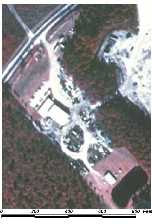
BACK TO CLASSIFICATION LIST
1560 Other Heavy Industrial
1560
- Other Heavy Industrial
LEVEL 1: 1000 Urban and Built-Up
LEVEL 2: 1500 Industrial
LEVEL 3: 1560 Other Heavy
Industrial
DESCRIPTION:
This class is used for any
processing or heavy manufacturing operations that are not included in the 1550
Light Industrial or 1560 Oil and Gas Processing classes. It
includes such specific heavy industries as ship building and repair,
pre-stressed concrete plants, metal fabrication, and large lumber mills.
Heavy manufacturing plants that use
any type of raw materials are included in this class. It also includes
plants that require minerals or wood-based materials as long as they
produce a finished manufacturing product. Facilities that produce primary
materials from wood-based materials or minerals belong in the Industrial class
(1500).
Heavy manufacturing operations are
characterized by large, heavy steel- frame, one-story buildings which support
overhead traveling cranes. Outside (open) storage of finished products is
typical, and large cranes are used for heavy lifting in those storage yards.
Occasionally, outside storage of impervious raw materials and waste is seen,
but such storage is not usual as with the heavy processing industries. Railroad
lines and spurs are common, with the spurs often entering the buildings.
Size and other characteristic
features help differentiate heavy industry from other Industrial classes.
However, the class is primarily determined by the type of process and product,
not by size or visible indicators alone. Manufacturing codes from ancillary
data sources provide such information.
Heavy industries tend to have
extensive handling, transport, heavy lifting, storage, waste treatment, and
power facilities. Light industrial operations, in comparison, are usually
enclosed operations without such extensive outdoor activities.
Other Industrial, Extractive and
Utility classes can have a similar appearance on aerial
photography. Ancillary land use data should be checked, if available,
to confirm this class. Heavy manufacturing may be mixed with other uses,
in which case the predominant use should be determined and the polygon
classified accordingly.
In transitional areas where species
specific wetland and upland polygons are below the appropriate MMU some
aggregation may be justified. In these cases intermixed community classes will
be assigned and mapped at a larger unit.
KEYS TO PHOTOINTERPRETATION:
There is little or no vegetation or planned landscaping.
There is often an unkempt, "industrial" look to the
property.
Operations are usually fenced and secured.
They may have open areas for storage or outdoor equipment or parking.
The sites are usually large; buildings tend to be large and
complex.
CONTEXT:
Landscape Position - Heavy industries are often clustered in
areas with appropriate zoning, utilities, transportation and other
factors. They tend to be located adjacent to urban areas, with access to
major transportation routes, including roads, railroads, water and airports.
Heavy industrial concentration is often located by port or rail
facilities. Alternatively, it may be located in more remote areas where
raw materials, energy, or water are available.
SIMILAR CLASSES:
1500 Industrial - Most classes in
the Industrial group can appear to have similar signatures. Heavy
industry is differentiated by size and other characteristics, but appearance
alone will not differentiate it from similar classes. Ancillary land use
data indicating the type of manufacturing will be critical in many cases.
1550 Other Light Industrial - Operations are mainly enclosed; buildings
are simple rectangular.
SPECIAL MAPPING CONVENTIONS:
Only those features that are inside
the facility boundaries and involved in its operation are included in the 1560
mapping unit. These may include parking and transportation areas, treatment
facilities, fuel storage, office buildings, and open areas within the
operational boundary.
Priority classes such as water
bodies and wetlands are exceptions to the above. If these features meet their
minimum size criteria they are always broken out, even if located within the
1560 mapping unit.
Dual coding convention: This is a Land Use
class. The LUCODE and LCCODE are the same. A separate land cover
code is not required.
DOQQ Image
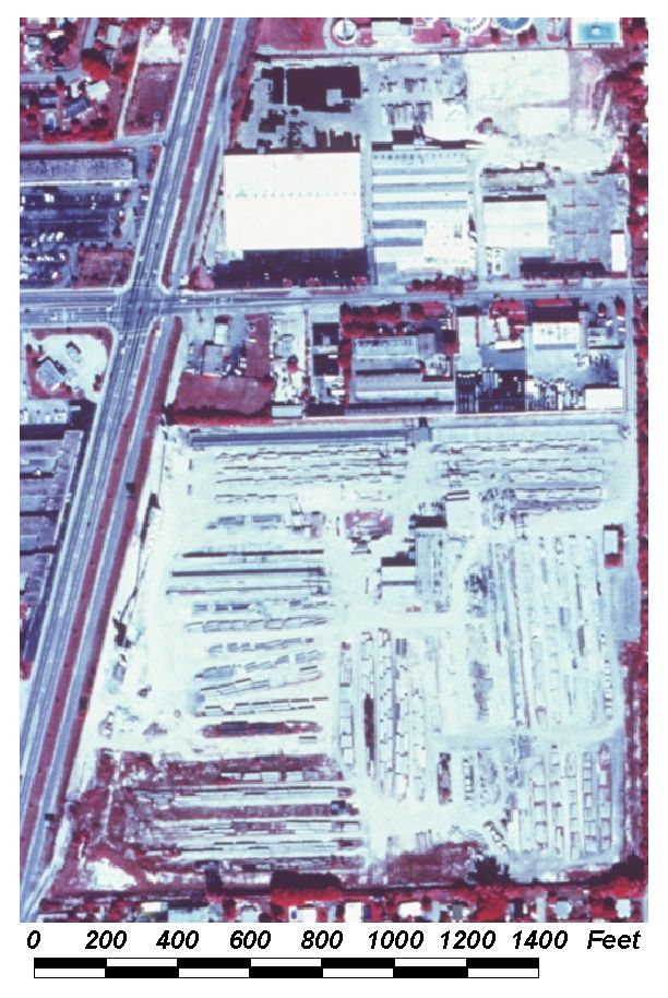
BACK TO CLASSIFICATION LIST
1590 Industrial Under Construction
1590
– Industrial Under Construction
LEVEL 1: 1000 Urban and Built-Up
LEVEL 2: 1500 Industrial
LEVEL 3: 1590 Industrial
Under Construction
DESCRIPTION:
This class includes all 1500 classes
that are in the process of construction. For a detailed description of
those classes see the PI key pages for each one.
This class can be difficult to
differentiate from similar classes, especially when under construction.
Ancillary land use data (i.e. parcel maps) should be used if available.
KEYS TO PHOTOINTERPRETATION:
See descriptions for 1500 classes
Much of the land surface is likely to be un-vegetated and disturbed.
Construction equipment and building may be visible.
There are likely to be mounds of fill material, temporary dirt roads,
ponding, construction material, construction trailers, and other signs of
on-going construction.
Areas under construction will be very light-toned, with a white
signature where soil is exposed.
CONTEXT:
Landscape Position - Industrial facilities are often clustered
together in larger areas with appropriate zoning, utilities, transportation and
other factors. They tend to be located adjacent to urban areas, and with access
to major transportation routes, including roads, railroads, water and airports.
Heavy industrial concentration is often located by port or rail facilities.
Finished products and warehouses tend to be located in urban fringe areas.
Fabricating and assembly industries are usually located adjacent to central
business districts.
SIMILAR
CLASSES:
1190, 1290, 1390 - all Residential
Under Construction Classes - will show the typical residential pattern;
individual buildings generally smaller than commercial buildings
7400 Disturbed Land - evidence of current construction
not usually evident; old machinery may be visible
7420 Borrow Areas - evidence of excavation such as pits and trenches
SPECIAL MAPPING CONVENTIONS:
Many of the indicators of the 1500
classes are not visible during the construction period. Ancillary data such
as parcel or zoning maps may be needed to differentiate this code from other
'under construction' classes.
Dual coding convention: This is a Land Use class. The LUCODE
and LCCODE are the same. A separate land cover code is not required.
BACK TO CLASSIFICATION LIST
1600
Extractive
1600
- Extractive
LEVEL 1: 1000 Urban and Built-Up
LEVEL 2: 1600 Extractive
DESCRIPTION:
This is an active Level 2 class that
should be applied only when one of the more specific Level 3 and 4 subclasses
cannot be determined. This may occur when the particular type of extractive
activity is not discernible from the aerial photo. The subclasses
include:
1610 Strip Mines
1620 Sand and Gravel Pits
1630 Rock Quarries
1640 Oil and Gas Fields
1650 Reclaimed Mine Land
1660 Holding Ponds
1670 Abandoned Mine Land
1620 Sand and Gravel pits are the
prominent form of extractive activity in Baldwin County.
General Description, modified from
FDOT manual:
Extractive areas encompass both
surface and subsurface mining operations. Included are strip mines -clays, peat
and heavy metals; sand and gravel pits; rock quarries - including
limerock and phosphate; and oil and gas fields. Holding ponds, reclaimed and
abandoned mines are also included. Industrial complexes where the
extracted material is refined, packaged or further processed, belong in the
1500 Industrial class. The recognizable impacts of these activities on the
landscape will vary from the giant pit mines covering vast areas to oil wells
which cover only a few square feet. Consistent identification of these diverse
mining areas can be difficult from remote sensing data alone.
Flooded pits and quarries, which may
be part of a mining operation, will be classified as 1660 Holding
Ponds. The presence of water bodies does not necessarily imply
inactive or unused extractive areas; ponds or lakes are often an integral part
of an extractive operation.
Abandoned and inactive mining operations
are a part of the extractive category. Reclaimed mine lands are also
included with either managed or natural re-vegetation. Both 1650 Reclaimed Mine Land and 1670 Abandoned Mine Land are land use classes that require
interpretation of land cover also. Areas of tailings and abandoned pits
and quarries may remain recognizable for a long time. Such areas may be barren
for decades after deposition. At some point of restoration the mining signature
will not be recognizable, and such areas are mapped in other appropriate
categories.
KEYS TO PHOTOINTERPRETATION:
Large areas of surface disturbance; scouring and piling of land and
overburden; often ponded.
Deep (rock quarry) or shallow (sand and gravel pits) excavations that
are often ponded
Presence of waste piles, piles of mined materials, and a variety of
excavating equipment such as bulldozers, shovels, dredges and drag lines
Transportation equipment such as trucks, mini cars, railway equipment
and conveyors
Some mining operations require considerable processing before shipping
and will have large structures and associated refining equipment
Most operations are quite large and impressive on the landscape.
CONTEXT:
Landscape Position - These land uses may be found in any area of
the County, depending on the specific class of activity.
SIMILAR CLASSES:
All active mining classes have a
potential for similar appearance on an aerial photo. When the particular type
of extractive activity cannot be determined, the Level 2 1600 code should be
used. Ancillary data, such as soils, should be used to help determine the type
of mine prior to using the more general class.
7400 Disturbed Land - 7400 may be used as a land cover code with land uses 1650
or 1670, or it may be used by itself if the land use cannot be determined
SPECIAL MAPPING CONVENTIONS:
This classification was modified by
the County. Flooded open water pits and quarries that are part of inactive
mining operations are classified as 5300 Reservoirs. If the mining
operation is still active, these are classified as 1660 Holding Ponds.
This Level 2 code may be used when
it is impossible to distinguish between 1610 Strip Mines, 1620 Sand and Gravel
Pits, and 1630 Rock Quarries. The PI must always use the most specific
class possible.
Dual coding convention: All the 1600 classes are Land
Use classes. The LUCODE and LCCODE are the same, except 1650 Reclaimed Mine Land and 1670 Reclaimed Mine Land. These require a separate Land
Cover code.
BACK TO CLASSIFICATION LIST
1610
Strip mines
1610
- Strip Mines
LEVEL 1: 1000 Urban and Built-Up
LEVEL 2: 1600 Extractive
LEVEL 3: 1610 Strip Mines
DESCRIPTION:
Strip mining is a method that accesses
buried material by stripping off the top surface of the land. If the
product is covered, all overburden is removed to gain access to the product.
Two broad categories of strip mining are: Area strip mining, which is practiced
on relatively level terrain; and contour strip mining, which is done in hilly
terrain.
The operations are easily identified
by characteristic land scarring, either as enormous pits, or in long shallow
trenches with the overburden piles along the trenches. Active operations are
indicated by the presence of power shovels, dredges, or other heavy tracked
construction equipment, bulldozers, trucks, maintenance and supervisory
buildings.
Cooling canals for thermal electric
or nuclear power plants might be confused with strip mines. The canals are a
regularly-spaced series of parallel trenches which cover many square miles. The
canals are connected to each other and to the power plant discharge canal,
whereas the water-filled trenches of strip mines do not interconnect.
Abandoned or inactive strip mines
are flooded. The water is a deep black and the surrounding area is reddish-gray
as vegetation re-establishes itself on the overburden and open areas. Abandoned
mines remain in the Extractive category until succession has produced a cover
which appears as a dark magenta tone on CIR photography, unless there is
evidence that the site is being reclaimed.
This Level 3 class also includes
mining operations such as clay, peat, and heavy metals.
KEYS TO PHOTOINTERPRETATION:
This mining method is identified by its land scarring, either in
pit form or in long trenches, with tailings along the trenching operation.
A series of elongated piles of spoil is present.
Clay and heavy metals mines tend to be large operations.
CONTEXT:
Landscape Position - Strip mining operations are generally
located in open, rural areas. The exact location depends on the geology of the
area. Boundaries with adjacent land uses are distinct.
SIMILAR CLASSES:
1620 Sand and Gravel Pits - conical
piles of sand and gravel may be visible
1630 Rock Quarries - most quarries are flooded
1650 Reclaimed Mine Land - vegetation tends to have a
planned, landscaped appearance
1670 Abandoned Mine Land - vegetation has a more random,
unplanned appearance
SPECIAL MAPPING CONVENTIONS:
The 1610 mapping unit includes
active and inactive mining operations and all other features that are part of
the mining operation. This includes storage areas, material stockpiles,
parking, offices and other buildings, roads, and open areas that are inside the
operational boundary. Those areas that are outside the active perimeter and not
related to the operation are not included.
Priority classes such as water
bodies and wetlands are exceptions to the above. If these features meet their
minimum size criteria they should be broken out. Also broken out are 1660
Holding Ponds, 1650 Reclaimed Mine Land and 1670 Abandoned Mine Land areas, if they meet minimum size
criteria. These classes can overlap and intermingle in mining areas, or
change quickly with water level fluctuations. Portions of the site may be
temporarily vegetated or water-filled. PIs should consider the
predominant uses and avoid excessively detailed line work.
Dual coding convention: This is a Land Use
class. The LUCODE and LCCODE are the same. A separate land cover code is
not required.
DOQQ Image
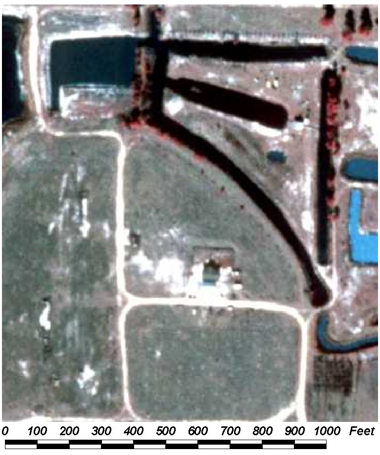
BACK TO CLASSIFICATION LIST
1620 Sand and Gravel Pits
1620
- Sand and Gravel Pits
LEVEL 1: 1000 Urban and Built-Up
LEVEL 2: 1600 Extractive
LEVEL 3: 1620 Sand and
Gravel Pits
DESCRIPTION:
This class includes active sand and
gravel mining operations and their associated features, as well as clay pits.
The operations usually include processing facilities for sorting,
cleaning, crushing, etc. Concrete batch plants or portland cement operations
may also be located at the mining sites. Active operations are indicated by the
presence of power shovels, dredges, heavy tracked construction equipment,
bulldozers, trucks, washing and screening equipment, and buildings for
maintenance, storage, and supervision. This is the most prevalent form of
extraction in Baldwin County.
Sand and gravel operations are often
located near built up areas, supporting local demands for construction
materials. They tend to be relatively small in size compared to other strip
mining operations such as metals and phosphates. Clay pits will appear similar
to dry sand and gravel pits, but will lack processing equipment.
KEYS TO PHOTOINTERPRETATION:
Signatures tend to be very light, bright tones for unsaturated areas.
Stockpiles are conical, often found at the end of elevated conveyor
belts.
Sides of excavations are smooth, scalloped and sloping, compared to
jagged vertical walls of rock quarries.
NRCS county soil maps should assist in locating these sites.
Pits may be flooded or dry, depending on depth, status, and water
conditions.
CONTEXT:
Landscape Position - These operations are generally located near
built up areas, serving the local demand for construction materials.
SIMILAR CLASSES:
1610 Strip Mines - major land
scarring apparent on photo
1660 Holding Ponds - almost always have a deep black signature
7200 Sand Other Than Beaches - do not have construction equipment, trucks, etc.
7420 Borrow Areas - appear as a depression, with a regular, often rectangular
shape
SPECIAL MAPPING CONVENTIONS:
The 1620 mapping unit includes all
active and inactive mining operations themselves and their other associated
features. Those areas that are outside the active facility perimeter and
not related to its functions are not included.
Priority classes such as water
bodies and wetlands are exceptions to the above. If these features meet their
minimum size criteria they should be broken out. Also broken out are 1660
Holding Ponds, 1650 Reclaimed Mine Land and 1670 Abandoned Mine Land, if they meet minimum size
criteria. These classes can intermix on the sites, or change quickly with
water level fluctuations. Portions of the site may be temporarily
vegetated or water-filled. PIs should consider the predominant uses and
avoid excessively detailed line work.
Dual coding convention: This is a Land Use
class. The LUCODE and LCCODE are the same. A separate land cover code is
not required.
DOQQ Image
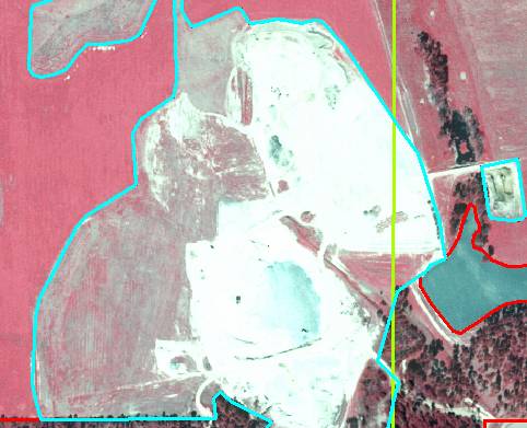
Field Picture
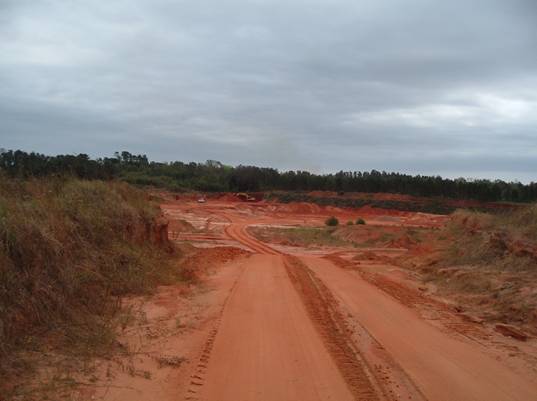
BACK TO CLASSIFICATION LIST
1630
Rock Quarries
1630
- Rock Quarries
LEVEL 1: 1000 Urban and Built-up
LEVEL 2: 1600 Extractive
LEVEL 3: 1630 Rock Quarries
DESCRIPTION:
Most quarries are flooded because of
the low, flat topography and high water table in limestone terrain. Blasting is
carried out under water and draglines remove the broken rock, excavating to
depths averaging forty feet in the process. Look for draglines, broken rock
drying in "surge piles" at the edge of the quarry, and trucks or
conveyors moving the partially dried rock to the crushers of a nearby
processing plant. Quarry edges, when visible, are vertical and jagged, unlike
the edges of sand and gravel pits, or clay pits, which usually show smoother,
scalloped, sloping edges. The water is very turbid in an active quarry,
appearing a grayish green on CIR photography, while the active quarry area is a
bright white.
KEYS TO PHOTOINTERPRETATION:
The quarry pits are deep, with jagged, vertical walls, unlike sand,
gravel and clay pits.
Rock piles lack the smooth, uniform texture and color of finer
materials.
The excavation equipment is characteristic of rock quarrying, with
draglines visible in active pits.
Broken rock lies in "surge piles" at the edge of the quarry,
and is conveyed by trucks or conveyors to nearby processing plants, which may
be on site.
Rock quarries, which usually support local construction, may be small
compared to intensive operations such as heavy metals and phosphates.
CONTEXT:
Landscape Position - Rock quarries are moving away from populated
areas to avoid impacts such as dust, noise and traffic. However, many are still
near developed areas, to take advantage of lower transportation costs.
SIMILAR CLASSES:
1600 Extractive- Most classes
in the extractive group can present similar signatures.
7000 Barren Land- Has a similar appearance, but
no indicators characteristic of mining.
SPECIAL MAPPING CONVENTIONS:
The 1630 mapping unit includes all
active and inactive mining operations and their associated features.
Those areas that are outside the facility perimeter and not related to its
functions are not included.
Priority classes such as water
bodies and wetlands are exceptions to the above. If these features meet their
minimum size criteria they should be broken out. Also broken out are 1660
Holding Ponds, 1650 Reclaimed Mine Land 1670 Abandoned Mine Land areas, if they meet minimum size
criteria. These classes can intermix on the sites, or change quickly with
water level fluctuations.
Temporarily inactive sites remain in
the 1630 category. Reclaimed sites are classified as 1650 Reclaimed Mine Land and abandoned sites as 1670 Abandoned Mine Land. At some point of
restoration or re-growth the mining function may not be apparent from the
aerial photography. If so, such areas are assigned to other appropriate
classes.
Dual coding convention: This is a Land Use class.
The LUCODE and LCCODE are the same. A separate land cover is not
required.
DOQQ Image
Field Picture
BACK TO CLASSIFICATION LIST
1640 Oil and Gas Fields
1640
- Oil and Gas Fields
LEVEL 1: 1000 Urban and Built-Up
LEVEL 2: 1600 Extractive
LEVEL 3: 1640 Oil and Gas
Fields
DESCRIPTION:
These areas are the sources of crude
petroleum products. No refining facilities are associated with these land uses
and they are often difficult to recognize. Native vegetation is left intact
where possible in an effort to minimize environmental impacts. The key features
for identification of this land use are the well pads and numerous cleared
linear corridors for access roads and pipes for the transport of the petroleum
products to a central handling facility for shipping to the refinery.
Well pads are identified as
clearings in the native vegetation, typically at the end of an access road or
directly adjacent to such a road, with a regularly shaped area of crushed stone
or other non-native material around the well head. With high resolution CIR
photography, the well may be visible with sufficient magnification. Access
roads and pipe corridors are visible as areas of cleared vegetation with
varying amounts of herbaceous or shrubby growth depending on the amount of
traffic and the status of maintenance. The vegetation will produce a magenta or
greenish shade depending on the type of vegetation and the amount of moisture
present. Wetter areas or winter dormant herbaceous vegetation typically present
the greenish tones while shrubs and growing herbaceous materials produce
magenta signatures. Storage facilities (e.g., tanks) are also present in the
vicinity of the distribution center.
KEYS TO PHOTOINTERPRETATION:
Well head pads and drilling equipment are present, visible as clearings
in the native vegetation, typically at the end of an access road.
Access roads and pipe corridors are visible as straight lines of cleared
vegetation with varying herbaceous or shrub overgrowth.
Flow control and storage tank facilities are present.
In forested areas oil and gas fields may appear as a patchwork of small
clearings connected by a grid system of access roads.
CONTEXT:
Landscape Position - Oil and Gas Fields are located in
undeveloped areas.
SIMILAR CLASSES:
1460 Oil and Gas Storage - Gas
storage tanks are often horizontal cylinders with rounded ends.
SPECIAL MAPPING CONVENTIONS:
The 1640 mapping unit includes active
and inactive mining operations and all associated features. Those areas
that are outside the facility perimeter and not related to its functions are
not included. Priority classes such as water bodies and wetlands are
exceptions to the above. If these features meet their minimum size criteria
they should be broken out.
Dual coding convention: This is a Land Use
class. The LUCODE and LCCODE are the same. A separate land cover is
not required.
DOQQ Image
Field Picture
BACK TO CLASSIFICATION LIST
1650 Reclaimed Lands
1650
- Reclaimed Mine Land
LEVEL 1: 1000 Urban and Built-Up
LEVEL 2: 1600 Extractive
LEVEL 3: 1650 Reclaimed Mine Land
DESCRIPTION:
This class is for mining sites that
have been or are being restored to approximate a natural state or converted
into other types of land use, such as pasture, recreation, or
development. It does not include portions of active mining areas that are
temporarily inactive, or abandoned mine lands. Check topography maps for
locations of old mining areas.
On close inspection, the geometry of
the site will reflect the extent of previous mining operations, examples of
which may be active in the surrounding landscape.
KEYS TO PHOTOINTERPRETATION:
Waste areas and spoil piles from mining operations may still
remain. Portions of the site may be abandoned.
Artificial water bodies created from the mining or reclamation
activities are often present, in contrast to natural lakes or a lack of surface
water features in the surrounding landscape.
If there are no indications or signature of prior mining
activities, the area should be classified as the natural cover type or
appropriate land use class.
CONTEXT:
Landscape Position - Reclaimed lands are generally located in
rural areas with a history of mining activities, some of which may be currently
active.
Vegetation - Vegetation is likely to be sparse compared to
natural areas, and tends to have a planned, landscaped appearance. Vegetative
communities are usually not the same as adjacent natural areas.
SIMILAR CLASSES:
1600 Extractive- Most classes
in the Extractive class can present similar signatures
1610 Strip Mines - major land scarring apparent on photo
1670 Abandoned Mine Lands - vegetation has a more random, unplanned appearance
3100 Herbaceous (Dry Prairie) - shows no evidence of mining activity
3200 Shrub and Brushland - vegetation has a natural appearance; no evidence of
mining activity
3300 Upland Non-Forested (Mixed) - vegetation has a natural appearance; no
evidence of mining activity
7400 Disturbed Land - has a more whitish, scoured appearance, with some active
site preparation or other activity visible
SPECIAL MAPPING CONVENTIONS:
The 1650 mapping unit includes the
former operational area of mining operations that have been reclaimed;
this includes former storage areas, material stockpiles, parking, offices and
other buildings, roads, and open areas that were at one time inside the
operational boundary.
Priority classes such as water
bodies and wetlands are exceptions to the above. If these features meet their
minimum size criteria they should be broken out. Also broken out are
Reservoirs (5300) and Abandoned Mine Lands (1670). These classes can be
intermixed on mining sites - some aggregation may be required at
the discretion of interpreters. PIs should consider the predominant
uses or cover and avoid excessively detailed line work.
Dual coding convention: This is a Land Use
class. Dual coding is always required - a land cover code must be assigned
in addition to the 1650 code. The land cover code is frequently from one
of the 3000 classes, 'Upland Non-Forested'.
DOQQ Image
Field Picture
BACK TO CLASSIFICATION LIST
1660
Holding Ponds
1660
- Holding Ponds
LEVEL 1: 1000 Urban and Built-Up
LEVEL 2: 1600 Extractive
LEVEL 3: 1660 Holding Ponds
DESCRIPTION:
This class includes the artificial
bodies of water within the operational boundary of active mining sites.
The ponds may be part of the active mining process or inactive at the time of
photography. If they are clearly in a final state of reclamation or abandonment
they should be classed as 5300 Reservoirs
Man-made ponds and lakes often form
an integral part of the extractive process. They serve a variety of
purposes such as storm water treatment, settling ponds, and the discharge point
for de-watering operations.
Determination of the intended use of
the ponds is usually not possible using aerial photos. Areas of open
water on a mining site are therefore classed 5300 Reservoirs or 5200 Lakes
rather than 1660 Holding Ponds, unless there is evidence (e.g. equipment
present) that shows there is active mining in the pit.
KEYS TO PHOTOINTERPRETATION:
Man-made ponds of varying size and shape, located in and around mining
areas.
Ponds are almost always black on CIR photography, or streaked with white
from the reflection of ripple patterns. More turbid sites may appear grayish
green, and active sites may also have an unnatural light blue color.
CONTEXT:
Landscape Position - Holding Ponds can be found throughout the
County in mostly remote, exurban areas.
SIMILAR CLASSES;
5300 Reservoirs - Evidence of active extraction not appparent
SPECIAL MAPPING CONVENTIONS:
Priority classes such as natural
water bodies and wetlands are broken out if they meet their minimum size
criteria. Ponds and quarries are usually classified as 5300 Reservoirs if
they are clearly in a final state of reclamation or abandonment.
Dual coding convention: This is a Land Use
class. The LUCODE and LCCODE are the same. A separate land cover code is
not required.
DOQQ Image
Field Picture
BACK TO CLASSIFICATION LIST
1700 Institutional
1700 -
Institutional
LEVEL 1: 1000 Urban and Built-Up
LEVEL 2: 1700 Institutional
DESCRIPTION:
This class includes a broad range of
Institutional uses which can be difficult to differentiate individually.
1700 includes uses such as educational, religious, medical and health care,
governmental, correctional, commercial child care, and others. Included within
a particular Institutional unit are all buildings, grounds, parking lots,
recreational areas, green houses, gardens, and other features that are attached
to the facility.
Educational institutions encompass
all levels of public and private schools, colleges, universities, training
centers, etc. The entire areas enclosing buildings, campus open space,
dormitories, recreational facilities and parking lots are included into this
category where they are identifiable.
KEYS TO PHOTOINTERPRETATION:
Institutions often have many smaller structures , including on-site
residences.
Many facilities are self sufficient; they may have their own power
generator and sanitary disposal systems.
Institutions are often fenced - passage may be restricted or controlled.
Correctional facilities tend to be confined facilities enclosed within multiple
fence structures.
They normally have good transportation access.
They tend to have large lawns and planned landscaping, with an absence
of natural vegetation.
Some operations are quite large and impressive on the landscape.
CONTEXT:
Landscape Position - The location depends on the type of
institution. Most educational and medical facilities are located in populated
areas. Military or correctional facilities are often in more isolated areas.
SIMILAR CLASSES:
1400 Commercial and Services -
Features such as office buildings may look the same whether public or private.
Ancillary land use data may be used to differentiate.
SPECIAL MAPPING CONVENTIONS:
Those areas that are not clearly
related to the functions of the institution are not included. Land cover areas,
such as pastures and forests, that are adjacent to the facility should
generally be classed with the land cover value, and not dual-coded. Only those
features that are inside the facility boundaries and actively involved in its
operation are coded 1700. These may include gardens, lawns, fields and
recreational areas. Spatial integration and function determine whether features
are included in the 1700 mapping unit. The PI is not required to discern
ownership or replicate property ancillary data, and should err on the side of
capturing land cover and environmental function.
Priority classes such as water
bodies, wetlands, golf courses, landfills and treatment facilities, are
exceptions to the above. If these features meet their minimum size criteria
they are always broken out, even if located within the 1700 mapping unit.
Dual coding convention: This is a Land Use
class. The LUCODE and LCCODE are the same. A separate land cover code is
not required.
BACK TO CLASSIFICATION LIST
1710 Educational Facilities
1710
- Educational Facilities
LEVEL 1: 1000 Urban and Built-Up
LEVEL 2: 1700 Institutional
LEVEL 3: 1710 Educational
Facilities
DESCRIPTION:
Educational facilities include all
public and private schools, colleges, universities, training centers, etc. It is
not possible to identify many smaller private schools or professional
educational facilities from aerial photos as they can occupy the same types of
structures, or parts of structures, used by non- educational land uses.
Supplemental data is often necessary to accurately determine this class.
In rural areas, many of these
structures have been abandoned and must be examined for signs of activity on
the aerial photo if first identified from a topographic map. The important
identifying features of these facilities are well known. The public school is
one of the easier items to identify due to its size, shape, and the related and
well-defined physical education areas. Even in the elementary schools, baseball
diamonds are evident and often other playground equipment and use patterns can
be seen. In the high schools, the baseball diamonds are joined by soccer and
football fields and track facilities. Separate on-premise parking for staff and
students is provided. Older school facilities in the central urban core are
limited in area as compared to newer facilities, and often the parking or
physical education facilities may be in a separate location from the school
building itself. A flagpole (or shadow of a flagpole) and landscaped areas can
often be distinguished.
Universities, colleges, and some
private secondary schools often occupy large areas of land. Main buildings
(administration and maintenance buildings, classrooms, libraries, cafeterias,
student centers, dormitories, group residences and staff houses on or adjacent
to the main campus), campus open spaces, parking lots, all supporting
facilities, and any other features that are functionally related to the
educational institution are included in this class.
Also included are stadiums and other
recreational facilities, experimental farms, greenhouses and research field
station structures, and other agricultural uses specifically associated with
the campus where they are identifiable, as well as research parks operated by
the university.
Nearby or adjacent industrial parks
should be examined closely for signs of connections with the campus; if the
aerial photo or supplemental data indicates university ownership, they are also
included in the 1710 Educational Facilites class.
KEYS TO PHOTOINTERPRETATION:
Often noted on topographic maps by either name or symbol.
Related and well-defined physical education areas are visible.
High schools likely have visible baseball diamonds, soccer and/or
football fields.
Universities often occupy large areas of land.
Collateral data may be needed to identify smaller educational
facilities.
CONTEXT:
Landscape Position - Educational facilities are found throughout
the County. They may abut almost any land use, including light industrial. In
rural areas the campus boundaries are usually clearly defined. In urban or
suburban areas, the campus may extend in irregular fashion into the surrounding
land uses. Some facilities (stadiums or sports fields of urban universities)
may be away from the main campus, and unidentifiable as educational facilities
without supplemental data.
SIMILAR CLASSES:
1400 Commercial and Services -
Features such as office buildings may resemble educational facilities.
Ancillary land use data may be used to differentiate these classes.
1700 Institutional - Ancillary data and context will help to determine whether
the facility should be properly classified as educational.
SPECIAL MAPPING CONVENTIONS:
Those areas that are not clearly
related to the functions of the educational institution are not included. Land
cover areas, such as pastures and forests, that are adjacent to the facility
should generally be classed with the land cover value, and not dual-coded. The
PI must delineate the operational boundary of the educational facility as
apparent on the aerial photo.
Only those features that are inside
the facility boundary and actively involved in its operation are coded 1710
Educational Facilities. These may include gardens, lawns, fields and
recreational areas. Spatial integration and function determine which features
are included in the 1710 mapping unit. The PI is not required to discern
ownership or replicate property ancillary data, and should err on the side of
describing land cover and environmental function.
Priority classes such as water
bodies, wetlands, golf courses, landfills and treatment facilities, are
exceptions to the above. If these features meet their minimum size criteria
they are always broken out, even if located within the 1710 mapping
unit.
Dual coding convention: This is a Land Use
class. The LUCODE and LCCODE are the same. A separate land cover code is
not required.
DOQQ Image
Field Picture
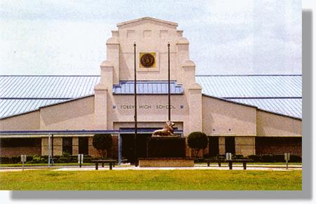
BACK TO CLASSIFICATION LIST
1720
Religious
1720
- Religious
LEVEL 1: 1000 Urban and Built-Up
LEVEL 2: 1700 Institutional
LEVEL 3: 1720 Religious
DESCRIPTION:
Religious areas include churches synagogues
and all the surrounding buildings and property. Many religious facilities
support schools and day care centers within their property. Many times they are identifiable from a
clearly visible steeple or dome structure.
Supplemental data is often necessary to accurately determine this class.
In rural areas, many of these
structures are single building facilities and have steeples. In residential areas they tend to be both
single structure and multiple structures for schools and offices. Large parking lots will be adjacent to
structures and will be nearly empty during the week except for a few cars and
vehicles associated with schools or day care centers and full on the weekends
during services.
Also included are other recreational
facilities specifically associated with the religious facility where they are
identifiable.
KEYS TO PHOTOINTERPRETATION:
These facilities are often noted on topographic maps by either name or
symbol.
Related and well-defined physical education areas are visible for
multiple structure facilities with schools or day care centers.
Collateral data may be needed to identify smaller religious facilities.
Large parking lots that are nearly empty during the week and full on
weekends during religious services.
CONTEXT:
Landscape Position - Religious facilities are found throughout
the County. They may abut almost any land use, including light industrial. In
rural areas the facility boundaries are usually clearly defined and may contain
only one structure. In urban or suburban areas, the facility may include
several buildings and recreation areas associated with schools or day care
centers.
SIMILAR CLASSES:
1400 Commercial and Services -
Features such as office buildings may resemble educational facilities. Ancillary
land use data may be used to differentiate these classes.
1710 Educational Facilities – The parking lots on this category are normally
full during the week unlike religious structures with larger parking
facilities.
SPECIAL MAPPING CONVENTIONS:
Those areas that are not clearly
related to the functions of the religious facility are not included. Land cover
areas, such as pastures and forests, that are adjacent to the facility should
generally be classed with the land cover value, and not dual-coded. The PI must
delineate the operational boundary of the religious facility as apparent on the
aerial photo or collateral parcel data.
Only those features that are inside
the facility boundary and actively involved in its operation are coded 1720
Religious Facilities. These may include gardens, lawns, fields and recreational
areas. Spatial integration and function determine which features are included
in the 1720 mapping unit. The PI is not required to discern ownership or
replicate property ancillary data, and should err on the side of describing
land cover and environmental function.
Priority classes such as water
bodies, wetlands, golf courses, landfills and treatment facilities, are
exceptions to the above. If these features meet their minimum size criteria
they are always broken out, even if located within the 1720 mapping
unit.
Dual coding convention: This is a Land Use
class. The LUCODE and LCCODE are the same. A separate land cover code is
not required.
BACK TO CLASSIFICATION LIST
1730
Military
1730
- Military
LEVEL 1: 1000 Urban and Built-Up
LEVEL 2: 1700 Institutional
LEVEL 3: 1730 Military
DESCRIPTION:
This class includes areas used by
the military, ranging from large bases, reservations, and training camps to
small installations, such as Coast Guard lighthouses and armories. Military
facilities are characterized by a wide variety of features including training
camps, missile sites, etc. Administration, storage, repair, security and other
functional military buildings are included, along with practice ranges, storage
lots and buffer zones. Auxiliary land uses, particularly residential,
commercial and other supporting uses located within the operational boundary of
the military base are included in this category.
KEYS TO PHOTOINTERPRETATION:
Obvious military equipment; tanks, airplanes, missile silos, etc.
Administration, storage, repair, security and other functional
buildings.
Practice ranges, storage areas, equipment storage lots.
Presence of air strips or drop zones.
Usually the installation will be surrounded by chain link fence.
CONTEXT:
Landscape Position - Military bases are often located in isolated
areas. However, they may support commercial, residential, and other uses
that are located in close proximity to the base itself.
SIMILAR CLASSES:
1100 to 1300 - Residential -
Residential areas that are not within the operational boundary of the base
should be coded as Residential.
1400 Commercial and Services - Features such as office buildings may look the
same whether public or private. Ancillary land use data may be used to
differentiate these classes.
1700 Institutional - Ancillary data and context will help to determine whether
the facility is more properly classified as Institutional.
SPECIAL MAPPING CONVENTIONS:
Those areas that are not clearly
related to the functions of the institution are not included. Land cover areas,
such as pastures and forests, that are adjacent to the facility should
generally be classed with the land cover value, and not dual-coded. The PI must
delineate the general boundary of the base and differentiate it from
non-military areas.
Only those features that are inside
the facility boundary and actively involved in its operation are coded 1730.
These may include gardens, lawns, fields and recreational areas. Spatial
integration and function determine which features are included in the 1730
mapping unit. The PI is not required to discern ownership or replicate property
ancillary data, and should err on the side of describing land cover and
environmental function.
Priority classes such as water
bodies, wetlands, golf courses, landfills and treatment facilities, are
exceptions to the above. If these features meet their minimum size criteria
they are always broken out, even if located within the 1730 mapping
unit.
Transportation features (roads,
railroads, airports, etc.) within Military installations that are large enough
to be separately classified will be assigned an 8100 Transportation level code
for land use rather than 1730 Military.
Dual coding convention: This is a Land Use
class. The LUCODE and LCCODE are generally the same; however wetlands or
vegetated areas within the visibly apparent military boundary should be
dual-coded with the LUCODE = 1730 and the appropriate LCCODE.
DOQQ Image
Field Picture
BACK TO CLASSIFICATION LIST
1740 Medical and Health Care
1740
– Medical and Health Care
LEVEL 1: 1000 Urban and Built-Up
LEVEL 2: 1700 Institutional
LEVEL 3: 1740 Medical and
Health Care
DESCRIPTION:
Medical and Health Care Facilities
are composed of Hospitals, Nursing Homes and clinics including all structures
and grounds associated with this category. Identification of medical and health
facilities is accomplished through either the interpretation process or as the
result of supporting supplemental data.
Hospitals usually occupy large areas
and can be found near urban and residential regions. They typically are well
maintained and landscaped areas, with the main hospital building or buildings
surrounded by subsidiary structures such as steam and power plants, water
towers, maintenance buildings, and parking lots. Nursing homes are very similar to hospitals
but on a smaller scale and tend to have less ancillary support structures
surrounding them. Clinics and medical
offices can be very similar to commercial and services classifications and sometimes
will fall under that category if smaller than the minimum mapping unit.
KEYS TO PHOTOINTERPRETATION:
Hospitals occupy large areas and have several support structures with
large parking areas.
Typically hospitals are multiple story buildings.
Nursing homes may vary in size and shape but normally have many of the
same subsidiary buildings and features as hospitals.
Clinics and medical offices can be smaller features similar to commercial
and services and may require ancillary source data.
CONTEXT:
Landscape Position – Typically found in urban areas and near
comparatively dense residential sections.
Smaller medical offices and clinics may be found on the fringe of
residential areas converted to commercial or services land use.
SIMILAR CLASSES:
1400 Commercial and Services -
Features such as office buildings may look the same whether public or private.
Ancillary land use data may be used to differentiate these classes.
1700 Institutional - Ancillary data and context will help to determine whether
the facility is Medical and Health related.
SPECIAL MAPPING CONVENTIONS:
Those areas that are not clearly
related to the functions of the institution are not included. Land cover areas,
such as pastures and forests, that are adjacent to the facility should
generally be classed with the land cover value, and not dual-coded. The PI must
delineate the general boundary of the facility and differentiate it from
non-correctional areas.
Only those features that are inside
the facility boundary and actively involved in its operation are coded 1740.
These may include gardens, lawns, fields and recreational areas. Spatial
integration and function determine which features are included in the 1740
mapping unit. The PI is not required to discern ownership or replicate property
ancillary data, and should err on the side of describing land cover and
environmental function.
Priority classes such as water
bodies, wetlands, golf courses, landfills and treatment facilities, are
exceptions to the above. If these features meet their minimum size criteria
they are always broken out, even if located within the 1760 mapping
unit.
Dual coding convention: This is a Land Use
class. The LUCODE and LCCODE are the same. A separate land cover code is
not required.
DOQQ Image
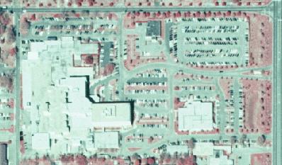
BACK TO CLASSIFICATION LIST
1750
Governmental
1750
- Governmental
LEVEL 1: 1000 Urban and Built-Up
LEVEL 2: 1700 Institutional
LEVEL 3: 1750 Governmental
DESCRIPTION:
All buildings and facilities which
are identifiable as non-military governmental are included in this class. Identification of Governmental facilities is
accomplished through either the interpretation process or as the result of
supporting supplemental data.
Governmental facilities can range from City Halls, Fire Stations Post
Offices and Police Stations to office buildings and maintenance yards. Many of these structures are referenced on
topographic maps and in the parcel data.
These related structures all tend to
have different characteristics. City
halls are typically in urban areas with unique architecture. Post Offices can be found throughout
the County in varying sizes and designs.
Fire Stations typically have one main building with large attached
garages. Police Stations can vary, but
typically have fleet maintenance yards associated with them.
KEYS TO PHOTOINTERPRETATION:
Typically found in urban areas or at the urban center of small towns.
Unique architecture may be employed.
Police Stations typically have fleet maintenance areas.
Fire Stations tend to have large attached garages over one story tall.
CONTEXT:
Landscape Position – Governmental facilities are typically found in
urban areas or at the urban center of small towns.
SIMILAR CLASSES:
1400 Commercial and Services -
Features such as office buildings may look the same whether public or private.
Ancillary land use data may be used to differentiate these classes.
1700 Institutional - Ancillary data and context will help to determine whether
the facility is Governmental.
SPECIAL MAPPING CONVENTIONS:
Only those features that are inside
the facility boundary and actively involved in its operation are coded 1750.
These may include gardens, lawns, fields and recreational areas. Spatial
integration and function determine which features are included in the 1750
mapping unit. The PI is not required to discern ownership or replicate property
ancillary data, and should err on the side of describing land cover and
environmental function.
Priority classes such as water
bodies, wetlands, golf courses, landfills and treatment facilities, are
exceptions to the above. If these features meet their minimum size criteria
they are always broken out, even if located within the 1760 mapping
unit.
Dual coding convention: This is a Land Use
class. The LUCODE and LCCODE are the same. A separate land cover code is
not required.
DOQQ Image
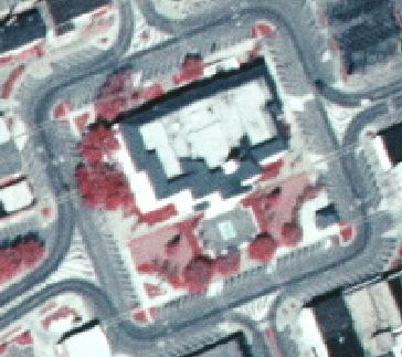
BACK TO CLASSIFICATION LIST
1760
Correctional
1760
- Correctional
LEVEL 1: 1000 Urban and Built-Up
LEVEL 2: 1700 Institutional
LEVEL 3: 1760 Correctional
DESCRIPTION:
Correctional institutions include
only federal and state prisons. All structures and grounds associated with this
category are included; e.g., agricultural areas associated with prison farms.
Identification of correctional facilities is accomplished through either the
interpretation process or as the result of supporting supplemental data.
Prisons usually occupy large areas,
especially when away from urban areas. They typically are set among
well-developed and landscaped open areas, with the prison building or buildings
surrounded by subsidiary structures such as staff residences, steam and power
plants, water towers, maintenance buildings, recreational facilities, and
parking lots. Identification is confirmed by security features such as
perimeter fences and guard towers (or the shadows of guard towers).
Normally, the prison buildings are
enclosed by multiple fences. When a large number of structures are present,
their regular and repetitive arrangement is similar to that seen in military
installations. However military installations will have a clearly visible perimeter
patrol road inside the fence, unlike prisons where the road may not be present
or shows few signs of activity if detected.
Prison farms may also be fenced, and
will show road and track patterns which connect the farm lands to the prison.
KEYS TO PHOTOINTERPRETATION:
Multiple fences normally visible.
Normally occupy large tracts of land.
Usually located outside of urban areas.
Guard towers are an indicator of correctional facilities
CONTEXT:
Landscape Position - Correctional Institutions can be found in
any exurban area. Boundaries with adjoining land uses will be clearly defined.
SIMILAR CLASSES:
1100 to 1300 - Residential -
Residential areas that are not within the operational boundary of the facility
should be coded residential
1400 Commercial and Services - Features such as office buildings may look the
same whether public or private. Ancillary land use data may be used to
differentiate these classes.
1700 Institutional - Ancillary data and context will help to determine whether
the facility is Correctional.
SPECIAL MAPPING CONVENTIONS:
Those areas that are not clearly
related to the functions of the institution are not included. Land cover areas,
such as pastures and forests, that are adjacent to the facility should
generally be classed with the land cover value, and not dual-coded. The PI must
delineate the general boundary of the facility and differentiate it from
non-correctional areas.
Only those features that are inside
the facility boundary and actively involved in its operation are coded 1760.
These may include gardens, lawns, fields and recreational areas. Spatial
integration and function determine which features are included in the 1760
mapping unit. The PI is not required to discern ownership or replicate property
ancillary data, and should err on the side of describing land cover and
environmental function.
Priority classes such as water
bodies, wetlands, golf courses, landfills and treatment facilities, are
exceptions to the above. If these features meet their minimum size criteria
they are always broken out, even if located within the 1760 mapping
unit.
Transportation features (roads,
railroads, airports, etc.) within correctional installations that are large
enough to be separately classified will be assigned an 8100 Transportation
level code for land use rather than 1760 Correctional.
Dual coding convention: This is a Land Use
class. The LUCODE and LCCODE are the same. A separate land cover code is
not required.
DOQQ Image
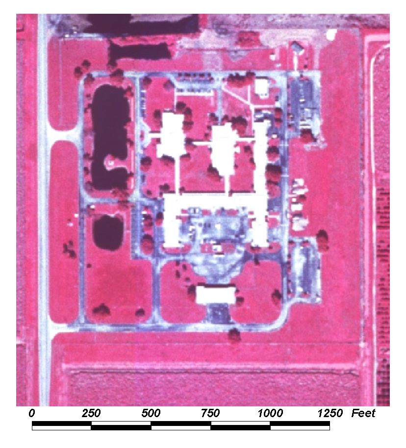
Field Picture
BACK TO CLASSIFICATION LIST
1770 Other Institutional
1770
– Other Institutional
LEVEL 1: 1000 Urban and Built-Up
LEVEL 2: 1700 Institutional
LEVEL 3: 1770 Other
Institutional
DESCRIPTION:
This category is reserved for
facilities which are unique in structure and location. In many cases supplementary data is required for
their correct identification. It is
composed of facilities such as; Elks Club, Masonic Lodge, VFW etc. These structures may have different
characteristics but they all tend to have a larger sized building for a hall
and sometimes smaller subsidiary buildings and parking lots with cars near
entrances.
KEYS TO PHOTOINTERPRETATION:
Typically found in urban or medium to high density residential areas or
at the urban center of small towns.
Main Buildings tend to be large meeting halls.
Can be located in residential fringe areas where structures have been
converted to commercial and services use.
CONTEXT:
Landscape Position – Found in urban areas or at the urban center
of small towns and within residential fringe areas.
SIMILAR CLASSES:
1400 Commercial and Services -
Features such as office buildings may look the same whether public or private.
Ancillary land use data may be used to differentiate these classes.
1700 Institutional - Ancillary data and context will help to determine whether
the facility is Governmental.
SPECIAL MAPPING CONVENTIONS:
Priority classes such as water
bodies, wetlands, golf courses, landfills and treatment facilities, are
exceptions to the above. If these features meet their minimum size criteria
they are always broken out, even if located within the 1770 mapping
unit.
Dual coding convention: This is a Land Use
class. The LUCODE and LCCODE are the same. A separate land cover code is
not required.
BACK TO CLASSIFICATION LIST
1780 Commercial Child Care
1780
– Commercial Child Care
LEVEL 1: 1000 Urban and Built-Up
LEVEL 2: 1700 Institutional
LEVEL 3: 1780 Commercial
Child Care
DESCRIPTION:
This category includes all privately
owned and operated child day car facilities not associated with religious or
other institutions. These facilities can
vary in size and are found in and around residential areas. Typically they have visible playgrounds associated
with them and driveways through the parking area for child drop off. Parcel data information may be required for
correct classification.
KEYS TO PHOTOINTERPRETATION:
Typically found in residential areas.
Visible playground areas attached to main structure.
Child drop-off areas found in parking lot.
CONTEXT:
Landscape Position – Commercial Child Care facilities are
typically found within or adjacent to residential areas.
SIMILAR CLASSES:
1400 Commercial and Services -
Features such as office buildings may look the same whether public or private. Ancillary
land use data may be used to differentiate these classes.
1710 and 1721 Institutional - Ancillary data and context will help to determine
whether the facility is Child Care, typically these classes are larger with
multiple structures.
SPECIAL MAPPING CONVENTIONS:
Those areas that are not clearly
related to the functions of the facility are not included. Adjacent land cover areas,
such as pastures and forests, are assigned the appropriate land cover value,
and not dual-coded. Only those features that are inside the operational
boundaries are coded 1440.
Priority classes such as water
bodies and wetlands are exceptions to the above. If these features meet their
minimum size criteria they are always broken out, even if located within the
1470 mapping unit.
Dual coding convention: This is a Land Use
class. The LUCODE and LCCODE are the same. A separate land cover code is
not required.
BACK TO CLASSIFICATION LIST
1790 Institutional Under Construction
1790
– Institutional Under Construction
LEVEL 1: 1000 Urban and Built-Up
LEVEL 2: 1700 Institutional
LEVEL 3: 1790 Institutional
Under Construction
DESCRIPTION:
This class includes all 1700 classes
that are in the process of construction. For a detailed description of
those classes see the PI key pages for each one.
This class can be difficult to
differentiate from similar classes, especially when under construction.
Ancillary land use data (i.e. parcel maps) should be used if available.
KEYS TO PHOTOINTERPRETATION:
See descriptions for 1700 classes
Much of the land surface is likely to be un-vegetated and disturbed.
Construction equipment and building may be visible.
There are likely to be mounds of fill material, temporary dirt roads,
ponding, construction material, construction trailers, and other signs of
on-going construction.
Areas under construction will be very light-toned, with a white
signature where soil is exposed.
CONTEXT:
Landscape Position – The location depends on the type of
institution. Most educational and medical facilities are located in populated
areas. Military or correctional facilities are often in more isolated areas.
SIMILAR
CLASSES:
1490, 1590 etc.- all Under
Construction Classes - will show the typical category pattern
7400 Disturbed Land - evidence of current construction not usually evident; old
machinery may be visible
7420 Borrow Areas - evidence of excavation such as pits and trenches
SPECIAL MAPPING CONVENTIONS:
Many of the indicators of the 1700
classes are not visible during the construction period. Ancillary data
such as parcel or zoning maps may be needed to differentiate this code from
other 'under construction' classes.
Dual coding convention: This is a Land Use class. The LUCODE
and LCCODE are the same. A separate land cover code is not required.
BACK TO CLASSIFICATION LIST
1800
Recreational
1800
- Recreational
LEVEL 1: 1000 Urban and Built-Up
LEVEL 2: 1800 Recreational
DESCRIPTION:
This is an active Level 2 class that
should be used only when one of the more specific subclasses cannot be applied.
The Level 3 subclasses are:
1810 Swimming Beach
1820 Golf Course
1830 Race Tracks
1840 Marinas and Fish Camps
1850 Parks and Zoos
1870 Stadiums - Not Academic
The 1800 code includes areas used
for outdoor activities such as community sports, open-air performances, or
those used as fairgrounds, as well as those areas where the apparent recreational
activity does not fit into one of the Level 3 classes, or cannot be readily
determined.
Those areas that are not clearly
related to recreational functions are not included. Land cover areas such as
pastures and forests that are adjacent to the facility should generally be
classed with the land cover value, and not dual-coded. Only those features that
are inside the recreational facility boundaries and actively involved in its
operation are included in this class. These may include gardens, lawns, fields
and recreational areas. Spatial integration is the key indicator. The PI is not
required to use ownership or property ancillary data, and should err on the
side of land cover and environmental function.
This class does not include fields
attached to other facilities where the primary use is different, such as
commercial or institutional facilities. For those examples, the 1400 or 1700
codes would be used, respectively, and would include the attached athletic
fields.
KEYS TO PHOTOINTERPRETATION:
Well organized grounds with parking facilities. Parking areas are often
not paved.
Easily recognizable fields with shapes and markings associated with
sports complexes
Community recreational facilities for baseball, football, soccer, tennis
etc.
Small buildings on-site used for food service, rest rooms, utilities.
CONTEXT:
Landscape Position - These land uses may be found in any area of
the County, depending on the specific class of activity.
SIMILAR CLASSES:
Recreational areas are usually
distinguishable by characteristic features. Features like golf courses and
stadiums are distinctive and easy to interpret. Problems may arise with:
Indoor recreational uses - these will be difficult to distinguish from
commercial and institutional uses. The error is not significant.
Resorts - these will often have recreational facilities, but are
classified as 1400 Commercial and Services.
Institutions - Schools will have recreational facilities that are to be included
in the 1700 mapping units. To be classed as 1800, the recreational areas should
be independent from commercial or institutional operations.
SPECIAL MAPPING CONVENTIONS:
This Level 2 code is to be used only
when it is impossible to assign one of the more specific Level 3 or 4
subclasses. The PI must always use the most specific class possible.
Dual coding convention: This is a Land Use
class. The LUCODE and LCCODE are the same. A separate land cover code is not
required.
DOQQ Image
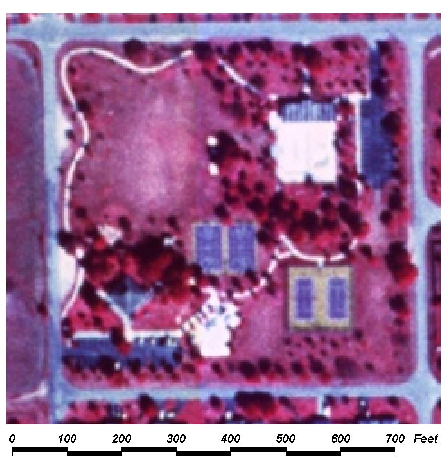
Field Picture
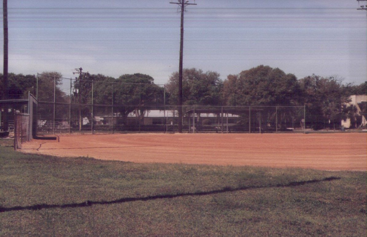
BACK TO CLASSIFICATION LIST
1810 Swimming Beach
1810
- Swimming Beach
LEVEL 1: 1000 Urban and Built-Up
LEVEL 2: 1800 Recreational
LEVEL 3: 1810 Swimming Beach
DESCRIPTION:
This class includes saltwater and freshwater
beach areas, both public and private, that are accessible from land and
available for recreational purposes. Recreational structures and
features are not required to be evident, as long as public access is
feasible.
This class includes most of the
County’s beach segments along the Gulf of Mexico. It also includes beaches along
bays, estuaries, and freshwater systems if they meet minimum size criteria.
KEYS TO PHOTOINTERPRETATION:
The following features may be visible on the photography: picnic
areas, service stands, piers and boardwalks, fenced areas, protected swimming
areas, ball courts and other recreational areas.
Parking areas are present, with no indication of purposes other
than beach recreation. These may be actual paved parking lots, or simply
cars that are visible along the access roads or on the beach itself. Note:
winter photography may not show many cars due to decreased activity.
Public beaches, if large enough, are usually indicated on topographic
maps.
CONTEXT:
Landscape Position - The presence of residential, commercial, or
other recreational uses in the vicinity of the beach is a confirmation of this
class. Accessibility from land by roads is also sufficient to assume
recreational uses. There are few beach segments along the Gulf of Mexico that are not used for recreational
purposes.
SIMILAR CLASSES:
7200 Sand Other Than Beaches - dunes or other sand areas not part of a beach
6500 Non-Vegetated Wetlands - generally tidal flats and shorelines
SPECIAL MAPPING CONVENTIONS:
Baldwin County classifies most coastal beaches as
1810, based on their accessibility for recreation, whether or not constructed
facilities are present.
This class generally refers to a
sandy, non-vegetated, recreational strip of land. The beach delineation
includes all recreational area between the water line and the next inland land
use or land cover. It may have inclusions of vegetation or other land uses that
are too small to meet minimum size criteria.
Swimming beaches are mapped where
visible if they meet the minimum area criteria of 1 acre.
Dual coding convention: This is a Land Use
class. The LUCODE and LCCODE are the same. A separate land cover code is not
required.
DOQQ Image
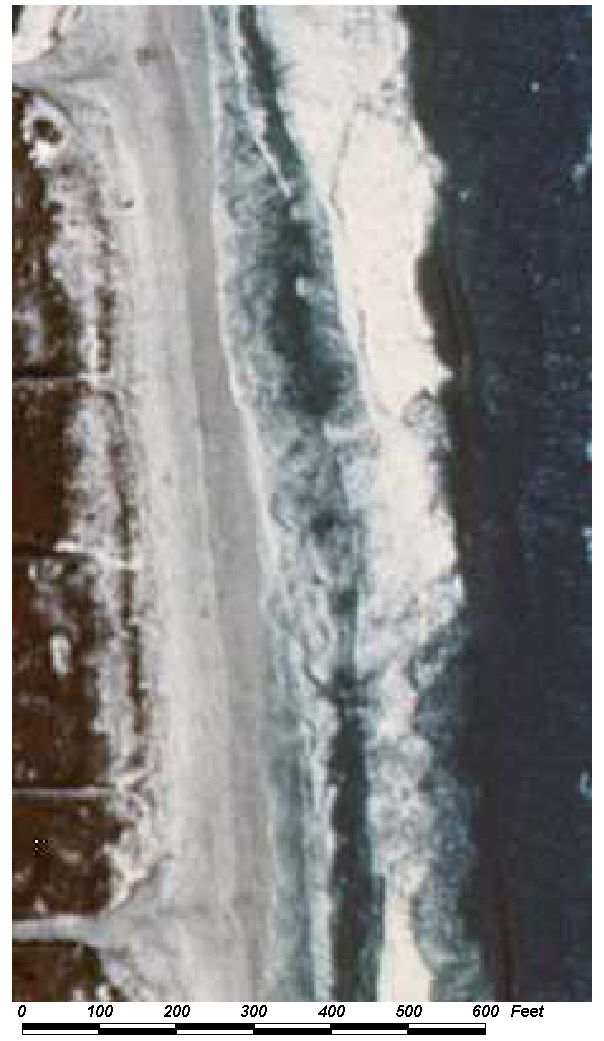
Field Picture
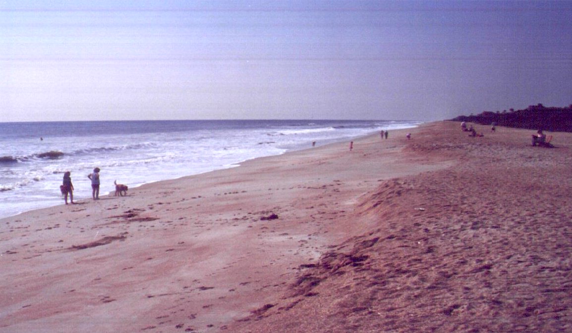
BACK TO CLASSIFICATION LIST
1820
Golf Course
1820
- Golf Courses
LEVEL 1: 1000 Urban and Built-Up
LEVEL 2: 1800 Recreational
LEVEL 3: 1820 Golf Courses
DESCRIPTION:
Golf courses are easily recognizable
by their landscaped features and have no similar classes. They are a priority
land use to the County, due to their environmental significance, and are always
required to be broken out from other land uses. The 1820 mapping unit
includes all facilities that are involved with the operation of the golf course
and associated recreation, including club houses, storage buildings and parking
lots. Other recreational facilities such as swimming pools and tennis courts
are included if they are auxiliary to the golf club. This class does not
include adjacent land uses not directly related to recreation. Water
features and wetlands are common in and around the courses, and must also be
broken out wherever they meet the 1 acre criteria.
This class also includes golf
courses under construction.
KEYS TO PHOTOINTERPRETATION:
Distinctive pattern of well-watered and maintained grass areas
Ponds and lakes of varying size and shape
Fairway strips appear as a smooth light magenta tone, with similarly
toned tees and greens at either end.
Sand traps- generally appear as whitish "dots" or small
rounded polygons in and around fairways
Areas between fairways often shrubby or wooded with a darker magenta
signature
Likely to contain a large "clubhouse" structure
Parking lot adjacent to facility
CONTEXT:
Landscape Position - Golf courses are located throughout the
state, usually in proximity to populated areas or transportation corridors.
They are often constructed on low-lying ground such as pine flatwoods, and may
be adjacent to or displace wetlands.
SIMILAR CLASSES:
Nothing else looks like a golf
course. However, they may be woven into other land uses - Residential in
particular. Many residential communities in the County are built around or
adjacent to golf courses. They may also be mixed into Institutional or
Commercial uses.
SPECIAL MAPPING CONVENTIONS:
The golf course itself must be
broken out wherever possible. However, discretion should be used to avoid
excessive interior linework. Housing areas around golf courses should be
delineated and classified separately from the golf course, as long as the
minimum mapping unit requirement of 1 acre is met. Wooded or open areas
that are inside the 1820 polygon are generally coded 1820.
Dual coding convention: This is a Land Use
class. The LUCODE and LCCODE are the same. A separate land cover
code is not required.
DOQQ IMAGE
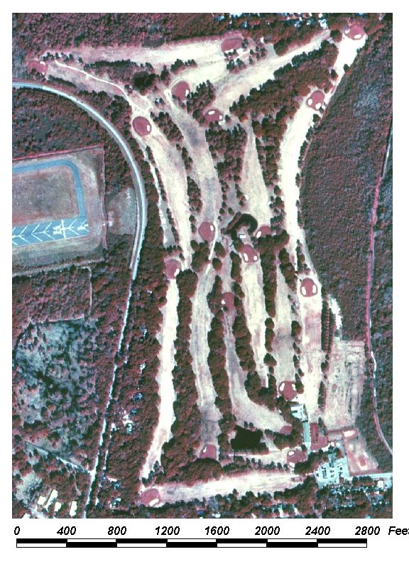
Field Picture
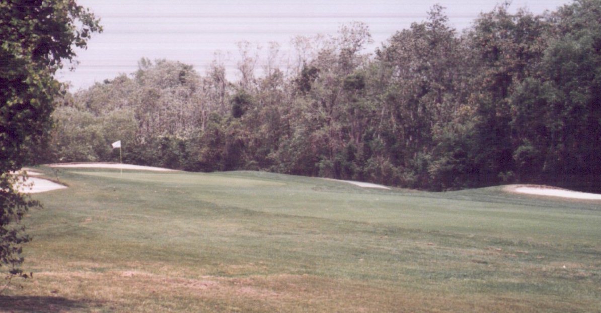
BACK TO CLASSIFICATION LIST
1830
Race Tracks
1830
- Race Tracks
LEVEL 1: 1000 Urban and Built-Up
LEVEL 2: 1800 Recreational
LEVEL 3: 1830 Race Tracks
DESCRIPTION:
This class includes a variety of
racing operations that are readily identifiable on aerial photography.
Examples are auto and motorcycle racing, drag strips, horse racing and dog
racing. The mapping unit includes all features associated with the
operation, including parking facilities, stadium and stands, storage and
staging areas, and open areas that are inside the operational boundary.
At many automobile and motorcycle
race tracks, grandstands and other spectator areas flank only a small portion
of the track, which itself is an irregular, closed loop. Drag strips may
resemble an air strip due to their straight smooth design and two vehicle
width. The distinguishing feature, however, will be the grandstands and the
parking facilities, and the lack of hangars or aircraft service features.
KEYS TO PHOTOINTERPRETATION:
Many racing tracks have a distinctive oval shape.
There are large parking areas adjacent to track, often unpaved.
Public area is likely to be well-kept and landscaped.
Stadium-type seating is usually present, except for very small
operations. The stands themselves may be limited to a small portion of the
total track area.
CONTEXT:
Landscape Positiion - Large race tracks are found in urban or
urban fringe areas. Various types of local interest racing are also located in
rural areas.
SIMILAR CLASSES:
2510 Horse Farms - The lack of
spectator seating or large parking areas helps distinguish these.
8113 Private Airports - Private air strips may appear similar to drag racing
strips, but will not have stadiums and large parking areas
SPECIAL MAPPING CONVENTIONS:
Included within the mapping unit are
all buildings, grounds, parking lots, recreational areas, and other features
that appear to be part of the facility. Those areas that are not clearly
related to the functions of the facility are not included. Adjacent open
areas are assigned the appropriate land cover value. Only those features that
are inside the operational boundaries are coded 1830.
Priority classes such as water
bodies and wetlands are exceptions to the above. If these features meet their
minimum size criteria they are always broken out.
Dual coding convention: This is a Land Use
class. The LUCODE and LCCODE are the same. Separate land cover
code is not required.
DOQQ Image
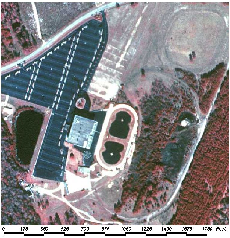
Field Picture
BACK TO CLASSIFICATION LIST
1840 Marinas and Fish Camps
1840
- Marinas and Fish Camps
LEVEL 1: 1000 Urban and Built-Up
LEVEL 2: 1800 Recreational
LEVEL 3: 1840 Marinas and Fish Camps
DESCRIPTION:
Marinas include fresh water and marine
harbors, yacht clubs and boat launching sites that are primarily used for
recreational marine craft. Boat mooring areas near the marina are mapped as
part of the marina area.
The shore facilities include storage
sheds, maintenance buildings, club houses and restaurants, and parking areas.
Boat launching sites are identified by a paved or unpaved parking area at the
water's edge, with one or more short launching ramps leading to the water. Cars
with boats on trailers or cars with empty boat trailers may be visible in the
parking area.
Marine railways, boats in slings, or
boats on cradles may be visible near the water.
Fish camps include boat launching
sites, docking facilities, fishing piers, bait house and store facilities, and
any lodging or camping facilities. Parking areas are generally not well
developed, but provide space for vehicles and for trailers. Some fish camps
provide rental water craft and may have storage facilities for these.
This class does not include
associated boat yards used for building and repairing boats. The mapping
unit does not include adjacent open areas, or those portions of piers and docks
that extend out over a water body.
KEYS TO PHOTOINTERPRETATION:
Indicator features include boats and boat ramps, docks, parking areas,
land and water access routes, fueling facilities and buildings associated with
the operations.
Piers show distinctive rectilinear geometric patterns, bright white
against the black tone of the water on CIR film.
Buildings may include storage sheds, maintenance buildings, club houses
and restaurants, and supply stores.
Boat trailers and associated wide parking areas are usually present
Channels through adjacent water bodies or wetlands may provide access to
the marina.
CONTEXT:
Landscape Position - Marinas are shoreline uses that tend to
occur in areas protected from storms by natural coves or bays, breakwaters, or
inland areas connected by canals to an open water body. They are usually close
to developed areas for better access. Fish camps are likely to be in more
remote areas, often in association with parks, public lands, and other natural
areas.
SIMILAR CLASSES:
1400 Commercial and Services - boat
repair service facilities may look similar, but will lack many of the above
indicators
1550 Light Industrial - Loading docks and trucks are a typical feature.
SPECIAL MAPPING CONVENTIONS:
Included within the mapping unit are
all buildings, grounds, parking lots, recreational areas, and other
features that are attached to the facility. Those areas that are not
clearly related to the functions of the facility are not included.
Adjacent open areas are assigned the appropriate land cover value.
Priority classes such as water
bodies and wetlands are exceptions to the above. If these features meet their
minimum size criteria they are always broken out.
Dual coding convention: This is a Land Use
class. The LUCODE and LCCODE are the same. A separate land cover code is
not required.
DOQQ Image
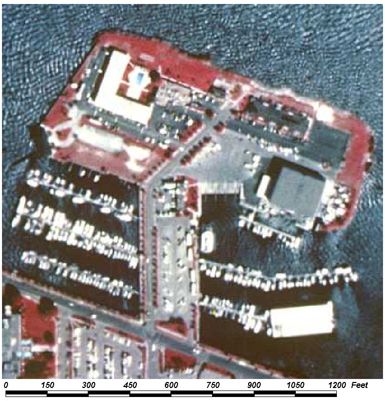
Field Picture
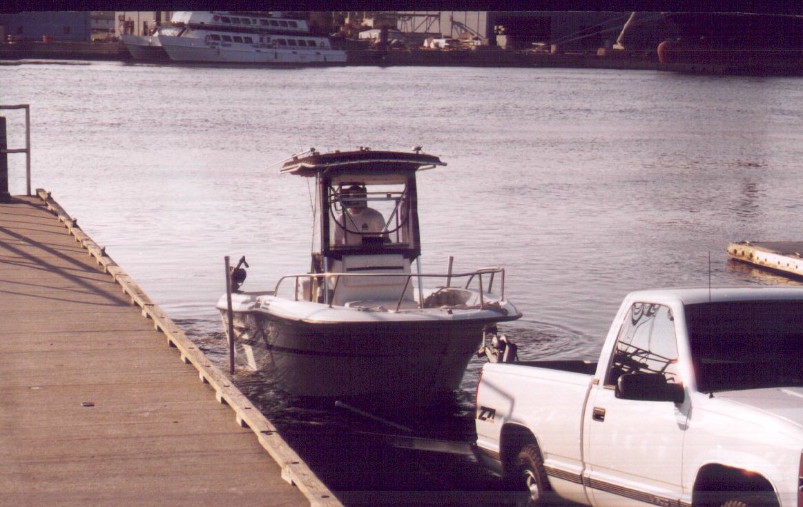
BACK TO CLASSIFICATION LIST
1850 Parks and Zoos
1850
- Parks and Zoos
LEVEL 1: 1000 Urban and Built-Up
LEVEL 2: 1800 Recreational
LEVEL 3: 1850 Parks and
Zoos
DESCRIPTION:
This class covers the operational
facilities that make up the active service areas of various outdoor and
recreational land uses. The class includes public and private parks - both
rural and urban, campgrounds, zoos, fairgrounds, botanical gardens, and
other. Note that amusement parks are not included in this class- they are
classified as 1400 Commercial and Services. The parks may contain a variety of
sub-activities, including play facilities, athletic fields, small museums,
zoos, exhibit areas, campgrounds, swimming areas, monuments and fountains,
gardens and other facilities. Some of these sub-activities would be assigned to
other classes if they were not in the larger context of a park.
Zoos are indicated by animal
houses/cages plus areas surrounded by fences or moats. They also contain
numerous winding light-toned walkways and roads, and maintenance and storage
buildings.
State parks and other public or
private outdoor scenic/recreational areas are designed for more active
recreation. They are largely left in natural cover, except for parking areas at
public access points, camping areas, and visitor facilities. Roads and trails
are visible leading to scenic and water access areas. Group or organized camps
within the park are identified by a denser network of trails and dirt roads.
Individual camping areas or cabins are spaced alongside these roads.
This class does not include the
surrounding open and natural areas, even though they may be associated and/or
on the same properties, unless they are an active, accessible part of the
operations. The intent is to avoid mapping open or natural areas as a
land use and thereby missing the land cover values. Open areas outside of
the active park facilities are not dual-coded with the land use value, since
this Land Cover / Land Use data layer does not attempt to delineate ownership
boundaries.
KEYS TO PHOTOINTERPRETATION:
This class has many types of facilities - few indicators apply
universally.
Winding walkways and other landscaping features are designed for
aesthetic appeal.
Shaded picnic areas and/or food service facilities are usually present.
Parking facilities must be present.
CONTEXT:
Landscape Position - Leisure parks and zoos are usually near
populated or high-access areas, and often are adjacent to residential
neighborhoods. Boundaries with adjacent land uses are regular and distinct.
Outdoor recreation parks tend to be in a rural context, associated with other
open areas, public lands, and water bodies.
SIMILAR CLASSES:
1400 Commercial and Services -
Recreational vehicle parks and private campgrounds are classified as 1400
Commercial and Services. However, campgrounds that are subsidiary to
larger park facilities, such as National Forests, are still classified as 1850
Parks and Zoos.
1700 Institutional - Institutional facilities may have many of the same
features. The PI must determine which use- Institutional or Recreational-
is predominant.
1800 Recreational - Other recreational classes such as beaches, marinas,
community recreational, and other uses may occur within parks and zoos as
sub-activities. These should not be broken out unless they are spatially
and functionally independent
Natural areas such as 1900 Open Land, 3000 Upland Non-Forested, 4000 Upland
Forests - May overlap this class and may be located on park lands. The key is
to break out active, high-access operational areas from low-access areas with
natural functions and values.
SPECIAL MAPPING CONVENTIONS:
This class can legitimately overlap
with other classes that have similar indicators. PIs need to determine
which use is predominant. Ancillary data, such as parcel data, should be used
for that purpose, but PIs should use discretion when dissecting the mapping
unit into recreational, institutional and commercial sub-units. PIs
should avoid excessively detailed line work while capturing useful
information. Linear or overly complex polygons should be avoided, in favor of
ones with compact shapes. This is similar to conventions for mapping
residential areas.
Included within the mapping unit are
all buildings, grounds, parking lots, recreational areas, and other features
that are attached to the park facility. Only those features that are
inside the operational boundaries are coded 1850.
Priority classes such as water
bodies, wetlands, golf courses, and treatment facilities are exceptions to the
above. If these features meet their minimum size criteria they are always
broken out.
Dual coding convention: This is a Land Use
class. A separate land cover code is not required, unless large inclusions
of other classes occur within operational boundaries. For example, a 5
acre patch of forest inside a municipal park could be dual coded as LC=4200/
LU=1850.
DOQQ Image
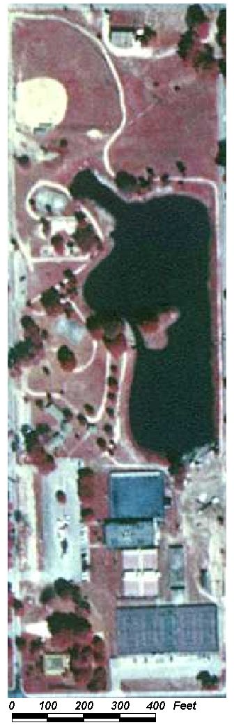
Field Picture
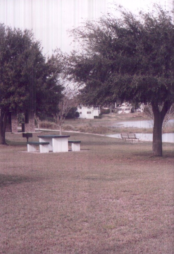
BACK TO CLASSIFICATION LIST
1860 Community Recreational Facilities
1860
– Community Recreational Facilities
LEVEL 1: 1000 Urban and Built-Up
LEVEL 2: 1800 Recreational
LEVEL 3: 1860 Community
Recreational Facilities
DESCRIPTION:
This class encompasses all of the
facilities that make up a local community recreation center. Community recreation centers are usually
dominated by one large structure with a main parking lot and various activities
and structures in proximity to the main building. Many of these main buildings will house
gymnasiums and be over one story tall typically with a flat roof. The
recreation centers may contain a variety of sub-activities, including play
facilities, athletic fields, exhibit areas, swimming areas, fountains, gardens
and other facilities. Some of these sub-activities would be assigned to other
classes if they were not in the larger context of Community Recreation.
The white markings of the playing
fields, such as the base paths and sidelines of a baseball diamond, should
stand out clearly against the dark background of the playing surface on
high-contrast CIR film. Football field lines should also be visible, and the
shadows of the goal posts may be visible at either end of the field. These lines may be faint or non-existent, not
as distinguishable as in a stadium.
KEYS TO PHOTOINTERPRETATION:
Large parking area is focused around a main structure typically large
and over one story high.
Various athletic fields and activities present near main structure.
Field markings are recognizable and characteristic.
Grounds are maintained and landscaped.
CONTEXT:
Landscape Position – Typically located in or near residential
areas.
SIMILAR CLASSES:
1850 Parks
typically do not have a large main structure.
1710
Educational facilities tend to have multiple structures, check ancillary source
data for correct classification.
SPECIAL MAPPING CONVENTIONS:
The mapping unit includes all
buildings, grounds, parking lots, athletic fields and other features that
are attached to the Recreation Center.
Adjacent open areas are assigned the
appropriate land cover code see parcel information for property
boundaries.
Priority classes such as water
bodies and wetlands are exceptions to the above. If these features meet their
minimum size criteria they are always broken out.
Dual coding convention: This is a Land Use
class. The LUCODE and LCCODE are the same. A separate land cover code is
not required.
BACK TO CLASSIFICATION LIST
1870 Stadiums: Not Academic
1870
- Stadiums - Not Academic
LEVEL 1: 1000 Urban and Built-Up
LEVEL 2: 1800 Recreational
LEVEL 3: 1870 Stadiums -
Not Academic
DESCRIPTION:
This class includes those stadiums
designed for sports events and not associated with educational
facilities such as high schools, colleges, or universities. It does not
include race tracks, parks, fairgrounds, or community recreational
facilities. Stadiums are characterized by large scale parking facilities
and spectator structures.
The white markings of the playing
fields, such as the base paths and sidelines of a baseball diamond, should
stand out clearly against the dark background of the playing surface on
high-contrast CIR film. Football field lines should also be visible, and the
shadows of the goal posts may be visible at either end of the field
KEYS TO PHOTOINTERPRETATION:
The structures and/or playing fields have a distinctive round or oval
shape, depending on the sport.
Stadiums may be enclosed by domed top.
Field markings are recognizable and characteristic.
Grounds are well maintained and landscaped.
Very large parking areas are included in the mapping unit.
Large scoreboards may be visible.
CONTEXT:
Landscape Position - Stadiums are normally located in populated
or high-access areas, but may be found in any area of the County.
SIMILAR CLASSES:
1830 Race Tracks - have a distinct
oval racing track
SPECIAL MAPPING CONVENTIONS:
The mapping unit includes all
buildings, grounds, parking lots, recreational areas, and other features
that are attached to the stadium.
Adjacent open areas are assigned the
appropriate land cover code. Only those features that are inside the
operational boundaries of the stadium are coded 1870.
Priority classes such as water
bodies and wetlands are exceptions to the above. If these features meet their
minimum size criteria they are always
broken out.
Dual coding convention: This is a Land Use
class. The LUCODE and LCCODE are the same. A separate land cover code is
not required.
DOQQ Image
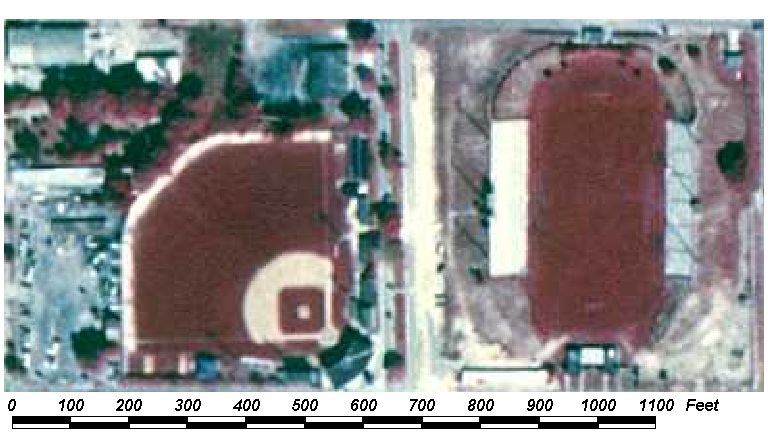
Field Picture
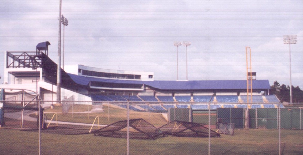
BACK TO CLASSIFICATION LIST
1880 Historical Sites
1880
– Historical Sites
LEVEL 1: 1000 Urban and Built-Up
LEVEL 2: 1800 Recreational
LEVEL 3: 1880 Historical
Sites
This classification covers all historic
and pre-historic sites as deemed by the appropriate authority. The historical sites may contain a variety of
sub-activities, such as; small museums, exhibit areas, monuments and fountains,
gardens and other facilities. Some of these sub-activities would be assigned to
other classes if they were not in the larger context of a historical site.
They are largely left in natural
cover, except for parking areas at public access points and visitor facilities.
Roads and trails are visible leading to scenic and historic areas.
This class does not include the
surrounding open and natural areas, even though they may be associated and/or
on the same properties, unless they are an active, accessible part of the
operations. The intent is to avoid mapping open or natural areas as a
land use and thereby missing the land cover values. Open areas outside of
the active historic site are not dual-coded with the land use value, since this
Land Cover / Land Use data layer does not attempt to delineate ownership boundaries.
KEYS TO PHOTOINTERPRETATION:
This class has many types of facilities - few indicators apply
universally.
Winding walkways and other landscaping features are designed for
aesthetic appeal.
Parking facilities must be present.
CONTEXT:
Landscape Position – Historical sites can be found in any context
and collateral data is often needed to classify correctly.
SIMILAR CLASSES:
1850 Parks
typically have more recreational facilities, campgrounds or picnic areas.
SPECIAL MAPPING CONVENTIONS:
The mapping unit includes all
buildings, grounds, parking lots, fields and other features that are
attached to the Historical Site.
Adjacent open areas are assigned the
appropriate land cover code see parcel information for property
boundaries.
Priority classes such as water
bodies and wetlands are exceptions to the above. If these features meet their
minimum size criteria they are always broken out.
Dual coding convention: This is a Land Use
class. The LUCODE and LCCODE are the same. A separate land cover code is
not required.
BACK TO CLASSIFICATION LIST
1890 Other Recreational
1890
– Other Recreational
LEVEL 1: 1000 Urban and Built-Up
LEVEL 2: 1800 Recreational
LEVEL 3: 1890 Other
Recreational
DESCRIPTION:
This classification is for
commercial recreation areas not covered under public recreation areas, golf
courses or race tracks. Some examples
include; Riding Stables, Go-Cart Tracks, Skeet Ranges, Shooting Ranges, Golf Driving Ranges, etc. These types of commercial recreation areas
tend to have a small main building for conducting business at the focal point
of a large parking lot surrounded by various fields each with a unique
signature.
KEYS TO PHOTOINTERPRETATION:
Large parking area is focused around a small main structure.
Activity related field/s located in proximity to main structure.
Parcel data may be required to identify correctly.
CONTEXT:
Landscape Position – Located throughout County Riding Stables, Skeet Ranges and Pistol Ranges typically located in rural areas,
while Golf Driving Ranges and Go-Cart Tracks located closer
to urban and residential areas.
SIMILAR CLASSES:
1850 Parks
typically tend to be more natural in land cover and oriented toward free
activities.
1860
Community recreation centers are usually dominated by one large structure with
a main parking lot.
SPECIAL MAPPING CONVENTIONS:
The mapping unit includes all
buildings, grounds, parking lots and other features that are attached to the
Recreation Activity.
Adjacent open areas are assigned the
appropriate land cover code see parcel information for property
boundaries.
Priority classes such as water
bodies and wetlands are exceptions to the above. If these features meet their
minimum size criteria they are always broken out.
Dual coding convention: This is a Land Use
class. The LUCODE and LCCODE are the same. A separate land cover code is
not required.
BACK TO CLASSIFICATION LIST
1900
Open Land
1900
- Open Land
LEVEL 1: 1000 Urban and Built-Up
LEVEL 2: 1900 Open Land
DESCRIPTION:
This category includes open,
undeveloped land within urban areas which tends to have transitional or
uncertain land uses. The associated land cover types are typically from 3000
Upland Non-Forested or 7000 Barren Land classes. This class is not
used to code forests or wetlands - classes for which land use tends to be more
stable - except where they may occur as small inclusions within the 1900
polygon. The Level 3 subclass 1920 - Inactive Land with Street Patterns -
is delineated separately.
Open Land has few if any structures, and
there is not enough indication of the land use (current or intended) to justify
assigning any other LCLU class. Often, urban inactive land may be in a transitional
state and ultimately will be developed into one of the typical urban land uses.
At the time of the inventory, however, the land use cannot be determined from
the aerial photo.
Many different types of land cover
can occur on open urban lands. For this reason, a separate land cover code is
always required. The most common land covers are from the 3000 Upland
Non-Forested classes.
KEYS TO PHOTOINTERPRETATION:
Signatures may range from heavily vegetated to a disturbed, scoured,
white appearance.
There is not enough indication of the land use to justify any other LCLU code.
CONTEXT:
Landscape Position - Land is considered to be in an urban context
if it is situated within a larger matrix of development. This matrix is
spatially defined by the concentration of land uses, transportation barriers,
and other constraints to movement and access. Open Land may be found in any area of the
County.
Vegetation - Ranges from barren land with no vegetation to
grasses, shrubs, or a combination of the two, and may even include scattered
trees.
SIMILAR CLASSES:
1190, 1290, and 1390 - Residential
Under Construction - These will have enough infrastructure, and usually
buildings, to show that construction is in progress.
1920 Inactive Land with Street Pattern - Street
patterns are evident, but development is either stalled or has been abandoned.
2120 Unimproved Pastures - Pasture will be in a more agricultural context.
3000 Upland Non-Forested - These classes are generally in a more rural and
undeveloped setting.
7400 Disturbed Land - This class is characterized by
man-made alterations.
SPECIAL MAPPING CONVENTIONS:
This class should be delineated whenever
possible in order to depict open areas situated in an urban context, since
these areas are more likely to undergo rapid changes.
Dual coding convention: This is a Land Use
class. Dual coding is always required - a Land Cover code must be assigned
in addition to the 1900 code. Typical land cover codes are from the 3000
and 7000 classes; any small inclusions of forested and wetlands should also be
dual-coded as land use 1900 and the appropriate land cover code.
DOQQ Image
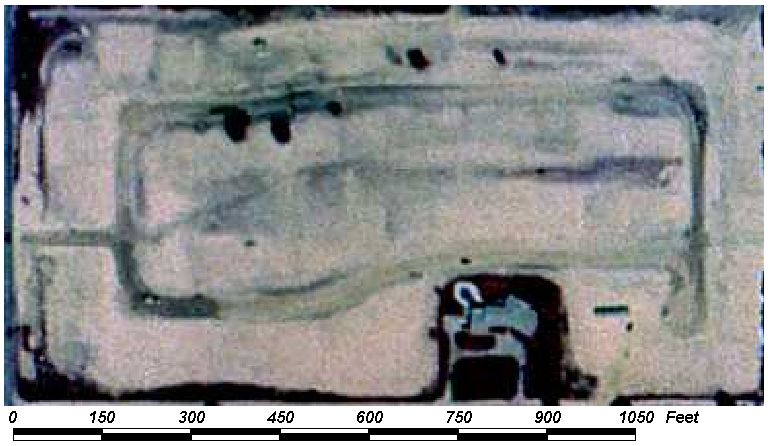
BACK TO CLASSIFICATION LIST
1910 Undeveloped Land within Urban Areas
1910
– Undeveloped Land within Urban Areas
LEVEL 1: 1000 Urban and Built-Up
LEVEL 2: 1900 Open Land
LEVEL 3: 1910 Undeveloped
Land within Urban Areas
DESCRIPTION:
This classification is for open
areas where development has not taken place. Typically these areas are
open fields or lots within an urban area which have never been developed or
there is no sign of past use.
A site is probably abandoned when
the soil tones are a grayish magenta, and darker magenta "salt and
pepper" patterns (of scattered weeds and shrubs) appear. These are typically vacant lots that have
never been sold for use or are in the process of being sold.
Many different types of land cover
can occur on open urban lands. For this reason, a separate land cover
code is always required. The most common land covers are from the 3000 and 4000
categories - Upland Non-Forested or Upland Forested. But many other types
of cover may be present.
KEYS TO PHOTOINTERPRETATION:
No additional street pattern is visible, but may be in an urban area
where development has taken place in the surrounding areas.
There are very few if any structures present, if present they are
temporary or storage type structures.
Absence of landscaping; The appearance is overgrown and indicates
neglect.
CONTEXT:
Landscape Position - This class can be found in urban
settings.
SIMILAR CLASSES:
1930 Urban
land in transition typically has a disturbed surface appearance and is mostly
un-vegetated.
1400, 1500,
1700 and 1800 fields or grass parking lots maintained by adjacent urban uses can
appear to be undeveloped, look for fence lines and signs of maintenance. Parcel data may be required to distinguish.
SPECIAL MAPPING CONVENTIONS:
There may be a number of different
land cover types occurring together, and these communities may be patchy,
intergraded, and otherwise difficult to map. PIs need to determine which
covers are predominant, and avoid dissecting the mapping unit with
excessively detailed linework. Convoluted polygons should be avoided, in
favor of ones with compact shapes.
Dual coding convention: This is a Land Use
class. Dual coding is always required - a Land Cover code must be assigned
in addition to the 1920 code. Typically, the land cover codes are from the
2000, 3000, 4000, 6000 and 7000 classes.
DOQQ Image
Field Picture
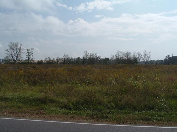
BACK TO CLASSIFICATION LIST
1920 Inactive Land with Street Pattern
1920
- Inactive Lands with Street Pattern
LEVEL 1: 1000 Urban and Built-Up
LEVEL 2: 1900 Open Land
LEVEL 3: 1920 Inactive Lands
with Street Pattern
DESCRIPTION:
This class includes open areas where
development had started but was for some reason halted, and appears in an
abandoned state at the time of the inventory. It does not include
developments that are under construction, or incomplete, or that are slowly
being completed. Lands in this class have street patterns but few if any
buildings.
A site is probably abandoned when
the soil tones are a grayish magenta, and darker magenta "salt and
pepper" patterns (of scattered weeds and shrubs) appear. Then, but for the
street pattern, the area would be considered undeveloped land.
The examples of this class in the
County are notable, usually sizable, and have a distinct, vacant
appearance in contrast to developing areas.
Many different types of land cover
can occur on open urban lands. For this reason, a separate land cover
code is always required. The most common land covers are from the 3000 and 4000
categories - Upland Non-Forested or Upland Forested. But many other types
of cover may be present.
KEYS TO PHOTOINTERPRETATION:
A street pattern is visible, although the
streets may not be maintained.
There are few if any structures. If present, they tend to be spaced
randomly in the polygon rather than in an organized or clustered manner.
Absence of landscaping; The appearance is overgrown and indicates
neglect.
CONTEXT:
Landscape Position - This class may be found in urban or rural
settings. It may be in lowland areas where the hydrology is an obstacle.
It is likely to occur in areas where the land values were low, but other
factors, such as remoteness or hydrology, rendered the project infeasible.
SIMILAR CLASSES:
1190, 1290,
and 1390 Residential Under Construction - These will have enough infrastructure,
and usually buildings, to give the appearance that construction is in progress.
The appearance indicates activity
1490 Commercial and Services Under Construction - same as above
1620 Sand
and Gravel Pits – Typically there is no structures under construction here and
are on the fringes of urban areas.
SPECIAL MAPPING CONVENTIONS:
There may be a number of different
land cover types occurring together, and these communities may be patchy,
intergraded, and otherwise difficult to map. PIs need to determine which
covers are predominant, and avoid dissecting the mapping unit with
excessively detailed linework. Convoluted polygons should be avoided, in
favor of ones with compact shapes.
Dual coding convention: This is a Land Use
class. Dual coding is always required - a Land Cover code must be assigned
in addition to the 1920 code. Typically, the land cover codes are from the
2000, 3000, 4000, 6000 and 7000 classes.
DOQQ Image
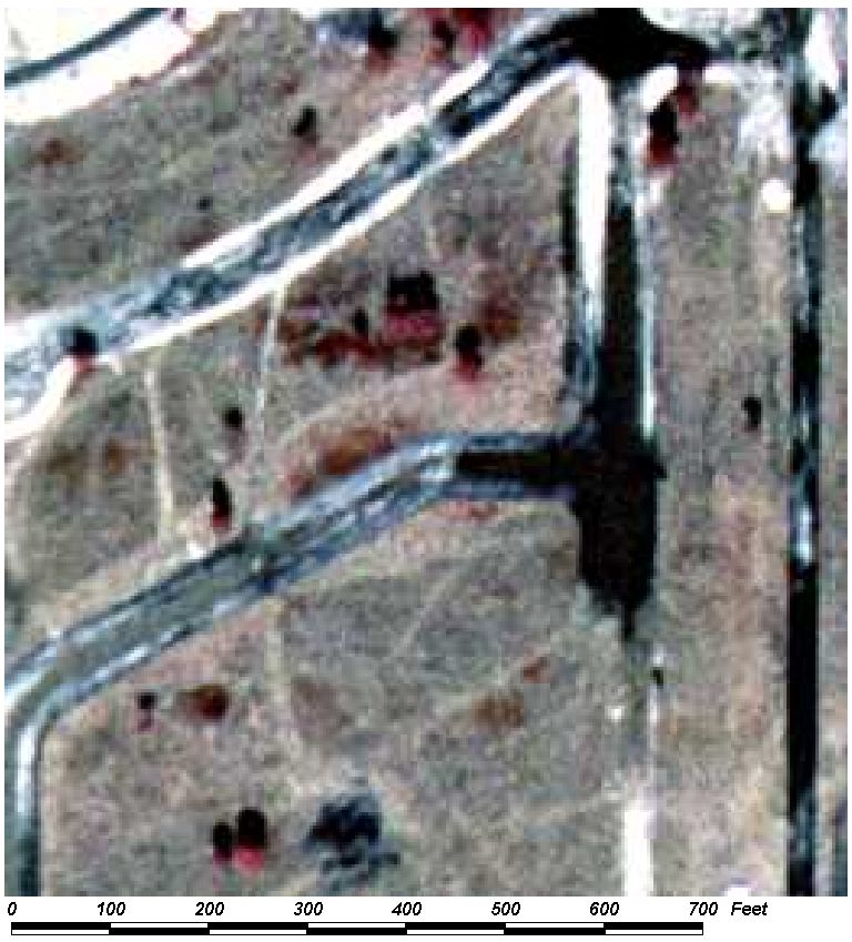
Field Picture
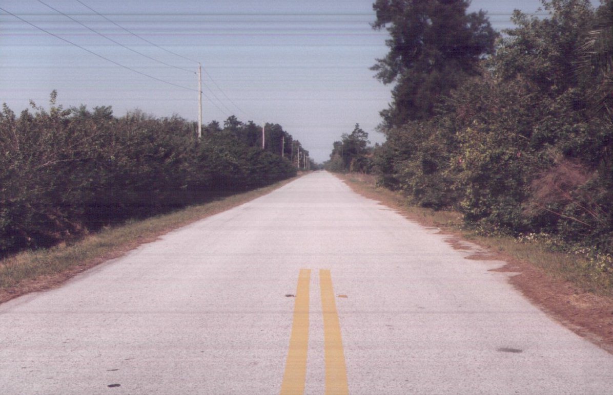
BACK TO CLASSIFICATION LIST
1930 Undeveloped Land in Transition without activity indicators
1930
– Undeveloped Land in transition without activity indicators
LEVEL 1: 1000 Urban and Built-Up
LEVEL 2: 1900 Open Land
LEVEL 3: 1930 Undeveloped
Land in transition without activity indicators
DESCRIPTION:
This classification is for urban
areas where development has recently begun to take place or is in the process
of conversion to a new land use at the time of the photography. These
areas typically are mostly un-vegetated and show barren or disturbed
earth. Buildings may be present in
construction or as non-permanent construction support or for storage
purposes. This class is used for urban
construction areas where potential use is not easily discernable.
Typically vegetation is not present
due to construction or leveling of the property.
A separate land cover value is not
required.
KEYS TO PHOTOINTERPRETATION:
Found in an urban area.
Structures typically are under construction or are temporary
construction facilities.
Barren or disturbed earth is common in transitional areas
CONTEXT:
Landscape Position - This class can be found in urban
settings.
SIMILAR CLASSES:
1930 Urban
land in transition typically has a disturbed surface appearance and is mostly
un-vegetated.
1400, 1500,
1700 and 1800 fields or grass parking lots maintained by adjacent urban uses
can appear to be undeveloped, look for fence lines and signs of
maintenance. Parcel data may be required
to distinguish.
SPECIAL MAPPING CONVENTIONS:
There may be a number of different
land cover types occurring together, and these communities may be patchy,
intergraded, and otherwise difficult to map. PIs need to determine which
covers are predominant, and avoid dissecting the mapping unit with
excessively detailed linework. Convoluted polygons should be avoided, in
favor of ones with compact shapes.
Dual coding convention: This is a Land Use
class. Dual coding is always required - a Land Cover code must be assigned
in addition to the 1930 code. Typically, the land cover code is 740 disturbed land.
BACK TO CLASSIFICATION LIST
1940 Other Open land
1940
– Other Open Land
LEVEL 1: 1000 Urban and Built-Up
LEVEL 2: 1900 Open Land
LEVEL 3: 1940 Other Open Land
DESCRIPTION:
This classification is for open
areas which are indistinguishable and do not fit into any other category. See Description for 1900 Open Land Code.
Dual coding convention: This is a Land Use
class. Dual coding is always required - a Land Cover code must be assigned
in addition to the 1920 code. Typically, the land cover codes are from the
2000, 3000, 4000, 6000 and 7000 classes.
BACK TO CLASSIFICATION LIST
*2000 AGRICULTURE
Agriculture - FLUCCS Code 2000
This Level 1 class is
not used in the map itself - a more specific subclass must be selected. The
Level 2 subclasses are:
2100 Cropland and Pastureland
2200 Tree Crops
2300 Feeding Operations
2400 Nurseries and Vineyards
2500 Specialty Farms
2600 Other Open Lands
Background: Agricultural uses cover
a large percentage of the County predominantly in the south. The preservation of farmland with its
economic and natural resource benefits is a prime concern of the County.
Agricultural activities have a significant effect on water supply, water
quality, flooding and natural resources, and can vary significantly in their
nutrient requirements, run-off and leaching, supplemental water needs, and
benefits to natural systems.
MAPPING CONVENTIONS:
Minimum mapping units: The minimum
mapping unit for all agricultural classes is 1 acre.
Differentiating
subclasses: The agricultural classes are generally open, cultivated lands
that can look similar on aerial photography. The land uses can change
very frequently from one class to another, depending on management. Also,
the agricultural areas may be intermixed with other general uses, such as
forestry, mining, rural residential, and rangelands, making context alone an
unreliable indicator. As a result of all these factors, there is a strong
possibility for confusion between the agricultural classes. In order to
differentiate these classes it is necessary to look closely at the details in
the PI key pages for each class.
Dual coding
convention: Most of the Agricultural classes are designated as Land Cover
classes. These are generally defined as a certain type of crop, in which
case the land cover can readily be inferred from what is being grown.
Some of the subclasses are designated as Land Use classes - these are
defined as a type of operation, such as Feeding Operations or Dairies, that
define land use rather than cover. In almost all the subclasses, the LCCODE and
LUCODE are the same. A separate dual code may be required in the case of
Dairy and Feeding Operations, for example, which have a number of components
that are differentiated by the use of different land cover codes.
SIMILAR CLASSES:
Agricultural lands can
be confused with a number of other classes. These include 1180 Rural
Residential; 1900 Open Lands; 3000 Upland
Non-Forested; and 4400 Tree Plantations. Also, agricultural lands that have
hydric soils should be classes as Wetlands - in most cases these would be wet
prairies being used for pasture. Farmland that is temporarily
flooded should not be classified as open water or wetlands, if it is clear that
it is an active farming area.
For more information:
See the PI keys for each
of the subclasses for more details and graphic examples.
BACK TO CLASSIFICATION LIST
*2100 Cropland and Pastureland
Cropland and Pastureland - FLUCCS Code 2100
This Level 2 class is
not used in the map itself - a more specific subclass must be selected. The
Level 3 subclasses are:
2110 Improved Pasture
2120 Unimproved Pasture
2130 Woodland Pasture
2140 Row Crops
2150 Field Crops
2160 Mixed Crops
There is one Level 4 subclass:
2156 Sugar Cane
Background: The vast majority of
farmland in the County falls under this general class. Primarily areas with
crops will be coded as row crops since field type crops are typically planted
only as cover during the winter season.
These classes vary significantly in their nutrient requirements, run-off
and leaching potential, supplemental water needs, and benefits to natural
systems. For example, unimproved pastures are usually low intensity
operations with significant habitat value and a low level of impacts. In
comparison, row crops are intensively managed, have little habitat value, high
nutrient requirements and significant potential for off-site impacts.
Cropland and pastureland
uses can have a strong influence on water supply, water quality, flooding and
natural resources.
MAPPING CONVENTIONS:
Minimum mapping units: The minimum
mapping unit for all agricultural classes is 1 acre.
Differentiating
subclasses: The agricultural classes are generally open, cultivated lands
that can have a similar appearance on aerial photography. The land uses
can change very frequently from one to another. Also, agricultural areas
may be mixed with other uses, such as forestry, mining, rural residential, and
rangelands, making context alone an unreliable indicator. As a result of
these factors, there is a strong possibility for confusion. In order to
differentiate these classes it is necessary to look closely at the details in
the PI key pages for each class.
Dual coding
convention: All of the 2100 classes are Land Cover classes that do not
require dual coding - the LCCODE and LUCODE are the same. However, some
of the land use classes, such as 1180 Rural Residential and 1650 Reclaimed Mine Land, may use one of the
2100 classes as a land cover class.
SIMILAR CLASSES:
Pastureland in
particular can be confused with a number of different other classes.
These include 1180 Rural Residential, 1900 Open Land, 3000 Upland
Non-Forested, and 4400 Tree Plantations. Also, pasturelands that have hydric
soils should be classed as wetlands - in most cases these would be wet prairies
which are being used for pasture. Farmland that is temporarily flooded
can be confused with water bodies or wetlands. Such areas should be classified
as farmland, if it is clear that it is an active farming area.
For more information:
See the PI keys for each
of the subclasses for more details and graphic examples.
BACK TO CLASSIFICATION LIST
2110 Improved Pastures
2110
- Improved Pastures
LEVEL 1: 2000 Agriculture
LEVEL 2: 2100 Cropland and Pastureland
LEVEL 3: 2110
Improved Pastures
DESCRIPTION:
Improved pastures are the most
intensively managed of the pastureland classes. They are usually cleared,
tilled, reseeded with specific grass types and periodically improved with brush
control and fertilizer application. In most cases they show some direct evidence
of cattle, such as watering ponds, troughs, feed bunkers, fencing, corrals,
barns or cow trails. The signature is fairly smooth and uniform, but shade
trees are often present. These fields may be cut for hay at some times of
the year. Improved pastures are usually in areas associated with other
agricultural and livestock activities.
The signature of improved pastures
is generally very smooth and uniform. Management includes mechanical and
chemical brush control, and application of fertilizers and other chemicals.
Irrigation during dry seasons and water removal during wet periods may be
accomplished by shallow, open ditch systems or underground drainage, and
pumping systems.
(The interpreter should be aware
that pumps and ditch irrigation are commonly used for unimproved pastures as
well and the critical identifying factor for the Improved Pasture land use type
is the monotypic appearance of the CIR signature.)
KEYS TO PHOTOINTERPRETATION:
Water ponds, troughs, feed bunkers may be present.
Cow trails may be visible.
Visible fence lines may be observed.
A distinct smooth pink signature is usually present indicating
maintenance.
Trees may be present for shading.
Hay bales may be present at some times of the year.
CONTEXT:
Landscape Position - Improved pastures are often found on broad
flat areas that were formerly flatwoods. They tend to grade into
unimproved pastures and woodlands pastures, and may be adjacent to wetlands.
The context of the surrounding landscape is helpful in distinguishing this
class from hay fields (2150 Field Crops) or grasslands (3100 Herbaceous - Dry
Prairie) .
Vegetation - Improved pastures are dominated by a single grass
species following clearing or brush removal activities, tilling and replanting.
Some introduced species and weeds are present in most of these pastures. Shrubs
such as wax myrtle may be present in very small numbers and are often very
small in size due to the intensive brush control programs employed.
Soils - This cover type occurs on a wide variety of soil types.
Most are found on acidic, sandy soils or loamy sands of former pine flatwoods
sites.
Hydrology - These cover types are usually not inundated and often
contain ditches as discussed above. High water tables may be present during the
wet season depending on the soil type on which they occur and inundation, if it
does occur, is brief.
SIMILAR CLASSES:
2120 Unimproved Pasture and 2130
Woodland Pasture - Unimproved Pasture will have a rougher texture than Improved
Pasture, due to more natural vegetation and less intense management. Woodland
Pastures will have at least 25% of the area in tree canopy.
2150 Field Crops - Field crops (wheat, oats, hay) may have a similar smooth
signature and are easy to confuse with improved pasture. Spatial context is
helpful in distinguishing field crop from improved pasture. Field crops are
generally found in areas managed for agronomic crops, characterized by rectangular
fields, farm roads, utility buildings, visible rotations, etc. Improved
pastures are generally in less intensive areas managed for livestock and
forage. If the area shows signatures of both field crops and pasture, it should
be classified as 2110 Improved Pasture.
3100 Herbaceous (Dry Prairie)- The 3100 class should be reserved for areas
where cattle are not present or are not likely to be present. These may be in
more urban settings, or in more remote areas formerly considered as rangelands.
SPECIAL MAPPING CONVENTIONS:
The mapping unit includes barns,
ranch houses, trailers, and other features common to the industry. Small
inclusions of other land cover or land uses may also be included, if under the
minimum size criteria. Tree canopy may be present up to 25% of the total
area, but if it is in patches larger than 1 acre these patches must be broken
out as 2130 Woodland Pasture. Priority classes such as water bodies, wetlands,
dumps, and feedlots must always be broken out separately, if they meet size
criteria.
Dual coding convention: This is a Land Cover class.
The LCCODE and LUCODE are the same. However, some of the land use classes
- such as 1180 Rural Residential, 1650 Reclaimed Mine Land, and 2520 Dairies - may use 2110 as
a land cover class.
DOQQ Image
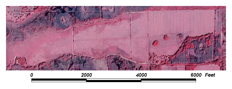
Field Picture
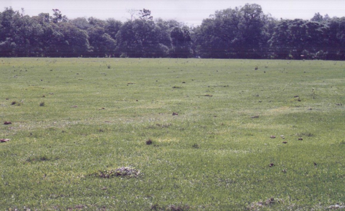
BACK TO CLASSIFICATION LIST
2120 Unimproved Pastures
2120
- Unimproved Pasture
LEVEL 1: 2000 Agriculture
LEVEL 2: 2100 Cropland and Pastureland
LEVEL 3: 2120
Unimproved Pasture
DESCRIPTION:
This class is similar to 2110
Improved Pasture, but with lower intensity of management. The
grasses are primarily a mixture of native grasses rather than a uniform, seeded
pasture crop. Normally, this land will not be managed with brush control and/or
fertilizer application.
The texture of unimproved pastures
is less smooth and uniform than improved pastures. Colors may vary depending on
the types and patterns of growth, producing a mottled appearance. Trees and
shrubs may be present, either dispersed or patchy. Tree
canopy, if present, covers less than 25% of the total area. If more than
25% tree canopy is present, the area is classified as 2130 Woodland
Pasture.
This land use type results in a very
smooth to slightly stippled texture with a color of greens with faint pink
occasionally present depending on the mixture of grasses and the presence of
low saw palmetto. Mixed grasses (mainly native species) result in mottled
appearance to the color and the texture. Additionally, pines or other trees
(oaks or palms) may be present at varying densities and shrubs or patches of
shrubs may be visible. These pastures may be ditched for water removal during
wet periods and irrigate during dry weather. Ditches are generally widely
spaced.
Management may include irregular
mechanical brush control and application of fertilizers and other
chemicals.
KEYS TO PHOTOINTERPRETATION:
Cleared land with major stands of trees and brush where native grasses
have been allowed to develop.
Evidence of cattle may be observed on the photography, such as water
ponds, troughs, feed bunkers and cattle trails.
Hay bales may be present at some times of the year.
The area is fenced, and the fence lines may be visible. Boundaries at
fence lines are generally distinct.
CONTEXT:
Landscape Position - Unimproved pastures are often found on broad
flat areas that were formerly pine flatwoods. They are usually associated
with other agricultural and livestock activities, . They tend to grade into
improved pastures and woodlands pastures, but may grade in to almost any other
land cover type, including wetlands. The surrounding landscape is helpful in
distinguishing this class from hay fields (2150 Field Crops) or grasslands
(3100 Herbaceous - Dry Prairie).
Vegetation - Unimproved pastures are dominated by a variety of
native grasses remaining following clearing or brush removal activities. Some
introduced species are also present in most of these land cover types. Shrubs
such as wax myrtle and saw palmetto are often scattered within the pasture.
Soils - This cover type occurs on a wide variety of soil types.
Most are found on acidic, sandy soils or loamy sands of former pine flatwoods
sites.
Hydrology - These cover types are usually not inundated and often
contain ditches as discussed above. High water tables may be present during the
wet season depending on the soil type on which they occur and inundation, if it
does occur, is brief.
SIMILAR CLASSES:
1900 Open Land - a more natural area; generally
not fenced
2110 Improved Pasture and 2130 Woodland Pasture - Improved Pasture will have a
smoother texture. Woodland Pasture will have at least 25% of the area in tree
canopy.
2150 Field crops - Field crops (wheat, oats, hay) may have a smoother
signature similar to improved pasture. Field crops are generally found in
areas managed for agronomic crops, characterized by rectangular fields,
farm roads, utility buildings, visible rotations, etc. Unimproved pastures are
generally in less intensive areas managed for livestock and forage.
2610 Fallow Cropland - Abandoned farm buildings, unmaintained roads and
irrigation systems are characteristic of this class.
3100 Herbaceous (Dry Prairie) - The 3100 class should be reserved for areas
where cattle are not present or are not likely to be present. These may be in
more urban settings, or in more remote areas formerly considered as rangelands
SPECIAL MAPPING CONVENTIONS:
The mapping unit includes barns,
ranch houses, trailers, and other features common relevant to agriculture.
Small inclusions of other land cover or land uses may also be included, if
under the minimum size criteria. Tree canopy may cover up to 25% of the
total area, but if canopy patches are larger than 1 acre they must be broken out
as 2130 Woodland Pasture. Priority classes such as water bodies, wetlands,
dumps, and feedlots must always be broken out separately, if they meet size
criteria.
Dual coding convention: This is a Land Cover class.
The LCCODE and LUCODE are the same. However, some of the land use classes
- such as 1180 Rural Residential and 1650 Reclaimed Mine Land - may use 2120 as a land cover
class.
DOQQ Image
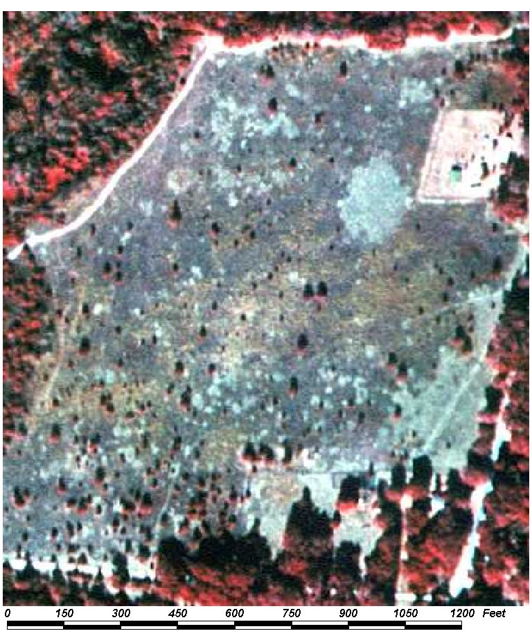
Field Picture
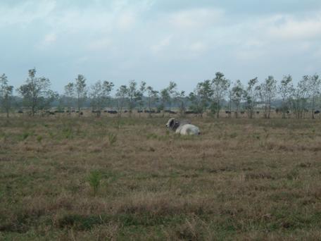
BACK TO CLASSIFICATION LIST
2130 Woodland Pastures
2130
- Woodland Pastures
LEVEL 1: 2000 Agriculture
LEVEL 2: 2100 Cropland and Pastureland
LEVEL 3: 2130 Woodland Pastures
DESCRIPTION:
Pasturelands that have from 25% to
100% forest canopy are included in this class.
Pastures are generally unimproved.
Evidence of cattle grazing may be difficult to see on photography, due to tree
cover. Such evidence, if visible, may include cattle trails leading to feed
bunkers, salt licks and watering areas, or cattle themselves.
Supplemental data and field verification may be needed to accurately map this
class.
KEYS TO PHOTOINTERPRETATION:
Twenty-five percent or more tree cover is present.
Visible evidence of cattle activity may include cattle trails,
feed bunkers, salt licks, hay bales, or watering areas. Cattle crossings
may be visible on the roads, defining a grazing boundary.
Cattle themselves may be visible in some areas.
Fence lines are usually obscured by canopy, but may be visible in open
areas.
CONTEXT:
Landscape Position - This type can be found in any forested area
within the project limits. Wetlands may be present within woodland pastures.
Vegetation - Woodland pastures are dominated by a variety of native tree and
shrub species. Most often the type will be of the pine flatwoods or pine and
oak types.
Soils - This cover type occurs on a wide variety of soil types.
Most are found on acidic, sandy soils or loamy sands of former pine flatwoods
sites.
Hydrology - These cover types are usually not inundated. High
water tables may be present during the wet season depending on the soil type on
which they occur and inundation, if it does occur, is brief.
SIMILAR CLASSES:
2120 Unimproved Pasture - Less than
25% of the total area is in tree canopy.
2200 Tree Crops - Pecan groves are often used as pastures, but must be coded as
2200. They have a more uniform texture and color and trees are in rows.
Old or abandoned groves become woodland pasture at some point - they should
then be classified as 2130 Woodland Pasture.
3200 Shrub and Brushland - These may look similar because shrub vegetation is
present and tree canopy may comprise up to 25% of the cover. However, cattle
are not present or likely to be present
4110 Pine Flatwoods - No indication of grazing is present
SPECIAL MAPPING CONVENTIONS:
The mapping unit includes barns,
ranch houses, trailers, and other operational features. Open areas may
cover up to 75% of the total area, but if those areas are larger than 1 acre
they should be broken out. In transitional areas where species specific
wetland and upland polygons are below the appropriate MMU some aggregation may
be justified. In these cases intermixed community classes will be assigned and
mapped at a larger unit. PI's must use discretion to avoid excessive line work
while adding useful information.
Priority classes such as water
bodies, wetlands, dumps, and feedlots must always be broken out separately, if
they meet their size criteria of 1 acre.
Dual coding convention: This is a Land Cover class.
The LCCODE and LUCODE are the same. However, some of the land use classes
- such as 1180 Rural Residential and 1650 Reclaimed Mine Lands - may use 2130
as a land cover class.
DOQQ Image
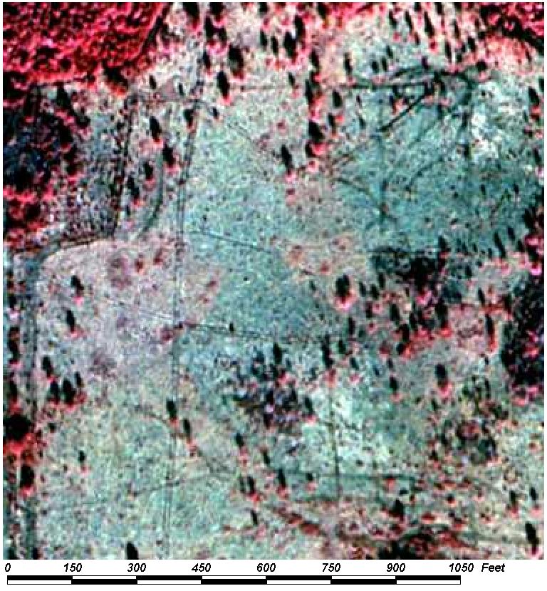
Field Picture
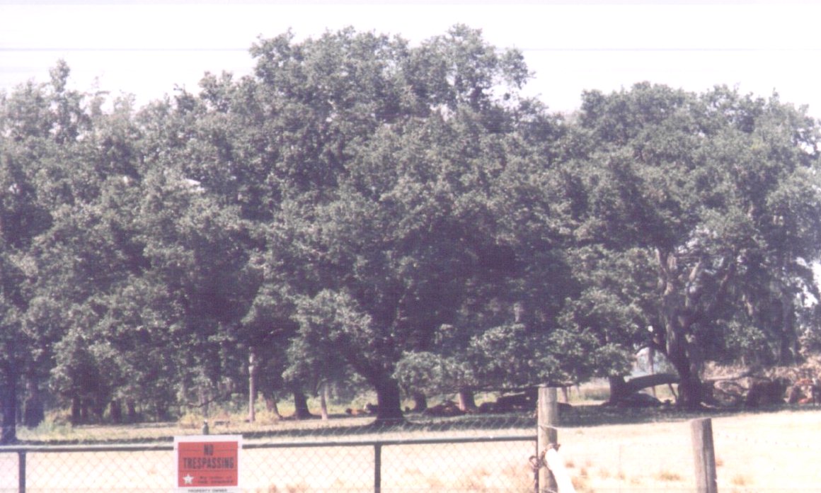
BACK TO CLASSIFICATION LIST
2140
Row Crops
2140
- Row Crops
LEVEL 1: 2000 Agriculture
LEVEL 2: 2100 Cropland and Pastureland
LEVEL 3: 2140 Row Crops
DESCRIPTION:
This class is for cultivated annual
crops that exhibit narrow row spacing. It does not include field
crops, which do not exhibit rows on photography, or trees and shrubs, which
tend to have a wider spacing. Also not included are farms specializing in
ornamentals and flowers. Typical row crops include predominantly peanuts
and cotton as well as, corn, tomatoes, potatoes, cabbage, beans, tobacco and a
host of other plants used mainly for animal and human consumption.
Row crops range from vast
monocultures of animal feeds to tiny commercial truck farms, and everything in
between. The appearance of the fields varies according to the specific
crop and season, from bare smooth soil to ridges to fully covered fields.
Some fields may also be in cover crops or in a fallow state. The reliable
indicators are the agricultural context and the appearance of fine textured
rows on most plots.
KEYS TO PHOTOINTERPRETATION:
The active fields have straight rows of crops and furrows or plow lines.
In wetter areas drainage ditches and levies or subsurface drains are
present.
Rows are visible even after harvesting of crops.
Farm buildings and equipment are seen in surrounding areas.
Irrigation systems are usually present.
Bare soil may be visible with varying amounts of pink and/or reds from
the crops.
CONTEXT:
Landscape Position - Row crops usually occur in an agricultural
context. Truck farms may operate on urban fringes, especially if on-site
marketing is used. A variety of other agricultural uses may be practiced
in the surrounding area, including field cropping, pastures, nurseries, and
tree crops.
Soils - Areas with naturally hydric soils are sometimes used for
row cropping and other agricultural operations. If they are active farm
operations they are coded as agricultural rather than wetlands or water bodies.
PI's should check public lands maps to determine whether the operation is still
active or in a process of restoration.
SIMILAR CLASSES:
2430 Ornamentals - row spacing is wider than row crops
2610 Fallow Cropland - has a more shrubby, irregular appearance
SPECIAL MAPPING CONVENTIONS:
The mapping unit includes barns,
offices, farm houses, warehouses, private air strips, farm roads and any other
operational features.
Priority classes such as water
bodies and wetlands are are always broken out if they meet their minimum size
criteria. However, areas that are active farm plots and only temporarily
under water should not be coded as water bodies. A note may be added by
the PI to indicate the field is inundated at the time of the photography.
Dual coding convention: This is a Land Use
class. The LUCODE and LCCODE are the same. A separate land cover code is
not required.
DOQQ Image
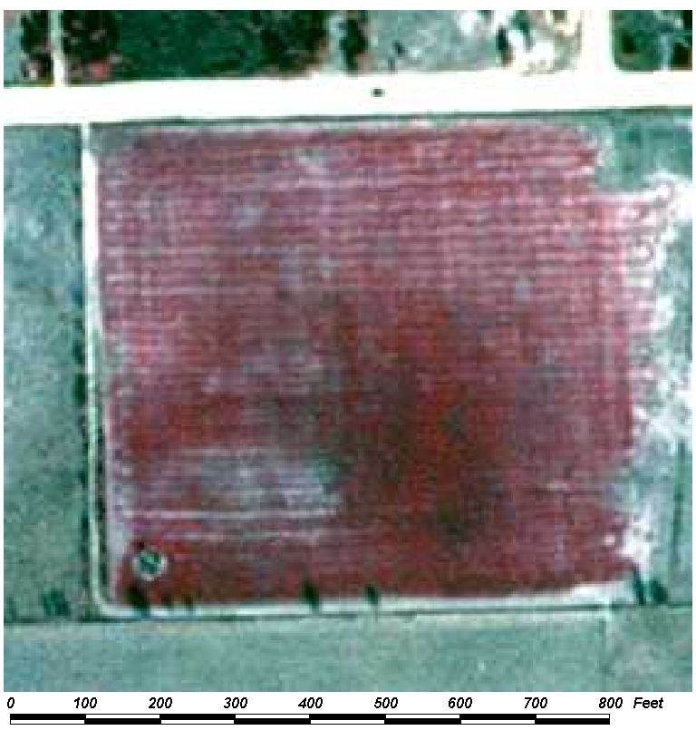
Field Picture
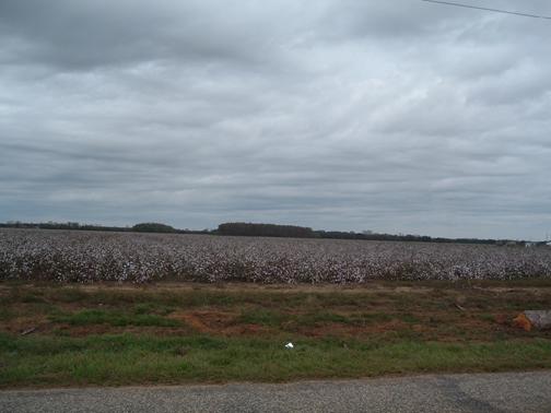
BACK TO CLASSIFICATION LIST
2150
Field Crops
2150
- Field Crops
LEVEL 1: 2000 Agriculture
LEVEL 2: 2100 Cropland and Pastureland
LEVEL 3: 2150 Field Crops
DESCRIPTION:
Field crops are agronomic crops
that, due to spacing or growth habit, do not exhibit a pattern of parallel rows
on the photography. Examples in Alabama are wheat, oats, hay, other
grasses. The fact that an area is mowed at some times is not sufficient for
inclusion in this class - it must be actively managed as a cultivated field
crop. Fields are either rectangular or circular in shape, with the circular
fields usually used for hay production. Hay crops tend to be isolated or will
appear in clusters of only a few fields. Broad expanses of rectangular fields
are generally sugar cane,and are coded as 2156.
In Baldwin County the primary field crop types are
hay, grasses, and turf farms. They may be very difficult to differentiate from
improved pasture in many cases - context may be a decisive factor in
distinguishing one from the other. Field checks may be the only way to
determine the actual use of some fields, especially when crop growth is in the
early stages. However, since hay crops are similar in function to other
classes such as pasture, the error cost is low and does not warrant extensive
checking. In fact, the farmer may rotate fields between pasture and hay over
successive seasons or years.
KEYS TO PHOTOINTERPRETATION:
Typical field crops are included as well as hay production areas
Flat, smooth signature from hay, grasses.
Bright pink signature from fertilization and maintenance.
Fence lines may be visible.
Mow lines and hay bales are often visible.
Subsurface or surface drainage, canals, and/or irrigation may be
visible.
No visible evidence of grazing livestock.
Field shapes are regular or rectangular, and have mostly straight edges.
CONTEXT:
Landscape Position - The PI has to consider the context if other
indicators are not conclusive. Cropland and pasture lands may occur
together, but areas that are predominantly crop land will have more of the
indicators shown above (fence lines, mow lines, rectangular fields) as well as
other features such as storage buildings, cultivating equipment, vehicles,
irrigation equipment, solid waste sites, and processing facilities. Field crops
may occur almost anywhere, but are typically found in areas of pasture and
ranching or dairy/horse farms. Sugar cane fields are generally found around the
southern portions of Lake Okeechobee.
Soils - A wide variety of soils from sandy to peat, and varying
drainage classes are used for Field Crops.
SIMILAR CLASSES:
2110 Improved Pasture - Will have
evidence of grazing, or a grazing context
2160 Mixed Crops - Will have less uniformity than field crops
2610 Fallow Cropland - Will show signs of abandonment, overgrowth
3100 Herbaceous (Dry Prairie) - Not actively managed for crops, although
cutting may occur
SPECIAL MAPPING CONVENTIONS:
This land cover type on the aerial
photography often appears as pasture that is not supporting livestock at the
time of photography but is rotated to field crop production, specifically hay.
If the area shows any evidence of cattle, or its signature could be classed as
either pasture or field crops, the area should be classified as 2110 Improved
Pasture.
Spatial context is helpful in
distinguishing this class from 2110 Improved Pasture. Field crops will
generally be found in a more intensively managed setting, surrounded by similar
areas with rectangular fields, farm roads, etc. Improved pasture will
generally be found in a less intensively managed environment.
NOTE: Areas of field crops
associated with a dairy shall be coded as part of the dairy operation, and not
coded as 2150.
Dual coding convention: This is a Land Cover
class. The LCCODE and LUCODE are the same. A separate land use code is
not required.
DOQQ Image
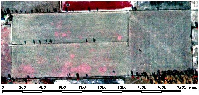
Field Picture
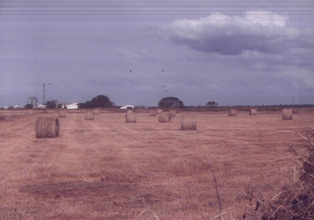
BACK TO CLASSIFICATION LIST
2160 Mixed Crops
2160
- Mixed Crops
LEVEL 1: 2000 Agriculture
LEVEL 2: 2100 Cropland and Pastureland
LEVEL 3: 2160 Mixed Crops
DESCRIPTION:
This class is used for areas where
the type of crop cannot be determined-either because the photo-signature does
not indicate a specific type of crop, or various crop types are in plots that
cannot be delineated separately. It may not be possible to break out the
different crop types if each plot is below the minimum mapping unit (1 acre),
or if the stage of the rotation (e.g. freshly plowed) does not reveal what type
of crop will be grown.
The crop patterns in some areas can
vary from season to season. Where mixtures of row crops, field crops,
pastures, fallow cropland, and other crops occur together, a precise delineation
is not always cost effective - some aggregation or generalization may be
justified. PI's must use discretion to avoid excessive line work while adding
useful information.
This class should not be used if a
reasonable assumption about the crop type can be made based on context,
surrounding uses, and other possible indicators. In general, it should be
reserved only for mixtures of crops that are too complex to differentiate
efficiently.
KEYS TO PHOTOINTERPRETATION:
Crop type is not identifiable due to temporary inactivity or the stage
of crop rotation. Some plots may be freshly tilled.
Multiple crop types occur on small areas, each type below the minimum
size criteria of 1 acre. Crop patterns appear somewhat random.
The mixture of cropping methods indicates that the land use changes
often.
The specific crop type cannot be determined from the photography or
supplemental data.
CONTEXT:
Landscape Position - This class tends to be limited to mostly
smaller operations, such as truck farms, or farms used for a second
income. These are likely to be in agricultural zones in or near urban
areas. A variety of other agricultural uses may be practiced in the surrounding
area, including field cropping, pastures, nurseries, and tree crops.
SIMILAR CLASSES:
2140 Row Crops - have straight rows
of crops and furrows or plow lines are visible
2150 Field Crops - have a bright pink, flat, smooth signature from
fertilization and maintenance
2430 Ornamentals - row spacing is wider than for row crops; shade cloths may
appear as black rectangles
SPECIAL MAPPING CONVENTIONS:
This is a Baldwin County modification to the FLUCCS system,
which does not have a class for mixed crops.
This class should not be used if a
reasonable assumption about the crop type can be made based on context and
other indicators. It should be reserved mainly for mixtures where more specific
classification is not possible.
The mapping unit includes any barns,
offices, farm houses, green houses, warehouses, farm roads and other
features that are part of the farming operation or inside the operational
boundary. Priority classes such as water bodies and wetlands are are
always broken out if they meet their minimum size criteria.
Dual coding convention: This is a Land Cover
class. The LCCODE and LUCODE are the same. A separate land
use code is not required.
DOQQ Image
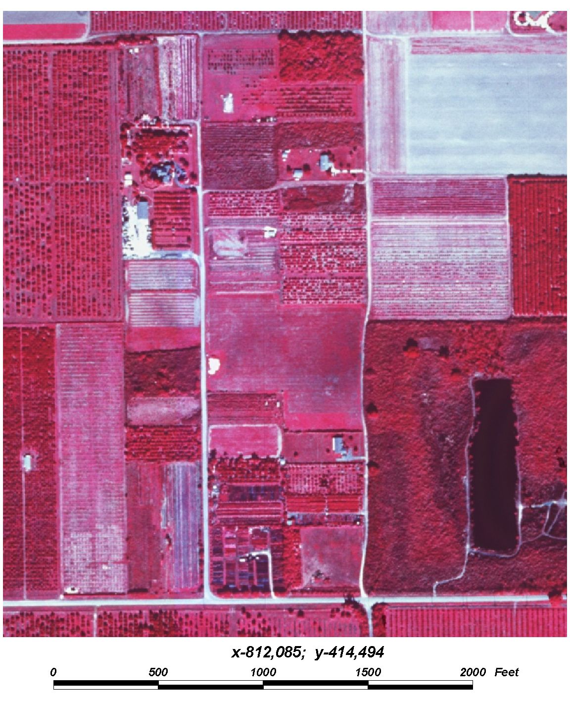
Field Picture
BACK TO CLASSIFICATION LIST
*2200 Tree Crops
Tree Crops - FLUCCS Code 2200
This Level 2 class is
not used in the map itself - a more specific subclass must be selected. The
Level 3 subclasses are:
2210 Citrus Groves
2220 Fruit Orchards
2230 Other Groves
Background: This class is used
for tree crop operations that produce fruit, nuts, or other resources not
including wood products.
Examples in Alabama include citrus
fruit, peaches, nectarines, but is mostly dominated by pecans. This class does
not include tree nurseries, vineyards, floriculture or ornamentals. It also
does not include tree plantations or any uses that primarily produce wood
products.
MAPPING CONVENTIONS:
Minimum mapping
units: The minimum mapping unit for all Agricultural classes is 1 acre.
Differentiating
subclasses: The agricultural classes are generally open, cultivated lands
that can have a similar appearance on aerial photography. The land uses
can change very frequently from one to another. Also, agricultural areas
may be mixed with other uses, such as forestry, mining, rural residential, and
rangelands, making context alone an unreliable indicator. As a result of
these factors, there is a strong possibility for confusion. In order to
differentiate these classes it is necessary to look closely at the details in
the PI key pages for each class.
Dual coding
convention: All of the 2200 classes are Land Cover classes. The LCCODE
and LUCODE are the same. A separate land use code is not required.
SIMILAR CLASSES:
Tree Crops can be
confused with other classes such as 2100 Cropland and Pastureland, 2130
Woodland Pasture, and 2400 Nurseries and Vineyards. Tree Crops have
wider-spaced rows and trees that are generally visible, while some crop types
may have visible rows, but no trees visible. Active pecan groves should be
examined for evidence of cattle grazing, which would meet the definition of
woodland pasture. Tree Crops also have a more uniform appearance than nurseries
or vineyards, which can have a variety of species.
For more
information:
See the PI keys for
each of the subclasses for more details and graphic examples.
BACK TO CLASSIFICATION LIST
2210
Citrus Groves
2210
- Citrus Groves
LEVEL 1: 2000 Agriculture
LEVEL 2: 2200 Tree Crops
LEVEL 3: 2210 Citrus Groves
DESCRIPTION:
This class includes active citrus
groves, such as oranges, grapefruits, and tangerines. If the groves are
abandoned they should be classified with the appropriate forested class.
The mapping unit includes all
facilities that are related to the citrus operation or located within the
operational boundary of the enterprise.
KEYS TO PHOTOINTERPRETATION:
Uniformly spaced rows of trees give the appearance of a grid pattern.
There may be intermittent spaces within groves.
The groves and its sub-units tend to be large, rectangular areas with
straight rows. One operation may cover thousands of acres.
Irrigation and drainage canals are usually present.
Healthy trees produce circular crowns with a dark brown/red color.
Larger trees may grow together into what appear to be long, wide hedges.
Groves appear to be well-managed and currently in production.
CONTEXT:
Landscape Position - Citrus is typically planted on well-drained,
sandier textured soils, but hydric soils have also been converted to citrus
groves in some places. Artificial drainage and irrigation are used in most
cases to keep soils in acceptable moisture ranges.
Soils - Citrus groves are typically found on well-drained sandy
soils.
SIMILAR CLASSES:
2400 Nurseries and Vineyards - Nurseries have multiple varieties, giving a less
uniform appearance. Vineyards have a closer spacing and individual plants
are not visible.
4410 Coniferous Pine - characteristic pine signature
4430 Forest Regeneration - recently cleared areas, with lines of piled up slash
and debris
SPECIAL MAPPING CONVENTIONS:
The mapping unit includes offices,
on-site marketing and processing facilities, permanent and temporary housing,
warehouses, private air strips, farm roads and any other operational features.
Any features not involved in the operation or not located within operational boundaries
are not included.
Dual coding convention: This is a Land Cover
class. The LCCODE and LUCODE are the same. A separate land use code is
not required.
DOQQ Image
Field Picture
BACK TO CLASSIFICATION LIST
2220 Fruit Orchards
2220
- Fruit Orchards
LEVEL 1: 2000 Agriculture
LEVEL 2: 2200 Tree Crops
LEVEL 3: 2220 Fruit
Orchards
DESCRIPTION:
This class includes crops which are
not citrus fruits. Crops such as peaches, pears, and plums are typical examples
of this class. If the groves are abandoned they should be classified with
the appropriate forested class.
Included in this class are all
facilities that are related to the orchard operation or located within the
operational boundary of the enterprise.
KEYS TO PHOTOINTERPRETATION:
Uniformly spaced rows of trees give the appearance of a grid pattern.
There may be intermittent spaces within orchards.
The orchard and its sub-units tend to be large, rectangular areas with
straight rows. One operation may cover thousands of acres.
Irrigation and drainage canals are usually present.
Healthy trees produce circular crowns with a dark brown/red color.
Larger trees may grow together into what appear to be long, wide hedges.
Groves appear to be well-managed and currently in production.
CONTEXT:
Landscape Position - Fruit orchards tend to be located in the
more southerly portions of the County.
Soils -Fruit orchards are typically planted on well-drained, sandier
textured soils, but hydric soils have also been converted to fruit orchards in
some places. Artificial drainage and irrigation are used in most cases to keep
soils in acceptable moisture ranges.
SIMILAR CLASSES:
2400 Nurseries and Vineyards - Nurseries have multiple varieties, giving a less
uniform appearance. Vineyards have a closer spacing and individual plants
are not visible.
4410 Coniferous Pine - characteristic pine signature
SPECIAL MAPPING CONVENTIONS:
The mapping unit includes offices,
on-site marketing and processing facilities, permanent and temporary housing,
warehouses, private air strips, farm roads and any other operational features.
Any features not involved in the operation or located within operational
boundaries are not included.
Priority classes such as water
bodies and wetlands are are always broken out if they meet their minimum size
criteria.
Dual coding convention: This is a Land Cover
class. The LCCODE and LUCODE are the same. A separate land use code is
not required.
DOQQ Image
Field Picture
BACK TO CLASSIFICATION LIST
2230
Pecan and other Groves
2230
– Pecan and other Groves
LEVEL 1: 2000 Agriculture
LEVEL 2: 2200 Tree Crops
LEVEL 3: 2230 Pecan and
other Groves
DESCRIPTION:
This class includes tree crops such
as pecans and other nut trees, and also groves where the type of fruit being
grown is unable to be determined. This
is the predominant tree crop in Baldwin County and is primarily in the south.
These groves appear as regularly
spaced trees of similar size and crown shape/ diameter in regular blocks are.
Trees do not necessarily produce circular crowns like citrus, however.
Additionally they may be taller (when mature) than citrus and have varying
reddish color return depending on the crop in production which is not as dark
as the dark brown red color of most citrus. As trees become larger, they may
form what appear as long hedges with each crown touching its neighbor along the
long axis of the row of trees.
Varying amounts of bare soil are
visible between the rows depending on the age of the grove and maintenance
practices and/or schedules. Older abandoned groves show encroachment of other
shrubs and grasses in between the trees, stressed or senile trees, and other
species of shrubs and trees replacing stressed or dead trees.
The type of grove is often not
possible to determine without collateral data. Size and shape of trees,
especially in more mature groves should distinguish this class from the more
rounded crowns of citrus trees.
KEYS TO PHOTOINTERPRETATION:
Uniformly spaced rows of trees give the appearance of a grid pattern.
There may be intermittent spaces within grove.
The groves and its sub-units tend to be large, rectangular areas with
straight rows. One operation may cover thousands of acres.
Irrigation and drainage canals are usually present.
Healthy trees produce circular crowns with a dark brown/red color.
Larger trees may grow together into what appear to be long, wide hedges.
Groves appear to be well-managed and currently in production.
CONTEXT:
Landscape Position - This land use type occupies much smaller
areas than that of fruit groves. Irrigation and drainage canals are still
present throughout the grove system providing water (pumped into the grove
during dry times) and drainage for excess rain water and high water tables
during wet periods. These other groves tend to be located in the southern
portions of the County.
Soils - This land use type is typically found on well-drained
sands.
SIMILAR CLASSES:
2400 Nurseries and Vineyards -
Nurseries have multiple varieties, giving a less uniform appearance.
Vineyards have a closer spacing and individual plants are not visible.
4410 Coniferous Pine - characteristic pine signature
4430 Forest Regeneration - recently cleared areas, with lines of piled up slash
and debris
SPECIAL MAPPING CONVENTIONS:
The mapping unit includes all
associated offices, on-site marketing and processing facilities, permanent and
temporary housing, warehouses, private air strips, farm roads and any other
operational features. Any features not involved in the operation or not
located within operational boundaries are not included.
Priority classes such as water
bodies and wetlands are are always broken out if they meet their minimum size
criteria.
Dual coding convention: This is a Land Cover
class. The LCCODE and LUCODE are the same. A separate land use code is
not required.
DOQQ Image
Field Picture
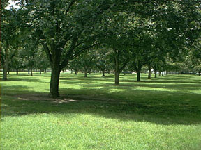
BACK TO CLASSIFICATION LIST
2240 Abandoned Groves
2240
- Abandoned Groves
LEVEL 1: 2000 Agriculture
LEVEL 2: 2200 Tree Crops
LEVEL 3: 2240 Abandoned Groves
DESCRIPTION:
This class includes tree crops such
as pecans and other nut trees, and also groves where the type of fruit being
grown is unable to be determined.
These groves appear as regularly
spaced trees of similar size and crown shape/ diameter in regular blocks are.
Trees do not necessarily produce circular crowns like citrus, however.
Additionally they may be taller (when mature) than citrus and have varying
reddish color return depending on the crop in production which is not as dark
as the dark brown red color of most citrus. As trees become larger, they may
form what appear as long hedges with each crown touching its neighbor along the
long axis of the row of trees.
Varying amounts of bare soil are
visible between the rows depending on the age of the grove and maintenance
practices and/or schedules. Older abandoned groves show encroachment of other
shrubs (Brazilian pepper and wax myrtle) and grasses in between the trees,
stressed or senile trees, and other species of shrubs and trees replacing
stressed or dead trees.
The type of grove is often not
possible to determine without collateral data. Size and shape of trees,
especially in more mature groves should distinguish this class from the more
rounded crowns of citrus trees. Many of
these areas are in transition to residential.
KEYS TO PHOTOINTERPRETATION:
Uniformly spaced rows of trees give the appearance of a grid pattern.
There may be intermittent spaces within grove.
The groves and its sub-units tend to be large, rectangular areas with
straight rows. One operation may cover thousands of acres.
Irrigation and drainage canals are usually present.
Healthy trees produce circular crowns with a dark brown/red color.
Larger trees may grow together into what appear to be long, wide hedges.
Groves appear to be well-managed and currently in production.
CONTEXT:
Landscape Position - This land use type occupies much smaller
areas than that of fruit groves. Irrigation and drainage canals are still
present throughout the grove system providing water (pumped into the grove
during dry times) and drainage for excess rain water and high water tables
during wet periods. These other groves tend to be located in the southern
portions of the County.
Soils - This land use type is typically found on well-drained
sands.
SIMILAR CLASSES:
2400 Nurseries and Vineyards -
Nurseries have multiple varieties, giving a less uniform appearance.
Vineyards have a closer spacing and individual plants are not visible.
4410 Coniferous Pine - characteristic pine signature
4430 Forest Regeneration - recently cleared areas, with lines of piled up slash
and debris
SPECIAL MAPPING CONVENTIONS:
The mapping unit includes all
associated offices, on-site marketing and processing facilities, permanent and
temporary housing, warehouses, private air strips, farm roads and any other
operational features. Any features not involved in the operation or not
located within operational boundaries are not included.
Priority classes such as water
bodies and wetlands are are always broken out if they meet their minimum size
criteria.
Dual coding convention: This is a Land Cover
class. The LCCODE and LUCODE are the same. A separate land use code is
not required.
DOQQ Image
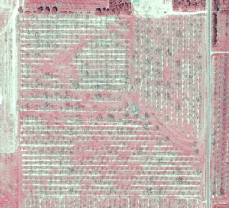
Field Picture
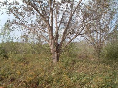
BACK TO CLASSIFICATION LIST
2300 Feeding Operations
2300
- Feeding Operations
LEVEL 1: 2000 Agriculture
LEVEL 2: 2300 Feeding Operations
DESCRIPTION:
This Level 2 class should be used
only for animal feeding operations that do not fall in to one of the two active
subclasses of cattle or poultry feeding. The most common usage for this
class is for swine production, which is not prevalent in the County at this time.
This class does not include
facilities used to process livestock into consumer food products. These
facilities, such as meat packing plants, are classified as 1500 Industrial.
Feeding operations are specialized
livestock production enterprises. They have large animal populations
restricted to relatively small areas, which results in a concentration of waste
material that is an environmental concern. The attendant waste disposal and
mitigation problems justify a separate category for these relatively small areas.
As with dairies, feeding operations
may have a number of sub-components. If so, they are classified as
follows:
- Central Buildings and Processing Facilities - LC
2300, LU 2300.
- Central, High-Intensity Pasture - LC 2300, LU
2300. (include with processing facility)
- Outlying Pasture - LC 2100s, LU
2100s.
- Treatment Ponds and Lagoons - LC 8360, LU 2300
KEYS TO PHOTOINTERPRETATION:
Modern swine production facilities, if introduced, are large,
industrial, indoor facilities rather than outdoor feedlots. Animals are not
typically visible.
Usually large, specialized livestock production areas with confined
feeding.
The concentration of livestock on small areas usually causes a severe
impact to ground cover.
Structures to shelter the animals and equipment are visible.
Fences, access paths, and waste disposal ponds may be visible.
CONTEXT:
Landscape
Position - Some operations are located near urban areas to take advantage of
proximity to transportation facilities and processing plants. However,
environmental concerns usually dictate that these facilities be located a
sufficient distance from residential areas.
SIMILAR CLASSES:
2520 Dairies - large buildings for
shelter and/or milking apparent
SPECIAL MAPPING CONVENTIONS:
The 2300 Feeding Operations code
applies to the buildings and adjacent high intensity areas which are an
integral part of the feeding operation.
Related treatment ponds should be
dual-coded. - e.g. 8360/2300.
Included within the 2300 polygon are
all buildings, grounds, parking lots, storage areas and other related
features.
Priority classes such as water
bodies and wetlands are always broken out if they meet their minimum size
criteria.
Dual coding convention: This is a Land Use class. A
separate land cover code is only required as noted above.
BACK TO CLASSIFICATION LIST
2310 Cattle Feeding Operations
2310
- Cattle Feeding Operations
LEVEL 1: 2000 Agriculture
LEVEL 2: 2300 Feeding Operations
LEVEL 3: 2310 Cattle
Feeding Operations
DESCRIPTION:
This class is for concentrated
feedlot operations that produce accelerated growth of cattle prior to
processing into food products. It is not for breeding, grazing or dairy
operations, and it does not include facilities (meat packing plants) used to
process the livestock into consumer food products.
Feeding operations are specialized, livestock
production enterprises that are rare but highly significant wherever they do
occur. They have large animal populations restricted to relatively small areas,
which results in a concentration of waste material that is an environmental
concern. The attendant waste disposal and mitigation problems justify a
separate category for these relatively small areas.
The signature of this class is
distinct - highly impacted ground cover around a core facility, with pronounced
trails and ditches. In impacted areas the ground is wet, causing a
characteristic dark color on CIR photos.
KEYS TO PHOTOINTERPRETATION:
These are usually large, specialized livestock production areas with
confined feeding.
The concentration of livestock on small areas usually causes a severe
impact to ground cover.
Fences, heavily used trails, feeding troughs, shelters, and waste
disposal features (treatment ponds, waste piles) may be visible.
CONTEXT:
Landscape Position - Feedlots are rare, but highly significant in
terms of water resources. Some operations are located near urban areas to take
advantage of transportation facilities and processing plants. However,
environmental concerns usually dictate a distance from residential areas.
SIMILAR CLASSES:
2110 Improved Pasture - Ground cover
is not heavily impacted
2520 Dairies - Dairies may have concentrated feeding operations. Such areas are
included as part of the dairy facility, and not delineated separately.
SPECIAL MAPPING CONVENTIONS:
Dual coding convention: This is a Land Use class. A
separate land cover code may be required, as described below.
- Central Buildings and Processing Facilities - LC
2310, LU 2310.
- Central, High-Intensity Pasture - LC 2310, LU 2310.
(include with processing facility)
- Outlying Pasture - LC 2100s, LU 2100s.
- Other Treatment Ponds - LC 8360, LU 2310.
DOQQ Image
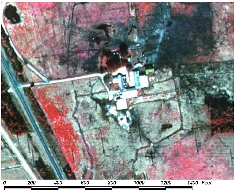
Field Picture
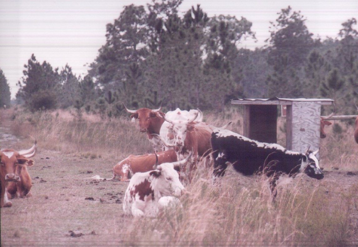
BACK TO CLASSIFICATION LIST
2320 Poultry Feeding Operations
2320
- Poultry Feeding Operations
LEVEL 1: 2000 Agriculture
LEVEL 2: 2300 Feeding Operations
LEVEL 3: 2320 Poultry
Feeding Operations
DESCRIPTION:
This class includes commercial
facilities that raise chickens for human consumption. It does not include
meat packing plants, which are classified as 1500 Industrial.
Poultry operations have a very
distinctive appearance on aerial photos - very long, narrow, white buildings
set in parallel, with relatively clean surrounding grounds. These are the
opposite of cattle feedlots, which appear to be very impacted, and have a more
"messy" appearance.
Poultry waste materials may be
treated or spread on site or removed for outside uses such as fertilizer.
KEYS TO PHOTOINTERPRETATION:
Long rectangular chicken coops are present.
The surrounding area is relatively un-impacted.
Small reservoirs may be seen adjacent to buildings, used for water
supply and storm water and/or wastewater treatment.
Fields around the facility may show varying degrees of enrichment
(pinkish colors) due to waste spreading or wastewater irrigation
activities.
CONTEXT:
Landscape Position - Poultry operations are common in parts of
the County, typically located in agricultural areas. They do not
have waste mitigation issues to the degree that swine and cattle feeding operations
do. However, odor and other environmental concerns usually require their
being located a substantial distance from residential areas.
SIMILAR CLASSES:
2400 Nurseries and Vineyards -
Greenhouses may resemble chicken coops. Context should be checked
carefully. Other types of crop production may also have greenhouses.
SPECIAL MAPPING CONVENTIONS:
If there are sub-components to the
operation, they are classified as follows:
- Central Buildings and Processing Facilities - LC
2320, LU 2320.
- Treatment Ponds - LC 8360, LU 2320
Included within the 2320 polygon are
all buildings, grounds, storage areas and other features that are involved
in the operation or within the operational boundary. Open lands adjacent
to the facility are not coded 2320 unless there are indications of impacts from
the poultry operation - property boundaries are not expected to coincide with
the 2320 mapping unit. Priority classes such as water bodies and wetlands
are always broken out if they meet their minimum size criteria.
Dual coding convention: This is a Land Use class.
Dual coding is only required in the case of treatment ponds. (See above)
DOQQ Image
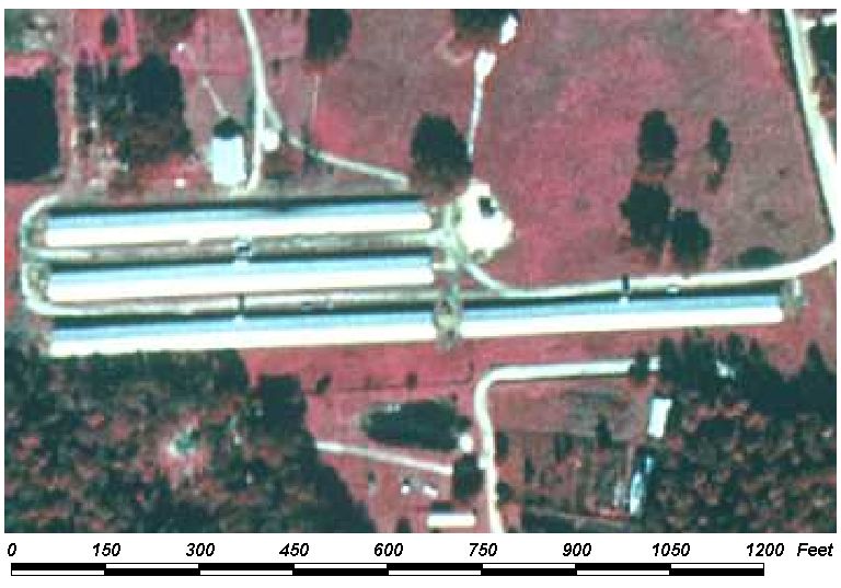
Field Picture
BACK TO CLASSIFICATION LIST
2400 Nurseries and Vineyards
2400
- Nurseries and Vineyards
LEVEL 1: 2000 Agriculture
LEVEL 2: 2400 Nurseries and Vineyards
DESCRIPTION:
This Level 2 class includes Nurseries
and Vineyards that are not described by one of the three active
subclasses. The subclasses are 2410 Tree Nurseries, 2420 Sod Farms, and
2430 Ornamentals. The 2400 code is used for nurseries and vineyards whose
purpose is other than tree production.
Some of the subclasses are very
similar in both definition and appearance, and will be difficult to
differentiate at farms that have a mixture of different uses. For
example, one small retail nursery may grow ornamental trees, small ornamentals,
ferns, and flowers. In these cases the PI must try to determine the
predominant use and code it accordingly. If the predominant use cannot be
determined, then the general code 2400 may be used.
Greenhouses or nurseries that are
attached and subsidiary to a larger farm operation of another type, such as row
crops or citrus groves are included in those land uses, and not classified in
the 2400 Nuseries and Vineyards class.
KEYS TO PHOTOINTERPRETATION:
There are usually small plots focused around long narrow rows of
greenhouses or long narrow rows of planted vines.
There may be a number of different types of plants with various row
widths.
Typically have numerous short rows running perpendicular to longer rows
These uses often found in areas of rich humus soils associated with
rivers, wetlands and basin depressions.
CONTEXT:
Landscape
Position- Nurseries and vineyards may be associated with farm operations,
forestry, landscaping or urban marketing operations. There are, in
general, few environmental concerns or nuisance factors, and they can be
located almost anywhere. Sizes range from tiny plots to very large
commercial operations.
Vegetation-
N/A
Soils-
N/A
Hydrology-
N/A
SIMILAR CLASSES:
2200 Tree Crops - Nurseries have
multiple varieties, giving a less uniform appearance. Vineyards have a
closer spacing and individual plants are not visible
SPECIAL MAPPING CONVENTIONS:
This Level 2 classification code is
used primarily for vineyards.
The mapping unit includes
greenhouses, offices, residential buildings, parking areas, farm roads and any
other operational features. Only features that are involved in the
enterprise or within the operational boundary are included. Priority classes
such as water bodies and wetlands are always broken out if they meet their
minimum size criteria.
Dual coding convention: This is a Land Cover
class. The LCCODE and LUCODE are the same. A separate Land
Use code is not required.
DOQQ Image
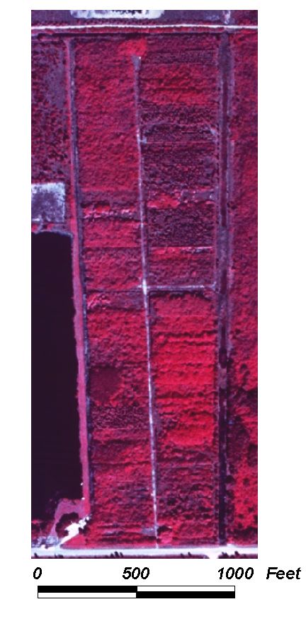
Field Picture
BACK TO CLASSIFICATION LIST
2410 Tree Nurseries
2410
- Tree Nurseries
LEVEL 1: 2000 Agriculture
LEVEL 2: 2400 Nurseries and Vineyards
LEVEL 3: 2410 Tree
Nurseries
DESCRIPTION:
This class includes nurseries which
grow trees for transfer to other destinations. There may be other products
grown at the facility, such as flowers and ornamentals, but they are not the
predominant use. Trees may be grown in-ground or in containers.
Most tree nurseries are for
ornamental trees used for landscaping. These trees can range from small
potted plants to large specimens, and many varieties are typically present.
Also included are timber nurseries, which have plants that appear small and
uniform on the photography.
KEYS TO PHOTOINTERPRETATION:
Trees are in rows similar to citrus groves, but there are many different
types of trees with varying shaped crowns, texture and color. Some areas
may be under artificial shading.
Sizes range from tiny plots to very large commercial operations.
Greenhouses and equipment storage areas are often present.
CONTEXT:
Landscape Position - Nurseries may be associated with tree crops,
forestry, landscaping or retail operations. They do not
present environmental or nuisance concerns, and can be located
almost anywhere within the County.
SIMILAR CLASSES:
2200 Tree Crops - Trees tend to be
mature and uniform, over large areas.
2430 Ornamentals - 2430 is used for smaller ornamentals, such as container
grown plants.
4400 Tree Plantations and 4410 Coniferous Pine - These may contain nurseries,
but the acreage is mostly in permanent plantation.
4430 Forest Regeneration - Trees are small but permanent, not for transplant.
SPECIAL MAPPING CONVENTIONS:
This class includes timber
nurseries, which is a modification of the FLUCCS system. (In the FLUCCS
system, timber nurseries are classified with the code 2460.)
The mapping unit includes
greenhouses, offices, residential buildings, parking areas, and any other
features involved in the enterprise or within the operational boundary.
Priority classes such as water bodies and wetlands are always broken out if
they meet their minimum size criteria.
Dual coding convention: This is a Land Cover
class. The LCCODE and LUCODE are the same. A separate land
use code is not required.
DOQQ Image
Field Picture
BACK TO CLASSIFICATION LIST
2420
Sod Farms
2420
- Sod Farms
LEVEL 1: 2000 Agriculture
LEVEL 2: 2400 Nurseries and Vineyards
LEVEL 3: 2420 Sod Farms
DESCRIPTION:
This class describes sod (turf)
farms. They are usually large, intensively managed areas of short,
uniform turf. The crop requires extensive fertilization and machinery,
indicated by the presence of buildings, tanks, and storage areas.
Irrigation canals are usually
present around the fields with the smaller irrigation/drainage ditches in
between smaller blocks or fields of sod. These fields produce a very manicured
look much the same as lawns without the landscaping shrubbery. Intensive
management is apparent with small roads and maintenance and storage sheds for equipment
and chemicals (fertilizers, herbicides and pesticides).
Harvested fields will either show as
bare soil (light greenish or whitish color) or as intermixed narrow strips of
bare soil and magenta or pinkish from the strips of sod left to grow the next
crop. The strip harvest method is not commonly used in commercial sod fields,
but may be observed in pastures which have been leased or sold for sod
production.
Sod farms have signatures similar to
well-manicured pastures, hay crops or urban lawns. Some pastures may be
leased for sod production; these should be classified as 2420 Sod Farms if sod
production appears to be the predominant use.
Sod farms are a priority class
because, like golf courses, they use high rates of fertilizers and other chemicals
that can migrate to ground or surface waters. Prolonged use as sod farms can
also deplete surface soils.
KEYS TO PHOTOINTERPRETATION:
Growing turf has a bright red, even signature.
Areas may be patchy, rectangular, and in different stages of growth.
Ponds may be used for irrigation, and irrigation patterns may be evident
as circles or blocks of uniform signature.
Irrigation and drainage canals and ditches are usually present, with
smaller ditches in between fields or blocks of sod, to insure proper moisture
conditions.
Features such as cattle, hay bales, silos, etc. will not be
present. Trees and shrubs are not present in the sod fields.
Harvested areas appear as long strips or rectangular patches of bare
soil in random locations.
CONTEXT:
Landscape
Position - This land use may occur anywhere within the project area but
typically would be expected to occupy areas between urban development and remote
agricultural lands so as to take advantage of readily available labor pools and
distribution/marketing facilities
Soils
- Sod farms require well-drained soils with uniform, controlled moisture
conditions and fertilization for healthy growth.
SIMILAR CLASSES:
2110 Improved Pastures - evidence of
grazing will be present
2150 Field Crops - hay bales may be visible
SPECIAL MAPPING CONVENTIONS:
The mapping unit includes offices,
storage areas for equipment and materials, and any other features involved
in the enterprise or within the operational boundary. Priority classes such as
water bodies and wetlands are always broken out if they meet their minimum size
criteria.
Dual coding convention: This is a Land Cover
class. The LCCODE and LUCODE are the same. A separate
land use code is not required.
DOQQ Image
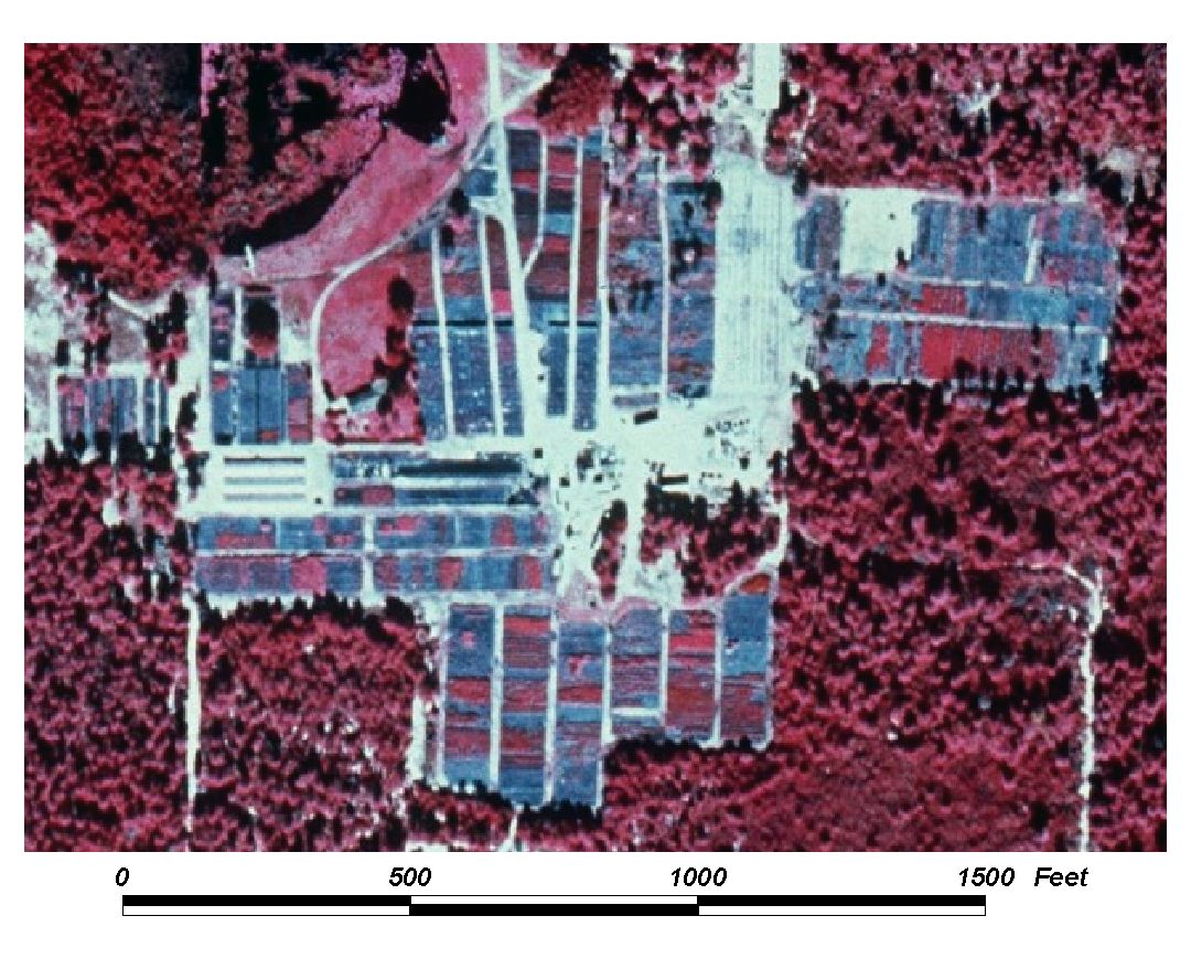
Field Picture
BACK TO CLASSIFICATION LIST
2430
Ornamentals
2430
- Ornamentals
LEVEL 1: 2000 Agriculture
LEVEL 2: 2400 Nurseries and Vineyards
LEVEL 3: 2430 Ornamentals
DESCRIPTION:
This class describes facilities that
raise ornamental plants for off-site use. It does not include ornamental trees,
which are classified as 2410 Tree Nurseries.
The signature is similar to 2410
Tree Nurseries, with rows of varying height, spacing, size and color tones
producing a mottled texture on the photography. Plants are grown in
containers arranged in different patterns of strips, blocks or rows. They may
also be grown under black shade cloth or in greenhouses. Inclusions of
other products, such as trees and flowers, may be present, but the predominant
use is for ornamentals, and the most common method is in containers, in rows,
outdoors.
KEYS TO PHOTOINTERPRETATION:
Plants are arranged in linear or rectangular patterns.
Shade cloth may be used for artificial shading, appearing as rectangular
areas with black returns similar to water. Black plastic may also be used for
ground cover to control weeds.
Row spacing is wider than row crops, and narrower than tree crops or
citrus.
CONTEXT:
Landscape Position - Ornamental nurseries may be associated
with other types of agriculture, tree crops, landscaping or retail
operations. Combined production/retail operations in urban and suburban
areas are common. Ornamental nurseries tend to be smaller in size than other
agribusiness operations, but can be extensive, as shown in the image
below. They do not present environmental or nuisance concerns in general,
and can be located almost anywhere within the County- most commonly near
other agricultural areas or on the outer fringes of developed areas.
SIMILAR CLASSES:
2140 Row Crops - Management is less
intensive; greenhouses, artificial shading, and other features are not
prevalent.
2410 Tree Nurseries - Rows are wider and tree crowns are evident.
5300 Reservoirs - Shade cloth and ground covers can present a black return
similar to water
SPECIAL MAPPING CONVENTIONS:
The mapping unit includes
greenhouses, offices, residential buildings, parking areas, and any other
features involved in the enterprise or within the operational boundary.
Priority classes such as water bodies and wetlands are always broken out if
they meet their minimum size criteria.
Dual
coding convention: This is a Land Cover class. The LCCODE and
LUCODE values are the same. A separate land use code is not required.
DOQQ Image
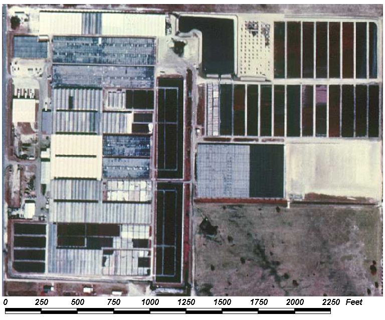
Field Picture
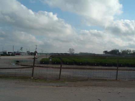
BACK TO CLASSIFICATION LIST
2500 Specialty Farms
2500
- Specialty farms
LEVEL 1: 2000 Agriculture
LEVEL 2: 2500 Specialty Farms
DESCRIPTION:
This class describes operations that
maintain animals and does not include pasture or feedlot operations. In the Baldwin County classification system, 2500 is an
active, general class that includes any specialty farms that are not described
in one of three active subclasses - 2510 Horse Farms, 2520 Dairies or 2540
Aquaculture. Examples of this class are dog kennels, ostrich, llama, or
buffalo farms, tropical fish farms, and captive breeding programs. The
2500 class is considered an Agricultural class, and does not include 1800
Recreational or 1700 Institutional facilities which may raise animals.
KEYS TO PHOTOINTERPRETATION:
This class covers a large range of diverse activities - no indicators
will apply precisely to all classes. Supplemental data is usually needed
to recognize these uses.
Operations are specialized for the production or breeding of show
animals or specialty foods.
Structures and acreage requirements will vary depending on operation.
Operations are usually fenced and may contain groupings of small
agricultural structures.
The caretaker or owner dwelling is usually on premises as these tend to
require a great deal of specialized attention.
CONTEXT:
Landscape Position - Specialty farms can occur anywhere, but are
more common in rural areas where open space, farm labor and privacy are
available.
SIMILAR CLASSES:
1100 Residential, Low Density and
1180 Rural Residential - If rural residences operate a specialty farm on site
they should be coded 2500.
1850 Parks and Zoos - Animal exhibits or research are usually in urban or urban
fringe areas
2300 Feeding Operations - These will usually have more visible impacts
2430 Ornamentals - Evidence of horticulture should be visible.
SPECIAL MAPPING CONVENTIONS:
Included within the 2500 polygon are
all buildings, grounds, cages, residences and other related features. The
operational boundaries may not be the same as property boundaries.
Priority classes such as water
bodies and wetlands are always broken out if they meet their minimum size
criteria.
Dual coding convention: This is a Land Use
class. The LUCODE and LCCODE are the same. A separate land
cover code is not required.
DOQQ Image
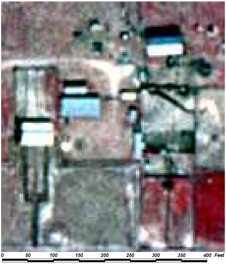
Field Picture
BACK TO CLASSIFICATION LIST
2510
Horse Farms
2510
- Horse Farms
LEVEL 1: 2000 Agriculture
LEVEL 2: 2500 Specialty Farms
LEVEL 3: 2510 Horse Farms
DESCRIPTION:
This category defines farms which
stable, breed and train horses for a variety of purposes. The purposes
may include private or commercial use or for sporting uses such as hunting,
exhibition, racing, riding and harness racing.
Horse farms are characterized by a
grouping of buildings in a rural area surrounded by pasture, often having an
oval or circular dirt "race" track for training of the horses. Small
arenas which have hurdles or fences for training of jumping horses may also be
present. These arenas may be covered with dirt or grass. Key features
identifying this land use category would be improved (or "intensively
managed" unimproved) pastures close to the main buildings, small pastures
or holding areas near main buildings, and the presence of long barns or stables
capable of housing the horses.
This class does not include
commercial stables set up just for riding, which should be assigned to the 1800
Recreational class. Riding stables are in urban areas and lack the
extensive pastures, barns, fencing, and other features of a farm. Where
horses are clearly present, and the proper code is not apparent, the area
should be classified as 2510.
Horse farms may be confused with
other pastures, especially where a cattle operation may also have some horses
and riding track present. In such cases one of the pasture categories
(2110 to 2130) is preferable.
KEYS TO PHOTOINTERPRETATION:
Extensive pasture areas are present, which may
be mowed or cultivated for hay and other support crops. Pastures are
usually well-maintained.
Barns or stalls for horses are present. Other buildings may
include offices and residences.
Stock ponds, tanks, or feeding troughs may be visible.
Track, training/exercise areas, pools, double fences are visible.
Training areas may be large oval tracks or small circular facilities.
CONTEXT:
Landscape Positions - Horse farms occur in an agricultural
context, or at the fringes of urban areas. They are found in rural areas of the
County and are often adjacent to a paved road or at the end of a dirt road
leading to the headquarters area from a paved road.
SIMILAR CLASSES:
2110, 2120, 2130 - Pastures -
normally lack training facilities.
1830 Race Tracks - horse race tracks have extensive parking and stadium
seating.
2520 Dairies - Dairies have a variety of other indicators
SPECIAL MAPPING CONVENTIONS:
Where horses are clearly present,
and there is doubt about which code to use, the PI should choose 2510 Horse
Farms instead of 1800 Recreational.
Included within the 2510 polygon are
all buildings, grounds, parking lots, recreational areas, and other
related features. Adjacent areas that are not involved in the horse farm
operation are not included. The boundaries of the horse farm may not be
the same as property boundaries. Priority classes such as water bodies and
wetlands are always broken out if they meet their minimum size criteria.
Dual coding convention: This is a Land Use
class. The LUCODE and LCCODE are the same. A separate land
cover code is not required.
DOQQ Image
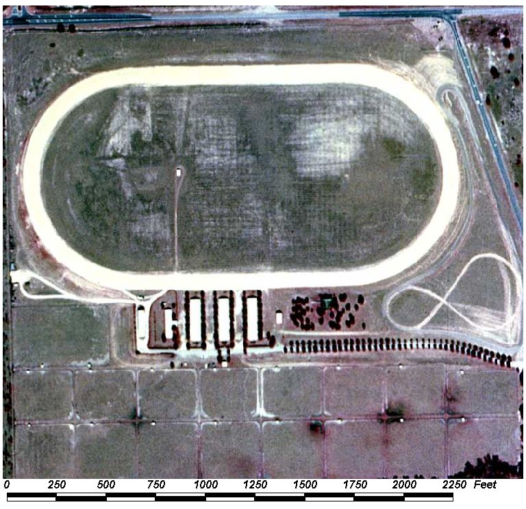
Field Picture
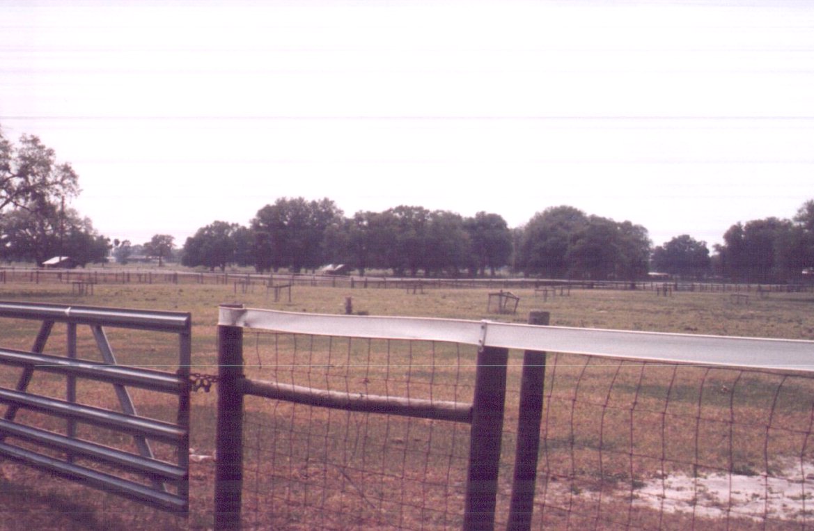
BACK TO CLASSIFICATION LIST
2520
Dairies
2520
- Dairies
LEVEL 1: 2000 Agriculture
LEVEL 2: 2500 Specialty Farms
LEVEL 3: 2520 Dairies
DESCRIPTION:
Dairies are commercial operations
that produce, process, and distribute milk and other dairy products. Dairies
have a number of sub-components that must be broken out separately. These
include: the central barns and processing facilities, with associated high-use
pasture; outlying pastures; and dairy lagoons. All of these
components are coded differently if they meet size criteria.
Solid waste facilities, including
manure piles, may also be found within the operational boundaries of a dairy;
however, they are not delineated separately, but are included in the 2520
polygon.
This land use is very similar in
appearance to a Horse Farm except that there tends to be more barns and the
barns tend to be longer. Additionally, the holding pens near the barns have
more paths worn in them from an increased number of animals and definite trails
lead to and from the barns. An oval or circular track will not be present in
this land use. As with Horse Farms, only the headquarters, workers residences,
barns/maintenance facilities, holding pens and immediately adjacent pastures
should be included in this category. Out pastures, almost always improved,
should be included in the appropriate pasture land use category.
Dairy sub-components are classified
as follows:
- Central Barns, Processing Facilities - LC 2520, LU
2520.
- Central, High-Intensity Pasture - LC 2520, LU 2520.
(include with processing facility).
- Outlying Pasture - LC 2100s, LU 2100s.
- Other Treatment Ponds - LC 8360, LU 2520
KEYS TO
PHOTOINTERPRETATION:
Facilities appear to be intensively managed. To maximize production,
dairies maintain a high concentration of animals and equipment in a small area.
Feed silos are typically present.
Large buildings for shelter and/or milking are present.
Dairies are always surrounded by areas of pasture.
Cattle tracks may be visible, especially leading to barns.
Manure piles and storage areas for feed, straw, and other materials are
present.
CONTEXT:
Landscape Position - Dairies are found in rural areas of the
County, usually located in agricultural areas to take advantage of open lands
and minimize conflicts with adjacent land uses.
SIMILAR CLASSES:
2100 Pasture and Cropland - Will not
have the large buildings and intensive management of dairies.
2310 Cattle Feeding Operations - Feed lots are even more intensive and show
significant surface impact
2510 Horse Farms - Cleaner, more uniform, less intense, less industrial
appearance. Presence of riding/training facilities, such as oval tracks
SPECIAL MAPPING CONVENTIONS:
The 2520 code applies to the
buildings and adjacent high intensity areas which are an integral part of the
managed enterprise. Related treatment ponds should be dual-coded. - e.g.
8360/2520.
Included within the 2520 polygon are
all buildings, grounds, parking lots, storage areas and other related
features. The boundaries of the dairy operation as apparent on the aerial
photography may not coincide with its actual property boundaries.
Priority classes such as water
bodies and wetlands are always broken out if they meet their minimum size
criteria.
Dual coding convention: This is a Land Use class.
Dual coding is only required in the case of treatment ponds and lagoons. (See
above)
DOQQ Image
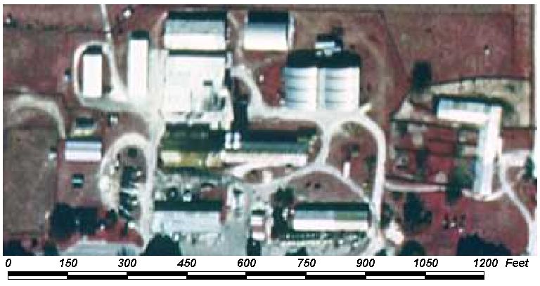
Field Picture
BACK TO CLASSIFICATION LIST
2540
Aquaculture
2540
- Aquaculture
LEVEL 1: 2000 Agriculture
LEVEL 2: 2500 Specialty Farms
LEVEL 3: 2540 Aquaculture
DESCRIPTION:
This class includes facilities that
raise marine or aquatic plant and animal species under natural or artificial
conditions for human and animal consumption. The operations may be very large
and organized, or small and informal. They tend to be easy to recognize,
as a series of small ponds near each other, with peripheral structures and
equipment on-site.
KEYS TO PHOTOINTERPRETATION:
Aquaculture sites have a series of small, usually rectangular, excavated
ponds, typically arranged in a parallel or rectangular pattern.
Color tones are black unless shallow aquatic vegetation is present,
which produces pink and reddish overtones to the water signature.
Associated structures, reservoirs, and drainage features are likely to
be present.
CONTEXT:
Landscape Position - Aquaculture sites are located where a
sufficient water supply is available by way of a shallow water table, surface
water, or ground water source, and effluent options are available.
They are typically found in rural areas where site conditions, labor and other
factors are favorable.
SIMILAR CLASSES:
5300 Reservoirs - Aquaculture ponds
are typically smaller, and exist in series.
8360/8340 Other Treatment Ponds/Wastewater Treatment Facilites - Rapid
infiltration beds may look similar to aquaculture, but are only partially
wetted and are more spread out.
SPECIAL MAPPING CONVENTIONS:
The mapping unit includes buildings,
storage areas, drainage ditches and any other features involved in the
enterprise or within the operational boundary. Priority classes such as water bodies
and wetlands are always broken out if they meet their minimum size criteria.
Dual coding convention: This is a Land Use
class. The LUCODE and LCCODE are the same. A separate land
cover code is not required.
DOQQ Image
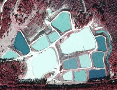
Field Picture
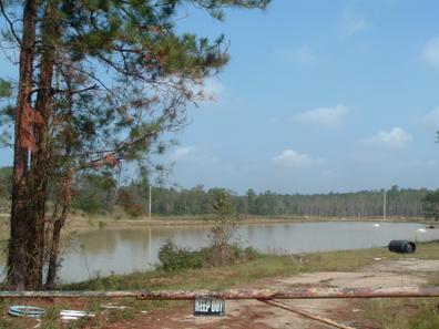
BACK TO CLASSIFICATION LIST
*2600 Other Open Lands - Rural
Other Open Lands - Rural - FLUCCS Code 2600
This Level 2 class is
not used in the map itself - the only Other Open Lands class used is the Level
4 subclass:
2610 Fallow Cropland
Background: This class includes
those agricultural lands whose intended usage cannot be determined. It includes
fallow cropland, lands on the urban fringe that may be in the process of
transition, but show no positive identifying features. It also includes dead or
deserted crops.
MAPPING CONVENTIONS:
Minimum mapping
units: The minimum mapping unit for all open land classes is 1 acre.
Differentiating
subclasses:
The only subclass
used is the Level 4 class - 2610 Fallow Cropland
Dual coding
convention: All of the 2600 classes are Land Cover classes. A
separate Land Cover code is always required.
SIMILAR CLASSES:
Other Open Land can be confused with
a number of different classes. These include 1180 Rural
Residential, 1900 Open Land, 3000 Upland
Non-Forested, and 4400 Tree Plantations. Agricultural land that is temporarily
flooded can be confused with water bodies or wetlands. Such areas should be
classified as Agricultural, if it is clear that it is an active agricultural
area.
For more
information:
See the PI key for
2610 Fallow Cropland for more details and graphic examples.
BACK TO CLASSIFICATION LIST
2610 Fallow Cropland
2610
- Fallow Cropland
LEVEL 1: 2000 Agriculture
LEVEL 2: 2600 Other Open Lands - Rural
LEVEL 3: 2610 Fallow
Cropland
DESCRIPTION:
This class includes agricultural
land that is normally harvested, but has been taken out of the normal crop
rotation. It does not include farmland that is temporarily unvegetated as
part of the normal rotation, such as during the period of soil preparation
prior to re-planting. This code is used primarily for fallow row crops or field
crops. It is not used for tree or vine crops, including groves, orchards,
nurseries and vineyards.
Fields do not have to be abandoned and the entire operation in disuse for this
type to be present, however. Portions of an otherwise active agricultural
operation may be lying fallow and fit within this category. Boundaries will
generally be distinct and rectangular.
Farmers usually try to maximize production by maintaining a tight rotation
schedule, assisted by the use of synthetic fertilizers and irrigation. In the
past, lands were kept fallow as a way to allow the soil to rest and rebuild,
but now it is a less frequent practice that usually indicates some difficulty,
transition, or change of plans.
KEYS TO PHOTOINTERPRETATION:
The former cropland is out of the normal annual rotation cycle -
generally out of production for more than one year, and old rows may still be
visible.
Signatures range from the magenta or light pinkish color of low
herbaceous vegetation to the dark magenta to bright to bright pink or red of medium
height shrubs and trees.
Newer fallow cropland will have a smooth texture. The longer it is out
of production the more irregular and shrubby its appearance.
The presence of an ditch pattern between fields and the advanced
condition of colonization by native vegetation in the absence of intensive land
management necessary to produce crops will be readily visible.
Abandoned farm buildings and unmaintained roads and irrigation systems
Fence lines may still be visible.
Fallow land may include land set aside for cover crops - growing
vegetation that will not be harvested, such as weeds or other non woody
vegetation.
CONTEXT:
Landscape Position - This class is only used for fields that are
in an area normally used for harvested crops. Most adjacent fields and
properties should be in normal rotation, unless for some reason the whole area
is temporarily affected. Context is critical, because fallow fields could
easily be confused with many other classes, if only signature is considered.
Fallow cropland may be found throughout the project area in rural settings.
Vegetation - low, herbaceous vegetation, with a possible
scattering of shrubs.
Soils - Fallow fields may be found on any upland soil type within
the project limits, but will most often be present on well drained sands with
low fertility.
Hydrology - Variable depending on the disrepair of the
irrigation/drainage system.
SIMILAR CLASSES:
2120 Unimproved Pasture - tends to
have a more shrubby and irregular signature
2140 Row Crops - straight rows visible
2150 Field Crops - mow lines and hay often visible
3000 Upland Non-Forested classes - very little indication of management
SPECIAL MAPPING CONVENTIONS:
NONE
Dual coding convention: This is a Land Use class. A
separate Land Cover code is always required.
DOQQ Image
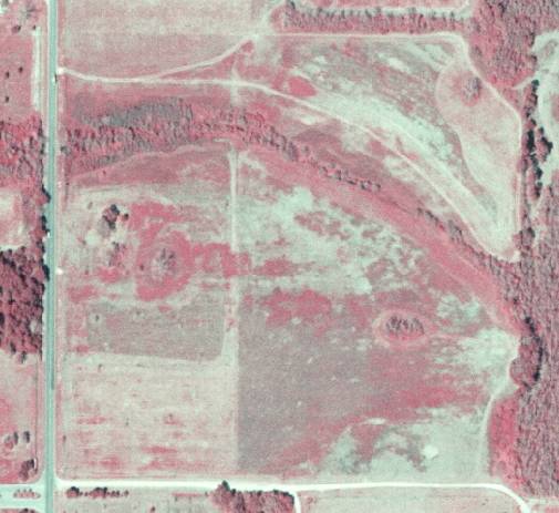
Field Picture
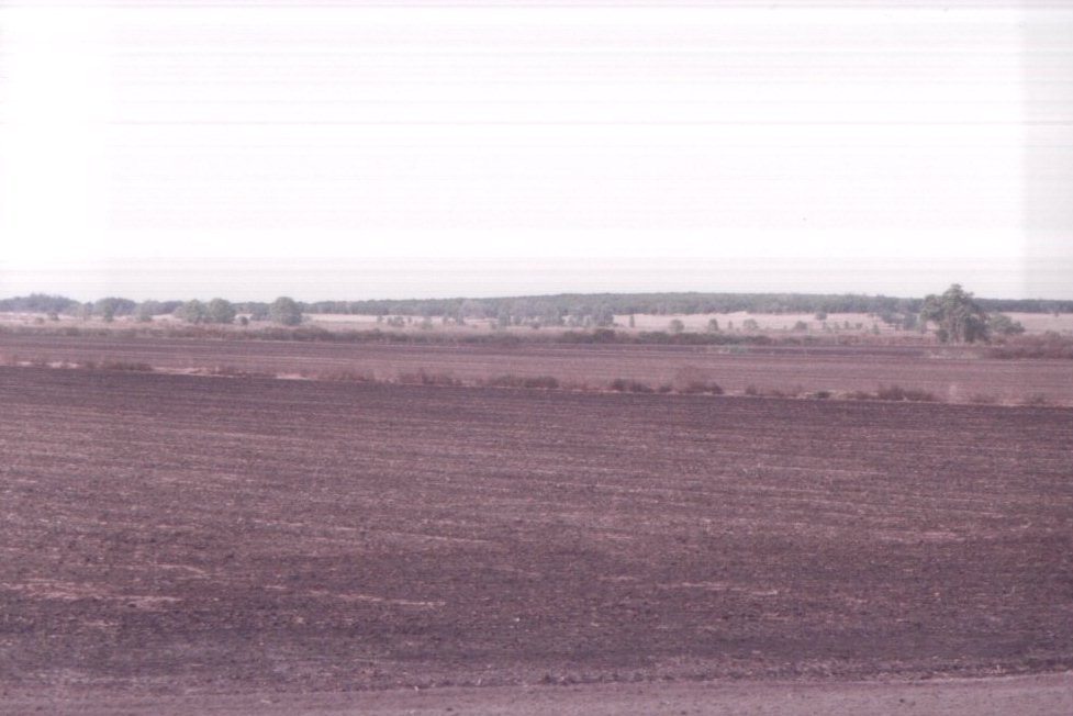
BACK TO CLASSIFICATION LIST
*3000 UPLAND
NONFORESTED
Upland Non-Forested - FLUCCS Code 3000
This Level 1 class is
not used in the map itself - a more specific subclass must be selected. The
Level 2 subclasses are:
3100 Herbaceous
3200 Shrub and Brushland
3300 Mixed
For details on each, see
their respective PI Key pages.
This Baldwin County class is a departure from the original FLUCCS system - the
class has been renamed from 'Rangeland' to ‘Upland Non-Forested' to
better describe land cover in open upland landscapes. However, while the
name is different, the usage does not vary significantly from statewide
practice. It is simply intended to be a more accurate description, and expands
the class to include open upland areas that do not fit the rangeland
definition, such as open urban areas. More explanation of the changes
follows.
Background: The historic meaning of
'Rangeland' comes from a national USDA definition, referring to natural plant
cover composed of principally native grasses, forbs and shrubs that are valuable
for forage. In Alabama, such lands were
frequently found at the margins of marshes, and therefore characterized as
transitional between uplands and wetlands. While they may be adjacent to
wetlands and occasionally inundated, the 3000s classes never include wetland
areas - it is the intent of the County to make a clear differentiation
between uplands and wetlands, and any areas that meet wetlands definitions must
be coded in the 6000 Wetlands class.
In the FLUCCS
system, Rangeland had the following general characteristics:
- Capable of being grazed by
cattle (although there may be no clear indications on photo).
- Management practices include
brush control, regulation of grazing intensity and season of use.
- Predominantly native
vegetation. If re-vegetated, it is managed like native vegetation.
- The land is not fertilized,
cultivated or irrigated. It may be cut for hay or other purposes.
There are many areas
that are typical rangeland. However, there are also open, non-forested
uplands in both rural and urban landscapes that do not fit the traditional
definition, or any other class. Rangeland was the most similar class to
such areas, so they were usually mapped in the 3000's. Such landscapes
are diverse in nature, and may have any of the following characteristics:
- Land cover and/or use may be
transitional and future use not evident.
- Prior use may have been
agriculture, citrus, mining, or wetlands and is frequently not discernible
from the aerial photo alone.
- Vegetation within the polygon
is diverse in type, texture and pattern.
- The shape of the polygon is
irregular, giving a natural appearance.
- Management is of very low
intensity, but too low to qualify as unimproved pasture or hay crop.
- Clear indication of cattle is
lacking. The presence or absence of cattle cannot be concluded.
Two FLUCCS codes that
were historically used to classify such areas are 1900- Open Land and 2600- Other Open
Land- Rural. These were catch-all categories for areas that were in
transition or of indeterminate use or cover. Such attributes do not give a
clear enough description of the polygon - most importantly, they do not
describe vegetation. Also, the fact that land use (vs. cover) is transitional
or cannot be determined is not a useful definition. Rather, it is the case for
much of the County, especially the "natural" areas. In the new
system, the class 2600 is an inactive class; 1900 is still used to signify open
lands in an urban context, but always in conjunction with a land cover code -
generally from the 3000 Upland Non-Forested classes.
MAPPING CONVENTIONS:
Minimum mapping units: The minimum
mapping unit for differentiating between Level 2 classes within the 3000
series and adjacent to each other is 1 acre (i.e. 3100 vs. 3200 vs.
3300). This allows aggregation, in order to conform to general mapping practice
and to avoid unnecessary linework in areas that are very similar, intermixed,
transitional or difficult to break out into distinct sub-areas.
Differentiating
subclasses: The subclasses 3100, 3200, and 3300 are based on the proportions
of herbaceous vs. shrub vegetation and the presence of trees. In general,
if the vegetation is herbaceous over 67% of the area or more, then 3100 is
used. If more than 67% of the area is composed of shrubs then it is classed as
3200. If there is a mixture and neither reaches a 67% dominance, then the class
3300 is used. The herbaceous or shrub component may have up to 25% trees.
If there are inclusions of solid forest patches within the polygon, then the
proportion of herbs vs. shrubs applies to the remaining area.
Dual coding
convention: For most of the Uplands Non-Forested classes, the land cover and
land use codes are the same. However, there are many cases where they are
different - these include land uses such as 1180 Rural Residential, 1650
Reclaimed Mine Land, 1670 Abandoned Mine Land, 1900 Open Land, and 1920
Inactive Land with Street Pattern, which are land uses requiring a separate
land cover code- which most often comes from the 3000 classes.
SIMILAR CLASSES:
2120 Unimproved Pasture
or 2130 Woodland Pasture are used where livestock grazing is
evident. Upland Non-Forested classes are commonly used to indicate citrus
groves which have been abandoned for long periods of time (more than six
years), have less than 50% citrus trees standing within the original grove, and
have returned to a naturally vegetated state.
For more information:
See the PI keys for each
of the subclasses for more details and graphic examples.
BACK TO CLASSIFICATION LIST
3100 Herbaceous (Dry Prairie)
3100
- Herbaceous (Dry Prairie)
LEVEL 1: 3000 Upland Non-Forested
LEVEL 2: 3100 Herbaceous (Dry Prairie)
DESCRIPTION:
This is one of three land cover
classes used for upland nonagricultural, non-forested lands which exhibit no
evidence of cattle grazing. 3100 Herbaceous (Dry Prairie) is used for
areas that have over 67% herbaceous cover, not counting any forested
inclusions, which may be up to 25% of the area. This class may be used with a
separate land use code, such as 1910 Undeveloped Land within
Urban Areas or
it may be used for both LCCODE and LUCODE when no other mapped land use code
applies.
This class includes prairie grasses
which occur on the upland margins of the wetland zone and inundation by water
is infrequent. Generally, it is the marginal area between marsh and upland
forested areas and in Urban areas that are undeveloped. These grasslands are
generally treeless but in wet areas would have many types of soils resulting in
a variety of vegetation types dominated by grasses, sedges, rushes and other
herbs while dryer grass areas would be dominated by wire grasses with some
brush present.
KEYS TO PHOTOINTERPRETATION:
67% or more herbaceous cover is present, not including forest patches.
The cover may be naturally occurring grassland or an introduced mixture of
species, depending on land use.
Scattered shrubs and trees may be present. Forest patches cover less than 25% of
total area, and scattered trees cover less than 25% of the herbaceous area.
Usually shows fine texture with smooth and mottled tones, unlike the
smooth textures and uniform tones of planted or improved grassland.
This class may be in a transition zone between forested and herbaceous
communities, or in re-vegetated areas that have been disturbed.
This class includes unimproved rural land or open urban areas that do
not fit any other land use in the classification system.
This class usually has natural shapes, follows landforms, and frequently
transitions to forested or brush communities.
The land is typically not fertilized, cultivated or irrigated. Brush
control or hay cutting may be practiced.
CONTEXT:
Landscape Position - The land cover type usually grades into wet
flatwoods, wet prairies (savannahs), marsh, stream swamps or hardwood hammocks
along streams and creeks, or upland live oak or cabbage palm hammocks.
Vegetation - Shrubs may be present but they must not be a
dominant part of the community and, therefore, are usually widely spaced and
sparse. Typical species include the bluestems (Andropogon spp.), threeawns
(Ansticia spp.), the panic grasses (Panicum spp.) and lovegrasses (Eragrostis
spp.). Low shrubs such as fetterbush (Lyonia lucida), rusty Lyonia (L.
ferruginea), dwarf blueberry (Vaccinium myrsinites), and wax myrtle (Myrica
cerifera) may also be scattered throughout the area.
Soils - Generally moderately to well drained, acid sandy soils as
are found in flatwoods communities
Hydrology - These communities have good drainage and are
infrequently inundated. Water tables may be near the surface, however, during
the wet season.
SIMILAR CLASSES:
2120 Unimproved Pasture and 2130
Woodland Pasture - These classes may look very similar to 3100, but livestock
grazing is evident.
3300 Mixed Upland Non-Forested - Neither herbaceous vegetation or shrubs are
dominant.
SPECIAL MAPPING CONVENTIONS:
This classification has been
modified by Baldwin County; it is to be used solely for upland
non-agricultural, non-forested lands which exhibit no evidence of cattle
grazing.
Dual coding convention: This is a Land Cover code.
The LCCODE and LUCODE are usually the same. However, 3100 is often used as the
LCCODE for various land uses, 1650 and 1670 Reclaimed or Abandoned Mine Lands, 1920 Inactive Land with Street Pattern, 8320
Electrical Power Transmission Lines, 1850 Parks and Zoos and primarily 1910 Undeveloped Land within
Urban Areas .
Herbaceous areas that are traditional rangelands or do not fit any other mapped
land use class are coded as LC=3100/LU=3100.
DOQQ Image
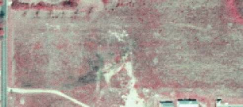
Field Picture
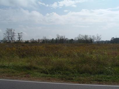
BACK TO CLASSIFICATION LIST
3200 Upland Shrub and Brushland
3200
- Shrub and Brushland
LEVEL 1: 3000 Upland Non-Forested
LEVEL 2: 3200 Shrub and Brushland
DESCRIPTION:
This is one of three land cover
classes used for upland nonagricultural, non-forested lands which contain no
evidence of cattle grazing. 3200 Shrub and Brushland is used for areas
that have over 67% shrub cover and less than 33% herbaceous cover. This
proportion ignores any forested patches, which may cover up to 25% of the total
area. Vegetation is usually native rather than introduced.
3200 Shrub and Brushland includes
areas where tree species are regenerating naturally after clear cutting or
fire, but are less than 20 feet tall. These include native hardwood and
coniferous species, but does not apply to plantations. Regenerating
plantations are coded as 4430 Forest Regeneration.
This class does not include
coastal scrub, or areas where Brazilian pepper is the dominant shrub species.
These are mappped at Level 3.
KEYS TO PHOTOINTERPRETATION:
More than 67% or more of the cover is shrub and brush, not including
forest patches.
Brushland may have a wide variety of species of small woody shrubs or
one dominant species that is well adapted for the site and terrain. (Except for
those shrub classes mapped at Level 3.)
The signature is typically a coarse texture with mottled tones, unlike the
smoother textures of herbaceous cover.
Often found on arid areas- a sandy or droughty understory may be
visible.
The land is not fertilized, cultivated or irrigated. No regular brush
control is occurring.
This class may be in a transition zone between forested and herbaceous
communities, or in revegetated areas that have been disturbed.
This class typically has natural shapes, follows landforms, and
frequently transitions to forested or herbaceous communities.
CONTEXT:
Landscape Position - This land cover type usually grades into
flatwoods, wet flatwoods, wet prairies (savannahs), marsh, stream swamps or
hardwood hammocks along streams and creeks, or upland live oak or cabbage palm
hammocks.
Vegetation - Common species include gallberry, wax myrtle,
saltbush, blueberries, rusty lyonia, fetterbush and other shrubs and brush, as
well as various types of short herbs and grasses.
Soils - Occurs on a wide variety of soils including acidic, well
to somewhat poorly-drained sands, loamy sands and highly disturbed soils.
Hydrology - This community is an upland association which may
experience a high water table for portions of the growing season but rarely
experiences inundation. If inundated, the duration is usually very short and
results from a storm event.
SIMILAR CLASSES:
3210 Palmetto Prairies - usually a
more even-toned reddish signature
3220 Coastal Scrub - found in coastal areas, with some sandy areas apparent
SPECIAL MAPPING CONVENTIONS:
This classification has been modified
by Baldwin County; it is to be used solely for upland
non-agricultural, non-forested lands which have no evidence of cattle grazing.
Dual coding convention: 3200 is a Land Cover
code. It is used as a dual code in conjunction with various land uses,
including 1650 and 1670 Reclaimed or Abandoned Mining Lands, 1920 Inactive Land with Street Pattern, 8320 Utility
Corridors, 1850 Parks and Zoos and primarily 1910 Undeveloped Land within
Urban Areas. Shrub and
Brushland areas that are traditional rangelands or do not fit any other mapped
land use class are coded as LC=3200/LU=3200.
DOQQ Image
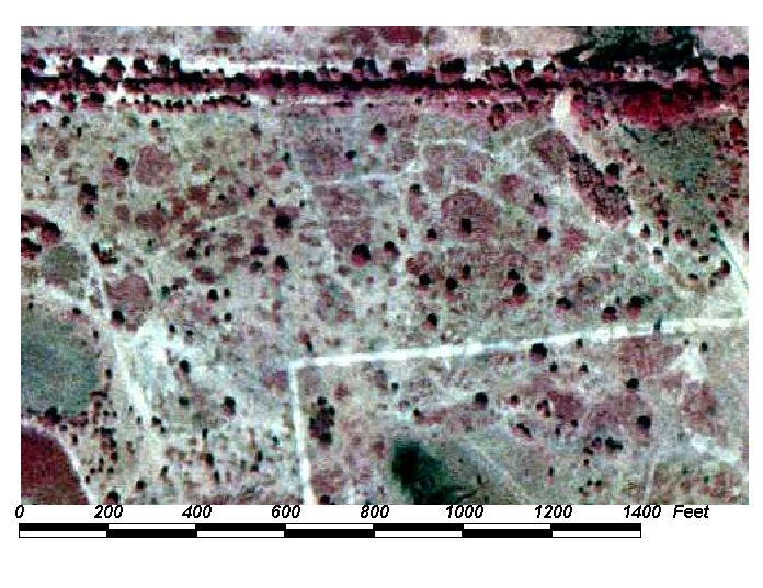
Field Picture

BACK TO CLASSIFICATION LIST
3220 Coastal Shrub
3220
- Coastal Shrub
LEVEL 1: 3000 Upland Non-Forested
LEVEL 2: 3200 Upland Shrub and Brushland
LEVEL 3: 3220 Coastal
Shrub
DESCRIPTION:
Coastal Shrub is characterized as stabilized,
wind-deposited coastal dunes that are vegetated with a dense thicket of
salt-tolerant shrubs. Other typical vegetation includes sand live oak, myrtle
oak, yaupon, and sea grape.
It is found on deep, wind-deposited
sands which have been wind-sorted and wave-washed. Coastal Shrub dunes are
generally quite stable but are susceptible to severe damage if the vegetation
is disturbed. Coastal Shrub species are frequently dwarfed and pruned as a
result of the salt spray-laden winds that kill twigs on the seaward side,
producing a smooth, dense, upward- slanting canopy resembling a sheared hedge.
KEYS TO PHOTOINTERPRETATION:
a mixture of shrubs and trees along coastal areas
shrubs exhibit a fairly uniform height, fluffy or "cottony"
texture (sometimes so uniform and monotypic that the texture is smooth) and a
light, faded pink or reddish color.
CONTEXT:
Landscape Position - This community occurs on the backside of the
beach dune usually beginning just over or at the top. Proceeding downslope, the
community grades into mangrove or, in the absence of grade to a lagoon, the
community grades to an upland situation occupied by Tropical Hardwoods or
Australian pine.
Vegetation - This community type is dominated by sea grape,
scrubby oaks, railroad vine, sea oats and other salt tolerant herbaceous and
shrubby species. Australian pine may be intermixed but are not dominant.
Soils - Coastal marine sands which are well to
excessively-drained.
Hydrology - Xeric conditions prevail except for occasional
wash-over during heavy storm surge.
SIMILAR CLASSES:
3200 Upland Shrub and Brushland -
found in inland areas, away from the coast
SPECIAL MAPPING CONVENTIONS:
This class is to be used only in
coastal areas of the County.
Dual coding convention: This is a Land Cover
class. The LCCODE and LUCODE are the same. A separate land use code is not
required.
DOQQ Image
Field Picture
BACK TO CLASSIFICATION LIST
3300 Mixed Rangeland
3300
- Mixed Upland Non-Forested
LEVEL 1: 3000 Upland Non-Forested
LEVEL 2: 3300 Mixed Upand Non-forested
DESCRIPTION:
This is one of three land cover
classes used for upland nonagricultural, non-forested lands which contain no
evidence of cattle grazing. 3300 Mixed Upland Non-Forested is used for areas in
which neither herbaceous species nor shrubs cover more than 67% of the
area. If herbaceous vegetation covers more than 67% of the area, it is classed
as 3100 Herbaceous. If shrubs cover more than 67% of the area, it is classed as
3200 Shrub and Brushland.
The 3300 Mixed class may include
areas where tree species are regenerating naturally after clear cutting or
fire, but are less than 20 feet tall. These include native hardwood and
coniferous species, but does not apply to plantations. Regenerating
plantations are coded as 4430 Forest Regeneration.
KEYS TO PHOTOINTERPRETATION:
The percentage of both herbaceous cover and shrubs is between 33%
and 67% - neither one covers more than 67% of the area.
There is a mixture of rough and smooth texture usually showing two or
more distinct tones (herbaceous vs. shrubs).
There may be a mixture of trees (less than 25%) without a dominant
understory vegetation.
This class may be in a transition zone between forested and herbaceous
communities, or in revegetated areas that have been disturbed.
This class includes unimproved rural land that does not fit any other
land use in the classification system.
This class includes agricultural property where the farming use has been
abandoned and natural vegetation has re-established.
The land is typically not fertilized, cultivated or irrigated. Brush
control or hay cutting may be practiced.
CONTEXT:
Landscape Position - This land cover type usually grades into
flatwoods, wet flatwoods, wet prairies (savannahs), marsh, stream swamps or
hardwood hammocks along streams and creeks, or upland live oak or cabbage palm
hammocks.
Vegetation - Typical herbaceous species include the bluestems,
threeawns, panic grasses, and lovegrasses. Typical shrubs include fetterbush,
rusty Lyonia, dwarf blueberry and wax myrtle.
Soils - Can be found on a wide variety of soils including acidic,
well to somewhat poorly-drained sands, loamy sands and highly disturbed soils.
Hydrology - This community is an upland association which may
experience a high water table for portions of the growing season but rarely
experiences inundation. If inundated, the duration is usually very short and
results from a storm event.
SIMILAR CLASSES:
2120 Unimproved Pasture and 2130
Woodland Pasture - These classes may look very similar to 3300, but livestock
grazing is evident.
3200 Shrub and Brushland - dominated by shrubs (>67%)
SPECIAL MAPPING CONVENTIONS:
This classification has been modified
by Baldwin County; it is to be used solely for upland
non-agricultural, non-forested lands which contain no evidence of cattle
grazing.
Dual coding convention: 3300 is a Land Cover code. It
is used as a dual code in conjunction with various land uses, including 1180
Rural Residential, 1650 and 1670 Reclaimed or Abandoned mining lands, 1920 Inactive Land with Street Patterns, 8320 Utility
Corridors, 1850 Parks and Zoos and primarily 1910 Undeveloped Land within
Urban Areas .
Mixed Upland Non-Forested areas that are traditional rangelands or do not fit
any other mapped land use class are coded as LC=3300/LU=3300.
DOQQ Image
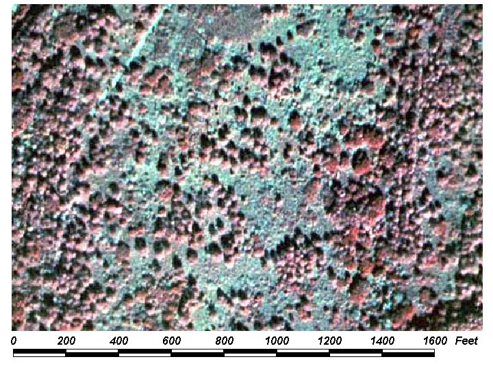
Field Picture
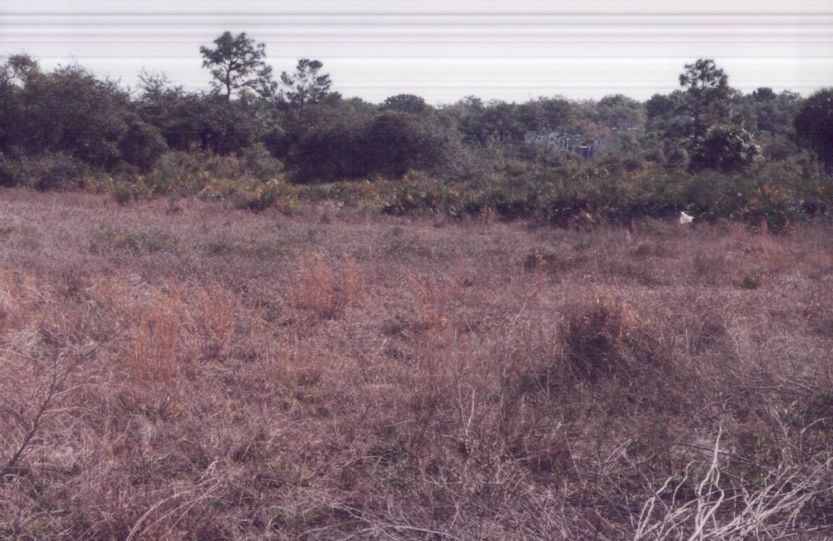
BACK TO CLASSIFICATION LIST
*4000 UPLAND FORESTED
Upland Forests - FLUCCS Code 4000
This Level 1 class is
not used in the map itself - a more specific subclass must be selected. The
subclasses are in 4 categories - Upland Coniferous Forest, Upland Hardwood Forest, Upland Mixed Forest and Tree
Plantations.
Upland forests are
landscape units which support a tree canopy closure of 25 percent or more.
This is a Baldwin County modification of the
FLUCCS system, which specifies a canopy closure of 10 percent or more. Baldwin County has also modified the
Level II forest codes 4300. The FLUCCS class 4300 is a continuation of
the Upland Hardwood Forest class; in Baldwin County 4300 is changed to Upland Mixed Forest, which in the FLUCCS
system is 4340.
Trees are woody plants
that are over 20 feet tall in their growth stage at the time of
photography. Immature trees that are under 20 feet tall are considered
shrubs.
Background: The Upland Forests
include both xeric (dry) and mesic (moderately moist) forest communities.
Wetland, or hydric, forest communities are classified in the Wetland class
(6000). Also included in the Upland Forest category are areas in which timber
harvesting has occurred but which exhibit no evidence of being developed for
other intended uses (clear-cuts in an area in which rotation forest management
is practiced is a prime example of such a case).
Alabama's forests serve as a
vital resource from not only a commercial viewpoint, but also from an aesthetic
and recreational one. Approximately 40 percent is commercial timber land. A
very significant portion of this land is allocated to pine plantation
monoculture. There are also many stands of pure hardwood species groups
occurring in Alabama. However, the majority
of forest lands occur as mixed communities of tree species and species groups.
For purposes of classification, a class is assigned if 67 % or more of the
total canopy can be assigned to that species or community group. If there is
less than 67% dominance, the mixed category (4340) is used. The
classification is based upon the species composition of the tree canopy as interpreted
from aerial imagery.
MAPPING CONVENTIONS:
Minimum mapping units: This general
class is not active in the data layer. The most specific subclass that
applies to the mapping unit must be always used.
Trees may occur in an
herbaceous or shrub matrix which covers up to 75% of the area. The
trees may be scattered and dispersed in the matrix as individual trees or small
(<5 acre) patches. If distinct patches of trees or other classes are
greater than 1 acre, they are broken out separately. In transitional
areas where species specific wetland and upland polygons are below the
appropriate MMU some aggregation may be justified. In these cases intermixed
community classes will be assigned and mapped at a larger unit. PI's must use
discretion to avoid excessive line work while adding useful information.
Differentiating
subclasses: Differentiating between natural forest communities requires
extensive experience in photointerpretation. The communities can only be
identified by the signatures of individual species, rather than by the general
color, texture and patterns of the mixture or community. It is
generally accepted that PI's cannot recognize these species unless they have
extensive experience in the field comparing features on the ground against the
exact same feature on recent photography. Also required is an understanding of
the forest ecology. These skills are difficult to obtain, which accounts
for the high levels of error sometimes found in mapping plant
communities.
Photointerpreters
consider the effects of seasonal changes on plant growth to interpret the
signatures of different plant species. For example, most hardwoods are
deciduous and subject to a period of winter dormancy. This dormancy period
provides a contrast in color tones between hardwoods and conifers, and is the
reason why most land cover mapping projects try to obtain winter photography.
Catching the "leaf off" period is difficult in Alabama. The seasonal
changes are often rapid, and PIs must pay careful attention to the date of photography
in order to interpret the signatures properly.
Photointerpretation of
vegetation is a science and an art which is beyond the scope of this guide to
document. The PI key pages will only focus on defining which species
and communities are included in each class. Mapping teams are required to
provide the necessary expertise from field work, training, reference materials
and, most of all, actual mapping experience with proper quality control.
Dual coding
convention: All of the forest communities are Land Cover classes that
do not normally require a separate Land Use code - LCCODE and LUCODE are
normally the same. However, in some cases, a separate land use code is
required. The following land uses must be classified where they occur in
a forested polygon: Rural Residential (1180), Inactive Land with Street Pattern
(1920), Reclaimed and Abandoned Mining Lands (1650 & 1670), and
Parks (1850).
SIMILAR CLASSES:
The most serious error
in forest mapping is to confuse upland and wetlands forests. The County
places a high priority on establishing a wetland / upland boundary.
Unfortunately, some forest species and communities stretch across this
boundary, and canopy signatures do not clearly indicate where hydric soils stop
and upland soils begin. The problem is addressed with experience,
ancillary data, magnified stereo viewing of imagery, field checking, and
tolerance of an acceptable level of error.
Upland forests may also
be confused with woodland pastures and non-forested uplands. These
classes often border each other, creating errors in transitional zones of a
lesser significance than wetlands/ uplands error.
For more information:
See the PI keys for each
of the subclasses for more details and graphic examples.
BACK TO CLASSIFICATION LIST
4100 Upland Coniferous Forests
4100
- Upland Coniferous Forests
LEVEL 1: 4000 Upland Forest
LEVEL 2: 4100 Upland Coniferous Forests
DESCRIPTION:
This Level 2 class should only be used
for upland coniferous forests that do not meet the requirements of a more
specific Level 3 subclass.
The canopy closure must be 25 %
or more, with at least a 67% dominance by coniferous species. The trees
must average over 20 feet tall at the time of photography.
The Upland Coniferous class may
include forest communities such as pine flatwoods, sand pine, and mixed
communities of pine-dominated xeric and mesic oaks .
Upland coniferous forests are
naturally generated, and do not include tree plantations, or planted groves of
citrus or other tree crops. However, almost all forests are subject to
human influence, and the composition of the forests is, to a large or small
degree, determined by management factors.
KEYS TO PHOTOINTERPRETATION:
The canopy closure must be 25 % or more, with at least a 67%
dominance by coniferous tree species.
Up to 33% of the canopy may be comprised of hardwood species.
CONTEXT:
Landscape Position - Coniferous forests are found throughout the
County wherever hydrology, fire, and management practices permit. Forests
may be found on any of the land uses, and may occur as inclusions in most of
the other land cover types. They may occur as scattered individual trees, or as
denser patches, or both.
Vegetation - see respective subclasses
Soils - see respective subclasses
Hydrology - see respective subclasses
SIMILAR CLASSES:
2130 Woodland Pastures- Pasture will show evidence of grazing.
2200 Tree Crops- Trees are grown in rows.
4340 Hardwood-Conifer Mixed - Some mixed classes may appear similar if
coniferous species make up a significant portion of the area.
SPECIAL MAPPING CONVENTIONS:
Trees may occur in a matrix of
herbs, shrubs, and other cover types, which can cover up to 75% of the
area. The trees may be scattered and dispersed in the matrix as
individual trees or small (<1 acre) patches. If distinct patches of
trees or other classes are greater than 1 acre, they are broken out separately.
In transitional areas where species
specific wetland and upland polygons are below the appropriate MMU some
aggregation may be justified. In these cases intermixed community classes will
be assigned and mapped at a larger unit.
Dual coding convention: This is a Land Cover class.
It does not normally require a separate land use code. However, where
coniferous forests occur in association with a mapped land use, a separate land
use code may be required. Examples: Inactve Land with Street Pattern (1920),
Reclaimed and Abandoned Mine Lands (1650 and 1670), Parks and Zoos (1850) and
primarily 1910 Undeveloped Land within
Urban Areas.
DOQQ Image
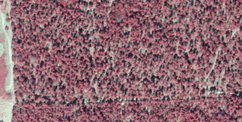
Field Picture
BACK TO CLASSIFICATION LIST
4110 Pine Savannah
4110
- Pine Savannah
LEVEL 1: 4000 Upland Forest
LEVEL 2: 4100 Upland Coniferous Forest
LEVEL 3: 4110 Pine Savannah
DESCRIPTION:
This class includes naturally
generated pine Savannahs. Pine species must achieve 25% crown canopy dominance
and the trees must average over 20 feet tall at the time of photography.
The pine savannah class in Baldwin County is dominated by slash pine.
Pine savannahs are generally the
most prevalent community type in undeveloped areas. Originally, longleaf pines
were common on drier sites while slash pines, which are less fire-resistant,
were confined to moist sites - wildfire being the contributing factor in this
distribution. However, fire control and artificial reforestation have extended
the range of slash pine into former longleaf sites.
KEYS TO PHOTOINTERPRETATION:
The canopy closure must be 25% or more.
Rounded, asymmetrical and "feathered", brick red canopies;
individual trees visible
Grassy understories are pale green with various pinkish tones. Saw
palmetto is visible as irregular shaped pink to pinkish red patches with
"feathered" edges and relatively smooth textured tops. More mesic
areas may contain noticeable amounts of cabbage palm and/or shrubs yielding
smooth bright red signatures as an understory component.
Flatwoods are often pockmarked with wet depressions dominated by
prairie/marsh vegetation.
CONTEXT:
Landscape Position - This community generally grades to hardwood
communities (either wetland or upland) in more mesic areas along streams,
rivers and other waterbodies or may be found surrounded by pasture.
Vegetation - Dominant species include slash pine, gallberry and
various grasses. More mesic areas may also contain grasses and grass-like
plants. Pine rockland communities are vegetated by stunted
slash pines with an understory of shrubs (palms) and herbs.
Soils - Typical soils are represented by imperfectly or poorly
drained, acidic sands with varying depth (typically 1-3 feet) to an organic or
clayey hardpan. The hardpan restricts downward movement of water. Drier areas
have more depth to hardpan or poorly developed hardpan.
Hydrology - Typical flatwoods do not have saturation or
inundation except following heavy rains.
SIMILAR CLASSES:
4120 Longleaf Pine - Xeric Oak -
crown canopy dominated by pine with mid-story of oak and visible sandy areas
4130 Sand Pine - occurs on hilly terrain and sandy soils; has a dark red or
purplish signature
6250 Wet Pinelands - Hydric Pine - absence of
other upland shrubs; grasses predominate with darker, green tones
in the understory. Hydric conditions produce muted color tones in the canopy,
which may be wider spaced and appear stunted or ragged compared to upland pine.
SPECIAL MAPPING CONVENTIONS:
Trees may occur in an herbaceous or
shrub matrix that covers up to 75% of the area. The trees may be
scattered and dispersed in the matrix as individual trees or small (<5 acre)
patches. If distinct patches of trees or other classes are greater than 1 acre,
they are broken out separately.
In transitional areas where species
specific wetland and upland polygons are below the appropriate MMU some
aggregation may be justified. In these cases intermixed community classes will
be assigned and mapped at a larger unit.
Dual coding convention: This is a Land Cover class.
It does not normally require a separate land use code. However, where pine
flatwoods occur in association with another mapped land use, a separate land
use code may be required. Examples: 1920 Inactive Land with Street Pattern, and possibly 1650
Reclaimed Mine Lands 1670 Abandoned Mine Lands and primarily 1910 Undeveloped Land within
Urban Areas.
DOQQ Image
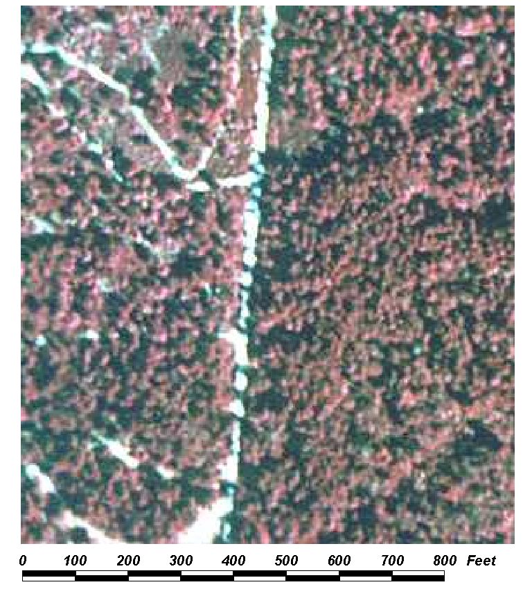
Field Picture
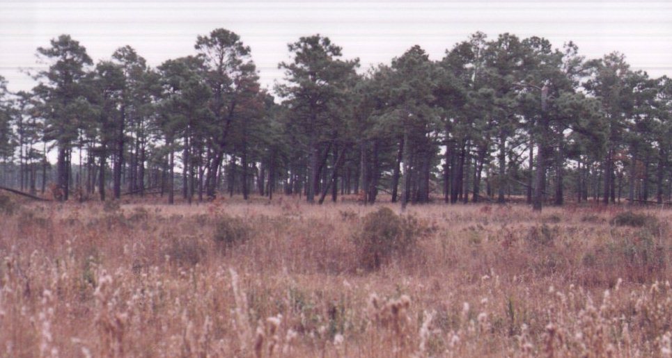
BACK TO CLASSIFICATION LIST
4200 Upland Hardwood Forest
4200 - Upland Hardwood Forest
LEVEL 1: 4000 Upland Forest
LEVEL 2: 4200 Upland Hardwood Forest
DESCRIPTION:
This Level 2 class includes upland
hardwood forests that do not meet the requirements of a more specific Level 3
or 4 subclass. The canopy closure must be 25 % or more, with at least a
66 % dominance by hardwood species. The trees must average over 20 feet tall at
the time of photography.
The Uplands Hardwoods class may
include forest communities such as oak-pine-hickory, , live oak, wax
myrtle-willow (not hydric), mixed temperate or tropical hardwoods, and
beech-magnolia. Xeric oaks and cabbage palm forests must be broken out
separately.
Uplands forests are naturally
generated, and do not include hardwood plantations, or planted groves of citrus
or pecans. However, almost all forests are subject to human influence,
and the composition of the forests is, to a large or small degree, determined
by management factors.
KEYS TO PHOTOINTERPRETATION:
The canopy closure must be 25 % or more, with at least a 66 %
dominance by hardwood tree species.
Up to 33% of the canopy may be comprised of coniferous species,
generating a characteristic brick red return throughout the year.
Hardwoods usually have large radial crowns and exhibit a fluffy and
textured tone. Healthy, growing deciduous trees will give a strong,
bright red CIR return.
Hardwoods are deciduous and are subject to a period of winter dormancy.
This dormancy period provides a contrast in color tones between hardwoods and
conifers. The seasonal changes are often rapid, and PIs must pay careful
attention to the date of photography in order to interpret the signatures
properly.
CONTEXT:
Landscape Position - Hardwood forests are found throughout the
County wherever hydrology, fire, and management practices permit. Forests
may be found on any of the land uses, and may occur as inclusions in most of
the other land cover types. They may occur as scattered individual trees, or as
denser patches, or both.
Vegetation - see respective subclasses
Soils - see respective subclasses
Hydrology - see respective subclasses
SIMILAR CLASSES:
2130 Woodland Pastures- Pasture will show evidence of grazing.
2200 Tree Crops- Trees are grown in rows.
4340 Hardwood-Conifer Mixed - Some mixed classes may appear similar if
coniferous species make up only a small portion of the area.
SPECIAL MAPPING CONVENTIONS:
Trees may occur in a matrix of
herbs, shrubs, and other cover types, which can cover up to 75% of the
area. The trees may be scattered and dispersed in the matrix as
individual trees or small (<1 acre) patches. If distinct patches of
trees or other classes are greater than 1 acre, they are broken out separately.
In transitional areas where species
specific wetland and upland polygons are below the appropriate MMU some aggregation
may be justified. In these cases intermixed community classes will be assigned
and mapped at a larger unit.
Dual coding convention: 4200 is a Land Cover class.
It does not normally require a separate land use code. However, where
hardwood forests occur in association with a mapped land use, a separate land
use code may be required. Examples: Rural Residential (1180), Inactve
Land with Street Pattern(1920), Reclaimed and Abandoned Mine Lands(1650 and
1670),and Parks and Zoos (1850).
DOQQ Image
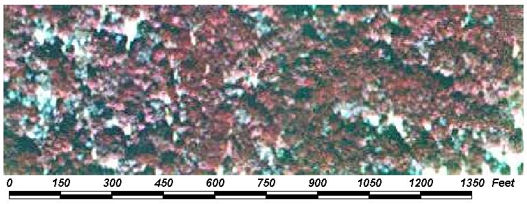
Field Picture
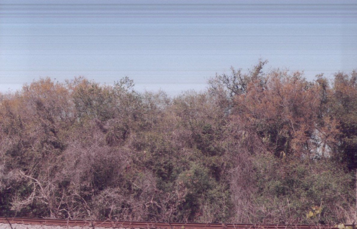
BACK TO CLASSIFICATION LIST
*4300 Upland Hardwood Forests, Continued
Upland Hardwood Forests, Continued - FLUCCS Code 4300
This Level 2 class is
not active in the map itself - one of the two active subclasses must be
selected. The two subclasses are:
4340 Hardwood - Conifer Mixed
4370 Australian Pine
Baldwin County definition of forest
requires a tree canopy closure of 25% or more. Trees are woody plants
that are over 20 feet tall in their growth stage at the time of photography.
Immature trees that are under 20 feet tall are considered shrubs.
MAPPING CONVENTIONS:
Trees may occur in an
herbaceous or shrub matrix which covers up to 75% of the area. The
trees may be scattered and dispersed in the matrix as individual trees or small
(<5 acre) patches. If distinct patches of trees or other classes are
greater than 1 acre, they are broken out separately.
In transitional areas
where species specific wetland and upland polygons are below the appropriate
MMU some aggregation may be justified. In these cases intermixed community
classes will be assigned and mapped at a larger unit.
Minimum mapping units: The minimum
mapping unit (MMU) for all upland forest classes is 1 acre.
Differentiating
subclasses: The two active subclasses are distinct from each other in
appearance. Australian pine grows as a monoculture and has a distinctive
signature.
Dual coding
convention: These are Land Cover classes. They do not normally require
a separate land use code. However, where hardwood forests occur in association
with another mapped land use, a separate land use code may be required.
Examples: 1180 Rural Residential, 1920 Inactive Land with Street Pattern, and
possibly 1650 Reclaimed Mine Lands and 1670 Abandoned Mine Lands.
SIMILAR CLASSES:
Upland Mixed forests can
easily be confused with Upland Hardwood or Upland Conifer forests in cases
where the proportion of either is close to 67%. This proportion is
difficult to judge, considering the infinite variety of forest expression and
similarity of species signatures on aerial photography. The criteria explained
above under Mapping Conventions helps to address this problem.
Upland mixed forests can
be easily confused with 6170 Mixed Wetland Hardwoods. Various species,
including pines and cabbage palms, can stretch across the wetlands boundary,
and canopy signatures do not always indicate a clear hydric/non hydric
boundary. The problem is addressed with experience, ancillary data,
magnified stereo viewing and field checking.
Upland mixed forests may
also be confused with woodland pastures and non-forested uplands. These
classes often border each other, making delineation of transitional zones
sometimes inexact .
For more information:
See the PI keys for each
of the subclasses for more details and graphic examples.
BACK TO CLASSIFICATION LIST
4340 Hardwood - Conifer Mixed
4340
- Upland Mixed Coniferous/Hardwood
LEVEL 1: 4000 Upland Forest
LEVEL 2: 4300 Upland Mixed Forest
LEVEL 3: 4340 Upland Mixed Coniferous/Hardwood
DESCRIPTION:
This class includes those forested
areas in which neither upland conifers nor hardwoods achieve a 67% crown canopy
dominance. The 4340 code is applied when the area cannot be broken down
into individual hardwood or conifer species. This can be due to minimum mapping
unit constraints or that the intermixture of species is such that precise
delineation would result in overly complex linework.
The canopy closure must be 25% or
more, and the trees must average over 20 feet tall at the time of photography.
KEYS TO PHOTOINTERPRETATION:
A mixture of crown types is present - both large radial hardwood and
smaller compact coniferous crowns with neither one being dominant (67% or
more).
As a result of the mixture of species, signatures are typically a
complex blend of colors, textures, and crown shapes.
On CIR photography conifers will appear as dull brick red to purple-red
in color and hardwoods will exhibit bright red returns.
Texture will be a mixture of smooth, cottony broad-leaved hardwoods,
pin-like crowns of broad-leaved evergreens such as bays and rounded to
"jagged" crowns of species of pine
Color returns will be greenish, bluish, reds and dark brownish reds of
all these varied species.
CONTEXT:
Landscape Position - Mixed forests often occur on the upland
areas adjacent to streams, waterways or surrounding wetland depressions. They
can occur in almost any forested area with mesic soil conditions.
Vegetation - The Uplands hardwoods component may include forest
communities such as oak-pine-hickory, live oak, wax myrtle-willow (not hydric),
mixed temperate or tropical hardwoods, and beech-magnolia. Upland pine
component includes slash, longleaf, and sand pines.
Soils - Generally found on mineral soils
Hydrology - Moist sites should support this community type in
non-wetland situations.
SIMILAR CLASSES:
4110 Pine Flatwoods - Pines are the
dominant species, with at least 67% canopy dominance.
4120 Longleaf Pine-Xeric Oak - Crown canopy is dominated by pine with a
mid-story of oak, and sandy areas are visible.
4200 Upland Hardwood Forests - Hardwood species dominate with at least 67%
cover.
SPECIAL MAPPING CONVENTIONS:
Trees may occur in an herbaceous or
shrub matrix which covers up to 75% of the area. The trees may be
scattered and dispersed in the matrix as individual trees or small (<1 acre)
patches. If distinct patches of trees or other classes are greater than 1
acre, they should be delineated separately.
In transitional areas where species
specific wetland and upland polygons are below the appropriate MMU some
aggregation may be justified. In these cases intermixed community classes will
be assigned and mapped at a larger unit.
Dual coding convention: 4340 is a Land Cover class.
It does not normally require a separate land use code. However, where
mixed forests occur in association with a mapped land use, a separate land use
code may be required. Examples: Inactive Land with Street Pattern (1920),
Reclaimed and Abandoned Mining (1650 and 1670), Parks and Zoos (1850) and
primarily 1910 Undeveloped Land within
Urban Areas.
DOQQ Image
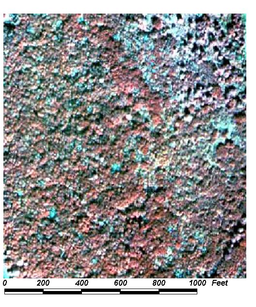
Field Picture
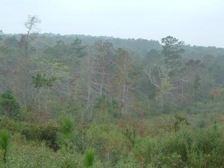
BACK TO CLASSIFICATION LIST
4400 Tree Plantations
4400
- Tree Plantations
LEVEL 1: 4000 Upland Forest
LEVEL 2: 4400 Tree Plantations
DESCRIPTION:
This Level 2 class includes any tree
plantations that do not meet the requirements of a more specific Level 3
subclass. It does not include tree crops such as citrus and pecan groves- which
produce food crops- and it does not include tree nurseries. Trees from
this class are harvested for lumber, pulp and other wood products, and
not for food.
Most of the plantation acreage in
the County is classified as 4410 Coniferous Plantation or 4430 Forest
Regeneration which resides primarily in the northern section of the County
Plantations are almost universally
planted in rows, which is the primary difference between plantations and
"natural" forests. Recognizing the various types of tree
plantations is a process of elimination - plantations in this class do not have
the characteristic signatures of pine plantations or orchards, for instance.
KEYS TO PHOTOINTERPRETATION:
Ancillary data may be required to break these plantations out from
similar classes.
Christmas tree plantations have smaller size trees on generally smaller
sites, with a patchy appearance due to harvesting patterns. Multiple species
are typically present, in contrast to pine plantations.
Hardwood plantations have a characteristic hardwood signature but are
planted in rows. Mature pecan groves may have an identical signature.
Trees are usually grown in parallel rows on tracts of land with definite
boundaries conforming to land ownership, section lines, etc.
CONTEXT:
Landscape
Position - Tree plantations can occur anywhere in the County, but are more
common in rural areas. Retail Christmas tree operations are often on the
outskirts of urban areas for better access to consumers.
Vegetation
- Species range from pines and associates to melaleuca and eucalyptus.
Soils
- Generally found on sandy, acidic soils
Hydrology
- Often on mesic sites with moderate to poor drainage and a high water table
during the wet season.
SIMILAR CLASSES:
2210 Citrus Groves - A citrus
production context will be present
2410 Tree Nurseries - May be container or green houses operations.
Numerous varieties are grown in tightly spaced rows
4100 Upland Coniferous Forests - These are not planted in rows
4130 Sand Pine - Has a carpet-like appearance and even-toned signature
SPECIAL MAPPING CONVENTIONS:
Dual coding convention: 4400 is a Land Cover class.
It does not normally require a separate land use code. However, where
plantations occur in association with a mapped land use, a separate land use
code may be required. Examples: Rural Residential (1180), Inactive
Land with Street Pattern (1920), Reclaimed and Abandoned Mining Lands (1650 and
1670), and Parks and Zoos (1850).
BACK TO CLASSIFICATION LIST
4410 Coniferous Plantations
4410
- Coniferous Plantations
LEVEL 1: 4000 Upland Forest
LEVEL 2: 4400 Tree Plantations
LEVEL 3: 4410 Coniferous
Plantations
DESCRIPTION:
This class is used for pine
plantations- pine species planted for purposes of pulp or wood
production. The class is relatively easy to recognize due to the
characteristic red brick colors, small crowns and straight rows.
Pine plantations are artificially
generated by planting seedling stock or seeds. The stands are characterized by
high numbers of trees per acre, characteristic red brick color tones and
uniform appearance. Row patterns are almost always apparent. Pine plantations
may also occur on wetland sites, requiring dual coding.
Young trees will have very narrow
crowns as the growth is concentrated in an upward direction. Older plantations
having more mature trees resemble flatwoods signatures, but the row pattern is
still discernable separating this type from a native flatwoods community.
KEYS TO PHOTOINTERPRETATION:
Straight rows of pine trees exhibit tightly packed crowns of nearly uniform
extent.
The pine canopy has a brick-red signature with an even tone.
The understory is visible if trees are not mature. It is generally
composed of typical flatwoods species, including saw palmetto and gallberry.
Pines in wet areas may appear stressed and ragged, but the rows are
evident.
CONTEXT:
Landscape Position - Pine plantations occur most often on sites
formerly occupied by former flatwoods communities. They may occur in any rural
area of the County except areas where highly productive agricultural soils make
the area better suited for crop production.
Vegetation - Species of pine and associates typically found in
the flatwoods.
Soils - Sandy, acidic soils typical of flatwoods sites.
Hydrology - Often on mesic sites with moderate to poor drainage
and high water table during the wet season.
SIMILAR CLASSES:
2210 Citrus Groves - Besides
characteristic signatures, citrus has a higher intensity management, and a
citrus production context.
2410 Tree Nurseries - May be container or green houses operations;
Numerous varieties are grown in tightly spaced rows.
4100 Upland Coniferous Forests - These are not planted in rows.
4130 Sand Pine - Has a carpet-like appearance and even-toned signature.
4430 Forest Regeneration - Trees are seedlings or saplings and barely visible
on aerial photos
SPECIAL MAPPING CONVENTIONS:
In order to be able to dual code
pine plantations with wetlands, 4410 is considered a land use class, in
contrast to the other forest types. Wetland sites that have been planted over
with pine are considered both pine plantation (LUCODE = 4410 or 4430) and
wetland (LCCODE = 6250 or 6300).
Dual coding convention: 4410 is a Land Use class. It
normally does not require separate land cover coding. Exceptions are pine
planted over wetland sites, as noted above.
DOQQ Image
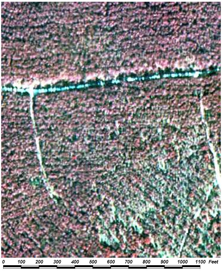
Field Picture
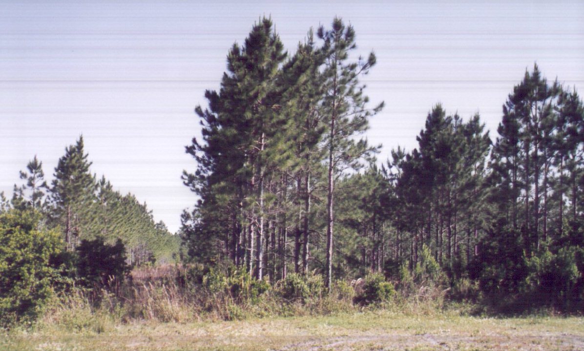
BACK TO CLASSIFICATION LIST
4420 Hardwood Plantations
4420
- Hardwood Plantations
LEVEL 1: 4000 Upland Forest
LEVEL 2: 4400 Tree Plantations
LEVEL 3: 4420 Hardwood
Plantations
DESCRIPTION:
This class includes hardwood forests
artificially generated by planting seedling stock or seeds for the purpose of
pulp or wood production. The stands are characterized by high numbers of trees
per acre and a uniform appearance. Row patterns are almost always apparent.
Young trees will have very narrow
crowns, as the growth is concentrated in an upward direction. Older plantations
have more mature trees and more resemble natural forest signatures. However,
the row pattern is still discernable, which differentiates this class from a
natural forest community.
KEYS TO PHOTOINTERPRETATION:
Straight rows of trees exhibiting tightly packed crowns of nearly uniform
extent.
The understory is visible if trees are not mature.
Typical signature of hardwoods with broader, fluffy red colored crowns,
varying in size and shape depending on the age of the stand and species planted
When melaleuca has been planted, stands are often very dense with the
typical signature return described under its land cover type description.
Eucalyptus plantations are not as dense and more individual crowns
should be visible. Leaf density of eucalyptus is also generally less than on
melaleuca and the signature should be more "feathery" in appearance.
CONTEXT:
Landscape Position - May occur in any rural area of the project
limits except those areas of highly productive agricultural soils which are
better used for crop production.
Vegetation - Most hardwoods are not planted.
Soils - Generally sandy, acidic soils. Melaleuca may be planted
on somewhat wetter sites.
Hydrology - Often on mesic sites with moderate to poor drainage
and a high water table during the wet season.
SIMILAR CLASSES:
2210 Citrus Groves - Besides
characteristic signatures, citrus has a higher intensity management, and a
citrus production context.
2410 Tree Nurseries - May be container or green houses operations;
Numerous varieties are grown in tightly spaced rows.
4100 Upland Coniferous Forests - These are not planted in rows.
4130 Sand Pine - Has a carpet-like appearance and even-toned signature.
4430 Forest Regeneration - Trees are seedlings or saplings and are barely
visible on aerial photos.
SPECIAL MAPPING CONVENTIONS:
In order to be able to dual code
hardwood plantations with wetlands, 4420 is considered a land use class, in
contrast to the other forest types. Wetland sites that have been planted over
with hardwood are considered both hardwood plantation (LUCODE = 4420 or 4430)
and wetland (LCCODE = 6170) .
Dual coding convention: 4420 is a Land Use class. A
separate land cover code is not normally required. Exceptions are hardwoods
planted over wetland sites, as noted above.
DOQQ Image
Field Picture
BACK TO CLASSIFICATION LIST
4430 Forest Regeneration Areas
4430
- Forest Regeneration Areas
LEVEL 1: 4000 Upland Forested
LEVEL 2: 4400 Tree Plantations
LEVEL 3: 4430 Forest Regeneration Areas
DESCRIPTION:
These are areas in which it is clear
that open areas will be reforested through prescribed silvicultural
practices rather than take on another land use or be abandoned. The area
may appear disturbed, thus producing a wide variety of photosignatures,
depending on the stage of regrowth following timber harvest. The boundaries of this class are somewhat
irregular, and can meander through an area of existing pine flatwoods.
Windrows of brush may be piled up
and visible on the photo, along with bare soil. The soil may show tones ranging
from light greys and greens to black, representing standing water. Vehicle ruts
and trails from equipment and dragging of trees may also be visible, along with
the pink, red, and magenta tones of herbaceous and shrub regrowth in recently
cut over areas.
These areas may be replanted at a
later time, but at the time of photography, no positive indication of the
intended use of the land is apparent. Surrounding areas of existing plantations
and the lack of surrounding development are indicators that forest regeneration
is likely to continue, and the 4430 code should be assigned. Signs of site
preparation following timber harvest indicate a change in land use to either
improved or unimproved pasture. If intensive preparation has been performed and
rows of seedlings are not visible, pasture land uses should be considered.
KEYS TO PHOTOINTERPRETATION:
Saplings must be less than 20' tall, and may or may not be visible.
Understory vegetation or bare soils are visible.
Signs of fire may be evident.
Recently clear cut areas with lines of piled up slash and debris
indicate regeneration.
Clearing, site preparation and planting activities are usually done in parallel
rows. However, sand pine plantations are aerially seeded, not in rows.
Pines in wet areas may appear stressed but the rows are still evident.
CONTEXT:
Landscape Position - Pine plantations occur most often on sites formerly
occupied by former flatwoods communities.
Vegetation - Species of pine and associates typically found in
the flatwoods.
Soils - Sandy, acidic soils typical of flatwoods sites.
Hydrology - Often on mesic sites with moderate to poor drainage
and high water table during the wet season.
SIMILAR CLASSES:
2210 Citrus Groves - Citrus plots
exhibit a higher intensity management, and a crop production context
2410 Tree Nurseries - May be container or green houses operations.
Numerous varieties are grown in tightly spaced rows
4100 Upland Coniferous Forests -These are not planted in rows, and are not
uniform
4410 Pine plantations - Rows of trees are distinctly visible - trees are over
20 feet tall
SPECIAL MAPPING CONVENTIONS:
Wetland sites that have been planted
over with pine are considered both pine plantation (LUCODE = 4410 or 4430) and
wetland (LCCODE = 6250 or 6300). Aids to delineation include 1995 LCLU, SSURGO soil data, and NWI wetland
maps.
It is assumed that freshly cut over
areas where pine has not yet been planted, in the vicinity of established pine
plantations, should be coded with LUCODE = 4430 Forest regeneration.
Dual coding convention: 4430 is a Land Use class. It
normally does not require separate land cover coding. Exceptions are pine
planted over wetland sites, as noted above.
DOQQ Image
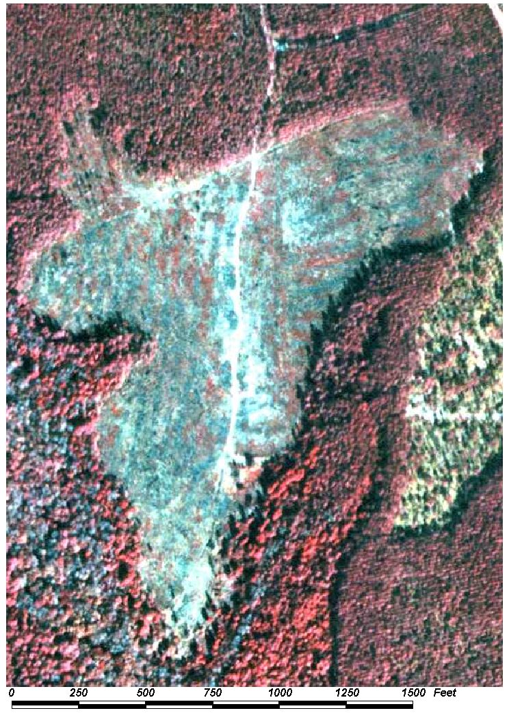
Field Picture
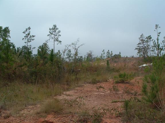
BACK TO CLASSIFICATION LIST
*5000 WATER
Water - FLUCCS Code 5000
This Level 1 class is
not active in the map itself - a more specific subclass must be selected. The
Level 2 subclasses include:
5100 Streams and Waterways
5200 Lakes
5300 Reservoirs
5400 Bays and Estuaries
5600 Slough Waters
5700 Bay and Gulf
For details on each
subclass (both Level 2 and Level 3) see the respective PI Key pages.
Background: Water is the most
important feature in the County's LCLU data layer. It is also
one of the easiest to map, due to the almost uniformly deep black signature it
presents on CIR photography. There is no Minimum Mapping Unit (MMU) for
water.
Water features can be
problematic, especially between similar classes within the general 5000
category. The main problem is change - including slow changes that render
lakes into prairies and vice versa, and beaches into ocean. Seasonal
changes may also turn water bodies into dry land, or cause the emergence or
disappearance of vegetation. On an hourly basis the changes in tide
can turn ocean into broad tidal flats or salt marsh. And human influence to
manage water levels can change the boundaries of water features, causing
reservoirs to fill or empty and canals to flow one way or the other. To
summarize - water is a dynamic and often transient feature on the flat, wet
surface of Alabama. The standard solution
is to delineate the water bodies as they appear at the time of photography.
MAPPING CONVENTIONS:
Some bodies of water are
not classified in the 5000 class. These include: the portions of water
bodies with emergent vegetation or floating islands, which are classified in
the 6000 Wetlands class, 1660 Extractive Holding Ponds, shoreline areas
obscured by piers and Port Facilities (8150), 2540 Aquaculture, and permanent
bodies of water that are temporarily drained. On the other hand,
areas that are only temporarily flooded may appear as water bodies due to
recent flooding or other factors.
Minimum mapping units: There is no MMU
for all 5000 Water classes. Waterways as narrow as 50 feet are included in the
map, and even narrower segments may be mapped to maintain connectivity.
In transitional areas
where species specific wetland and upland polygons are below the appropriate
MMU some aggregation may be justified. In these cases intermixed community
classes will be assigned and mapped at a larger unit.
Differentiating
subclasses: See Similar Classes below and the respective 5000 subclass
Key pages.
Dual coding
convention: All the subclasses in the 5000 category are Land Cover
classes. They do not require a separate land use code. Land Cover and
Land Use (LCCODE and LUCODE) are always the same.
SIMILAR CLASSES:
Some of the specific
difficulties in mapping subclasses in the 5000 Water and 6000 Wetlands classes
include the following:
- reservoirs vs. lakes vs.
lagoons and impoundments.
- transportation canals vs.
streams and waterways
- tidal flats vs. salt marsh vs.
water.
- enclosed salt water ponds.
- mapping shorelines in coastal
areas
- wetlands vs. water vs. marshy
lakes.
- standing water on other land
uses, such as agricultural fields.
- rivers vs. long linear bays and
inland waterways.
The PI Key pages for
each of the water and wetlands subclasses indicate how the above issues are
resolved. However, no set of decision rules can take all the subjectivity
out of the map. As a result, water boundaries, just as with all other
classes, do not agree precisely between one data layer and another.
For more information:
See the PI keys for each
of the subclasses for more details and graphic examples.
Other data layers that
delineate water bodies include NWI wetlands, USGS hydrology layers, the
National Hydrography Data (NHD) layer, Baldwin County Parcel Data, NRCS
soils maps, and previous LCLU maps. Each of these
have their particular strengths and weaknesses. Imagery and aerial photos
can often provide the best confirmation for any given date.
BACK TO CLASSIFICATION LIST
*5100 Streams and Waterways
Streams and Waterways - FLUCCS Code 5100
This general Level 2
class is not used in the map itself - a more specific subclass must be
selected. The Level 3 subclasses are:
5110 Natural River, Stream, Waterway
5120 Channelized River, Stream, Waterway
Background: This category includes
rivers, creeks, canals and other linear water bodies flowing across the
landscape within defined channels. They are delineated where they average 50
feet or greater in width. Where the water course is interrupted by a
control structure, the impounded water area will be classified as 5300
Reservoirs. The 5100 class includes both natural and modified waterways,
as well as man-made canals and channels.
MAPPING CONVENTIONS:
Minimum mapping units: Waterways are
mapped if they are 50 feet or greater in width. Narrower segments are also
mapped as needed in order to maintain connectivity. Marine waterways over one
mile wide are classified as 5400 Bays and Estuaries.
Water lying under
bridges, docks, piers, port facilities or other structures is mapped as
water.
The boundary between
streams and lakes, reservoirs or the ocean is the straight line across the
mouth of the stream unless the mouth is more than one mile (1.85 kilometers)
wide. In that case, the rule given under Bays and Estuaries is followed.
Dual coding
convention: All of the 5100 classes are Land Cover classes. The LCCODE
and LUCODE are the same. A separate land use code is not required.
SIMILAR CLASSES:
5400 Bays and Estuaries
- These are inlets of the sea greater than one mile in width. Marine waterways
less than one mile in width are classified as 5100 Streams and Waterways.
5600 Slough Waters - These are blocked, stagnant, slow moving channels.
BACK TO CLASSIFICATION LIST
5110 Natural River, Stream, Waterway
5110
- Natural River, Stream, Waterway
LEVEL 1: 5000 Water
LEVEL 2: 5100 Streams and Waterways
LEVEL 3: 5110 Natural River, Stream, Waterway
DESCRIPTION:
This class includes natural rivers,
creeks, and other linear water bodies flowing across the landscape within
defined channels. They are delineated where they average 50 feet or greater in
width. Where the water course is interrupted by a control structure, the
impounded water area will be classified as 5300 Reservoirs.
This class includes only natural
waterways, and not man-made canals and channels.
There is not one conclusive feature
separating natural from channnelized waterways. The PI must determine whether a
water body is predominantly natural or channelized.
KEYS TO PHOTOINTERPRETATION:
Water will generally exhibit a color tone varying from dark blue or
black to a medium gray.
Natural waterways generally follow the landscape, and have natural
shapes, with very few straight edges.
CONTEXT:
Landscape Position - Natural streams and waterways may be found
throughout the County draining the surrounding lands.
SIMILAR CLASSES:
5120 Channelized River, Stream, Waterway - These are
entirely or substantially man-made, or substantially modified by man.
5410 Embayments Opening Directly to Bay or Gulf - more than one nautical mile
in width and have a direct connection to the open sea
5420 Embayments Not Opening Directly to Bay or Gulf - more than one nautical
mile in width
5600 Slough Waters - These are blocked, stagnant, slow moving channels.
SPECIAL MAPPING CONVENTIONS:
Natural Rivers, Streams and Waterways are mapped
if they are 50 feet or greater in width. Narrower segments are also mapped as
needed in order to maintain connectivity. Marine waterways over one mile wide
are classified as 5400 Bays and Estuaries.
Natural waterways flowing under
bridges, docks, piers, port facilities or other structures are mapped as
water.
The boundary between natural
waterways and lakes, reservoirs or the ocean is the straight line across the
mouth of the stream unless the mouth is more than one mile (1.85 kilometers)
wide. In that case, the rule given under Bays and Estuaries is followed.
Dual coding convention: This is a Land Cover class.
The LCCODE and LUCODE are the same. A separate land use code is not required.
DOQQ Image
Field Picture
BACK TO CLASSIFICATION LIST
5120 Channelized Waterways, Canals
5120
- Channelized River, Stream, Waterway
LEVEL 1: 5000 Water
LEVEL 2: 5100 Streams and Waterways
LEVEL 3: 5120 Channelized River,
Stream, Waterway
DESCRIPTION:
This class includes artificially
improved rivers, creeks, canals and other linear water bodies flowing across
the landscape within man-made (or substantially man-made or altered) channels.
They are delineated where they average 50 feet or greater in width. Where
the water course is interrupted by a control structure, the impounded water
area will be classified as 5300 Reservoirs.
This class includes only channelized
waterways, and not natural rivers, streams, and waterways.
There is not one conclusive feature
separating channelized from natural waterways. The PI must determine whether a
water body is predominantly channelized or natural.
KEYS TO PHOTOINTERPRETATION:
Water will generally exhibit a color tone varying from dark blue or
black to a medium gray.
Shorelines generally have straight or regular shapes for most of their
length, and may not appear to follow the surrounding topography.
CONTEXT:
Landscape Position - Channelized streams and waterways may be
found throughout the County, used for travel, shipping, or irrigation.
SIMILAR CLASSES:
5110 Natural River, Stream, Waterway - These are entirely
or substantially natural, and generally follow the surrounding topography.
5410 Embayments Opening Directly to Bay or Gulf - more than one nautical mile
in width and have a direct connection to the open sea
5420 Embayments Not Opening Directly to Bay or Gulf - more than one nautical
mile in width
5600 Slough Waters - These are blocked, stagnant, slow moving channels.
SPECIAL MAPPING CONVENTIONS:
Channelized waterways and canals are
mapped if they are 50 feet or greater in width. Narrower segments are also
mapped as needed in order to maintain connectivity. Marine waterways over one
mile wide are classified as 5400 Bays and Estuaries.
Channelized waterways and canals
flowing under bridges, docks, piers, port facilities or other structures are mapped
as water.
The boundary between this class and
other water features such as lakes, reservoirs, or the ocean is the straight
line across the mouth of the stream unless the mouth is more than one mile
(1.85 kilometers) wide. In that case, the rule given under 5400 Bays and
Estuaries is followed.
Dual coding convention: This is a Land Cover class.
The LCCODE and LUCODE are the same. A separate land use code is not required.
DOQQ Image
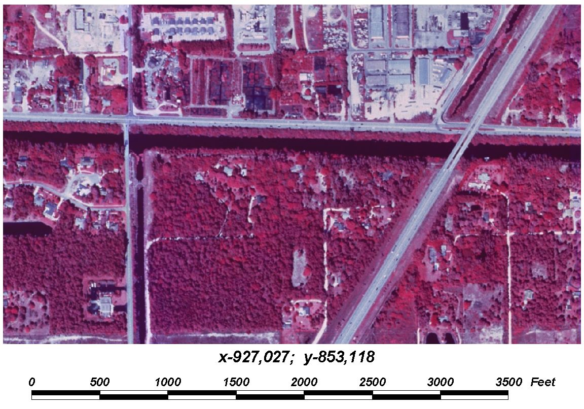
Field Picture
BACK TO CLASSIFICATION LIST
5200 Lakes
5200
- Lakes
LEVEL 1: 5000 Water
LEVEL 2: 5200 Lakes
DESCRIPTION:
This class includes freshwater and saltwater
bodies of water, that are predominantly natural in origin. It includes all
natural bodies of water situated in a depression, excluding reservoirs. Also
included are isolated open water areas within coastal marshes and mangrove
forests that have no visible connection to adjacent coastal waters.
It does not include water bodies
that are man-made or extensively modified, which are classed as 5300
Reservoirs. It also does not include enclosed saltwater ponds, major
springs, holding ponds or treatment ponds.
In contrast with reservoirs, water
bodies in this class have a natural appearance - curved shorelines, normal
vegetation, healthy (black) water tones, and few if any control structures.
However, the presence of some of these indicators does not necessarily make it
a reservoir, since most water bodies are subject to human influence and
modification.
The PI must determine if the water
body is predominantly natural or man-made, based on the water body's context,
functions, indicators, and general appearance. There is no precise
dividing line, and error costs between 5200 and 5300 are not necessarily high.
For larger lakes and those with apparent natural origins, 5200 is the more
appropriate code.
The limits of the water are mapped
to that shown on the aerial photo and only represent conditions on the date of
photgraphy.
KEYS TO PHOTOINTERPRETATION:
Water will exhibit a varying tone from very dark to medium depending on
the turbidity and sediment load of the water.
Highly turbid waters have a light bluish, greenish, or whitish signature
due to the reflection from suspended solids in the water.
Shorelines will appear natural and follow the landscape. May also show
evidence of fluctuating water levels on shoreline.
CONTEXT:
Landscape Position - Lakes occur throughout the County, in
varying concentrations. Water bodies in highly developed areas are much
more likely to be reservoirs. The PI should examine undeveloped areas of
the surrounding landscape to see if water bodies are a common feature.
Otherwise, they are likely to be man-made.
SIMILAR CLASSES:
5110 Natural River, Stream, Waterway - These are
linear features.
5120 Channelized River, Stream, Waterway - These are
linear features, either man-made or substantially altered by man.
5300 Reservoirs - These are man-made, or significantly altered by man.
6510 Tidal Flats - Coastal areas where varying tide levels reveal sand or mud
substrates.
SPECIAL MAPPING CONVENTIONS:
In urban areas, natural lakes may
have water control structures to control lake level or discharge. These are
still considered 5200 Lakes, rather than 5300 Reservoirs.
Emergent marshes may exhibit high
water conditions at the time the aerial photography was taken. The emergent
vegetation may not be visible in these areas. Even though collateral data may
identify these areas as 6410 Freshwater Marshes or 6430 Wet Prairies, they
should be coded as water bodies (5200, 5300) due to their open water signature
at the time of photography.
Active agricultural areas that are
temporarily flooded should be classed as the appropriate agriculture class, not
water bodies. The PI should check collateral data to see if these areas
are public lands undergoing restoration. Other permanent land
uses that are temporarily flooded should be given the appropriate land use
class, not 5200. An example would be flooded parking lots in a mall, or
roadways under water. Land covers, in general, that are under water
should be classed as open water. Some PI discretion is required to determine
whether the flooded condition is typical or highly infrequent, and whether it
is an appropriate characterization of the mapping unit.
Dual coding convention: This is a Land Cover class.
The LCCODE and LUCODE are the same. A separate land use code is not
required.
DOQQ Image
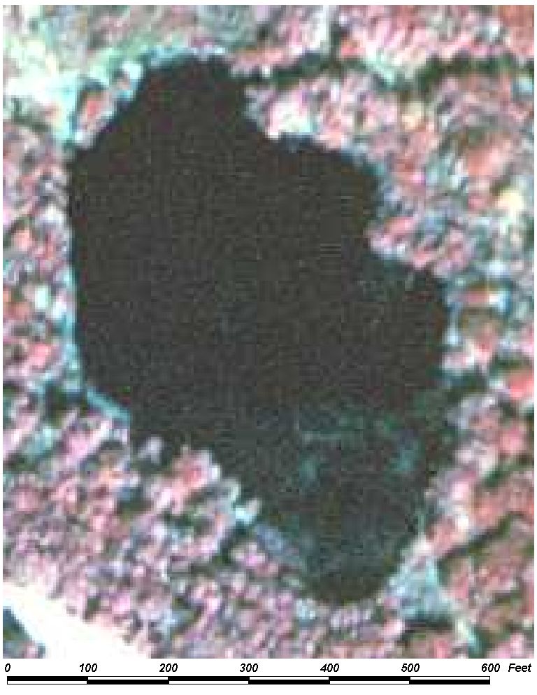
Field Picture
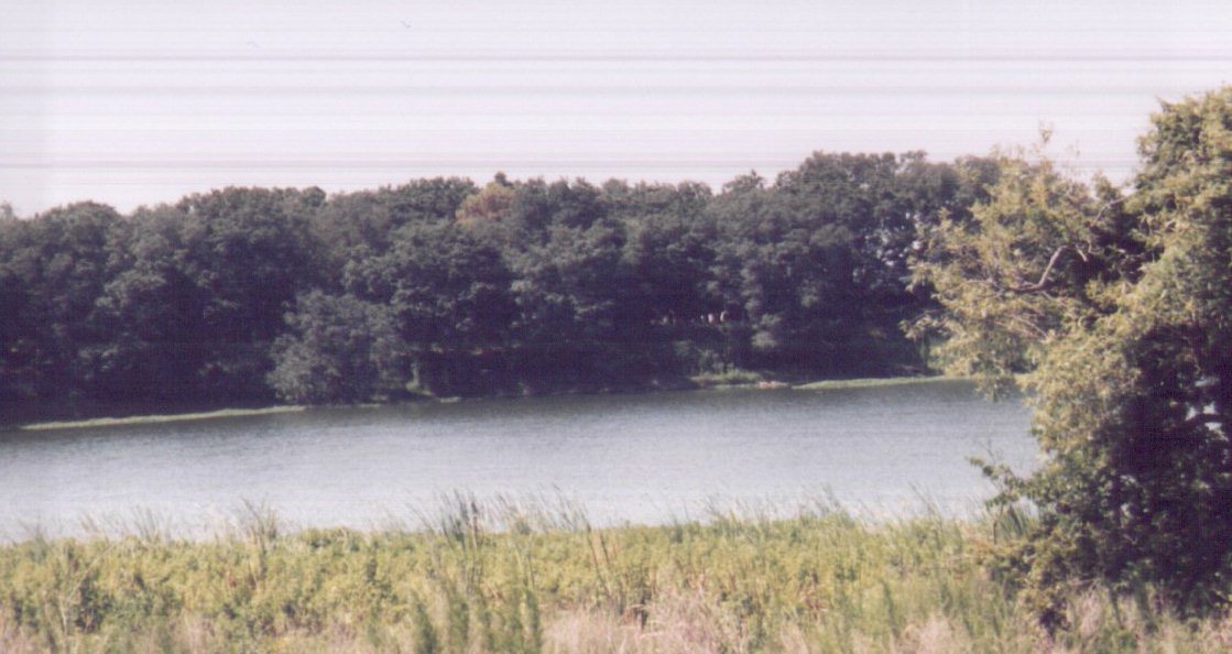
BACK TO CLASSIFICATION LIST
5300 Reservoirs
5300
- Reservoirs
LEVEL 1: 5000 Water
LEVEL 2: 5300 Reservoirs
DESCRIPTION:
Reservoirs are artificial
impoundments of water, or water bodies that have been significantly modified
from the natural state. They are used for irrigation, flood control, municipal
and rural water supplies, stormwater treatment, recreation and
hydro-electric power generation. Dams, levees, other water control structures
or the excavation itself usually will be evident to aid in the
identification.
There is no fine dividing line or
conclusive indicator feature to separate lakes and reservoirs. The PI
must determine whether a water body is predominantly natural or
man-made. In cases where a water body was historically present, the PI
should classify the polygon as 5200 Lakes.
KEYS TO PHOTOINTERPRETATION:
Reservoirs are artificial impoundments of water which will often contain
a man-made structure on at least one side of the water body.
Generally, all or part of the shorelines are straight or regular
shapes, and do not appear to follow the surrounding topography. Linear
shapes are uncommon.
Reservoirs are likely to diverge from the black signature of natural
water bodies. Signature and tone of the water will be dependent on turbidity
and sediments in the water body.
CONTEXT:
Landscape Position - Reservoirs occur throughout the County, in
varying concentrations. Water bodies in highly developed areas are much
more likely to be reservoirs. The PI should examine undeveloped areas of
the surrounding landscape to see if water bodies are a common feature.
Otherwise, they are likely to be man-made.
SIMILAR CLASSES:
1660 Holding Ponds - Associated with
an active mining operation. Holding ponds at abandoned or reclaimed
mining sites are considered reservoirs.
5200 Lakes - natural water bodies; shorelines appear natural and tend to follow
the landscape.
SPECIAL MAPPING CONVENTIONS:
USGS topo maps can assist in the
determination of whether or not a lake is artificial. New reservoirs, such as
those created in subdivisions, may not be mapped on topo maps, or may look
radically different from water bodies on the older maps.
This class does not include
reservoirs that are part of either the 1600 Extractive or 8300 Utilities
classes. These ancillary facilities, when clearly identified as belonging to
another land use, should be mapped with that land use.
Several emergent marshes exhibit
high water conditions at the time the aerial photography was taken. No emergent
vegetation visible in these areas. Collateral data may identify these areas as
6410 Freshwater Marshes or 6430 Wet Prairies; however, they are coded as 5200
Lakes or 5300 Reservoirs due to their open water signature.
Dual coding convention: This is a Land Cover class.
The LCCODE and LUCODE are the same. A separate land use code is not required.
DOQQ Image
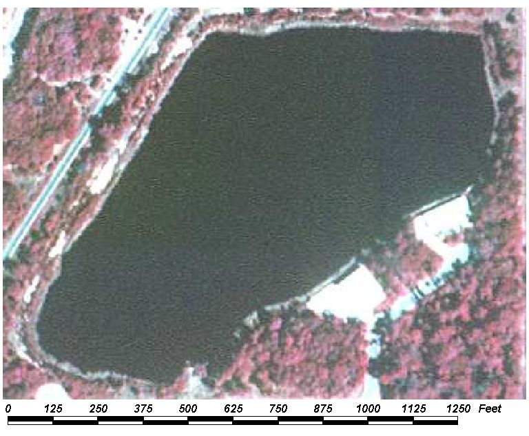
Field Picture
BACK TO CLASSIFICATION LIST
*5400 Bays and Estuaries
Bays and Estuaries - FLUCCS Code 5400
This general Level 2
class is not used in the map itself - a more specific subclass must be
selected. The Level 3 subclasses are:
5410 Embayments Opening Directly to Gulf or Bay
5420 Embayments Not Opening Directly to Gulf or Bay
5430 Enclosed Saltwater Ponds Within Salt Marsh
Background: This class is defined as
inlets or arms of the sea that extend into the land, and are between 1 and 10
nautical miles in width (1.85 to 18.5 kilometers). Embayments less than
one nautical mile in width are classed as 5100 Streams and Waterways.
Embayments or portions of embayments more than 10 nautical miles in width are
not considered as included within the limits of the United States.
Isolated water bodies
that have no visible surface connection to adjacent coastal waters are
classified as 5200 Lakes. However, enclosed saltwater ponds within a salt
marsh (generally mosquito impoundments) are classified as 5430 Enclosed
Saltwater Ponds Within Salt Marsh.
MAPPING CONVENTIONS:
Minimum mapping units: There is no
minimum mapping unit for 5400 classes, except 5430 Enclosed Saltwater Ponds
Within Salt Marsh - the MMU for this class is 1 acre.
Differentiating
subclasses: See the Level 3 key pages for guidance on how to distinguish
these classes.
Dual coding
convention: All of the 5400 classes are Land Cover classes. The LCCODE
and LUCODE are the same. A separate land use code is not required.
SIMILAR CLASSES:
5100 Streams and
Waterways - less than one nautical mile (1.85 km) in width
5200 Lakes - no visible access to coastal waters
5430 Enclosed Salt Water Ponds - artificially enclosed for mosquito control
5600 Slough Waters - not connected via open water to any coastal waters
6420 Saltwater Marsh - exhibits emergent vegetation
6510 Tidal Flats - white to whitish grey signature; typically sand or mud, with
some scattered vegetation
BACK TO CLASSIFICATION LIST
5410 Embayments Opening Directly to Mobile Bay or Gulf of Mexico
5410
- Embayments Opening Directly to Mobile Bay or Gulf of Mexico
LEVEL 1: 5000 Water
LEVEL 2: 5400 Bays and Estuaries
LEVEL 3: 5410 Embayments
Opening Directly to Gulf or Bay
DESCRIPTION:
Embayments are inlets or arms of the
sea that extend into the land.
Water bodies in this class are those
which have a direct connection to the open Gulf of Mexico or Mobile Bay and do not meander great distances
up or down the interior of the coast. Where the feature does turn sharply north or south, and
becomes narrow (less than one nautical mile in width), and travels a long way
with a strip of land separating it from the open seas, other land cover codes
will be used (such as 5420 Embayments Not Opening Directly to Gulf or Bay or
5110 Natural River, Stream, Waterway).
They produce a signature typical of
water - blackish on CIR photography - unless they contain turbid water, in
which case they may appear lighter in color.
The boundary between this class and the
open sea will be a straight line connecting the waterward-most headlands drawn
across the mouth of the opening. In cases where the embayment is so shallowly
indented into the land that the area of water enclosed in this manner would be
less than that encompassed by a semicircle drawn with the boundary line as its
radius, the coastline itself will be the boundary of the coastline and no Bays
and Estuaries code will be used.
KEYS TO PHOTOINTERPRETATION:
Located only in coastal areas
Levees may be present
Surrounding vegetation is characteristic of saltwater marshes, and may
include spartina, mangroves, borrichia. Levees may support Brazilian pepper.
CONTEXT:
Landscape Position - This class is only found in coastal
locations. Therefore it will only be used for waters directly along the Gulf of Mexico or Mobile Bay that are within the project area.
SIMILAR CLASSES:
5200 Lakes - independent freshwater
bodies
5420 Bays and Estuaries Not Opening Directly to Gulf or Bay - no direct
connection to the open Gulf of Mexico or Mobile Bay
5600 Slough Waters- channels of slow-moving water in coastal marshland
SPECIAL MAPPING CONVENTIONS:
There is no minimum mapping unit for
this class.
Dual coding convention: This is a Land Cover
class. The LCCODE and LUCODE are the same. A separate
land use code is not required.
DOQQ Image
Field Picture
BACK TO CLASSIFICATION LIST
5420 Embayments Not Opening Directly to Mobile Bay or Gulf of Mexico
5420
- Embayments Not Opening Directly to Mobile Bay or Gulf of Mexico
LEVEL 1: 5000 Water
LEVEL 2: 5400 Bays and Estuaries
LEVEL 3: 5420 Embayments
Not Opening Directly to Gulf or Bay
DESCRIPTION:
Embayments are inlets or arms of the
sea that extend into the land.
Water bodies in this class are those
which do not have a direct connection to the open Gulf of Mexico or Mobile Bay and may meander up or down the
interior of the coast with a strip of land separating the majority of their water
surface from the open Gulf of Mexico or Mobile Bay.
They exhibit a signature typical of
water - blackish on CIR photography - unless they contain turbid water, in
which case they may appear lighter in color.
Where this feature becomes narrow
(less than 1 nautical mile) and travels for long distances with a strip of land
separating it from the open seas, it should be classified as either 5110 Natural River, Stream, Waterway or 5120 Channelized River, Stream, Waterway.
KEYS TO PHOTOINTERPRETATION:
Located only in coastal areas
Levees may be present
Surrounding vegetation is characteristic of saltwater marshes, and may
include spartina, mangroves, borrichia. Levees may support brazilian pepper.
CONTEXT:
Landscape Position - This class is only found in coastal
locations. Therefore it will only be used for waters directly along the Gulf of Mexico or Mobile Bay that are within the project area.
SIMILAR CLASSES:
5200 Lakes - these are independent
water bodies, having no connection to open seas
5410 Bays and Estuaries Opening Directly to Gulf or Bay - have a direct
connection to the open Gulf of Mexico or Mobile Bay.
5600 Slough Waters- channels of slow-moving water in coastal marshland
SPECIAL MAPPING CONVENTIONS:
There is no minimum mapping unit for
this class.
Dual coding convention: This is a Land Cover
class. The LCCODE and LUCODE are the same. A separate
land use code is not required.
DOQQ Image
Field Picture
BACK TO CLASSIFICATION LIST
*5700 Gulf of Mexico and Mobile Bay
Gulf of Mexico and Mobile Bay - FLUCCS Code 5700
This Level 2 class is not
used in the map itself - a more specific subclass must be selected. The Level 3
subclasses are:
5710 Gulf of Mexico
5720 Mobile Bay
Background: This class is a Baldwin County modification of the
FLUCCS class 5700 Major Bodies of Water.
MAPPING CONVENTIONS:
Minimum mapping units: There is no
minimum mapping unit for all water classes.
Differentiating
subclasses: The Gulf of Mexico and Mobile Bay are separated by the Gulf Shores Beaches and Dauphin Island.
Dual coding
convention: All of the 5700 classes are Land Cover classes. The LCCODE
and LUCODE are the same. A separate land use code is not required.
SIMILAR CLASSES:
The Gulf of Mexico and Mobile Bay have the same open
water signature as other water features. They are distinguished by their large
size and position on the coastlines of Baldwin County.
For more information:
See the PI keys for each
of the subclasses for more detailed information.
BACK TO CLASSIFICATION LIST
5710 Gulf
of Mexico
5710 - Gulf of Mexico
LEVEL 1: 5000 Water
LEVEL 2: 5700 Gulf and Bay
LEVEL 3: 5710 Gulf of Mexico
DESCRIPTION:
This code was created by Baldwin County and is not part of FLUCCS.
The Gulf of Mexico is an arm of the Atlantic Ocean bordering on eastern Mexico, the southeast United States, and Cuba. It connects with the Atlantic Ocean through the Straits of Florida.
KEYS TO PHOTOINTERPRETATION:
· The Gulf of Mexico has the typical open water
signature.
· It is distinguished
by its size and location off the south coast of Baldwin County.
CONTEXT:
· Landscape
Position - The Gulf of Mexico is located off the south coast of Baldwin County.
SIMILAR CLASSES:
5720 Mobile Bay - This is the only similar class,
located off the west coast of Baldwin County.
SPECIAL MAPPING CONVENTIONS:
This is a Baldwin County modification to the FLUCCS system.
The classification is based on the
water levels visible at the date of photography. Ancillary data may show other
patterns of vegetation and water, due to changes in hydrology.
Dual coding convention: This is a Land Cover class.
The LCCODE and LUCODE are the same. A separate land use code is not required.
BACK TO CLASSIFICATION LIST
5720 Mobile Bay
5720
– Mobile Bay
LEVEL 1: 5000 Water
LEVEL 2: 5700 Gulf and Bay
LEVEL 3: 5720 Mobile Bay
DESCRIPTION:
This code was created by Baldwin County and is not part of FLUCCS.
Mobile Bay is located in Southern Alabama and comprises the west coast of Baldwin County.
It is bounded to the south by the Gulf Shores Beaches and Barrier Islands.
KEYS TO PHOTOINTERPRETATION:
Mobile Bay has the typical open water
signature.
It is distinguished by its size and location off the west coast of Baldwin County.
CONTEXT:
Landscape Position - Mobile Bay is located in Southern Alabama and comprises the west coast of Baldwin County.
It is bounded to the south by the Gulf Shores Beaches and Barrier Islands.
SIMILAR
CLASSES:
5710 Gulf of Mexico - This is the only similar class,
located to the south of Baldwin County.
SPECIAL MAPPING CONVENTIONS:
This is an Baldwin County modification to the FLUCCS system.
The classification is based on the water
levels visible at the date of photography. Ancillary data may show other
patterns of vegetation and water, due to changes in hydrology.
Dual coding convention: This is a Land Cover class.
The LCCODE and LUCODE are the same. A separate land use code is not required.
BACK TO CLASSIFICATION LIST
*6000 WETLANDS
Wetlands - FLUCCS Code 6000
This Level 1 class is
not used in the map itself - a more specific subclass must be selected.
The Level 2 subclasses are:
6100 Wetland Hardwood
Forests
6200 Wetland Coniferous Forests
6300 Wetland Forested Mixed
6400 Vegetated Non-Forested Wetlands
6500 Non-Vegetated Wetlands
Background: Wetlands are a high
priority feature to the County, as they perform so many critical functions
related to water resources management. In particular, the
wetlands/uplands boundary is critical to many types of decision-making.
The subclasses of wetlands are relatively general, representing broad
vegetation communities. However, as with the other natural land cover
classes, consistently high accuracy is often difficult to achieve due to the
project imagery, time-frame, budget and other constraints. For
higher resolution maps of natural vegetation, users should obtain data layers
scaled to smaller project areas, such as the major watershed basins of the
County.
Wetlands are those areas
where the water table is at, near or above the land surface for a significant
portion of most years. The hydrologic regime is such that aquatic or hydrophytic
vegetation usually is established, although alluvial and tidal flats may be
non-vegetated. Examples of wetlands include marshes, mudflats, emergent
vegetation areas and swamps. Shallow water areas with submerged aquatic
vegetation are usually classed as water and not included in the Wetland
category.
Extensive parts of some
river floodplains qualify as Wetlands. These do not include agricultural land
where seasonal wetness or short-term flooding may provide much of the soil
moisture necessary for crop production. But uncultivated wetlands used as pine
plantation or pastures are retained in the Wetlands category.
Wetlands that are
currently drained for any purposes belong to other land use categories, such as
Agriculture, Rangeland, Forested Uplands or Urban and Built-Up. When the
drainage is discontinued and the pre-existing hydrologic regime
re-established, the classification reverts to Wetlands. Wetlands managed for
wildlife purposes may show short-term changes in vegetation and hydrology under
different management practices, but they are still classified as Wetlands.
The above definitions
are tailored to the limitations imposed by the project methodology, which
relies primarily on aerial photography to delineate wetland
communities. In absence of extensive fieldwork, imposing a more
definitive description of wetlands is not feasible.
MAPPING CONVENTIONS:
Minimum mapping units: The minimum
mapping unit (MMU) for all 6000 Wetlands classes is 1 acre. Upland areas within wetlands will be broken
out if they are greater than .25 acres.
Wetland systems can
range from large monocultures to complex intermixtures of different
classes. Individual plants or trees may be dispersed evenly
throughout a matrix or grouped in patches. If distinct patches of any
class are greater than 1 acre, they are broken out separately. In
transitional areas where species specific wetland and upland polygons are below
the appropriate MMU some aggregation may be justified. In these cases
intermixed community classes will be assigned and mapped at a larger
unit. PI's must use discretion to avoid excessive line work while
adding useful information.
Upland areas that occur
as "islands" within wetlands systems are also broken out down to .25
acres. Adjacent uplands obey the standard MMU of 1 acre, unless otherwise
defined.
Differentiating
subclasses: See the PI keys for each of the subclasses for indicators that
assist in differentiation.
Differentiating between
natural communities requires expertise in photointerpretation. The
communities are recognized by the signatures of individual species, rather than
by the general color, texture and patterns of the mixture or
community. It is generally accepted that PI's cannot recognize
these species unless they have extensive experience in the field comparing
features on the ground against the exact same feature on recent photography.
Also required is an understanding of the system's ecology. These skills
are difficult to obtain, which accounts for the high levels of error sometimes
found in mapping plant communities.
Dual coding
convention: All of the wetlands classes are Land Cover classes that do
not normally require a separate dual code - LCCODE and LUCODE are normally the
same. However, in rare cases, a separate land use code is required.
The most common example is for pine plantations on hydric soils ; reclaimed and
abandoned mining areas may also require separate dual coding.
SIMILAR CLASSES:
The County places a high
priority on establishing a wetland boundary, but it is sometimes easy to
confuse upland and wetlands communities based on photosignature
alone. Vegetation is usually the only visible indicator of the hydrologic
boundary on aerial photography. Unfortunately, many species and
communities stretch across this boundary, which ranges from being distinct to
being virtually invisible.
Many of the wetland
classes have similar upland counterparts that occur in wetland margins or in
adjacent uplands. Notable examples are hardwood forests, flatwoods, cabbage
palms, wet and dry prairies and pastures, and even pine plantations. In
addition, the hydrologic regimes can change due to unpredictable, long or
short-term climatic fluctuations and human interventions. These factors
often make the delineation of a wetland / upland boundary problematic.
The problem is addressed with experience, ancillary data, magnified stereo
viewing of imagery, field checking, and tolerance of an acceptable level
of error.
For more information:
See the PI keys for each
of the subclasses for more details and graphic examples.
BACK TO CLASSIFICATION LIST
6100 Wetland Hardwood Forests
6100
- Wetland Hardwood Forest
LEVEL 1: 6000 Wetlands
LEVEL 2: 6100 Wetland Hardwood Forest
DESCRIPTION:
This is an active Level 2 class that
should be applied only when one of the more specific Level 3 or Level 4
subclasses does not apply.
Wetland Hardwood Forests are
wetlands whose canopy is at least 67% dominated by wetland hardwood species and
are the result of natural generation.
KEYS TO PHOTOINTERPRETATION:
· Over 67% of the
canopy is composed of hardwood species adapted to grow in hydric soils.
· NRCS soils maps
indicate hydric soils.
· See the Level 3 and
Level 4 class pages for keys to interpreting these classes.
CONTEXT:
· Landscape Position
- Wetland hardwood forests can be found almost anywhere in the project area
where hydric conditions exist and trees have not been cleared.
· Vegetation - See
respective subclasses.
· Soils - See respective
subclasses.
· Hydrology - See
respective subclasses.
SIMILAR CLASSES:
Wetland hardwood forests can appear similar to many of the Level 3 and Level 4
subclasses, depending on the species composition. See the respective key pages
for more information on how to differentiate these classes.
SPECIAL MAPPING CONVENTIONS:
NONE
Dual coding convention: This is a Land Cover class.
The LCCODE and LUCODE are the same. A separate land use code is not required.
DOQQ Image
Field Picture
BACK TO CLASSIFICATION LIST
6110
Bay Swamps
6110
- Bay Swamps
LEVEL 1: 6000 Wetlands
LEVEL 2: 6100 Wetland Hardwood Forests
LEVEL 3: 6110 Bay Swamps
DESCRIPTION:
Bay Swamps occur throughout Baldwin County as relatively small communities.
This community can be found on hillsides, in depressions in pine flatwoods, in
ravines, or as strips along edges of creeks. These swamps are characterized by
dense, low vegetation and are believed to be fed by groundwater and run-off
from higher land.
A crown canopy closure of at
least 67% but less than 90% evergreen bay species is required for inclusion
in this class.
Dominant species include one or more
species of broadleaved, evergreen bay trees, such as loblolly bay, sweet bay,
red bay, and swamp bay. The upper canopy of some sites may be dominated
by pines, especially slash pine, but bays and other indicators will be
prevalent in the subcanopy and understory. Understory species include
large gallberry, fetterbush, wax myrtle and titi.
KEYS TO PHOTOINTERPRETATION:
There is a stippled texture of medium to tall closely packed narrow tree
canopies.
Colors are usually bright scarlet red year round.
CONTEXT:
Landscape Position - Occurs on hillsides, in depressions, in
ravine areas and in poorly defined drainages.
Vegetation - Dominant trees include loblolly bay, sweet bay, red
bay or swamp bay. May have pines or other hardwoods intermixed as associates.
Soils - Typically poorly to very poorly drained and usually high
in organic matter content.
Hydrology - Bay swamps are usually saturated or less often
seasonally flooded.
SIMILAR CLASSES:
4200 Upland Hardwood Forests -
Canopy signatures may be very similar if evergreens are dominant, but understories
reflect drier conditions.
6170 Mixed Wetland Hardwoods - Evergreen bays and other associated species are
not as prevalent, and inundation is not sustained. Red maples and other
deciduous species may be prominent.
SPECIAL MAPPING CONVENTIONS:
The canopy closure must be 25
percent or more, and the trees must average over 20 feet tall at the time
of photography.
In transitional areas where species
specific wetland and upland polygons are below the appropriate MMU some
aggregation may be justified. In these cases intermixed community classes will
be assigned and mapped at a larger unit.
Dual coding convention: This is a Land Cover class.
The LCCODE and LUCODE are the same. A separate land use code is not
required.
DOQQ Image
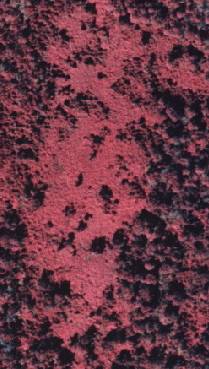
Field Picture
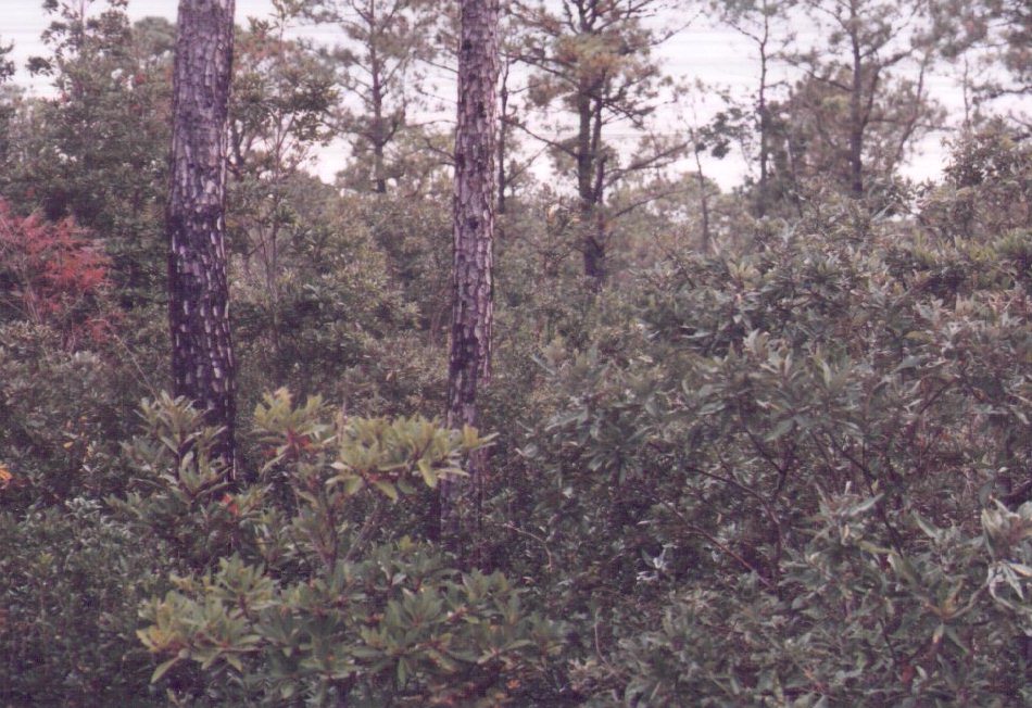
BACK TO CLASSIFICATION LIST
6170 Mixed Wetland Hardwoods
6170
- Mixed Wetland Hardwoods
LEVEL 1: 6000 Wetlands
LEVEL 2: 6100 Wetland Hardwood Forest
LEVEL 3: 6170 Mixed Wetland
Hardwoods
DESCRIPTION:
This class is a general class for
any wetlands hardwood forests that do not fall in to one of the other 6100
subclasses. Examples of this class
include bottomland and floodplain communities dominated by hardwoods;
willow swamps; and mixed hardwoods found in other landscape
positions.
Defined as a very broad class, 6170
may have species mixtures ranging from relatively homogeneous stands, such as
those dominated by red maple or willows, to a wide diversity of different
species. Species in the mixtures may include red maple, black gum, water oak,
sweetgum, willows, water hickory, water tupelo, water ash, chinese tallow,
magnolias and bays. Cypress is often present but not dominant
(under 25%).
KEYS TO PHOTOINTERPRETATION:
A number of different types of communities are included in this class,
with a broad range of signatures depending on species composition.
Signatures range from blue-gray, bright red to light pink, indicating a
diversity of different species.
Tree crowns are typically broad, except for inclusions of cypress, and
other narrower species.
CONTEXT:
Landscape Position - Wetland hardwood forests can occur on a
range of different landforms and hydrologic regimes, including floodplains and
bottomlands, basins and depressions, lake and coastal fringes, and disturbed
wet areas. Broad extents occur on wide floodplains along the delta region
of the Tensaw and Mobile Rivers and other major drainageways. Grady ponds are also dominated by mixed
hardwoods.
Vegetation - This community is comprised of a mixture of shrubs
and trees which either do not fit within any other category due to species
composition (i.e., neither willow or titi) or else has an unidentifiable mix of
species where none are predominant.
Soils - These communities occur in depressions which collect
silty sediments and are generally high in organics or on a variety of mineral
soils. Some organic layers are thick enough to qualify as a histic epipedon.
Hydrology - Wetness varies in these communities from temporary
inundation through long-term semi-permanent to permanent flooding.
SIMILAR CLASSES:
6110 Bay Swamps - scarlet red
signature year round
6210 Cypress - usually a grayish, or grayish green signature
6300 Wetland Forested Mixed - pine species achieve at least 33% crown canopy
cover
SPECIAL MAPPING CONVENTIONS:
In transitional areas where species
specific wetland and upland polygons are below the appropriate MMU some
aggregation may be justified. In these cases intermixed community classes will
be assigned and mapped at a larger unit.
Dual coding convention: This is a Land Cover class.
The LCCODE and LUCODE are the same. A separate land use code is not required.
DOQQ Image
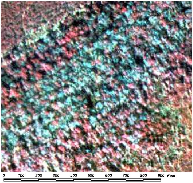
Field Picture
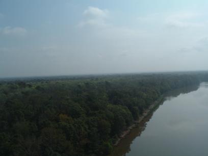
Delta
Region
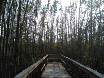
Grady Pond
BACK TO CLASSIFICATION LIST
6200 Wetland Coniferous Forest
6200
- Wetland Coniferous Forest
LEVEL 1: 6000 Wetlands
LEVEL 2: 6200 Wetland Coniferous Forest
DESCRIPTION:
This is an active Level 2 class that
should be applied only when one of the more specific Level 3 or Level 4
subclasses does not apply. This level 2
code when used is for hydric pine wetlands.
Wetland Coniferous Forests are
wetlands whose canopy is at least 67% dominated by wetland coniferous species
and are the result of natural generation.
KEYS TO PHOTOINTERPRETATION:
Over 66% of the canopy is composed of
coniferous species adapted to grow in hydric soils.
NRCS soils maps indicate hydric soils.
See the Level 3 and Level 4 class pages for
keys to interpreting these classes.
CONTEXT:
Landscape Position - Wetland coniferous
forests can be found almost anywhere in the project area where hydric
conditions exist and trees have not been cleared.
Vegetation - Cypress and pines
- both longleaf and slash pine - are the dominant coniferous species. Slash
pine is the dominant pine in the southern portion of the County, where it is
the only common pine. Water-tolerant hardwoods such as blackgum, swamp tupelo,
and red maple may be seen in association with cypress. Cabbage palm may also be
included in some areas.
Soils - Soils range from the semi-permanent
to permanent hydroperiods of cypress swamps to the sandy and acidic soils of
pine flatwoods, which are subject to brief seasonal inundation or saturation.
Hydrology - Hydrology ranges from
semi-permanent flooding to brief seasonal inundation.
SIMILAR CLASSES:
Wetland coniferous forests can appear similar to many of the Level 3 and Level
4 subclasses, depending on the species composition. See the respective key
pages for more information on how to differentiate these classes.
SPECIAL MAPPING CONVENTIONS:
Wetland sites that have been planted
over with pine are considered both pine plantation (LUCODE = 4410 or 4430) and
wetland (LCCODE = 6250 or 6300). The 1995 land cover maps, the County's
wetlands vegetation maps and NRCS soils are useful as collateral data.
Dual coding convention: This is a Land Cover class.
The LCCODE and LUCODE are usually the same. A separate land use code is not
generally required. However, if the community is also a pine plantation then
the LUCODE may be separately coded as 4410 Coniferous Plantation or 4430 Forest
Regeneration.
DOQQ Image
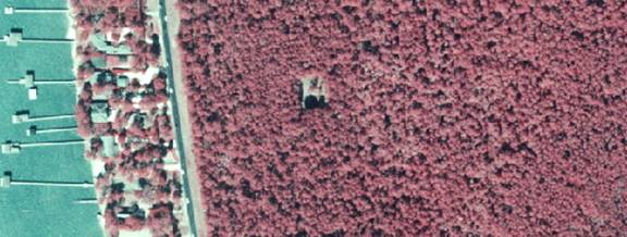
Field Picture
BACK TO
CLASSIFICATION LIST
6210 Cypress
6210
- Cypress
LEVEL 1:6000 Wetlands
LEVEL 2:6200 Wetland Coniferous Forest
LEVEL 3: 6210 Cypress
DESCRIPTION:
This class is for forested wetland communities
in which pond cypress or bald cypress comprises over 67% of the forest canopy.
In the case of pond cypress, common associates are swamp tupelo, slash pine and
black titi. In the case of bald cypress, common associates are water tupelo,
swamp cottonwood, red maple, american elm, pumpkin ash, carolina ash, overcup oak, and water
hickory. Bald cypress may be associated with laurel and water oaks, sweetgum
and sweetbay on drier sites.
Cypress trees are deciduous conifers with a
long leaf-off cold period, making them relatively easy to identify with winter
photography. Crowns are densely packed and pin-like, although some
larger, broader individuals may protrude above the rest or in isolation.
KEYS TO PHOTOINTERPRETATION:
Cypress species maintain at least a 67% dominance in the canopy.
Tree crowns are usually tightly packed.
Sites are flooded for long periods - typically 4 to 8 months in any
given year.
Usually grayish, or grayish green, puffy signature - classic
"Q-Tip" appearance.
Spring signature is often pink due to the regeneration of the cypress
needles.
Pine has a larger crown signature than cypress. Therefore, if an area
appears to be evenly split between pine and cypress, there is actually more
cypress than pine, and the polygon should be classified as 6210.
CONTEXT:
Landscape Position - Cypress is found in a variety of
situations, but typically requires prolonged inundation and periodic dry
spells. It occurs in long linear drainages as cypress "strands". It
may be present as a distinct community along the fringes of lakes, or in
bottomlands and floodplains associated with rivers. Cypress "heads" may also occur at
the beginning of drainage ways. It can also be part of the mix of hardwood
swamps or bay swamps wherever they occur.
Vegetation - Clearly dominated by cypress, either pond or bald.
Other species (water tolerant hardwoods) such as blackgum, swamp tupelo, red
maple, American elm, pumpkin ash, Carolina ash, overcup oak and water hickory
may be present as associates but these must not comprise more than 33% of the
system. Drier sites may include laurel and water oaks, sweetgum and bays.
Soils - Variable but generally poorly or very poorly drained.
Soils are very poorly drained and high in organics with a peat layer of varying
thickness on the surface.
Hydrology - Hydroperiods are semi-permanent to permanent in the
center of domes and swamps. There are also deep, prolonged seasonal
hydroperiods (e.g, next to rivers).
SIMILAR CLASSES:
6250 Wet Pinelands-Hydric Pine - generally brick red signature; understory of
grasses, and at times, shrubs
6300 Wetland Forested Mixed - a wide variety of textures and crown types,
depending on species
SPECIAL MAPPING CONVENTIONS:
Fringes of cypress community as
narrow as 30 feet wide should be mapped, if they meet minimum mapping units.
Dual coding convention: This is a Land Cover class.
The LCCODE and LUCODE are the same. A separate land use code is not
required.
DOQQ Image
Field Picture
BACK TO
CLASSIFICATION LIST
6250 Wet Pinelands - Hydric Pine Flatwoods
6250
- Wet Pinelands - Hydric Pine Flatwoods
LEVEL 1: 6000 Wetlands
LEVEL 2: 6200 Wetland Coniferous Forest
LEVEL 3: 6250 Wet Pinelands
- Hydric Pine Flatwoods
DESCRIPTION:
This class is for wetland coniferous
forests with a sparse to moderate canopy of longleaf and/or slash pine.
The "sparse to moderate"
tree canopy of this class is defined as a crown canopy closure of 25% or more.
It may be naturally generated, or
the result of pine plantations that are planted in rows through flatwoods
depressions. The understory is grasses, wiregrass, forbs and sometimes
sparse bay trees. If the wetland pine community is part of a pine
plantation (with rows evident), a land use code of either 4410 Coniferous
Plantation or 4430 Forest Regeneration is required, in addition to the 6250
land cover code.
Hydric pinelands appear similar to
mesic pine communities, but on careful inspection show decreased vigor and
height. The high water table favors hydrophytic shrubs, grasses, herbs,
gallberry and other typical upland species. Understories are comprised mostly
of grasses, with subdued color tones, and surface water is sometimes visible.
In the absence of fire, species such as loblolly bay may be visible in the
understory, imparting a bright reddish tone.
KEYS TO PHOTOINTERPRETATION:
Over 67% of the canopy is composed of coniferous pine species adapted to
grow in hydric soils.
NRCS soils maps indicate hydric soils.
Color tones on CIR are red brick, similar to uplands pine, but lack
brightness due to decreased vigor. In wetlands the trees tend to be more
widely spaced and appear somewhat stunted or ragged.
CONTEXT:
Landscape Position - This community can be found almost anywhere
in the project area where hydric conditions exist and trees have not been
cleared.
Vegetation - Slash pine is the dominant tree species, especially
in the southern part of the County, where it is the only common pine;
understory consists of grasses, wiregrass, forbs, and sometimes sparse saw
palmetto.
Soils - Soils are usually sandy and acidic, underlain by hardpan,
and subject to brief seasonal inundation or prolonged soil saturation.
Hydrology - Surface water may be visible following heavy rains.
SIMILAR CLASSES:
6260 Pine Savannah - The crown canopy closure is less than 25%.
6300 Wetland Forest Mixed - Conifers are not predominant.
SPECIAL MAPPING CONVENTIONS:
Wetland sites that have been planted
over with pine are considered both pine plantation (LUCODE = 4410 or 4430) and
wetland (LCCODE = 6250 or 6300). The 1995 land cover maps and NRCS soils
are useful as collateral data.
Dual coding convention: This is a Land Cover class.
The LCCODE and LUCODE are the same. A separate land use code is not required,
except in the case of plantations, as noted above.
DOQQ Image
Field Picture
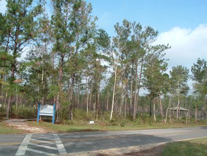
BACK TO
CLASSIFICATION LIST
6300 Wetland Forested Mixed
6300
- Wetland Forested Mixed
LEVEL 1: 6000 Wetlands
LEVEL 2: 6300 Wetland Forested Mixed
DESCRIPTION:
This class is used for wetland
forested communities in which neither hardwoods nor evergreen conifers achieve
a 67% dominance of the crown canopy composition, and where no other more
specific 6100 Wetland Hardwood Forest or 6200 Wetland Coniferous Forest class applies.
Mixed wetland forests occur on a
wide variety of soil moisture conditions, from permanently wet to seasonally or
infrequently wet.
A combination of hardwoods and
evergreen conifers can occur in nearly all the foregoing forested wetlands
communities, including cypress, bay swamps, hardwood swamps, hammocks and
depressions, floodplains and bottomlands. It is not possible to describe a
context that is representative.
The signatures will vary widely
depending on which combination of trees and understory species make up the
mixture.
KEYS TO PHOTOINTERPRETATION:
Forested systems composed of a mixture of hardwoods and evergreen
conifers in which neither species achieves greater than 67% dominance.
Species may include a mixture of deciduous and evergreen tree species
such as black gum, red maple, water oak, cabbage palm, bay trees and evergreen
conifers adapted to wet environments.
Will usually exhibit a variety of textures and crown types depending on
species present.
Open water or water staining may be evident where canopy is open.
Seasonality is an influence on photo signature, as hardwoods reflect
dormancy in winter months.
CONTEXT:
Landscape Position - This community could occur in almost any
slightly lowered position of the landscape where sufficient moisture exists to
support hydrophytic vegetation.
Vegetation - Dominated by an "even" mixture of
hardwoods and cypress. Neither cypress nor the hardwoods achieve 67% cover.
Soils - Generally found on mineral soils.
Hydrology - Hydroperiod is variable in this type due to the wide
range of species mixtures which can occur within this land cover type. Typical
conditions will likely be temporary to seasonal inundation, however.
SIMILAR CLASSES:
4340 Hardwood-Conifer Mixed - These
forests occur in upland environments, without the conditions to support wetland
species.
6100 Wetland Hardwood Forests (except mangroves) - These forests are dominated
by hardwood species, and while conifers may be present, they do not achieve
more than a 33% crown canopy closure.
6200 Wetland Coniferous Forests - These forests are dominated by coniferous
species, and while hardwoods may be present, they do not achieve more than a
33% crown canopy closure.
SPECIAL MAPPING CONVENTIONS:
These communities are likely
to be complex mixtures of different species. Individual plants or
trees may be dispersed in a matrix or grouped in patches. If distinct
patches of any class are greater than 1 acre, they are broken out separately.
In transitional areas where species specific wetland and upland polygons
are below the appropriate MMU some aggregation may be justified. In these cases
intermixed community classes will be assigned and mapped at a larger unit. PI's
must use discretion to accurately characterize the communities but avoid
excessive linework.
Dual coding convention: This is a Land Cover
class.The LCCODE and LUCODE are the same. A separate land use code is not
required.
DOQQ Image
Field Pictures
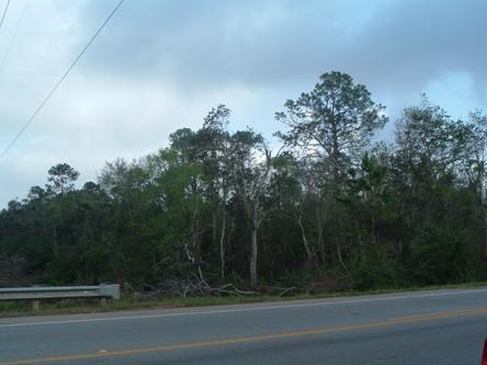
BACK TO
CLASSIFICATION LIST
*6400 Vegetated Non-Forested Wetlands
Vegetated Non-Forested Wetlands - FLUCCS Code 6400
This Level 2 class is not
used in the map itself - a more specific subclass must be selected. The
Level 3 subclasses are:
6410 Freshwater
Marshes/Graminoid Prairie-Marsh
6420 Saltwater Marshes/Halophytic Herbaceous Prairie
6430 Wet Prairies
6440 Emergent Aquatic Vegetation
Background: Vegetated, non-forested
wetlands include marshes and seasonably flooded basins and meadows. These
communities usually occur on level, low-lying areas. Sawgrass and cattail
are the predominant species in freshwater marshes while spartina and needlerush
are the predominant species in the saltwater marsh communities.
To be non-forested, the
tree canopy closure must be less than 25%. Trees are defined as woody
plants that are over 20 feet in height.
MAPPING CONVENTIONS:
Minimum mapping units: The minimum
mapping unit (MMU) for wetlands is 1 acre. Upland areas that occur
as "islands" within wetlands systems are broken out down to .25
acres. Adjacent uplands obey the standard MMU of 1 acre, unless otherwise
defined.
Differentiating
subclasses: The 4 subclasses are defined by their respective characteristic
plant species. The communities can only be identified by the signatures of
individual species, rather than by the general colors, textures and patterns.
This generally requires extensive experience in the field comparing features
against the photography. There is substantial room for confusion based
on the similar signatures that these subclasses present. The problem is
addressed with experience, ancillary data, magnified stereo viewing of imagery
and field checking.
See the PI keys for each
of the subclasses for indicators that assist in differentiation.
Dual coding
convention: All of the 6400 classes are Land Cover classes that do not
normally require a separate dual code - LCCODE and LUCODE are normally the
same. However, in rare cases, a separate land use code is required.
Relevant examples are marshes and prairies on reclaimed and abandoned mining
areas, which may require separate dual coding. Wetlands that are
also pastures or pine plantations are dual coded accordingly, with the wetland
code always assigned to the LCCODE field.
SIMILAR CLASSES:
The most common source
of confusion with this class is between non-forested wetlands and water bodies.
In general, the PI is required to map the area as it appears on the source
photography - if there is a black return without sign of emergent vegetation a
water class would be applied. Since the wetted area can change rapidly in flat
terrains, this causes some inconsistencies between different maps, and can only
be considered a "snapshot" of the hydrologic regime in many
cases.
In view of the ephemeral
nature of water bodies and the complex intermixtures of signature, it is not
always cost effective to delineate every minute boundary. Some
aggregation often presents a more accurate and more useful model for users.
Another source of
confusion is that between wet prairies and uplands pastures. These may be
difficult to determine on photography, and collateral data such as NRCS soils
is likely to be helpful.
For more information:
See the PI keys for each
of the subclasses for more details and graphic examples.
BACK TO
CLASSIFICATION LIST
6410 Freshwater Marshes / Graminoid Prairie - Marsh
6410
- Freshwater Marshes/Graminoid Prairie-Marsh
LEVEL 1: 6000 Wetlands
LEVEL 2: 6400 Vegetated Non-Forested Wetlands
LEVEL 3: 6410 Freshwater
Marshes/Graminoid Prairie-Marsh
DESCRIPTION:
This class is used for wetlands communities
characterized by herbaceous plant species that occur on sites where surface
water is present for extended periods during the growing season, but is absent
by the end of the growing season in most years.
Freshwater marshes tend to be open
expanses of grasses, sedges, rushes and other types of herbaceous plants.
Periods of inundation are intermediate between deep marshes (6440 Emergent
Aquatic Vegetation) and wet prairies (6430 Wet Prairies) - sites are usually
covered with water at least two months of the year, and undergo prolonged
periods of soil saturation.
KEYS TO PHOTOINTERPRETATION:
Signatures are very diverse, as a result of the variety of plant
assemblages and land forms that make up freshwater marshes. Monocultures of
sawgrass or cattail have smooth, uniform signatures. More diverse,
non-graminoid communities may have more patchy and irregular signatures with a
variety of height, colors and textures.
Scattered shrubs and trees may be present, especially on drier sites and
in the absence of fires.
The sites typically have a coarse textured organic surface soil over
soft organic muck substrates. NRCS soils maps indicate muck soils.
CONTEXT:
Landscape Position - Marshes are usually encountered along
rivers, streams or lakes in floodplain situations. They also occur in
depressional situations with water supplied by rainfall or groundwater. Basin
marshes are often former lake or pond systems which are progressing along the
ecological process to a drier community. Many of these communities are found
within pasture settings.
Vegetation - Dominated by herbaceous vegetation including
pickerelweed, arrowhead, maidencane, common reed, arrowroot, switch grass,
cordgrass and bulrush.
Soils - Very poorly drained, mineral or organic.
Hydrology - These communities are seasonally to permanently
flooded and many only dry out during extended droughts.
SIMILAR CLASSES:
4430 Forest Regeneration
- Wet areas with marsh-like signatures are often observed where land
has been cleared for pine plantations. These areas are not identified as 6410
unless the natural vegetation is still present.
5000 Water - High water conditions at the time of photography may cover over
the emergent vegetation in some marsh systems. These areas are coded as water
bodies, even though collateral data may identify them as 6410 Freshwater
Marshes or 6430 Wet Prairies, due to their open water signature at the time of
photography.
5250 Marshy Lake - Water and vegetation are
intermixed in patchy patterns with indistinct boundaries that are difficult to
delineate separately.
6430 Wet Prairies - These generally have less water and shorter herbage.
6440 Emergent Aquatic Vegetation - Signatures are variable, including bright
pinks or mottled reds and grays, depending on species.
SPECIAL MAPPING CONVENTIONS:
Areas dominated by sawgrass are
included in this class, unless they are 10 acres in size or greater, in which
case they are mapped at Level 4 as 6411 Freshwater Marsh - Sawgrass.
Where other freshwater marsh species
are observed in a larger sawgrass community, the freshwater marsh portion is
not delineated separately unless it is greater than 10 acres.
Marshes may have a complex, patchy
distribution of different species groups, open water, and other communities.
In transitional areas where species-specific wetland and upland polygons are
below the appropriate MMU some aggregation may be justified. In these cases
intermixed community classes will be assigned and mapped at a larger
unit. The map should accurately characterize the communities but avoid
excessive linework.
Dual coding convention: This is a Land Cover class.
The LCCODE and LUCODE are the same. A separate land use code is not required.
DOQQ Image
Field Picture
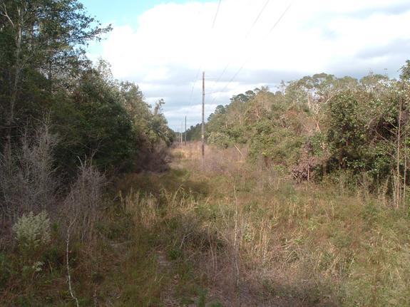
BACK TO
CLASSIFICATION LIST
6420 Saltwater Marshes / Halophytic Herbaceous Prairie
6420
- Saltwater Marshes/Halophytic Herbaceous Prairie
LEVEL 1: 6000 Wetlands
LEVEL 2: 6400 Vegetated Non-Forested Wetlands
LEVEL 3: 6420 Saltwater Marshes/Halophytic
Herbaceous Prairie
DESCRIPTION:
This class is used for wetlands
communities of nonwoody, salt-tolerant plants occupying intertidal zones that
are at least occasionally inundated with salt water. They exist at the
interface of land and marine waters, wherever wave energy is sufficiently low
to allow their development and where mangrove trees are not dense enough to
shade out the characteristic vegetation.
Within these constraints, the areal
extent of saltwater marshes is determined in large part by the size of the
intertidal zone. Regions of low relief and high tidal range are likely to have
extensive salt marshes.
Note: The saltwater marsh is an
early successional community in South Alabama. These areas are generally taken over by mangroves,
especially within mosquito impoundments.
KEYS TO PHOTOINTERPRETATION:
Marshes present a smooth textured appearance with vegetation generally
below 3 feet. Color tones are greenish to whitish-green, varying with
predominant species.
A distinct watershed and network of drainage creeks (tidal channels) is
often present.
A bare, whitish area, or "salt pan" may be visible in flatter
areas near the landward limit of salt marshes.
Some dikes may be visible. Large areas have been impounded for mosquito
control.
Vast expanses of vegetation are separated into distinctive zones, often
with abrupt boundaries.
Light pinkish-red of young mangroves may be visible in these
communities, but are not dominant.
CONTEXT:
Landscape Position - This community occurs in low energy coastal
and estuarine environments with sufficiently high salinities to support these
salt community species.
Vegetation - Dominant species include: cordgrasses, needlerush,
seashore salt grass, saltwort, sea oxeye daisy, glassworts and fringerush.
These species are generally short - less than three feet tall.
Soils - Very poorly drained and usually mucky, sandy clay loams
or saline sands.
Hydrology - Tidal fluctuations directly influence the hydrology.
SIMILAR CLASSES:
5430 Enclosed Saltwater Ponds Within
Salt Marsh - These have an open water signature and are often impounded by
levees.
6500 Non-Vegetated Wetlands - See decision rules used to differentiate tidal
flats. Tidal flats under 1 acre found within saltwater marshes are mapped
as open water or saltwater marsh depending on context.
6510 Tidal Flats - These are non-vegetated, or with only sparse vegetation.
SPECIAL MAPPING CONVENTIONS:
Marshes may have a complex, patchy
distribution of different species groups, open water, and other
communities. In transitional areas where species specific wetland and
upland polygons are below the appropriate MMU some aggregation may be
justified. In these cases intermixed community classes will be assigned and
mapped at a larger unit.
Dual coding convention: This is a Land Cover class.
The LCCODE and LUCODE are the same. A separate land use code is not required.
DOQQ Image
Field Picture
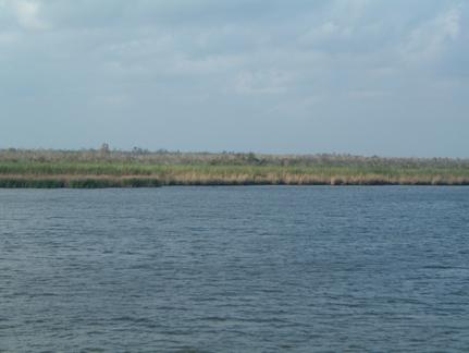
BACK TO
CLASSIFICATION LIST
6430
Wet Prairies
6430
- Wet Prairies
LEVEL 1: 6000 Wetlands
LEVEL 2: 6400 Vegetated Non-Forested Wetlands
LEVEL 3: 6430 Wet Prairies
DESCRIPTION:
This class is composed of
predominantly grassy vegetation on wet soils and is usually distinguished from
marshes by having less water and shorter herbage.
Wet Prairies are communities of
grasses, sedges, rushes, and herbs typically dominated by sand cordgrass,
maidencane, or a mixture of species. They are subject to frequent fire, and
naturally occur on mineral soils that are inundated for a relatively short
duration each year, but with prolonged soil saturation.
KEYS TO PHOTOINTERPRETATION:
Less water and shorter herbage than marshes.
Usually found in smaller depressional areas.
A darker, almost stain-like area in a grassy area.
Usually associated with rangeland or pasture.
Communities of grasses, sedges, rushes, and herbs typically dominated by
sand cordgrass, maidencane, or a mixture of species.
Usually on mineral soils that are inundated for a relatively short
duration each year but with prolonged soil saturation.
Subject to frequent fire.
CONTEXT:
Landscape Position - Wet prairies occur in depressions in the
landscape within flatwoods and pastures, and are also found at the edges of
cypress domes and marshes. Conditions supporting wet prairies may also
support forested depressions or wetland savannahs under other management and
fire regimes. They may also result from alterations of hydrology, such as former
marshes that are drying out from artificial drainage or groundwater
drawdowns; or former low flatwoods with a rising water table due to
impoundment or precipitation. With these varying conditions, wet prairies can
be found throughout the County.
Vegetation - Dominated by wiregrasses, spike rushes, beak rushes,
yellow- eyed grass, white top sedge, sand cordgrass, maidencane and St. Johns wort.
Soils - Generally poorly to very poorly-drained acidic sands with
varying amounts of organic matter and an underlying layer of clay or hardpan.
Hydrology - Hydroperiods are generally seasonal but water may
persist for more than three months.
SIMILAR CLASSES:
4430 Forest Regeneration - Wet
prairie-like signatures are often observed where land has been cleared for pine
plantations. If these areas are actually wetlands they are coded 6430 - if they
are used for pine regeneration the 4430 code is also applied as a land use
code.
5000 Water - Seasonal high water conditions at the time of photography may
cover over the herbaceous vegetation in some wet prairies. These areas are
coded as water bodies, even though collateral data may identify them as 6410
Freshwater Marshes or 6430 Wet Prairies
6180 Cabbage Palm Savannahs - A very similar signature is present, but there is
also a sparse canopy of palms.
6410 Freshwater Marshes - More water and more broad-leaved species present
different signatures.
SPECIAL MAPPING CONVENTIONS:
Wet prairies may have a complex,
patchy distribution of different species groups and other communities. In
transitional areas where species specific wetland and upland polygons are below
the appropriate MMU some aggregation may be justified. In these cases
intermixed community classes will be assigned and mapped at a larger unit.
Dual coding convention: This is a Land Cover class.
The LCCODE and LUCODE are the same. A separate land use is not required.
DOQQ Image
Field Picture
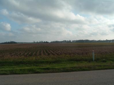
BACK TO CLASSIFICATION
LIST
6440 Emergent Aquatic Vegetation
6440
- Emergent Aquatic Vegetation
LEVEL 1: 6000 Wetlands
LEVEL 2: 6400 Vegetated Non-Forested Wetlands
LEVEL 3: 6440 Emergent
Aquatic Vegetation
DESCRIPTION:
This class is for flooded (aquatic)
areas with emergent or floating vegetation. It includes communities otherwise
known as deep marsh or floating marsh. In the absence of vegetation these
areas would be classed as water bodies, which indeed they are. Submerged
aquatic vegetation (SAV) is not included in this class or in the land cover
data layer. It is generally included with open water.
Four of the most common emergent
aquatic communities are described below:
Deep Marsh - Deep water wetlands
dominated by a mixture of water lilies and deep water emergent species.
Semi-permanently to permanently flooded.
Lakeshore Emergents - Emergent
vegetation growing along lake shores and usually semi-permanently flooded. Panicum
hemitomon and species of Scirpus are most common.
Water Lilies–- Floating-leaved
species in the genera Nymphaea, Nuphar, Nelumbo, Brasenia
and Nymphoides. Usually semi-permanently to permanently flooded.
Floating Marshes - Communities of
free-floating plants (such as water hyacinth, water lettuce, or Lemna) or floating mats of rhizomatous
species (such as alligator weed or various grasses and sedges).
The FLUCCS system includes five
subclasses of emergent aquatic species: Water lettuce, Spatterdock, Water
hyacinth, duck weed, and water lily. These subclasses are not active in
this data layer.
KEYS TO PHOTOINTERPRETATION:
Deep water wetlands dominated by free-floating plants, such as water
lilies, water hyacinth, water lettuce, or lemna, or floating mats of
rhizomatous species, such as alligator weed or various grasses and sedges.
Signatures are variable, including bright pinks or mottled reds and
grays, depending on species. Distinct smooth red signatures caused by floating
plants are strong indicators of deep marsh.
CONTEXT:
Landscape Position - Emergent aquatics are found in depressed
areas, solution holes, ponds, lakes, canals, rivers, streams and other areas
where persistent water prevents the growth of other plants. These areas
are permanently inundated and only dry out during extended droughts or
artificial drawdowns.
Vegetation - Community dominated by floating or emersed aquatic
plants including spatterdock, water lily, water lettuce, water hyacinth,
duckweed and salvinia.
Soils - Substrates for this community will be highly organic
silts accumulated over otherwise sandy or sandy loam soils which are very
poorly-drained.
Hydrology - These areas are permanently inundated and only dry up
during extended droughts.
SIMILAR CLASSES:
5000 Water - including areas of
submergent aquatic vegetation
6410 Freshwater Marshes - The context is not aquatic. Plants are typically
taller and less open water is visible.
SPECIAL MAPPING CONVENTIONS:
Where emergent aquatic vegetation is
observed in a larger freshwater marsh of mixed species, the emergent aquatic
portion is not delineated separately unless it is greater than 10 acres.
Dual coding convention: This is a Land Cover class.
The LCCODE and LUCODE are the same. A separate land use code is not
required.
DOQQ Image
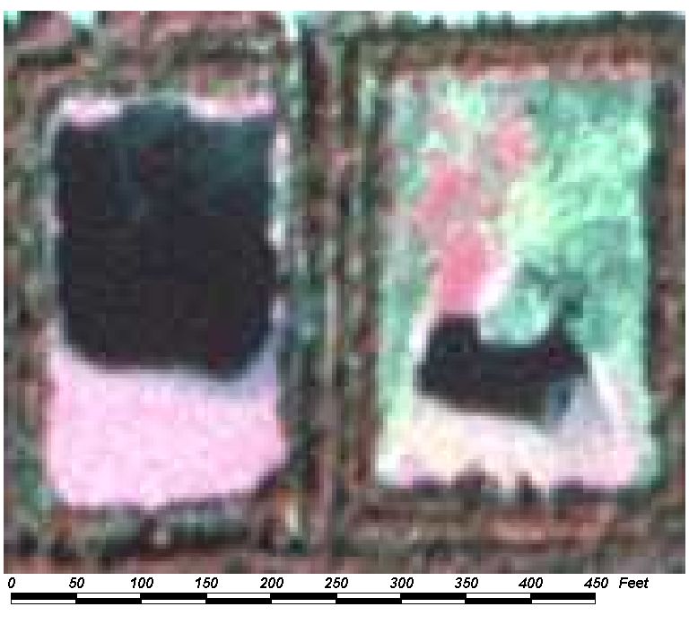
Field Picture
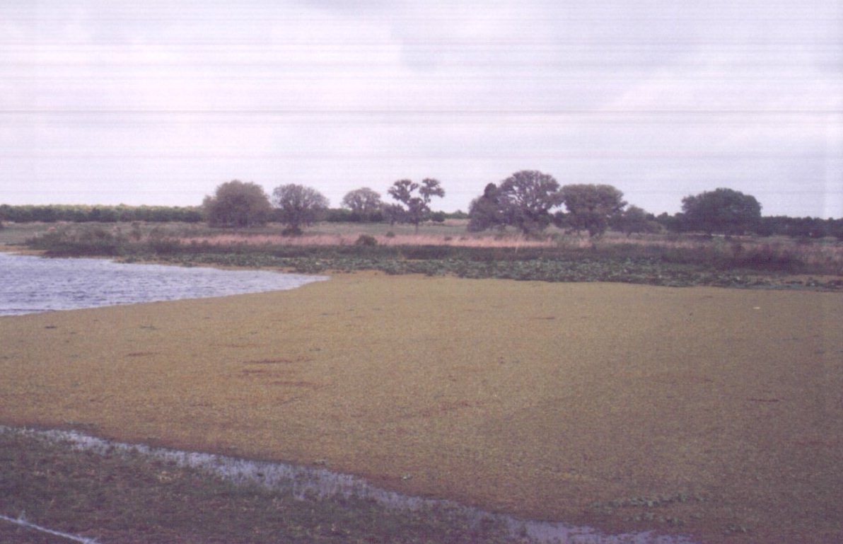
BACK TO
CLASSIFICATION LIST
6500 Non-Vegetated Wetland
6500
- Non-Vegetated Wetlands
LEVEL 1: 6000 Wetlands
LEVEL 2: 6500 Non-Vegetated Wetlands
DESCRIPTION:
Non-Vegetated Wetlands are hydric surfaces
that lack vegetation due to reasons such as those below:
- The erosional effects of wind and water may
transport surface materials so rapidly that the establishment of plant
communities is hindered;
- The fluctuation of the water surface level is
such that vegetation cannot become established;
- Submerged or saturated substrates may develop
toxic conditions of extreme acidity or salinity.
Tidal flats, shorelines and
intermittent ponds are the most common examples of this class. Also included are
barren salt flats on higher grounds resulting from surface evaporation.
NOTE: Tidal Flats are classified at Level
4 as 6510 Tidal Flats.
KEYS TO PHOTOINTERPRETATION:
Hydrologic changes or toxic conditions (salinity, acidity, chemical or
thermal pollution) prevent plant growth.
White signatures are characteristic of dry or sandy areas.
Examples are tidal mud flats, tidal sand flats, shorelines, intermittent
ponds, salt flats.
CONTEXT:
Landscape Position - This class usually occurs on areas where
water fluctuations are too rapid to permit establishment of plant communities.
Vegetation - These areas are generally unvegetated.
Soils - Substrate can range from mud and sand to rocks.
Hydrology - Water fluctuation is a distinguishing characteristic.
SIMILAR CLASSES:
5250 Marshy Lake - Water and vegetation are
intermixed in patchy patterns with indistinct boundaries that are difficult to
delineate separately.
5410 Embayments Opening Directly to Bay or Gulf - will have a more open water
signature than tidal flats
5420 Embayments Not Opening Directly to Bay or Gulf - will have a more open
water signature than tidal flats
5430 Enclosed Saltwater Ponds Within Salt Marsh - These generally appear as
open water and do not have a direct hydrologic connection to coastal waters.
6420 Saltwater Marshes - These have at least 25% vegetative cover.
7200 Sand Other Than Beaches - These have no influence by fluctuating water
levels.
SPECIAL MAPPING CONVENTIONS:
This class is one of the most
problematic of the FLUCCS land cover classes to map, for the following reasons:
- The ability to recognize tidal flats depends on
tide stage - during high tides this feature is submerged. Therefore
the resulting maps may only provide a "snapshot" varying with
tidal stage.
- Tidal channels occurring within salt marshes are
often too narrow and complex to allow complete delineation within this
project's scope. For this reason a 5 acre MMU is used.
- The actual coastline should technically be drawn
at the mid point of tidal stage. That requires information resources
beyond the scope of the mapping project. For more accurate
coastlines other maps, such as those of USGS or NOAA, should be
consulted.
- Barren salt flats may pop up in surprising locations
and look like dry, sandy areas. Collateral data is required.
The minimum mapping unit for this
class is 1 acre.
Dual coding convention: This is a Land Cover class.
The LCCODE and LUCODE are the same. A separate land use code is not
required.
DOQQ Image
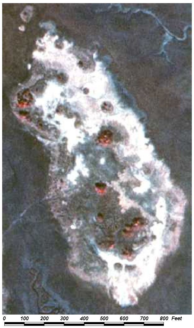
Field Picture
BACK TO
CLASSIFICATION LIST
6510
Tidal Flats
6510
- Tidal Flats
LEVEL 1: 6000 Wetlands
LEVEL 2: 6500 Non-Vegetated Wetlands
LEVEL 3: 6510 Tidal
Flats
DESCRIPTION:
Tidal Flats are non-vegetated,
shallow-water habitats situated between the low and high tide limits. Their
substrate is soft to semi-soft sand or mud. They are found where sediments
accumulate and are usually bordered landward by Spartina alterniflora
marshes and seaward by tidal channels or subtidal seagrass beds.
An important characteristic of this
class is its alternating tidal cycle of submergence and exposure to the
atmosphere.
KEYS TO PHOTOINTERPRETATION:
Signatures are very wet sand or mud giving a dark grey or greenish grey
tone and very smooth texture.
If the tide is not completely out and substrates are somewhat sandy, the
return may be a light or whitish blue.
Examples are tidal mud flats, tidal sand flats, shorelines, intermittent
ponds, salt flats.
CONTEXT:
Landscape Position - Tidal flats occur in the shallower portions
of estuaries and bays which are protected from intense wave action. They are
found along the shorelines and in tidal channels or openings in the salt marsh
and mangrove communities.
Vegetation - This category is unvegetated by definition.
Soils - Substrates are saline sands and muds.
Hydrology - Intermittently exposed or regularly flooded (and
exposed) by daily tidal action.
SIMILAR CLASSES:
5100 Streams and Waterways - dark
blue or black signature, indicating deeper water
5410 Embayments Opening Directly to Bay or Gulf - will have a more open water
signature than tidal flats
5420 Embayments Not Opening Directly to Bay or Gulf - will have a more open
water signature than tidal flats
5430 Enclosed Saltwater Ponds Within Salt Marsh - not situated between high and
low tide limits
6420 Saltwater Marshes - characterized by expanses of grasses, sedges, rushes,
and other herbaceous plants
7200 Sand Other Than Beaches - not associated with water; usually
wind-deposited
SPECIAL MAPPING CONVENTIONS:
This class is one of the most problematic
of the FLUCCS land cover classes to map, for the following reasons:
- The ability to recognize tidal flats depends on
tide stage - during high tides this feature is submerged. Therefore
the resulting maps may only provide a "snapshot" which will vary
depending on tidal stage.
- Tidal channels occurring within salt marshes are
often too narrow and complex to allow complete delineation. For this
reason, they may sometimes be aggregated into the surrounding marsh in
order to avoid overly complex linework.
- The actual coastline should technically be drawn
at the mid point of tidal stage. This requires information resources
beyond the scope of the mapping project. For more accurate coastline
determination other maps, such as those of USGS or NOAA, should be
consulted.
- Barren salt flats may appear in locations which
can be mistaken for dry, sandy areas. Collateral data is required.
Dual coding convention: This is a Land Cover
class. The LCCODE and LUCODE are the same. A separate land use code is not
required.
DOQQ Image
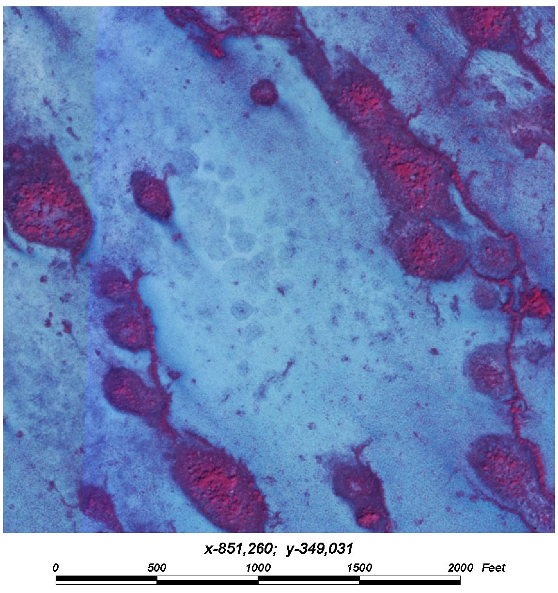
Field Picture
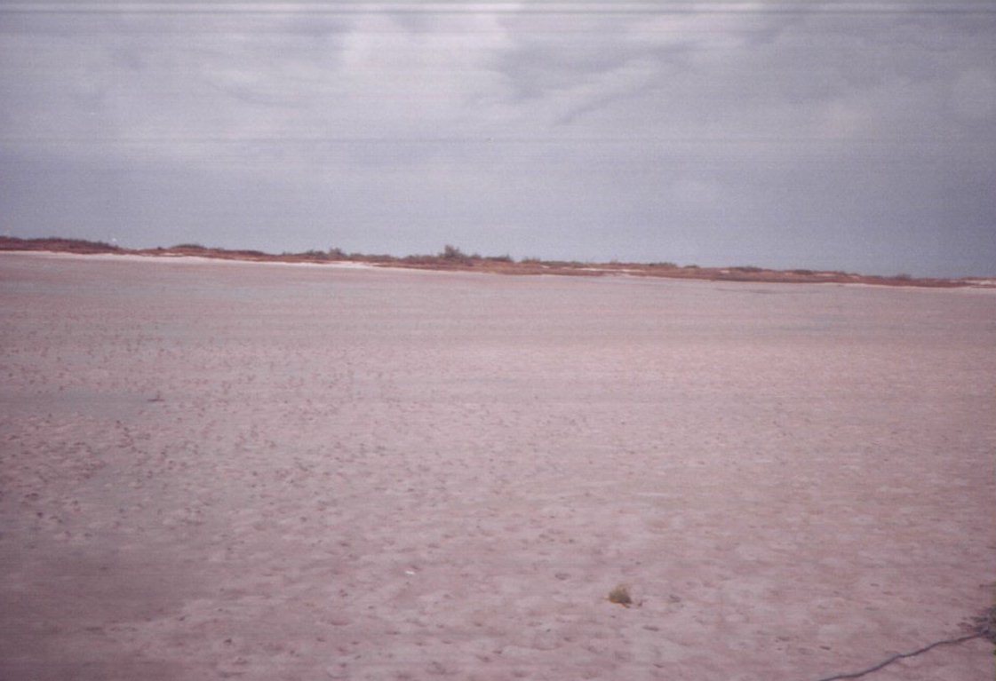
BACK TO
CLASSIFICATION LIST
6530 Intermittent Ponds
6530
– Intermittent Ponds
LEVEL 1: 6000 Wetlands
LEVEL 2: 6500 Non-Vegetated Wetlands
LEVEL 3: 6530
Intermittent Ponds
DESCRIPTION:
Intermittent ponds are un-vegetated
wetlands that exist for only a portion of the year. It’s existence relies upon water received
directly precipitation and runoff.
An important characteristic of this class
is its alternating cycle of flooding during the rainy season and after
significant rainfall.
KEYS TO PHOTOINTERPRETATION:
Signatures are defined rings around sand and mud in low lying areas of
varying color, usually gray and white colors.
If holding water on photography, the return may be a light or whitish
blue.
Some areas may have drainage canal coming from them in agricultural
areas.
CONTEXT:
Landscape Position - This class usually occurs on areas where
water fluctuations are too rapid to permit establishment of plant communities.
Vegetation - These areas are generally un-vegetated.
Soils - Substrate can range from mud and sand to rocks.
Hydrology - Water fluctuation is a distinguishing characteristic.
SIMILAR CLASSES:
5100 Streams and Waterways - dark
blue or black signature, indicating deeper water
6430 Wet Prairies are difficult to distinguish but typically show signs of
vegetation.
6420 Saltwater Marshes - characterized by expanses of grasses, sedges, rushes,
and other herbaceous plants
7200 Sand Other Than Beaches - not associated with water; usually
wind-deposited
SPECIAL MAPPING CONVENTIONS:
- Usually occupies a small depression in
agriculture or pasture lands.
Dual coding convention: This is a Land Cover class.
The LCCODE and LUCODE are the same. A separate land use code is not required.
BACK TO
CLASSIFICATION LIST
*7000 BARREN LAND
Barren Land - FLUCCS Code 7000
This Level 1 class is
not used in the map itself - a more specific subclass must be selected. The
Level2 subclasses include:
7200 Sand Other Than Beaches
7300 Exposed Rock
7400 Disturbed Land
7420 Borrow Areas
7430 Spoil Areas
For details on each, see
the respective PI Key pages.
Background: Barren land has very
little or no vegetation and limited potential to support vegetative
communities. In general, it is an area of bare soil or rock. Vegetation, when
present, is very sparse and scrubby. Not all barren areas will be coded as such
- barren land may temporarily exist due to human activity. In such cases the
mapping unit may be coded with the specific land use, or dual coded with both
the land cover and a separate land use code.
Barren land classes are
all Land Cover classes that are frequently used together with a
Land Use code, such as 1180 Rural Residential or 1670 Abandoned Mining Land. Possible dual
coding combinations are listed below under Dual Coding Conventions.
However, in most cases of disturbed areas, the land cover type is not required
- examples are industrial areas, land fills, active mining operations, and
others listed below under Similar Classes.
The Barren classes apply
only to upland areas. Non-vegetated wetlands, such as tidal flats and
salt flats, are assigned the appropriate 6500 code. Borrow areas that are
saturated or inundated are mapped as either Wetlands or Water.
MAPPING CONVENTIONS:
Minimum mapping units: The minimum
mapping unit for all 7000 Barren Land classes is 1 acre.
Differentiating
subclasses: Subclasses are not difficult to differentiate. Note that -
7200 Sand Other Than Beaches - applies to undisturbed areas, in contrast with
the 7400 classes.
Dual coding
convention: All of the 7000 classes are Land Cover classes. The LCCODE
and LUCODE are usually the same. However some subclasses may be used to
describe the land cover for various land use classes such as 1180 Rural
Residential, 1650 Reclaimed Mine Land, 1670 Abandoned Mine Land, 1900 Open Land , 1920 Inactive Land
With Street Pattern and others.
SIMILAR CLASSES:
1190, 1290, 1390, etc. -
Any of the 'Residential Under Construction' classes can be disturbed, but are
not dual coded with 7000s.
1500 Industrial - Industrial areas, particularly heavy industry, are often
disturbed and unvegetated.
1600 Extractive - Active mining areas will appear disturbed, but are not
classed as 7000. Use a 7000 class only for reclaimed or abandoned areas,
with dual coding to show both land cover and land use.
2000 Agriculture. Fields that are unvegetated because they are fallow or
under preparation and cultivation may be confused with Barren Land. The context
should be considered.
3000 Upland Non-Forested - These areas will have vegetation. There may be
inclusions of Barren Land, which should be broken
out if large and distinct.
4430 Forest Regeneration. These may appear
unvegetated when trees are small. PIs should look carefully at the
forestry context.
6500 Non-Vegetated Wetlands - These will be in areas where water levels
fluctuate.
For more information:
See the PI keys for each
of the subclasses for more details and graphic examples.
BACK TO
CLASSIFICATION LIST
7100 Beaches Other Than Swimming Beaches
7100
- Beaches Other Than Swimming Beaches
LEVEL 1: 7000 Barren Land
LEVEL 2: 7100 Beaches Other Than Swimming Beaches
DESCRIPTION:
This class includes saltwater and
freshwater beach areas that are not accessible from land and are not publicly
owned. No recreational structures or facilities are present.
This class includes some of the County’s
beach segments along the Gulf of Mexico. It also includes beaches along bays, estuaries, and
freshwater systems if they meet minimum size criteria.
KEYS TO PHOTOINTERPRETATION:
Parking areas are not present.
These are naturally forming sand formations which are typically white to
light gray on the photography.
CONTEXT:
Landscape Position - The presence of residential, commercial, or
other recreational uses in the vicinity of the beach is a confirmation of this
class. Accessibility from land by roads is also sufficient to assume
recreational uses. There are few beach segments along the Gulf of Mexico that are not used for recreational
purposes.
SIMILAR
CLASSES:
7200 Sand Other Than Beaches - dunes or other sand areas not part of a beach
6500 Non-Vegetated Wetlands - generally tidal flats and shorelines
1810
Swimming Beaches – These beaches will show definite land accessibility and
recreational facilities.
SPECIAL MAPPING CONVENTIONS:
Baldwin County classifies most coastal beaches as
1810, based on their accessibility for recreation, whether or not constructed
facilities are present.
This class generally refers to a
sandy, non-vegetated, strip of land along the Bay or Gulf. It may have
inclusions of vegetation or other land uses that are too small to meet minimum
size criteria.
Beaches are mapped where visible if
they meet the minimum area criteria of 1 acre.
Dual coding convention: This is a Land Use
class. The LUCODE and LCCODE are the same. A separate land cover code is not
required.
7200 Sand Other Than Beaches
7200
- Sand Other Than Beaches
LEVEL 1: 7000 Barren Land
LEVEL 2: 7200 Sand Other Than Beaches
DESCRIPTION:
Sand Other Than Beaches refers to
natural, sandy, un-vegetated areas - usually dune sands. Dunes are of
aeolian (wind transported) origin and are composed of sand grains deposited
downwind from a natural source of sand. Dune sizes vary greatly with diameters
ranging from a few feet to more than several hundred feet. Their heights also
vary and their shapes display considerable variety. Where the dunes are the
major feature, shore and strand lines, coastal plains, river flood plains and
deltas are secondary.
This class is not restricted to dune
sands as bare sands exist in other forms, such as other un-vegetated areas of
open sand, which do not fit within the other land use categories of "Under
Construction."
Use of this class requires presence
of less than 10 percent vegetative cover within the polygon.
KEYS TO PHOTOINTERPRETATION:
Characteristic bright white out-cropping occurring in areas of sand
deposition or historic dunes.
May be of various sizes and often occur as ridges or on slopes where
vegetation cannot grow due to lack of soil accumulation.
Not associated with water (at present time); may be wind deposited.
CONTEXT:
Landscape Position - This land use may occur anywhere within the
project area. Where it occurs away from the coast or a water body, it generally
is the result of some form of disturbance. The interpreter is therefore
cautioned to look for other land use activities occurring in the area to
determine if this code is correct or if another code should be applied.
Vegetation - Dune features in inland areas are usually vegetated,
not barren.
Soils - Sand is generally the only soil type present.
SIMILAR CLASSES:
1810 Swimming Beach - generally
linear features accessible for recreation; parking lots may be visisble
6500 Non-Vegetated Wetland - influenced by water level fluctuations
Also, see 'Similar Classes' in the 7000 General Description
SPECIAL MAPPING CONVENTIONS:
The minimum mapping unit for this
class is 1 acre. Linear features as narrow as 30 feet are mapped.
Dual coding convention: This is a Land Cover
class. The LUCODE and LCCODE are generally the same. A
separate land use code may be required in rare exceptions- for instance, if
dunes occur in conjunction with uses such as 1180 Rural Residential or 1920
Inactive Land With Street Patterns.
DOQQ Image
Field Picture
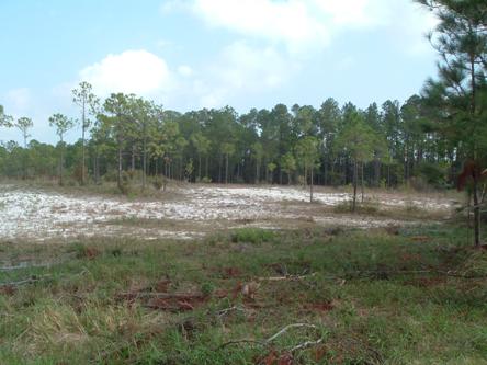
BACK TO
CLASSIFICATION LIST
7300
Exposed Rock
7300
- Exposed Rock
LEVEL 1: 7000 Barren Land
LEVEL 2: 7300 Exposed Rock
DESCRIPTION:
This class consists of exposed
bedrock and other accumulations of rock materials lacking vegetative cover.
Exposed bedrock, when weathered, may be lacking vegetation due to the fine soil
materials being removed by the actions of wind and water.
Use of this category requires
presence of less than 10 percent vegetative cover within the polygon.
KEYS TO PHOTOINTERPRETATION:
rough textured, light colored appearance
a sprinkling of magenta or reddish tones indicating scattered vegetation
CONTEXT:
Landscape Position - It may be found anywhere in the County, and
also in abandoned quarry areas which have reverted to native vegetative types.
(Also see Special Mapping Conventions)
SIMILAR CLASSES:
1500 Industrial - Some Industrial operations are often disturbed and
unvegetated.
1600 Extractive - Parts of some of the Extractive classes may appear as rock,
but are included in their Extractive class.
7400 Disturbed Land - The soil or substrate has been
altered by human activity.
SPECIAL MAPPING CONVENTIONS:
This class is found interspersed
with marsh grass in coastal areas.
Dual coding convention: This is a Land Cover
class. The LUCODE and LCCODE are the same. A separate
land use code is not required.
DOQQ Image
Field Picture
BACK TO
CLASSIFICATION LIST
7400 Disturbed Land
7400
- Disturbed Land
LEVEL 1: 7000 Barren Land
LEVEL 2: 7400 Disturbed Land
DESCRIPTION:
This is the general Level 2 class for
barren and/or disturbed lands. It is only used where the more specific
Level 3 classes (7420 or7430) do not apply.
These are areas where soil and/or
substrate has been altered or removed by human activity. The cause of
disturbance is not always known - for example, this code may be used with the
land use class 1900 Open Land, which may be land in transition
and without a recognizable intended use.
The barren classes apply only to
upland areas. Non-vegetated wetlands, such as tidal flats and salt flats,
are classified in the appropriate wetlands class. Borrow areas that are
saturated or inundated are mapped as wetlands or water.
KEYS TO PHOTOINTERPRETATION:
Soil and/or substrate has been altered or removed by human activity.
Signatures are typically white or white with mottling due to
regenerating vegetation.
The ground may appear scraped and worked, usually with angular or
geometric boundaries.
There may be evidence of old machinery, possibly abandoned without
visible cause.
The lack of vegetation cannot be attributed simply to fire damage.
CONTEXT:
Landscape Position - These areas can be found in any part of the
County, and may be extensive in size. They are more common in former
mining areas and in transitional urban areas.
Vegetation - Barren land has very little or no vegetation and
limited potential to support vegetative communities. In general, it is an
area dominated by bare soil, but may have some very sparse vegetation.
Soils - A variety of soil types may be found in this class.
SIMILAR CLASSES:
1190, 1290, 1390 - Any of the
Residential Under Construction classes can be disturbed, but are not dual coded
with 7400 as a land cover code.
1500 Industrial - Industrial areas, particularly heavy industrial, are often
disturbed and un-vegetated. 1600 Extractive - Active mining areas will appear
disturbed, but are not classed as 7000s. Use 7000s only for reclaimed or
abandoned areas.
2000 Agriculture - Fields that are un-vegetated because they are fallow or
under preparation and cultivation may be confused with barren land. The
context should be examined to properly classify these areas.
3000 Upland Non-Forested - These areas will have vegetation. There may be
inclusions of barren land, which should be broken out if large and distinct.
4430 Forest Regeneration - These may appear un-vegetated when trees are small.
6500 Non-Vegetated Wetlands - These are influenced by water fluctuations.
SPECIAL MAPPING CONVENTIONS:
This code should be used very
sparingly, and only when other classes are not applicable.
The standard 5 acre MMU applies
without exception.
Do not use this code for burned
areas if the permanent land cover can be identified. For example, pine
flatwoods where the underbrush has been cleared by a controlled burn but the
pines remain should be coded as 4110 Pine Flatwoods.
Dual coding convention: This is a Land Cover class.
The LCCODE and LUCODE are ususally the same, but often 7400 is used as the land
cover code for land uses such as 1180 Rural Residential, 1650 Reclaimed
Lands, 1670 Abandoned Lands, 1900 Open land, 1920 Inactve Land with Street
Pattern, and others.
DOQQ Image
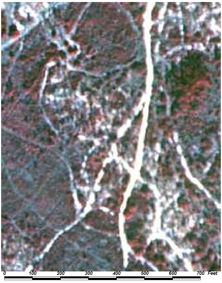
Field Picture
BACK TO
CLASSIFICATION LIST
7420
Borrow Areas
7420
- Borrow Areas
LEVEL 1: 7000 Barren Land
LEVEL 2: 7400 Disturbed Land
LEVEL 3: 7420 Borrow Areas
DESCRIPTION:
Borrow areas are depressions caused
by the removal of earth that is intended to be used as fill material. The types
of material include top soil, clean fill, and other mixed substrates that can
be used to raise the grade at construction sites, road projects, or for
landscaping. It does not include commercial grade sand, clay, limestone, peat
or other mining materials, which would are classified in the 1600 Extractive
classes.
After the disturbance is over, these
sites may fill with water or start to re-vegetate, in which cases other codes
will apply. Active sites will show signs of heavy machinery traffic and earth
moving equipment is usually present.
These areas may not be reliably
identifiable from airphotos and collateral data is typically not available.
Active sites will show obvious signs of vehicular use and earth moving
equipment should be present along with an office type trailer.
KEYS TO PHOTOINTERPRETATION:
There is evidence of excavation such as pits, trenches, etc.
Excavation equipment and transportation access may be visible.
Using stereo photography, PIs can identify depressions with regular,
often rectanguar shapes. Depressions may be large or small in extent.
Some parts of the depressions tend to fill with water. The water signature
is often an unusual tone (blues, greens on CIR photos, rather than the typical
black tone) due to turbidity
Varying amounts of magenta and greenish tones will be present within the
pit as vegetation returns to the site.
CONTEXT:
Landscape Position - Borrow areas are often located near
highways, railroads, and other major projects. They also support urban
construction by being located at the fringes of developing areas.
SIMILAR CLASSES:
1500 Industrial - Industrial areas,
particularly heavy industrial, are often disturbed and unvegetated.
1600 Extractive - Active mining areas will appear disturbed, but are not given
7000 codes. Use 7000s only for reclaimed or abandoned areas. Borrow areas
may look very similar to strip mines, sand and gravel pits, and quarries.
3000 Upland Non-Forested, and 4430 Forest Regeneration - There may be
inclusions of barren land, but they will not appear as depressions on aerial
photography.
5300 Reservoirs - Borrow pits or other artificial depressions that contain
water should be classed as reservoirs. See the 5300 key page for exceptions.
1190, 1290, 1390 - Residential Under Construction - These classes are not dual
coded with 7000 codes. Borrow areas are depressional and usually off-site from
the construction.
7430 Spoil Areas - These may look the same initially. Stereo viewing will
show that they are mounds rather than depressions.
SPECIAL MAPPING CONVENTIONS:
The standard 5 acre minimum mapping
unit applies without exception.
If there are a number of smaller
(< 5 acre MMU) borrow pits in the same area they should be aggregated
together into a single mapping unit. More than 50% of the total area
should be barren and/or excavated in this case.
Borrow pits that contain water
should be classed as 5300 Reservoirs, with no MMU.
Dual coding convention: This is a Land Cover
class. The LCCODE and LUCODE are usually the same, but in rare cases, 7420
could be used as the land cover for land uses such as 1650 Reclaimed Mine Lands or 1670 Abandoned Mine Lands.
DOQQ Image
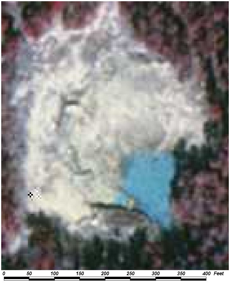
Field Picture
BACK TO
CLASSIFICATION LIST
7430
Spoil Areas
7430
- Spoil Areas
LEVEL 1: 7000 Barren Land
LEVEL 2: 7400 Disturbed Land
LEVEL 3: 7430 Spoil Areas
DESCRIPTION:
Spoil areas are elevated mounds
created by artificial deposition of excavated or dredged materials.
The material is natural soils, sediments and rocks.
In Baldwin County, spoil areas are also frequently
seen as levees formed along canals used for drainage or transportation.
Also, spoil islands are created from sediments dredged out of bays and
estuaries.
The mounds appear as elevated areas
when viewed in stereo. Compared to borrow areas, mounds tend to have
regular shapes due to the way they were created. The most common shape is
circular. The mounds also tend to appear in regular patterns on the
landscape.
This class does not include spoil
areas at active mining operations composed of overburden, waste or processed
sediments. A number of other exceptions are listed below under
'Similar Classes'.
Spoil mounds are included in this
class as long as they remain barren. Once vegetated or developed, they
are treated like any other area and the appropriate land cover/land use codes
apply.
Levees, or spoil areas functioning
as levees, are classified as 7430 whether vegetated or not.
The flat topography of the project
area will aid in the identification of this land use type as any mound or
regular raised feature should be suspect as spoil if of substantial size.
KEYS TO PHOTOINTERPRETATION:
The mounds show up as elevated areas when
viewed in stereo.
Mounds tend to have regular shapes, usually
circular or linear.
On former mining sites, spoil areas are
usually large mounds with artificial shapes (symmetrical shapes, straight
edges, sharp angles, etc).
The movements of mining or dredging machines
may create a series of mounds in regular, straight or curved patterns, or a
series of wavy hills.
CONTEXT:
Landscape Position - Spoil areas often occur
in strips along levees, canals, channels, or as small islands near dredged
areas. They should occur along the sides of man-made canals and channelized or
dredged streams and lakes. Levees appear alongside canals or channels. In this
context, spoil areas may be encountered throughout the project area outside
urban centers.
SIMILAR CLASSES:
1190, 1290, 1390 -Residential Under
Construction - These classes are not dual coded with 7430. Spoil areas are
elevated and usually detached from the construction.
1500 Industrial - Industrial areas may have spoil mounds, but they are not
coded 7430
1600 Extractive - Active mining areas have spoil mounds, but they are not
classed as 7430. Use 7430 only for reclaimed or abandoned areas.
7420 Borrow Areas - These may look the same initially. Stereo viewing
will show that they are depressions rather than mounds.
SPECIAL MAPPING CONVENTIONS:
Levees are mapped if they average 90
feet wide or greater.
If there are a number of smaller
(< 5 acre MMU) spoil mounds in the same area they should be aggregated
together into a single mapping unit. More than 50% of the total area should be
barren and/or mounded in this case.
Dual coding convention: This is a Land Cover class.
The LCCODE and LUCODE are usually the same, but in rare cases, 7430 could be
used as the land cover for land uses such as 1650 Reclaimed Mine Lands and 1670 Abandoned Mine Land.
DOQQ Image
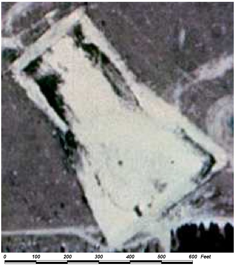
Field Picture
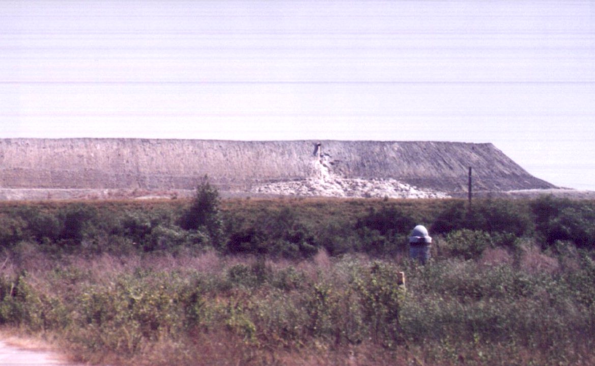
BACK TO CLASSIFICATION LIST
*8000 TRANSPORTATION, COMMUNICATION &
UTILITIES
Transportation, Communications and Utilities
FLUCCS Code 8000
This Level 1 class is
not used in the map itself - a more specific subclass must be selected. The
Level 2 subclasses include:
8100 Transportation
8200 Communications
8300 Utilities
Background: This broad class
includes not only Transportation classes but also Communications and
Utilities.
Transportation
facilities are used for the movement of people and goods; therefore, they are
major influences on land and many land use boundaries are outlined by them.
Highways are easily
identifiable on medium altitude photography. Highways include areas used for
interchanges, limited access rights-of-way and service facilities. The center
median, pavement and sizable buffer zone should be included even if exact
boundaries cannot be detected.
The Transportation
category includes rail-oriented facilities including stations, round-houses,
repair and switching yards and related areas. It also includes airport
facilities such as runways, intervening land, terminals, service buildings,
navigational aids, fuel storage, parking lots and a limited buffer zone.
Transportation areas
also include ports, docks, shipyards, dry docks, locks and water course control
structures designed for transportation purposes. The docks and ports include
buildings, piers, parking lots and adjacent water utilized by ships in the loading
and unloading of cargo or passengers. Locks, in addition to the actual
structures, include the control buildings, power supply buildings, docks and
surrounding supporting land use (i.e., parking lots and vegetated areas).
Communications classes
include airwave communications, radar and television antennas with associated
structures. When stations are associated with a commercial or governmental
facility, they will be included in those specific categories (1400 Commercial
and Serves or 1700 Institutional) rather than 8200 Communication.
Utilities include power
generating facilities and water treatment plants and related facilities such as
transmission lines for electric generation plants and aeration fields for
sewage treatment sites. Small facilities or those associated with an
industrial, commercial or extractive land use are included within these larger
respective categories.
MAPPING CONVENTIONS:
Minimum mapping units: There is a
minimum width criteria for linear features in the 8000 classes. Non-linear
features have a minimum area criteria. They will be mapped as generally
indicated below. Individual key pages will describe these criteria in more
detail:
8120 Railroads and
Railyards - Must exceed an average width of 100 feet over long segments.
8140 Roads and Highways
- Must exceed 100 feet in width over long segments and have four lanes and a
substantial median.
8320 Electrical Power
Transmission Lines - Must be at least 150 feet in width and have a different
land cover than the surrounding landscape.
8340 Wastewater
Treatment Facilities - must be 1 acre or more.
8350 Solid Waste
Disposal - must be 1 acre or more.
Differentiating
subclasses: Some of the subclasses may be difficult to differentiate without
ancillary data. Electrical power transmission lines may look very similar
to other utility corridors, and may in fact occur together.
Communications facilities are difficult to identify.
Dual coding
convention: The 8000 classes are Land Use classes that do not normally require
a separate land cover class. Some exceptions are noted above. Additional
exceptions include 8340 Sewage Treatment and 8350 Solid Waste Disposal, which
require dual coding under certain defined situations. For
more details see each subclass PI key.
SIMILAR CLASSES:
With minor exceptions,
the 8000 classes are relatively distinctive and are readily differentiated from
other categories. For details and exceptions see the PI keys for each
subclass.
For more information:
See the PI keys for each
of the subclasses for more details and graphic examples.
BACK TO
CLASSIFICATION LIST
8100 Transportation
8100
- Transportation
LEVEL 1: 8000 Transportation,
Communications and Utilities
LEVEL 2: 8100 Transportation
DESCRIPTION:
This general Level 2 class is used
where more specific Level 3 classes do not apply.
It is also used where roads and
railroads are directly adjacent to each other, and neither one individually
meets the minimum width criteria, but their combined width is greater
than 100 feet. They are delineated as one polygon and coded 8100
Transportation.
Transportation facilities are used
for the movement of people and goods; therefore, they are major
influences on the land, and many land use boundaries are outlined by them.
Highways include areas used for
interchanges, limited access right-of-ways and service facilities. The center
median, pavement, and a sizable buffer zone are included even if exact
boundaries cannot be determined. Highways are easily identified on project
photography.
Rail-oriented facilities include
stations, round-houses, repair and switching yards, and related areas.
Airport facilities include runways,
intervening land, terminals, service buildings, navigational aids, fuel storage,
parking lots, and a limited buffer zone.
Transportation areas also include
ports, docks, shipyards, dry docks, locks, and water course control structures
designed for transportation purposes. The docks and ports include buildings,
piers, parking lots and adjacent waters utilized by ships in the loading and
unloading of cargo or passengers. Locks, in addition to the actual structure,
include the control buildings, power supply buildings, docks, and surrounding
supporting land uses (i.e. parking lots and green areas).
KEYS TO PHOTOINTERPRETATION:
See the respective Level 3 key pages for more details.
CONTEXT:
Landscape Position - Transportation features can be found
throughout the County.
SIMILAR CLASSES:
The Transportation classes are distinctive
and are readily differentiated from other classes. For details and exceptions,
see the PI keys for each of the Level 3 subclasses.
SPECIAL MAPPING CONVENTIONS:
There are minimum width criteria for
linear features in the 8100 class. The following criteria apply:
8120 Railroads - These must be multi-track railroads to be
delineated and must exceed 100 feet in width over long segments.
8140 Roads and Highways - They must have 4 lanes and a median and
must exceed 100 feet in width over long segments. (See the 8140 key page for
more details.)
8320 Electrical Power Transmission Lines - These must exceed 150
feet in width and have a different land cover than the surrounding landscape.
Dual coding convention: This is a Land Use class. The
LUCODE and LCCODE are the same. A separate land cover code is not required.
DOQQ Image
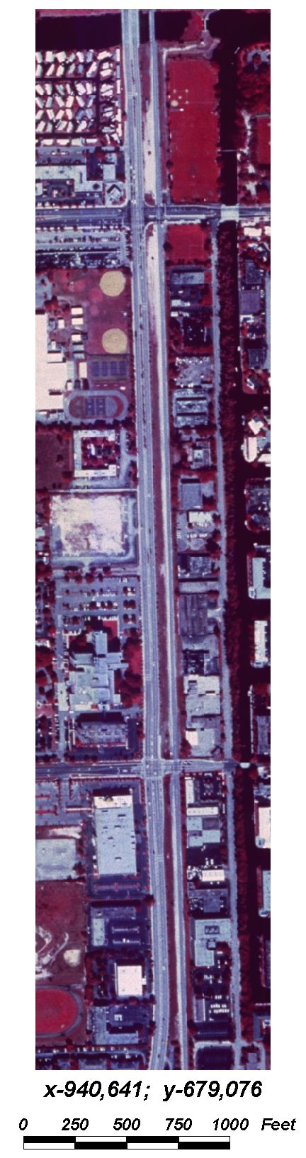
BACK TO
CLASSIFICATION LIST
8110
Airports
8110
- Airports
LEVEL 1: 8000 Transportation,
Communication, and Utilities
LEVEL 2: 8100 Transportation
LEVEL 3: 8110 Airports
DESCRIPTION:
This class includes airports and
airfields of various sizes, along with their associated facilities. It
includes fixed-base commercial, and major airline operations. Heliports and
seaplane bases are included if they meet size criteria (1 acre). It does
not include single owner private air strips, nor does it include aviation
facilities on military bases where the aviation is clearly subsidiary to the
other functions of the base.
Included within the mapping unit are
all buildings, grounds, parking lots, hangers, passenger terminals, fuel
storage, control towers, maintenance areas and other features that are involved
in the operation.
Private airports and grass airports
are classified at Level 4, and not included in this class.
KEYS TO PHOTOINTERPRETATION:
Aircraft are usually recognizable on the aerial photos
There is a distinctive pattern of runways, taxiways and terminal
buildings with associated markings.
Commercial airfields and buildings are usually identified on topo maps.
At abandoned airfields, the runways and aprons may show deterioration
and/or obstructions. The ends of abandoned runways are painted with a
large white "X".
Helipads have white circles painted on the landing pads, often marked
with the letter "H".
CONTEXT:
Landscape Position - Aviation facilities are found throughout the
County. Major airports are along transportation corridors and
usually do not abut residential neighborhoods.
SIMILAR CLASSES:
Airports have a unique appearance on
aerial photos. Military airports may look similar to commercial airports - in
these cases, where aviation is the predominant use, the 8110 coding is
appropriate.
SPECIAL MAPPING CONVENTIONS:
Included within the mapping unit are
all buildings, grounds, parking lots, hangers, passenger terminals, fuel
storage, control towers and other features that are involved in the
operation.
Those areas that are not clearly
related to the functions of the facility or inside the operational boundaries
are not included. Adjacent open areas are assigned the appropriate land
cover value.
Priority classes such as water
bodies, wetlands, land fills or waste treatment sites are exceptions to the
above. If these features meet their minimum size criteria they are always
broken out.
Off-site parking areas are coded
8100 Transportation, unless they are adjacent to the airport and exclusively
used for airport parking.
Airports under construction are
classified as if the construction were complete.
Dual coding convention: This is a Land Use
class. The LUCODE and LCCODE are the same. A separate land cover code is
not required.
DOQQ Image
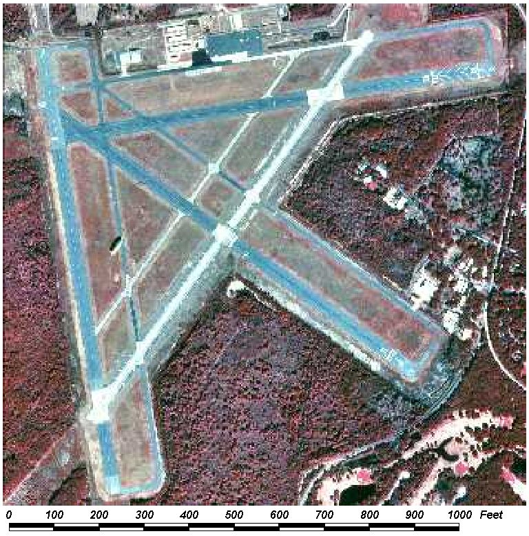
BACK TO CLASSIFICATION LIST
8120 Railroads and Railyards
8120
- Railroads and Railyards
LEVEL 1: 8000 Transportation,
Communication, and Utilities
LEVEL 2: 8100 Transportation
LEVEL 3: 8120 Railroads and
Railyards
DESCRIPTION:
This includes all railroad tracks
greater than 100 feet wide, and all facilities related to the rail operations.
Only multi-track railroads are included. Related facilities include:
Classification yards (marshaling yards) are used to sort freight cars
and are identified by a large group of parallel tracks with a restricted (one
or two track) entrance and exit called a chokepoint. In an active yard,
numerous freight cars and small switch engines will be found.
Servicing yards are normally found in or near marshaling yards
and are identified by the presence of roundhouses (for light repair and storage
of locomotives) and turntables for turning the engines around.
Car repair shops appear as long, low buildings straddling one or
more tracks, with cars awaiting repairs on sidings adjacent to the buildings.
Freight or loading yards are identified by loading platforms,
freight stations, warehouses, and access to other means of transportation
Special loading stations are identified by grain elevators, coal and ore bins,
oil storage tanks, and livestock pens with loading ramps.
Storage yards, used to store rolling stock, are recognized by
dead end trackage not adjacent to any loading facility.
Station yards are for storage of passenger cars, are found near
passenger terminals, and are identified by the presence of a variety of
passenger cars not connected to a train.
Freight stations may be identified
by loading docks along railroad tracks on one side of a building and loading
docks along a road or street on the opposite side. Freight stations are smaller
than warehouses, and are designed only for the temporary storage of goods
received. Freight stations usually occur as single structures near passenger
stations.
Passenger stations vary in size from
the small rural depot or surburban station to the large stations and terminals
of major cities. Small stations usually do not have loading docks and may not
have parking areas for vehicles in the vicinity. The large stations located in
cities are identified by a large number of tracks leading into or past a large
building which houses the waiting rooms, ticket offices, and other passenger
facilities. The track or boarding area is normally covered.
Railroads that are abandoned or
inactive are included, unless the tracks have been removed. Abandoned
rail facilities may be identified by adding
the "abandoned" modifier to the land use code.
KEYS TO PHOTOINTERPRETATION:
Tracks are generally straight linear features of varying width. They
most often appear as a thin, straight line.
Freight stations appear as long, small warehouses with loading docks on
both sides. One side is along the railroad tracks, and the other is along a
roadway, pier, or other form of transportation.
Passenger stations may be small rural depots or large city terminals,
characterized by auto parking, buildings, and covered tracks and boarding
areas.
CONTEXT:
Landscape Position - Rail facilities are located throughout the
County. Railroad tracks are always present or nearby.
SIMILAR CLASSES:
8140 Roads and Highways - road
surface and traffic lane markings visible
SPECIAL MAPPING CONVENTIONS:
Included within the mapping unit are
all buildings, grounds, parking lots, passenger terminals, fuel
storage, and other related features. Those areas that are not clearly
related to the railroad or inside the operational boundaries are not
included.
Priority classes such as water
bodies, wetlands, land fills or waste treatment sites are always broken out if
they meet minimum size criteria.
Railroads under construction are
classified as if the construction were complete.
Dual coding convention: This is a Land Use
class. The LUCODE and LCCODE are the same. A separate land cover code is
not required.
DOQQ Image
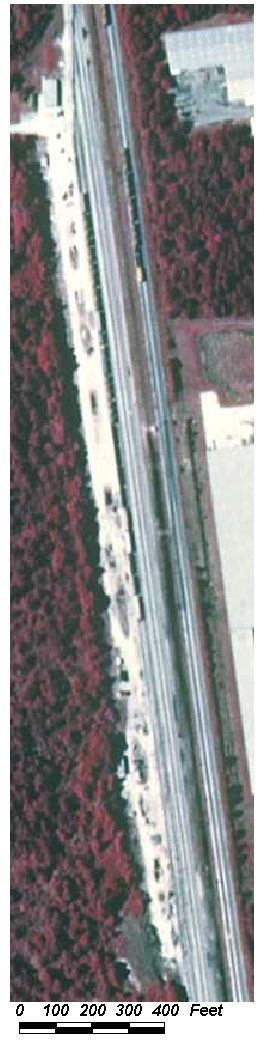
Field Picture
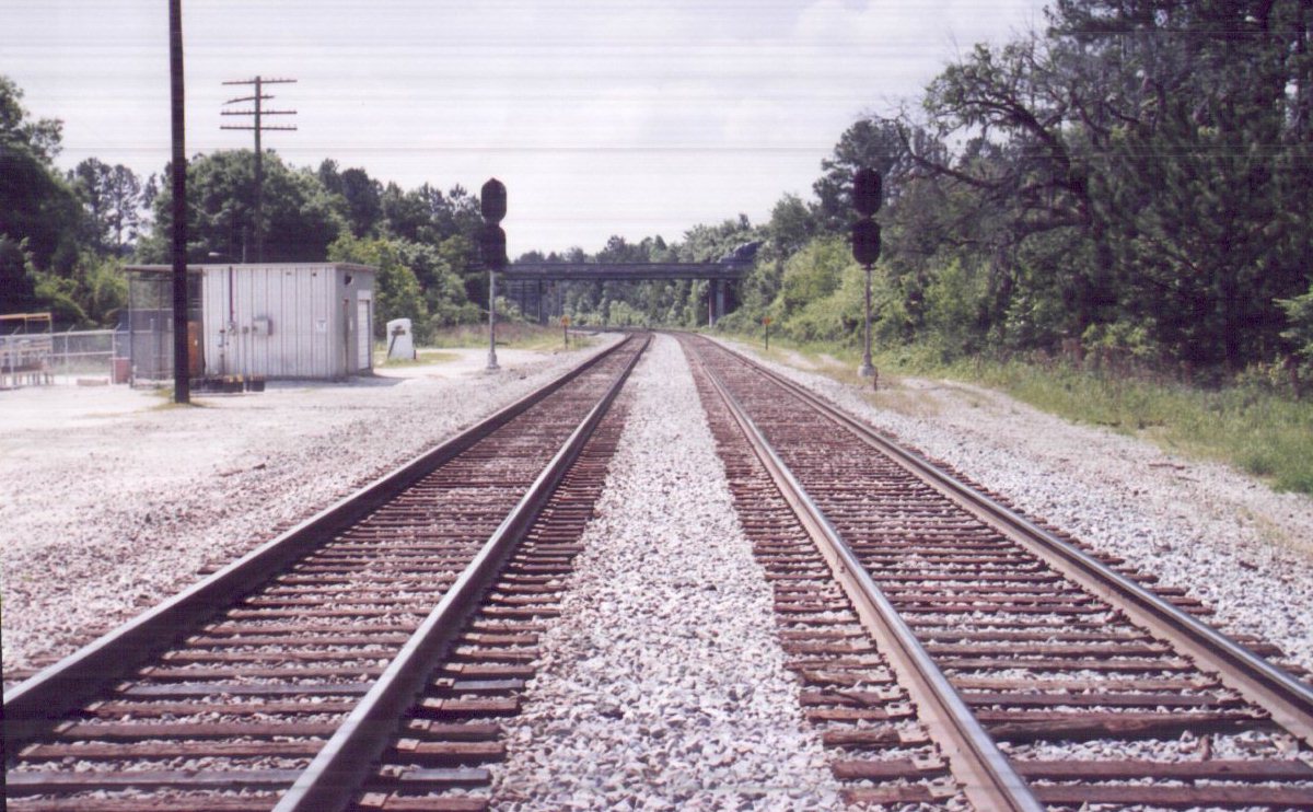
BACK TO CLASSIFICATION LIST
8140 Roads and Highways
8140
- Roads and Highways
LEVEL 1: 8000 Transportation,
Communication, and Utilities
LEVEL 2: 8100 Transportation
LEVEL 3: 8140 Roads and
Highways
DESCRIPTION:
This class includes those highways
exceeding 100 ft. in width, with 4 or more lanes and median strips. The intent
of this data layer is to include only the major transportation corridors.
Roads and highways will be
delineated where they meet ALL of the following conditions:
They exceed 100 feet in width.
They are a divided highway and possess a median along most
segments.
They possess at least 4 lanes (two lanes in each direction).
Also included in the mapping unit
are all interchanges, right-of-ways, highway patrol facilities, maintenance and
service facilities and associated parking areas. Highway maintenance
facilities may include local highway departments and roadside depots - these
may not be located along major routes and may require supplemental data to
identify.
However, parking lots along
transportation routes that are used only for parking are not included in this
class and are classified as 8100 Transportation.
KEYS TO PHOTOINTERPRETATION:
The right-of-way boundary forms the edge of the mapping unit. It
is usually fenced, and the boundary is usually distinct from adjacent land
use. The ROW usually follows along the top of a highway cut or the along
the base of a highway fill area.
CONTEXT:
Landscape Position - Major highways are located throughout the
County.
SIMILAR CLASSES:
8120 Railroads - Railroads tend to
be straight or have long, smooth curves. They also have few houses or
commercial establishments along them.
SPECIAL MAPPING CONVENTIONS:
Any median strips exceeding 150 ft.
in width will be delineated and classified with the appropriate land cover
class.
Priority classes such as water
bodies and wetlands are always broken out if they meet minimum size criteria.
Segments of highways (and other
transportation features) that pass over priority classes, such as rivers, are
not mapped.
Highways under construction are
classified as if the construction were complete.
Dual coding convention: This is a Land Use
class. The LUCODE and LCCODE values are the same, except in
the case of medians, as noted in Special Mapping Conventions.
DOQQ image
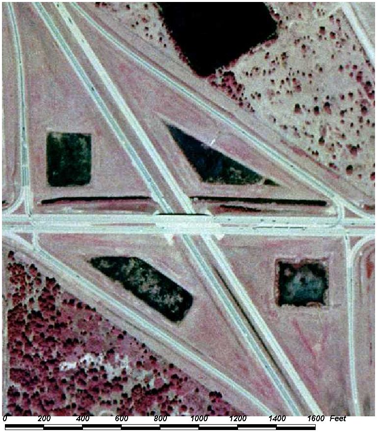
Field Picture
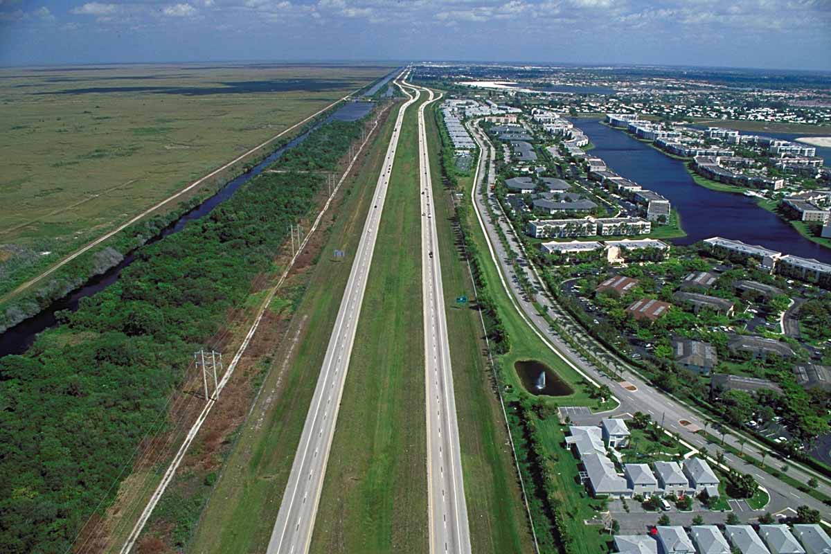
BACK TO CLASSIFICATION LIST
8150 Port Facilities
8150
- Port Facilities
LEVEL 1: 8000 Transportation, Communication,
and Utilities
LEVEL 2: 8100 Transportation
LEVEL 3: 8150 Port
Facilities
DESCRIPTION:
This class is used for marine
freight and passenger terminals and ferry slips. It is for dockside
facilities that are directly related to transportation, including structures,
subsidiary parking areas, docks and mooring areas, warehouses and open storage
areas, port administration and passenger terminals, and on-site roads, rail
spurs and other conveyance facilities.
This class does not include other
commercial and industrial activities present at ports, including those that
provide supporting services to the port facilities. Also not included are
shipyards employed in ship building and repair. Only uses that are
directly involved in transportation are included.
Marine freight terminals are
identified by characteristic long loading/off-loading piers with associated
warehouses and open storage areas. Open storage may range from rows of
automobiles to stacked containers. Cargo vessels and lighters tied to the docks
or moored nearby confirm commercial freight activities.
Modern marine terminals have heavy
cranes for loading and unloading container ships, similar to the portal and
hammerhead cranes used for fitting out floating hulls at a shipyard; their
presence requires a detailed examination of the surrounding area for shipyard
facilities, which are classifed as 1560 Heavy Industrial.
KEYS TO PHOTOINTERPRETATION:
Heavy cranes for loading and unloading container ships may be present.
Ships will usually be visible alongside docks, not blocking each other.
Ferry slips are identified by tall pilings that enclose the slip.
Ferry routes are often shown on highway maps as dashed lines.
Roads and rail spurs serve the terminal.
Open storage may include uniform rows of automobiles or stacked
containers.
CONTEXT:
Landscape Position - Port facilities can be found in any
shoreline area. The boundaries with adjacent commercial and industrial
land uses may be poorly defined.
SIMILAR CLASSES:
1560 Other Heavy Industrial -
Shipyards have heavy cranes similar to port facilities. Careful
inspection or supplemental data is needed to differentiate them.
SPECIAL MAPPING CONVENTIONS:
Included within the mapping unit are
all structures, parking areas, docks and mooring areas, warehouses and open
storage areas, port administration and passenger terminals, and on-site roads,
rail spurs and other conveyance facilities. Those areas that are not directly
related to transportation functions are not included.
Port Facilities under construction
are classified as if the construction were complete.
Dual coding convention: This is a Land Use
class. The LUCODE and LCCODE are the same. A separate land
cover code is not required.
DOQQ Image
Field Picture
BACK TO CLASSIFICATION LIST
8200 Communications
8200
- Communications
LEVEL 1: 8000 Transportation,
Communications, and Utilities
LEVEL 2: 8200 Communications
DESCRIPTION:
This class refers to communications
facilities larger than 1 acre that are not attached to another land
use. When the stations are part of a commercial or governmental
facility, they will be included in those categories rather than classified
separately.
This class is predominantly for
airwave communications facilities composed of antennae or transmission towers
and all associated structures. It includes transmission towers and
antennae for radio transmission or for microwave transmission of television and
telephone communications.
Transmission towers may be
detectable, but antennae are difficult to see on photography except perhaps by
their shadows.
KEYS TO PHOTOINTERPRETATION:
Usually small facilities with towers, radars and antenna present.
These often occur as small open spaces in isolated rural areas - usually
fenced and with a small building. The boundaries with adjacent land cover
are usually distinct.
In urban areas the antennas and towers may be roof-mounted.
Stereo enlargement is often necessary for proper identification.
Long, thin shadows may be present.
These structures are usually very tall, and are sometimes placed on the
tops of tall buildings.
CONTEXT:
Landscape Position - They can be located anywhere, including
rural areas, but are preferably sited at high points in the landscape.
SIMILAR CLASSES:
1900 Open Land - may appear heavily vegetated or
have a disturbed, scoured, white appearance
3100 Herbaceous (Dry Prairie) - vegetation is diverse in type, texture, and
pattern
8320 Electrical Power Transmission Lines - appear as long, linear strips that
transect the landscape
SPECIAL MAPPING CONVENTIONS:
When Communications facilities are
subsidiary to another mapped land use, they will be included in that land use
rather than classified separately. Included within the mapping unit are any
buildings, grounds, parking lots, storage and other related features.
Those areas that are not inside the operational boundaries are not included.
Dual coding convention: This is a Land Use
class. The LUCODE and LCCODE are the same. A separate
land cover code is not required.
DOQQ Image
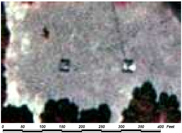
Field Picture
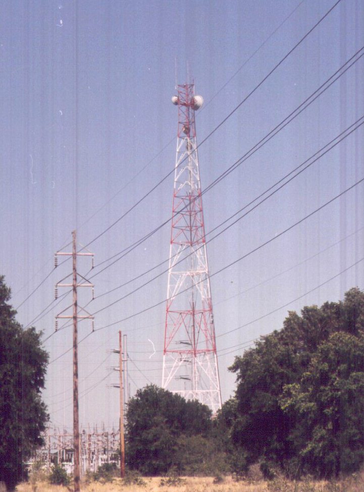
BACK TO CLASSIFICATION LIST
8300
Utilities
8300
- Utilities
LEVEL 1: 8000 Transportation,
Communications and Utilities
LEVEL 2: 8300 Utilities
DESCRIPTION:
This general Level 2 class is only
to be used where more specific Level 3 classes do not apply.
Utilities include power generating
facilities and water treatment plants and their related facilities such as
transmission lines for electric generation plants and aeration fields for
sewage treatment sites.
Utilities associated with an
Industrial, Commercial or Extractive land use are included within those other
classes, and are not classified as 8300 Utilities.
Many of the Utilities are priority
classes, in view of their importance to water resources.
KEYS TO PHOTOINTERPRETATION:
See the respective Level 3 key pages for more details.
CONTEXT:
Landscape Position - Utility features
can be found throughout the County.
SIMILAR CLASSES:
The Utilities classes are
distinctive and are readily differentiated from other classes. For details and
exceptions, see the PI keys for each of the Level 3 subclasses.
SPECIAL MAPPING CONVENTIONS:
There are Minimum Mapping Units for
the 8300 Utilities classes as outlined below: The following criteria apply:
8310 Electrical Power Facilities - These must be 1 acre or more.
8320 Electrical Power Transmission Lines - These must exceed 150
feet in width and have a different land cover than the surrounding landscape.
8330 Water Supply Plants - These must be 1 acre or more.
8340 Sewage Treatment - These must be 1 acre or more.
8350 Solid Waste Disposal - These must be 1 acre or more.
8360 Other Treatment Ponds - These must be 1 acre or more.
Dual coding convention: This is a Land Use class. The
LUCODE and LCCODE are the same. A separate land cover code is not required.
BACK TO
CLASSIFICATION LIST
8310 Electrical Power Facilities
8310
- Electrical Power Facilities
LEVEL 1: Transportation,
Communication, and Utilities
LEVEL 2: Utilities
LEVEL 3: Electrical Power
Facilities
DESCRIPTION:
Electric power plants include
fossil-fuel and nuclear plants. Subsidiary facilities included are cooling
ponds or towers, canals, and facilities for receiving and storing fuel (coal,
oil), parking areas, and transformer yards.
Electricity generating plants are
indicated by transformer yards, which look like intricate wire cages supported
by a heavier open steel frame; they are often easier identified by their
shadows. High-voltage lines often can be seen running from the transformer
yards. Fossil fuel plants and nuclear plants use water for cooling the
condensers (which condense the steam used to drive the turbines connected to
the generators).
Intake and discharge canals, and
cooling ponds or cooling towers are evident; the nuclear plant at Turkey
Point is conspicuous by having six square miles of linear, parallel cooling
ponds. The fossil plant at Barley Barber Swamp in western Martin County is easily identified by the plant
facilities adjacent to a very large cooling pond system. These cooling ponds
should be mapped as part of the Electrical Power Facilities when directly
adjacent to the plant and identifiable as part of the facility.
Fossil fueled plants are common in Alabama. They are distinguished from
nuclear plants by the lack of a large monolithic reactor building, the presence
of two or more tall chimney stacks, and the presence of either coal stockpiles
or oil storage tanks.
The presence of the large boiler
house and large transformer yards next to the relatively small main building (the
generator hall) distinguishes the thermal power plant from a heavy
manufacturing or processing plant, which would not require two large sources of
power for the same building.
Substations, which have transformer
yards with the same complex appearance as those at power plants, occur at the
ends of high-voltage transmission lines near built-up areas.
KEYS TO PHOTOINTERPRETATION:
The power plants require water for cooling, and are always located next
to natural or artificial water bodies. Intake and discharge canals are present.
Cooling towers or chimney stacks are present, and steam may be visible.
Transformer yards look like intricate wire cages supported by a heavy
open steel frame. They are present at the power plants and at substations at
the ends of the transmission lines near built-up areas.
Fossil fueled plants have piles of coal and/or large oil storage tank
farms. Rail spurs, pipe lines or dock facilities are needed to deliver
the fuels.
CONTEXT:
Landscape Position - Power plants are located next to water
bodies used for cooling, often near other industrial areas. Transformer
yards and substations are found throughout the County, usually adjacent to
built-up areas.
SIMILAR CLASSES:
1560 Other Heavy Industry - These have
large manufacturing facilities, and do not require extensive transformer yards,
cooling towers, etc.
SPECIAL MAPPING CONVENTIONS:
Only those features that are inside
the facility boundaries and involved in its operation are included in the 8310
mapping unit. These may include parking and transportation areas, treatment
facilities, fuel storage, office buildings, and open areas within the
operational boundary.
Priority classes such as water
bodies and wetlands are exceptions to the above. If these features meet their
minimum size criteria they are always broken out.
All utilities under construction are
classified as if the construction were complete.
Dual coding convention: This is a Land Use
class. The LUCODE and LCCODE are the same. A separate
land cover code is not required.
DOQQ Image
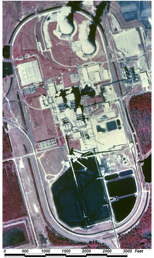
Field Picture
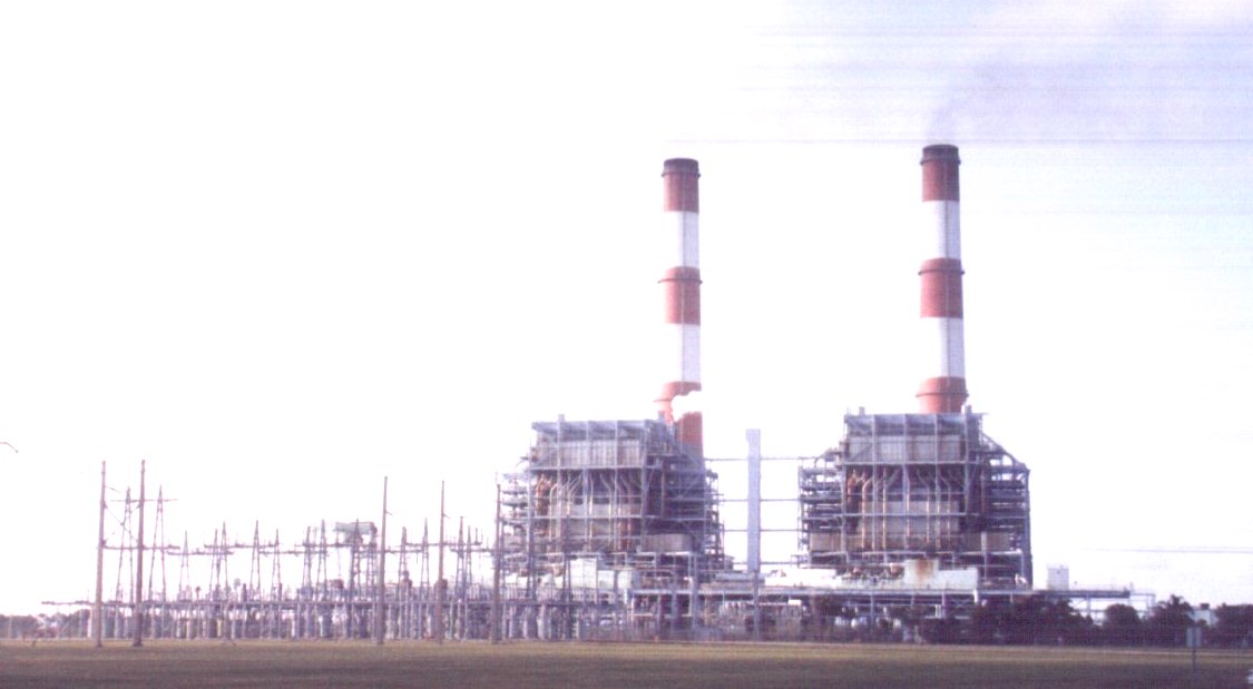
BACK TO CLASSIFICATION LIST
8320 Electrical Power Transmission Lines
8320
- Electrical Power Transmission Lines
LEVEL 1: 8000 Transportation,
Communication, and Utilities
LEVEL 2: 8300 Utilities
LEVEL 3: 8320 Electrical
Power Transmission Lines
DESCRIPTION:
This class includes only
high-voltage power transmission lines. The right-of-ways (ROW's) are not
usually shared with any other utilities, and have a distinct appearance due to
design considerations. The ROW's appear as long, linear strips that
transect the landscape.
High voltage lines must be at least
30 feet above the ground or vegetation, so they are carried on high insulated
towers above cleared swaths of land. The cleared swaths may be over 500
feet wide, and may be used for other purposes, including agricultural and
recreational uses.
KEYS TO PHOTOINTERPRETATION:
The (ROW's) are not shared with other utilities, due to the
corrosive effects of the electrical currents and other factors.
The lines and ROW's are typically very straight. Bends in the lines are
sharp, not gradual or curved. The lines do not need to conform to topography,
as do most other utilities.
Vegetation in the strip is usually cleared of trees and shrubs and
maintained as an open, accessible area.
Support towers and their shadows are often visible. They are spaced
at an even distance apart in a generally straight line.
Actual transmission lines are sometimes visible, if over a dark
background such as water.
Trails usually wind along the ROW's, from tower to tower.
CONTEXT:
Landscape Position Electrical Power Transmission Lines can occur anywhere
within the project area, in any context. The transmission line ROW's begin in
transformer yards at power generating stations and end at transformer yards at
substations in built-up areas.
SIMILAR CLASSES:
8120 Railroads - Tracks are visible,
ROW's have gradual curves, and the lines follow topography.
SPECIAL MAPPING CONVENTIONS:
Utility corridors are delineated
only where they are 150 feet or greater in width and their land cover is
different from the surrounding landscape.
In those corridor segments where the
landcover is identical to adjacent areas, such as through pastures or
rangeland, the utility feature will not be mapped.
The above applies as follows:
LU=8320/LC=8320 where they are 150 to 300 feet in width.
LU=8320 and dual-coded with the appropriate Land Cover code where
they exceed 300 feet in width.
Continuity of the strip across the
landscape is not required.
Transmission lines under
construction are classified as if the construction were complete.
Dual coding convention: This is a Land Use
class. A separate Land Cover code is only required as indicated above.
DOQQ Image
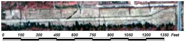
Field Picture
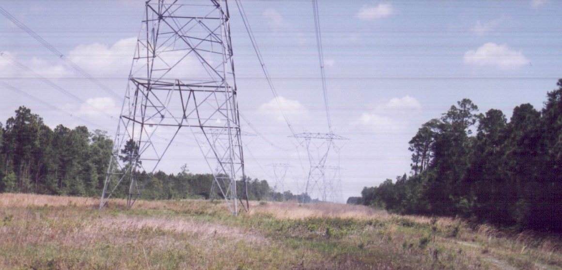
BACK TO CLASSIFICATION LIST
8330 Water Supply Plants - Including Pumping Stations
8330
- Water Supply Plants - Including Pumping Stations
LEVEL 1: Transportation,
Communication, and Utilities
LEVEL 2: Utilities
LEVEL 3: Water Supply
Plants - Including Pumping Stations
DESCRIPTION:
This class includes water treatment
plants, settling basins, water storage towers, wells and pumping facilities
that serve municipalities or residential subdivisions. It does not
include water treatment facilities attached to 1400 Commercial, 1500
Industrial, 1600 Extractive, or 1700 Institutional classes. It does not include
water transmission pipelines, which are classified as 8100
Transportation.
Nearly all water supply plants in
the County use ground water. Well fields are not mapped unless the
boundaries of the well field are distinct on the photography. Wells,
pipelines and storage towers often do not meet minimum size
criteria.
The treatment plants are identified
by a number of low, open sedimentation tanks. The tanks are circular or
rectangular and about 100 to 200 feet across. The plants vary greatly in
size. Each plant may contain buildings, storage areas, sludge disposal sites,
pumping facilities, parking and other features.
KEYS TO PHOTOINTERPRETATION:
Mixing tanks and settling basins are rectangular and contain a series of
baffles or mechanical agitators.
"Dorr" clarifiers are circular settling tanks that may have
rotating scrapers and a single narrow walkway running from the rim to the
center of the tank.
Ground water wells can be at varying distances and elevations from the
plant and each other, and may not be identifiable without ancillary data.
CONTEXT:
Landscape Position - Water treatment plants are located in or
near built-up areas. The plants may be separate from well fields and
storage towers. Plants that use surface water are usually located near
the water body.
SIMILAR CLASSES:
Water treatment plants may appear
similar to treatment facilities that use similar equipment at industrial sites,
or with water treatment operations at commercial or institutional facilities.
8340 Sewage Treatment - Sewage
treatment plants use much of the same equipment. STP trickling filters
look like Dorr clarifiers - low circular tanks. But they are
distinguished by having four narrow booms that revolve around the center of the
tank, sprinkling effluent over the filter bed. STP's may also have sludge
digestion tanks and large sand filter beds.(see 8360 Other Treatment Ponds)
SPECIAL MAPPING CONVENTIONS:
Well fields are not mapped unless
the boundaries are distinct on the photography. Wells, pipelines and
storage towers often do not meet minimum size criteria. If well fields are
mapped, a separate land cover code is required for the well field
polygon.
Treatment plants under construction
are classified as if the construction were complete.
Dual coding convention: This is a Land Use
class. The LUCODE and LCCODE are the same. A separate land
cover code is not required.
DOQQ Image
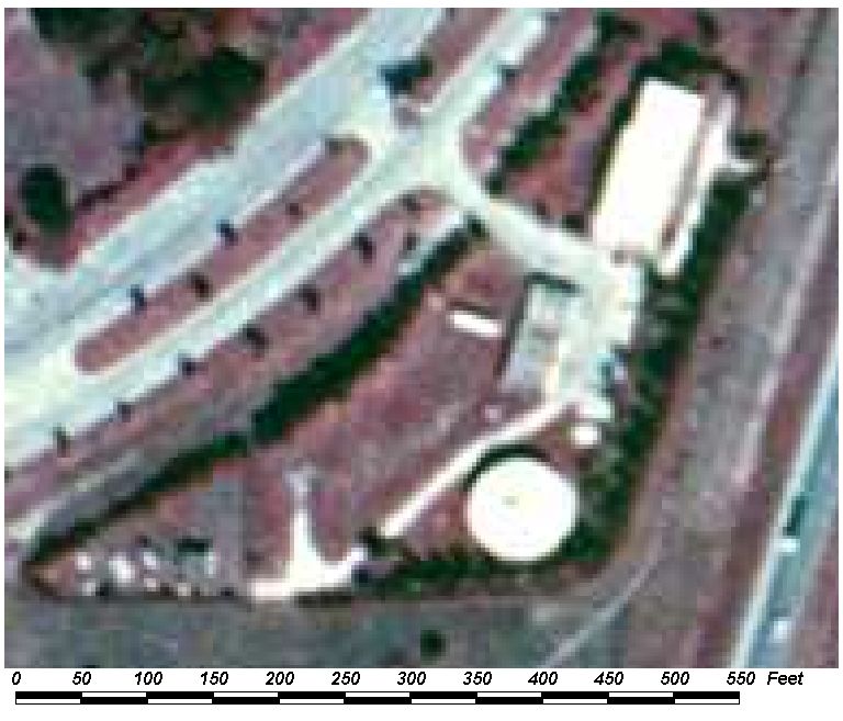
Field Picture
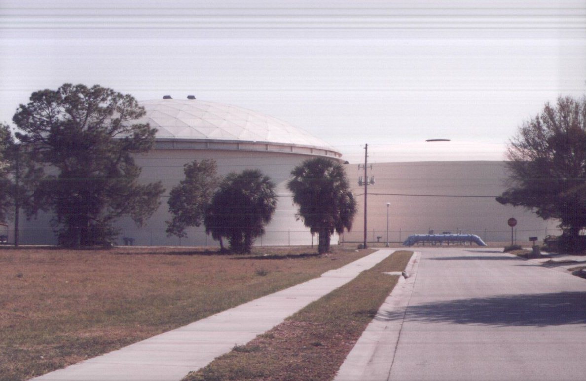
BACK TO CLASSIFICATION LIST
8340 Sewage Treatment
8340
- Sewage Treatment
LEVEL 1: 8000 Transportation,
Communication, and Utilities
LEVEL 2: 8300 Utilities
LEVEL 3: 8340 Sewage
Treatment
DESCRIPTION:
There are at least three different
types of facilities included in this class, and they have nothing in common except
wastewater. In order to tell them apart, 8340 is designated a land use
class, and a separate land cover class is assigned to LCCODE. The land cover
code identifies what kind of sewage treatment facility it is. Typical
land cover codes associated with wastewater treatment plants (WTPs)
include 2150 Field Crops (hay), 3100 Herabceous- Dry Prairie, 6000 Wetlands, or
8360 Other Treatment Ponds, as described below.
The three types of facilities (and
there may be more) are:
- Wastewater Treatment Plants
- Spray Fields
- Percolation Beds - also known as rapid
infiltration basins (RIBs)
- Wetlands used for wastewater treatment and
discharge.
The treatment plants themselves are
characterized by round digesters, about 100 to 200 feet in diameter. Aerobic
digesters are open on top, and have visible booms that pivot from the center
and spray the effluent on the digester beds. Anaerobic digesters
are smaller in size and covered. Treatment plants may also have settling
basins, drying beds, settling ponds or lagoons, and enclosed buildings.
They tend to be near (but not too near) urban areas, and may also
be located near discharge features (such as streams, wetlands, or the
coast). WTP's are coded 8340/8340, for LCCODE/LUCODE.
Spray fields tend to be hay fields
located near the WTP. They are associated with the WTPs
rather than private farm operations, so typical farming features (barns,
homesteads, etc.) may be absent. Since spray fields get a large dose of
nutrient and water, they tend to have an exxagerated red or pink color,
indicating vegetative growth. Patterns of fertilization may be uneven,
since disposal is the main objective, not crops. Land cover code is from
2000s and 3000s.
Wetlands used for wastewater
treatment may be hard to identify. Ancillary data such as County or DEP maps
are the best source. Also, look for conveyance systems (pipes, pump
houses, canals) or other artificial features, such as dikes, levies, straight
edges and partitioning of the wetlands. Accelerated growth may result in
exaggerated reddish tones. Land cover code is from the 6000s.
Percolation beds are also called
rapid infiltration beds (RIBs). The appearance of these basins suggests
aquaculture, except they are larger and may be spaced farther apart (spacing
allows more infiltration without raising the water table). They are located in
rural areas separated from development, for obvious reasons. Look for road
access and some minor utilities (sheds, fences, gates, valves); there may be
few other features to assist interpretation. Land cover code for RIBs is
8360 (Other Treatment Ponds). The basins and connecting uplands are
delineated together as a single polygon.
KEYS TO PHOTOINTERPRETATION:
Treatment
Plants:
Primary, secondary, & tertiary cylindrical treatment tanks ,
appearing as small circles (round from above).
Large processing/office buildings and smaller structures for storing
equipment, supplies.
Visible settling ponds, often have aquatic vegetation in them with a bright
pink signature.
Spray
Fields:
Lack of typical agricultural indicators (barns, homesteads).
Reddish tones due to increased fertilizer and water.
Irregular growth patterns.
Treatment
Wetlands:
Conveyance systems, such as pipes, pumping facilities, canals may be
visible.
Artificial features, such as dikes, levies, partitioning into sub-areas.
Reddish tones from increased nutrient.
Percolation
Beds:
Large, rectangular-shaped basins, uniformly spaced, sometimes far apart.
Located in rural areas away from development.
Beds are mostly dry, but some show standing or surface moisture.
CONTEXT:
Landscape Position - Sewage treatment plants are located near
municipalities (often near large water bodies) throughout the project area.
Boundaries with adjacent land uses are regular and well-defined.
SIMILAR CLASSES:
8330 Water Supply Plants - 8330 has
fewer treatment structures, and is usually closer to residential areas.
2540 Aquaculture - may look like percolation beds, or RIB's. Aquaculture ponds
tend to be smaller, closer together, in farming context. Also, RIBs are mostly
dry.
SPECIAL MAPPING CONVENTIONS:
Priority classes such as water
bodies and wetlands are always broken out if they meet minimum size criteria.
All utilities under construction are
classified as if they were complete.
Dual coding convention: The land cover code for each 8340
variant is as follows:
- for Treatment Facilities, the land cover code
defaults to 8340.
- for Spray Fields, use 2150 or 3100 for land
cover.
- for Treatment Wetlands, use appropriate wetlands
class
- for Percolation Beds, use 8360 - Other Treatment
Ponds.
DOQQ Image
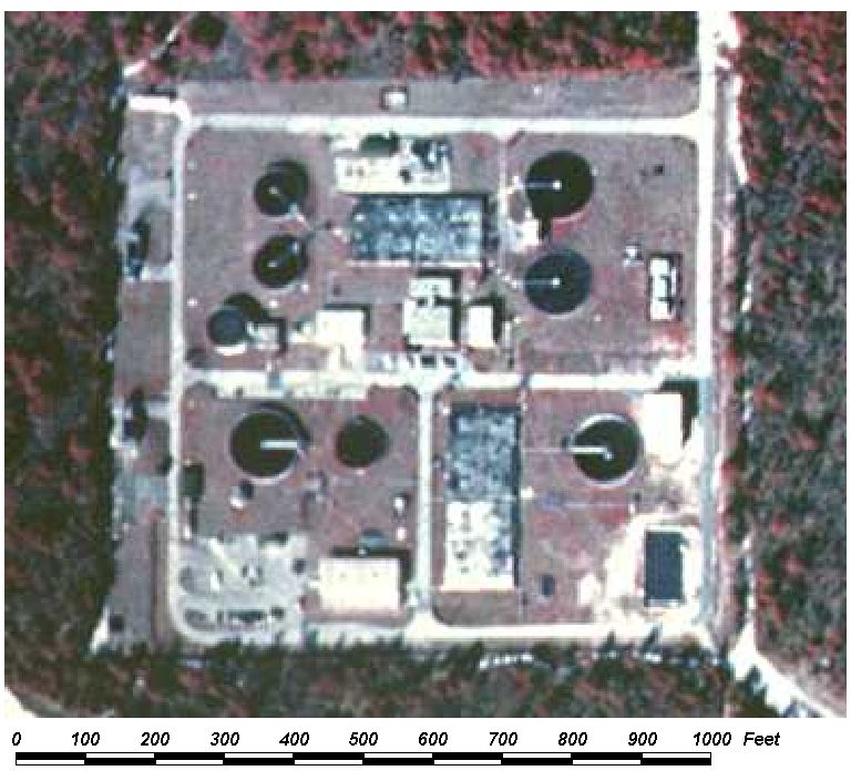
Field Picture
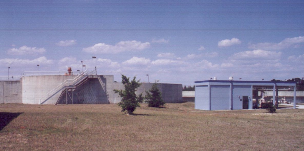
BACK TO CLASSIFICATION LIST
8350 Solid Waste Disposal
8350
- Solid Waste Disposal
LEVEL 1: 8000 Transportation,
Communication, and Utilities
LEVEL 2: 8300 Utilities
LEVEL 3: 8350 Solid Waste
Disposal
DESCRIPTION:
This class includes sanitary landfills,
dumps and other waste disposal areas. The sites may be publicly or
privately operated, and may or may not be permitted. It does include dumps and
landfills that are found at private operations such as farms, institutions,
industrial and commercial sites, if they meet size criteria. However, it
does not include storage of uniform wastes and residuals that are part of a
normal process stream, such as mine tailings and treatment plant sludges -
these are treated as subsidiary to the operation and included with the
applicable land use.
Sanitary landfill operations are
identified by supervisor's buildings, bulldozer and truck tracks, and a small
white fringe of debris that has not been covered by the fill. Despite buffer
zone requirements for wetlands and water bodies, landfills may still be seen
adjacent to wetlands and water bodies. This is partly because so many parts of
the project area have a very high water table. The high water table (and thin
soils) interfere with the proper operation of sanitary landfills and often
results in above ground mounded disposal appearing as a truncated pyramid
Incinerators are often present,
either rough conical structures with ground entrances, or structures having
elevated loading, platforms and truck ramps. These features, and the tracks
made by trucks removing the remaining material, may be visible if the
incinerator is active.
Landfills and dumps may be fenced. A
junk yard may also be fenced and contain a small building; it is distinguished
from a dump only by the arrangement of the junked equipment, emphasized by
patterns of vegetation and trails around the equipment. Mine dumps and ore
dressing tailings areas may also be mistaken for solid waste dumps; they are
often depicted on topographic maps.
KEYS TO PHOTOINTERPRETATION:
Landfills are characterized by large elevated mounds. Leachate seeps may
be visible at the base of the mounds. At legal sites only the small
active areas are not covered with a uniform fill material.
Heavy equipment, treatment ponds, offices and warehouses, storage bins,
and other facilities may be present.
The appearance of landfills can vary from very regular and organized to
very messy and disordered. Boundaries with adjacent land uses can be distinct
or irregular.
Large parts of the site have little or no vegetation. The sites
tend to be heavily modified by earth moving activities, with or without a clear
pattern or intent.
Un-permitted dumps lack the regular shapes and smooth-textured earth
fill of sanitary landfills. Open pits, trash, and junked vehicles and
appliances are often visible.
CONTEXT:
Landscape Position - Found throughout the project area, in any
context except for densely built-up areas. Solid waste disposal sites are often
adjacent to an Open Land class. Boundaries with adjacent
land uses are usually not well-defined.
Land fills
are located at the closest acceptable distance from the built-up areas that
generate the solid wastes. Disposal sites are difficult to approve in urban
areas due to public reaction. Un-permitted dumps are often located in the
least conspicuous locations, such as a remote back corner of a property or at
the end of a remote dirt road in a forested area.
SIMILAR CLASSES:
1500 Industrial - Areas that are
disturbed, under construction, or used for storage of raw or residual materials
may look like dumps. Sites that store uniform wastes and residuals as part of a
normal process stream are subsidiary to the industrial site and not included in
this class.
1600 Extractive - Excavating equipment such as bulldozers, shovels, dredges,
and drag lines are visible. 7400 Disturbed Land - Soil and/or substrate has been
altered by human activity; white or whitish, mottled signature due to
regenerating vegetation.
7420 Borrow Areas - Excavation equipment may be visible; appear as depressions
with regular, often rectangular shapes.
7430 Spoil Areas - These will lack many of the above 8350 indicators, but may
otherwise look like dumps.
SPECIAL MAPPING CONVENTIONS:
The minimum mapping unit (MMU) for
this class is 1 acre. Landfills are considered a very high priority
feature in water resource management.
Landfills under construction are
classified as if the construction were complete.
Dual coding convention: This is a Land Use class.
The LUCODE and LCCODE are generally the same. However,
treatment ponds at a landfill are dual-coded with 8360 Other Treatment Ponds as
the LCCODE along with 8350 as the LUCODE.
DOQQ Image
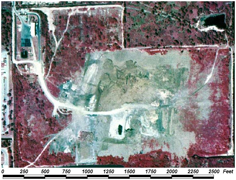
Field Picture
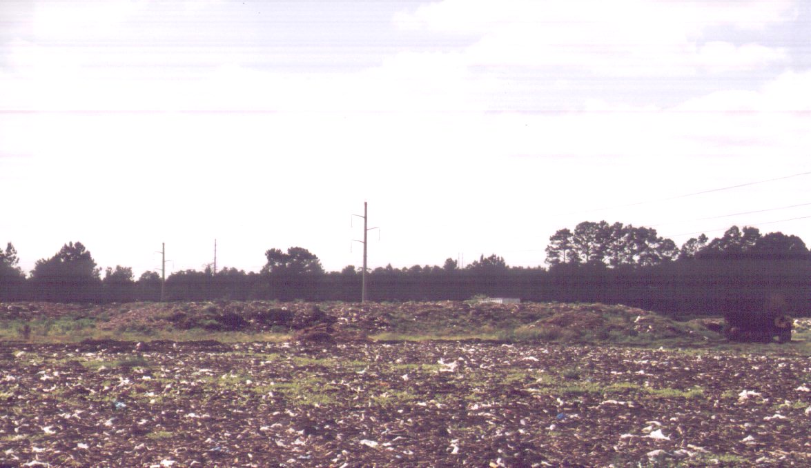
Landfill.
Note mounding and surface trash
BACK TO CLASSIFICATION LIST
8360 Other Treatment Ponds
8360
- Other Treatment Ponds
LEVEL 1: 8000 Transportation,
Communication, and Utilities
LEVEL 2: 8300 Utilities
LEVEL 3: 8360 Other
Treatment Ponds
DESCRIPTION:
This code was created by Baldwin County to classify those lagoons, holding
ponds, impoundments and infiltration ponds which are utilized for agricultural
or industrial treatment purposes.
This 8360 code is used for
facilities that are designed and utilized for specific treatment or
infiltration functions, including percolation beds used for sewage
treatment/disposal.
It is not used for typical farm
ponds, stormwater treatment ponds and other "reservoirs" that generally function as normal
water bodies. It is not used for holding ponds in mining applications, which
are classified as 1660 Holding Ponds.
KEYS TO PHOTOINTERPRETATION:
The interpreter needs to recognize the type of facility that the
impoundment is associated with, and, if possible, its function.
It is generally located in or adjacent to the operation it serves.
Percolation beds (RIBs) may be isolated in rural areas.
Inflow/outflow structures, plumes or aerial spray, pumps, and other
buildings or equipment are often visible.
Levees and access roads are generally present.
The water color may deviate from the typical black color seen on CIR
photography, due to altered chemistry or biota. Colors may be blues
or greens, and contrast distinctly with surrounding natural water bodies.
Shape of the impoundment appears artificial, with straight lines,
angles, geometric curves, or symmetrical shapes.
CONTEXT:
Landscape Position - Treatment ponds can be associated with
industrial, agricultural and municipal facilities. They are not
associated with mining operations or with residential areas.
SIMILAR CLASSES:
1660 - Holding Ponds associated with
extraction (mining)
5300 Reservoirs - Reservoirs do not have a treatment or infitration function.
6000 Wetlands and 7000 Barren Land - Treatment ponds may be confused
with wetlands or barren categories if vegetated or in a dry state.
SPECIAL MAPPING CONVENTIONS:
This is a Baldwin County modification to the FLUCCS system,
which does not have this class.
Treatment Ponds in this class are
given the Land Cover code 8360 whether they are vegetated or empty.
Priority classes such as water
bodies, wetlands, golf courses, land fills or waste treatment site are always
broken out if they meet minimum size criteria.
Treatment facilities under
construction are classified as if the construction were complete.
Dual coding convention: This is a Land Cover class. Dual
coding is always required - a Land Use class must always be assigned in
addition to the 8360 code. The land use code is determined by the type of
facility the treatment pond is associated with, if identifiable. An example is
2520 Dairies. If the type of facility is unidentifiable, the PI should use his
best judgement based on context, ancillary data or field checking.
DOQQ Image
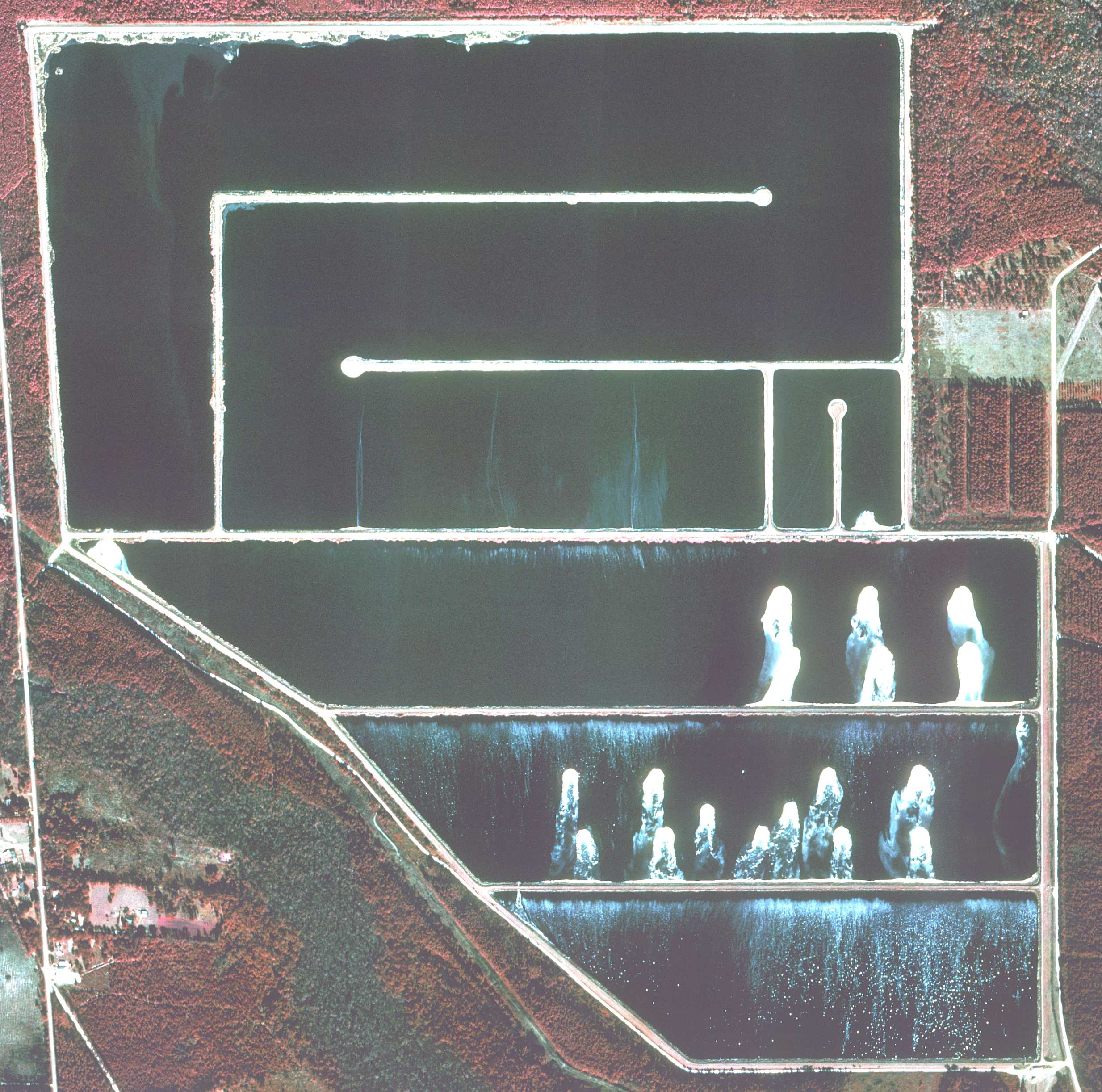
Field Picture
BACK TO CLASSIFICATION LIST
User
Guide
GUIDE TO
USING THIS WEB PAGE
Users can
access the "Classification System" page, point and click on a
selected code and access the "FLUCCS Photointerpretation Key" page which
describes the selected code.
Aerial
images were clipped from the original digital imagery used for the
photointerpretation. These Digital Ortho Quadrangle (DOQ) image clips are
displayed on each key page. Ground level field pictures, representing each
classification type, are also included on each key page.
Each FLUCCS
Photointerpretation Key page describes a unique FLUCCS code. The following
sections are included on each page of the key:
- CLASSIFICATION CODE: Indicates the entire
four-digit FLUCCS code as applied during photointerpretation.
- LEVEL: Lists each level within the
four-digit FLUCCS code.
- DESCRIPTION: This is the description of
the classification code as it is used by Baldwin County in this dataset. Classification
codes are based on the Florida Land Use, Cover, and Forms Classification
System; Department of Transportation, State Topographic Bureau, Thematic
Mapping Section; January 1999 Edition. They are modified as needed by
the County to meet their mapping objectives.
- KEYS TO PHOTOINTERPRETATION:These are descriptions which
consist of the typical characteristics of each class. Features which are
associated with the class and which are visible on the imagery are
described. The apparent signature (colors, tones, textures, etc.) of the
class on the imagery may be described as well as its typical location
within the landscape.
- CONTEXT: This section describes the
context within which each class is typically found. It briefly describes
(where applicable) one or more of the following characteristics: Landscape
Position, Vegetation, Soils, and Hydrology.
- SIMILAR CLASSES: Other FLUCCS classes which
may share one or more of the same characteristics as the classification
code being described are indicated in this section.
- SPECIAL MAPPING CONVENTIONS: Describes the
photointerpretation or mapping rules established to address the
particular classification code. This section also describes differences
between the original FLUCCS system, as defined by the Department of
Transportation (DOT), and the Baldwin County system, which has been
modified from the original DOT system.
- DUAL CODING CONVENTIONS: This section describes the
Land Cover/Land Use code combinations as applied to each class.
Generally, the Land Cover code (LCCODE) and the Land Use code (LUCODE)
are the same. However, instances where they are different are noted
here.
Note: There are also PI Key pages
for MODIFIERS: These are added to LCLU codes to denote types of vegetation
or impact that are not classified under a particular FLUCCS code.
BACK TO CLASSIFICATION LIST