

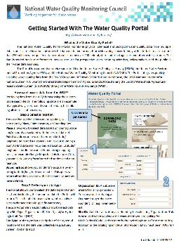
Check out the new step-by-step guide for using the WQP!
- Explanation of portal search parameters
- Explanation of data retrievals
- Download all Water Quality Exchange (WQX) allowable value lists and definitions
The Water Quality Data Portal (WQP) provides an easy way to access data stored in various large water quality databases. The WQP provides various input parameters on the form including location, site, sampling, and date parameters to filter and customize the returned results. The WQP can return site information (locations where samples were collected), or it can return sample results (analytical data of collected samples). Any field in the form left blank will cause a search for all parameters in that field. For example, if a user selects US and California for the country and state respectively, but leaves the county field blank, data will be returned for all counties in California. This is also true of the fields under "SITE PARAMETERS" and "SAMPLING PARAMETERS".
Equivalent data retrievals can be performed using web services, which have the same input parameters and predefined output formats offered through the form. For more information and examples on accessing the web services, see the Web Services Guide. Users less familiar with the standard notation used to encode a web services request may find the form more convenient. As the form is filled out, a URL can be generated by clicking on "Show RESTlike queries" at the bottom of the form. This can be used as the URL to access the data through web services.
Available Databases
USGS NWIS - Water-resources data collected from approximately 1.5 million sites in all 50 states, the District of Columbia, Puerto Rico, the Virgin Islands, Guam, American Samoa, and the Commonwealth of the Northern Mariana Islands. NWIS is updated every 24 h. Data recently added to NWIS may not be immediately accessible through the WQP. Data is available for each location since the beginning of the database.
USEPA STORET - A data warehouse for water quality, biological, and physical data used by state environmental agencies, EPA, other federal agencies, universities, private citizens, and others. STORET is updated weekly on Thursday evening. Data recently added to STORET may not be immediately accessible through the WQP. The portal will return data from each location since the beginning of the database.
Explanation of portal search parameters
The WQP can be searched through three different search options:
- Location parameters
- Site parameters
- Sampling parameters
LOCATION PARAMETERS
Bounding Box - Enter the North and South latitudes and the East and West longitudes to create a bounding box. Latitude and Longitude should be entered in decimal degrees relative to the NAD83 datum. Longitudes in the western hemisphere should be preceded with a negative sign ("-").
Example:
- North: 46.12
- East: -89.15
- South: 45.93
- West: -89.68
Distance Within - Enter latitude and longitude and a radial distance to create a search area. Distance should be entered in miles. Latitude and longitude should be entered in decimal degrees relative to the NAD83 datum. Longitudes in the western hemisphere should be preceded with a negative sign ("-"). Many stations outside the continental US do not have latitude and longitude referenced to WGS84 and therefore cannot be found using these parameters.
Example - 20 miles from latitude 46.12 degrees N, longitude 89.15 degrees W would be entered as:
- Distance: 20
- Latitude: 46.12
- Longitude: -89.15
Country - Countries represented in the database can be selected from the select country window and will be populated in the form. Multiple states are listed in the field separated by semicolons. Countries that exist in only one data source are listed with the database in parentheses. More than one country may be selected. Multiple countries are listed in the field separated by semicolons. The country code(s) may be directly entered into the form if known. The country code for the United States (US) is shown by default.
Example - To select data for the entire United States, enter the country code "US" and leave all other location parameters blank.
State - States represented in the database can be selected from the select state window and will be populated in the form; multiple states are listed in the field separated by semicolons. States that exist in only one data source are listed with the database in parentheses. States are listed (or entered) in the field in the following format: COUNTRY CODE: FIPS STATE CODE. FIPS state codes were established by the National Institute of Standards, publication 5-2. States can be directly entered on the form if the FIPS STATE CODE is known.
Example - The state of Iowa and Arizona would be listed (or entered) as US:19;US:04.
County - Counties represented in the database within the selected states can be selected from the select county window and will be populated in the form; multiple counties can be listed and are the field separated by semicolons in the form. Counties that exist in only one data source are listed with the database in parentheses. Counties in only one database will list the name of the database in parentheses. Counties will be listed in the form using FIPS county codes in the following format: COUNTRY CODE: FIPS STATE CODE: COUNTY CODE. FIPS county codes were established by the National Institute of Standards, publication 6-4. Counties can be directly entered in the form if the FIPS county code is known.
Example - Adams and Clay counties in Iowa would be listed (or entered) as US:19:003;US:19:041
SITE PARAMETERS
Site Type - A site type is a generalized location in the hydrologic cycle, or a man-made feature thought to affect the hydrologic conditions measured at a site. Select from a list of site types represented in the source databases. Site types that exist in only one data source are indicated with the database in parentheses. More than one site type may be selected. Multiple site types are listed in the field separated by semicolons. Table 1 includes a definition for each site type that is available.
Table 1. Available site types and definitions
| Site Type | Definition |
|---|---|
| Aggregate groundwater use (NWIS only) | An aggregate groundwater site type is used when it is not possible or practical to describe the specific sites as springs or as any type of well including 'multiple wells', or when water-use information is only available for the aggregate. Aggregate sites that span multiple counties should be coded with 000 as the county code, or an aggregate site can be created for each county. |
| Aggregate surface-water-use(NWIS only) | An aggregate surface-water site type is used when it is not possible or practical to describe the specific sites as diversions, outfalls, or land application sites, or when water-use information is only available for the aggregate. Aggregate sites that span multiple counties should be coded with 000 as the county code, or an aggregate site can be created for each county. |
| Atmosphere | A site established primarily to measure meteorological properties or atmospheric deposition. |
| Estuary | A coastal inlet of the sea or ocean; esp. the mouth of a river, where tide water normally mixes with stream water (modified, Webster). Salinity in estuaries typically ranges from 1 to 25 Practical Salinity Units (psu), as compared oceanic values around 35 psu. |
| Facility | A non-ambient location where environmental measurements are expected to be strongly influenced by current or previous activities of humans. |
| Glacier | Body of land ice that consists of recrystallized snow accumulated on the surface of the ground and moves slowly downslope over a period of years or centuries. Since glacial sites move, the lat-long precision for these sites is usually coarse. |
| Lake, Reservoir, Impoundment | An inland body of standing fresh or saline water that is generally too deep to permit submerged aquatic vegetation to take root across the entire body (cf: wetland). This site type includes an expanded part of a river, a reservoir behind a dam, and a natural or excavated depression containing a water body without surface-water inlet and/or outlet. |
| Land | A location on the surface of the earth that is not normally saturated with water. Land sites are appropriate for sampling vegetation, overland flow of water, or measuring land-surface properties such as temperature. (See also: Wetland). |
| Ocean | Site in the open ocean, gulf, or sea. (See also: Estuary). |
| Other Groundwater(STORET only) | A location below the land surface that cannot otherwise be categorized within the other site types. |
| Other Surface Water(STORET only) | A water body on the land surface that cannot otherwise be categorized within the other site types. |
| Spring | A location at which the water table intersects the land surface, resulting in a natural flow of groundwater to the surface. Springs may be perennial, intermittent, or ephemeral. |
| Stream | A body of running water moving under gravity flow in a defined channel. The channel may be entirely natural, or altered by engineering practices through straightening, dredging, and (or) lining. |
| Subsurface | A location below the land surface, but not a well, soil hole, or excavation. |
| Well | A hole or shaft constructed in the earth intended to be used to locate, sample, or develop groundwater, oil, gas, or some other subsurface material. |
| Wetland | Land where saturation with water is the dominant factor determining the nature of soil development and the types of plant and animal communities living in the soil and on its surface (Cowardin, December 1979). Wetlands are found from the tundra to the tropics and on every continent except Antarctica. Wetlands are areas that are inundated or saturated by surface or groundwater at a frequency and duration sufficient to support, and that under normal circumstances do support, a prevalence of vegetation typically adapted for life in saturated soil conditions. Wetlands generally include swamps, marshes, bogs and similar areas. Wetlands may be forested or unforested, and naturally or artificially created. |
Organization ID - A designator used to identify a unique business establishment within a context. Select from a list of organization IDs represented in the source databases. Organization IDs that exist in only one data source are listed with the database in parentheses. More than one organization ID may be selected. Multiple organization IDs are listed in the field separated by semicolons. Organization IDs are case-sensitive. For more information on Water Quality Exchange (WQX) Organization IDs, see About STORET/WQX.
Site ID - A designator used to describe the unique name, number, or code assigned to identify the monitoring location. Site IDs are case-sensitive and should be entered in the following format: AGENCY-STATION NUMBER. More than one site ID may be entered, separated by semicolons. If STATION NUMBER is specified but not AGENCY, "USGS" will be assigned as the default.
Examples:
- For NWIS site: USGS-301650084300701
- For STORET site: R10BUNKER-CUA005-5
- For multiple sites: IN002-413354086221001;USSCS-311257091521312;USEPA-414007085591501
HUC - The federal code used to identify the hydrologic unit of the monitoring location to the cataloging unit level of precision. Full hydrologic unit codes (HUCs) or partial HUCs using trailing wildcards ("*") may be entered. Only trailing wildcards are accepted. More than one HUC may be entered, separated by semicolons. The lists and maps of hydrologic units are available from the USGS.
Examples:
- 01010003;01010004
- 010801*
- 01010003;010801*;01010005
SAMPLING PARAMETERS
Sample Media - Name indicating the environmental medium where a sample was taken. Select from a list of sample media represented in the source databases. STORET biological data are unavailable through the WQP. Sample media that exist in only one data source are listed with the database in parentheses. More than one sample medium may be selected. Sample media are listed in the field separated by semicolons. Table 2 includes a definition for each sample medium that is available.
Table 2. Available sample media and definitions
| Sample Medium | Definition |
|---|---|
| Air | Atmospheric gases. |
| Biological Tissue(NWIS only) | Any type of tissue that comprises either whole or parts of insects, fish, or other organisms living in an aquatic environment, animals that may or may not have been collected from a water body, or whole or parts of plants, aquatic or non-aquatic. |
| Habitat(STORET only) | The habitat conditions at the monitoring site; physical features of the area surrounding the monitoring location site. |
| Other | None of the other sample media. |
| QC(STORET only) | Data that provides quality control results; often paired with other results information. |
| Sediment | Includes bottom material and suspended sediment sample media. Bottom material is a mixture of mineral and organic matter that compose the top bed deposits (usually the first few inches) underlying a body of water. Suspended sediment is sediment carried in suspension by the turbulent components of the fluid or by the Brownian movement (a law of physics). |
| Soil | A wet or dry substance composed of unconsolidated fine grain rock fragments (minerals) and organic material that has been modified sufficiently by physical, chemical, or biological processes to support terrestrial plant growth. |
| Water | The physical or chemical composition of the water at the monitoring site. |
Characteristic Group - Select from a list of characteristic groups represented in the source databases. Characteristic groups that exist in only one data source are listed with the database in parentheses. More than one characteristic group may be selected and are each listed in the field separated by semicolons. A complete listing of which characteristic matches to which characteristic group can be seen on the NWIS Parameter help page.
Characteristic - Characteristic names identify different types of environmental measurements. The names are derived from the USEPA Substance Registry System (SRS). USGS uses parameter codes for the same purpose and has associated most parameters to SRS names. Select from a list of characteristics represented in the source databases. Characteristics that exist in only one data source are listed with the database in parentheses. More than one characteristic may be selected. Characteristics are listed in the field separated by semicolons.
The nomenclature for USEPA and USGS characteristics, while similar, are not identical. For instance, the USEPA lists each dissolved oxygen characteristic, while the USGS classifies dissolved oxygen under "oxygen". Consequently, users interested in retrieving dissolved oxygen data from both databases must select "dissolved oxygen" from STORET and "oxygen" from the WQP list of characteristics. Selecting "oxygen" will return dissolved oxygen results from the USGS and all USEPA results relating to free gaseous oxygen. In addition, small differences in naming may cause chemically identical characteristics to be listed under different names or names that are formatted differently. For example, 1,4-dichlorobenzene may be listed as "1,4-dichlorobenzene", "p-dichlorobenzene", or both. A user desiring all 1,4-dichlorobenzene data would need to select both names (and variants thereof) to retrieve the results.
Start Date - Two parameters (after and before), may be used together or individually to restrict the retrieval to data collection activities starting within a range of dates. Dates must be entered in MM-DD-YYYY format.
MAPPING SITES
If you would like to see the locations of sites before you download the data, you can do this by using the "Show sites on map" button. you can map up to 250,000 sites using this tool. The sites are color coded by data source. Here you can see part of the South Skunk watershed, with NWIS< STORET, and STEWARDS sites

If you would like to see additional information about the sites, you can click on individual sites or click on the box tool below the zoom buttons to be able to choose multiple sites

Since the Water Quality Portal only provides discrete monitoring data, we also make it possible to see where USGS long-term flow monitoring sites are, by using the layer picker on the upper right hand side of the map, and choosing "NWIS Stream Gages." Note that these gage locations are based on the GAGES-II dataset, which only runs through 2009. Some of these gages may have been discontinued, and there may be other gage data available. Learn more about the GAGES-II dataset by clicking here

FILE FORMAT
Choose a file format to download the result set. Five available formats are listed and described in Table 3.
Table 3. Available file formats
| File Format | Description |
|---|---|
| Comma-separated | Output format is comma-separated columns. |
| Tab-separated | Output format is tab-separated columns. |
| MS Excel | Output format is a .xlsx file compatible with MS Excel 2007 and greater(Excel 2003 and earlier may be able to use a helper program to open the file) . Excel 2007 and later have a limit of 1,048,576 rows. If your download file exceeds this limit, only the first 1,048,576 rows will open. |
| KML | Output format is Keyhole Markup Language (KML) compatible with Google Earth and other GIS tools. This option is not available for the results service. |
Explanation of data retrievals
Water monitoring data made available by the Water Quality Portal is delivered in a common format and nomenclature defined by the WQX-Outbound Schema. Retrieve water quality sampling site information for the results satisfying the query parameters input in the form by clicking on the "Sites only" button. Retrieve water quality sample results for the results satisfying the query parameters input in the form by clicking on the "Sample results only" button. Data elements included in each data retrieval type are listed in Table 4 and Table 5.
Project Project level metadata
| Project Retrieval Element | Definition |
|---|---|
| OrganizationIdentifier | A designator used to uniquely identify a unique business establishment within a context. |
| OrganizationFormalName | The legal designator (i.e. formal name) of an organization. |
| ProjectIdentifier | A designator used to uniquely identify a data collection project within a context of an organization. |
| ProjectName | The name assigned by the Organization (project leader or principal investigator) to the project. |
| ProjectDescriptionText | Project description, which may include a description of the project purpose, summary of the objectives, or brief summary of the results of the project. |
| SamplingDesignTypeCode | A code used to identify the type of sampling design employed for this project to ensure that sampling activities can support project objectives. |
| QAPPApprovedIndicator | Indicates whether a Quality Assurance Project Plan (QAPP) has been approved for the submitted project. |
| QAPPApprovalAgencyName | An outside approval authority identifier for the QAPP (e.g. EPA or State Organization). |
| ProjectFileUrl | A link to follow to access the files associated with the project |
| ProjectMonitoringLocationWeightingURL | A URL to get associated ProjectMonitoringLocationWeighting data. Only populated if there is Project Monitoring Location Weighting data |
Project Monitoring Location Weighting
| Project Monitoring Location Element | Definition |
|---|---|
| OrganizationIdentifier | A designator used to uniquely identify a unique business establishment within a context. |
| OrganizationFormalName | The legal designator (i.e. formal name) of an organization. |
| ProjectIdentifier | A designator used to uniquely identify a data collection project within a context of an organization. |
| MonitoringLocationIdentifier | A designator used to describe the unique name, number, or code assigned to identify the monitoring location. |
| MeasureValue | The recorded dimension, capacity, quality, or amount of something ascertained by measuring or observing. |
| MeasureUnitCode | The code that represents the unit for measuring the item. |
| StatisticalStratumText | Identifies the statistical stratum applied to this site. |
| LocationCategoryName | Free text describing a category of naturally similar site types, such as high-gradient. |
| LocationStatusName | Indicates whether this site is active and available for sampling. |
| ReferenceLocationTypeCode | Identifies whether this site is a reference or control site by specifying the reference location type |
| ReferenceLocationStartDate | The calendar date on which the monitoring location started being used as a reference site. |
| ReferenceLocationEndDate | The calendar date on which the monitoring location stopped being used as a reference site. |
| ResourceSubjectText | A name given to the resource that created or defined the reference location. |
| ResourceCreatorName | An entity primarily responible for making the content of the resource that created or defined the reference location. |
| ResourceSubjectText | A topic of the content of the resource that created or defined the reference location. |
| ResourcePublisherName | An entity responsible for making the resource available that created or defined the reference location. |
| ResourceDate | A date of an event in the lifecycle of the resource that created or defined the reference location. |
| ResourceIdentifier | An unambiguous reference to the resource within a given context. |
| CommentText | General comments about the project monitoring location weighting. |
Table 4. Site retrieval elements and definitions
[From the WQX-Outbound2.0 schema documentation.]
| Site Retrieval Element | Definition |
|---|---|
| OrganizationIdentifier | A designator used to uniquely identify a unique business establishment within a context. |
| OrganizationFormalName | The legal designator (i.e. formal name) of an organization. |
| MonitoringLocationIdentifier | A designator used to describe the unique name, number, or code assigned to identify the monitoring location. |
| MonitoringLocationName | The designator specified by the sampling organization for the site at which sampling or other activities are conducted. |
| MonitoringLocationTypeName | The descriptive name for a type of monitoring location. |
| MonitoringLocationDescriptionText | Text description of the monitoring location. |
| HUCEightDigitCode | The 8 digit federal code used to identify the hydrologic unit of the monitoring location to the cataloging unit level of precision. |
| DrainageAreaMeasure/MeasureValue* | The drainage basin of a lake, stream, wetland, or estuary site. Measure value is given in the units stored in DrainageAreaMeasure/MeasureUnitCode. |
| DrainageAreaMeasure/MeasureUnitCode* | The code that represents the unit for measuring the item. |
| ContributingDrainageAreaMeasure/MeasureValue* | The contributing drainage area of a lake, stream, wetland, or estuary site. Measure value is given in the units stored in ContributingDrainageAreaMeasure/MeasureUnitCode. |
| ContributingDrainageAreaMeasure/MeasureUnitCode* | The code that represents the unit for measuring the item. |
| LatitudeMeasure | The measure of the angular distance on a meridian north or south of the equator. |
| LongitudeMeasure | The measure of the angular distance on a meridian east or west of the prime meridian. |
| SourceMapScaleNumeric | The number that represents the proportional distance on the ground for one unit of measure on the map or photo. |
| HorizontalAccuracyMeasure/MeasureValue* | The horizontal measure of the relative accuracy of the latitude and longitude coordinates." Measure value is given in the units stored in HorizontalAccuracyMeasure/MeasureUnitCode. |
| HorizontalAccuracyMeasure/MeasureUnitCode* | The code that represents the unit for measuring the item. |
| HorizontalCollectionMethodName | The name that identifies the method used to determine the latitude and longitude coordinates for a point on the earth. |
| HorizontalCoordinateReferenceSystemDatumName | The name that describes the reference datum used in determining latitude and longitude coordinates. |
| VerticalMeasure/MeasureValue | The measure of elevation (i.e., the altitude), above or below a reference datum. Measure value is given in the units stored in VerticalMeasure/MeasureUnitCode. |
| VerticalMeasure/MeasureUnitCode | The code that represents the unit for measuring the item. |
| VerticalAccuracyMeasure/MeasureValue* | The vertical measure of the relative accuracy of the latitude and longitude coordinates. Measure value is given in the units stored in VerticalAccuracyMeasure/MeasureUnitCode. |
| VerticalAccuracyMeasure/MeasureUnitCode* | The code that represents the unit for measuring the item. |
| VerticalCollectionMethodName | The name that identifies the method used to collect the vertical measure (i.e. the altitude) of a reference point. |
| VerticalCoordinateReferenceSystemDatumName | The name of the reference datum used to determine the vertical measure (i.e., the altitude). |
| CountryCode | A code designator used to identify a primary geopolitical unit of the world. |
| StateCode | A code designator used to identify a principal administrative subdivision of the United States, Canada, or Mexico. |
| CountyCode | A code designator used to identify a U.S. county or county equivalent. |
| AquiferName* | Name of the aquifer in which the well is completed. |
| FormationTypeText* | Name of the primary formation or soils unit, in which the well is completed. |
| AquiferTypeName* | The type of aquifer, such as confined or unconfined. |
| ConstructionDateText* | Date of construction when well was completed. May be year only. |
| WellDepthMeasure/MeasureValue* | Depth below land surface datum (LSD) to the bottom of the hole on completion of drilling. Measure value is given in the units stored in WellDepthMeasure/MeasureUnitCode. |
| WellDepthMeasure/MeasureUnitCode* | The code that represents the unit for measuring the item. |
| WellHoleDepthMeasure/MeasureValue* | Depth below land surface datum (LSD) to the bottom of the hole on completion of drilling. Measure value is given in the units stored in WellHoleDepthMeasure/MeasureUnitCode. |
| WellHoleDepthMeasure/MeasureUnitCode* | The code that represents the unit for measuring the item. |
| ProviderName | The name of the database that provided the data to the Water Qaulity portal (E.G. STORET, NWIS, STEWARDS) |
* - Element is only in NWIS.
† - Element is only in STORET.
Table 5. Sample result retrieval elements and definitions
[From the WQX-Outbound2.0 schema documentation.]
| Result Retrieval Element | Definition |
|---|---|
| OrganizationIdentifier | A designator used to uniquely identify a unique business establishment within a context. |
| OrganizationFormalName | The legal designator (i.e. formal name) of an organization. |
| ActivityIdentifier | Designator that uniquely identifies an activity within an organization. |
| ActivityTypeCode | The text describing the type of activity. |
| ActivityMediaName | Name or code indicating the environmental medium where the sample was taken. |
| ActivityMediaSubdivisionName | Name or code indicating the environmental matrix as a subdivision of the sample media. |
| ActivityStartDate | The calendar date on which the field activity is started. |
| ActivityStartTime/Time | The time of day that is reported when the field activity began, based on a 24-hour timescale. |
| ActivityStartTime/TimeZoneCode | The time zone for which the time of day is reported. Any of the longitudinal divisions of the earth's surface in which a standard time is kept. |
| ActivityEndDate | The calendar date when the field activity is completed. |
| ActivityEndTime/Time | The time of day that is reported when the field activity ended, based on a 24-hour timescale. |
| ActivityEndTime/TimeZoneCode | The time zone for which the time of day is reported. Any of the longitudinal divisions of the earth's surface in which a standard time is kept. |
| ActivityDepthHeightMeasure/MeasureValue | A measurement of the vertical location (measured from a reference point) at which an activity occurred. Measure value is given in the units stored in ActivityDepthHeightMeasure/MeasureUnitCode. |
| ActivityDepthHeightMeasure/MeasureUnitCode | The code that represents the unit for measuring the item. |
| ActivityDepthAltitudeReferencePointText | The reference used to indicate the datum or reference used to establish the depth/altitude of an activity. |
| ActivityTopDepthHeightMeasure/MeasureValue | A measurement of the upper vertical location of a vertical location range (measured from a reference point) at which an activity occurred. Measure value is given in the units stored in ActivityTopDepthHeightMeasure/MeasureUnitCode. |
| ActivityTopDepthHeightMeasure/MeasureUnitCode | The code that represents the unit for measuring the item. |
| ActivityBottomDepthHeightMeasure/MeasureValue | A measurement of the lower vertical location of a vertical location range (measured from a reference point) at which an activity occurred. Measure value is given in the units stored in ActivityBottomDepthHeightMeasure/MeasureUnitCode. |
| ActivityBottomDepthHeightMeasure/MeasureUnitCode | The code that represents the unit for measuring the item. |
| ProjectIdentifier | A designator used to uniquely identify a data collection project within a context of an organization. |
| ActivityConductingOrganizationText | A name of the Organization conducting an activity. |
| MonitoringLocationIdentifier | A designator used to describe the unique name, number, or code assigned to identify the monitoring location. |
| ActivityCommentText | General comments concerning the activity. |
| SampleAquifer* | A code that designates the aquifer associated with groundwater samples. |
| HydrologicCondition* | Hydrologic condition is the hydrologic condition that is represented by the sample collected (i.e. ? normal, falling, rising, peak stage). |
| HydrologicEvent* | A hydrologic event that is represented by the sample collected (i.e. - storm, drought, snowmelt). |
| SampleCollectionMethod/MethodIdentifier | The identification number or code assigned by the method publisher. |
| SampleCollectionMethod/MethodIdentifierContext | Identifies the source or data system that created or defined the identifier. |
| SampleCollectionMethod/MethodName | The title that appears on the method from the method publisher. |
| SampleCollectionEquipmentName | The name for the equipment used in collecting the sample. |
| ResultDetectionConditionText | The textual descriptor of a result. |
| CharacteristicName | The object, property, or substance which is evaluated or enumerated by either a direct field measurement, a direct field observation, or by laboratory analysis of material collected in the field. |
| ResultSampleFractionText | The text name of the portion of the sample associated with results obtained from a physically-partitioned sample. |
| ResultMeasureValue | The reportable measure of the result for the chemical, microbiological or other characteristic being analyzed. Measure value is given in the units stored in ResultMeasure/MeasureUnitCode. |
| MeasureQualifierCode | A code used to identify any qualifying issues that affect the results. |
| ResultMeasure/MeasureUnitCode | The code that represents the unit for measuring the item. |
| ResultStatusIdentifier | Indicates the acceptability of the result with respect to QA/QC criteria. |
| StatisticalBaseCode | The code for the method used to calculate derived results. |
| ResultValueTypeName | A name that qualifies the process which was used in the determination of the result value (e.g., actual, estimated, calculated). |
| ResultWeightBasisText | The name that represents the form of the sample or portion of the sample which is associated with the result value (e.g., wet weight, dry weight, ash-free dry weight). |
| ResultTimeBasisText | The period of time (in days) over which a measurement was made. For example, BOD can be measured as 5 day or 20 day BOD. |
| ResultTemperatureBasisText | The name that represents the controlled temperature at which the sample was maintained during analysis, e.g. 25 deg BOD analysis. |
| ResultParticleSizeBasisText | User defined free text describing the particle size class for which the associated result is defined. |
| PrecisionValue | A measure of mutual agreement among individual measurements of the same property usually under prescribed similar conditions. |
| ResultCommentText | Free text with general comments concerning the result. |
| USGSPCode* | 5-digit number used in the US Geological Survey computerized data system, National Water Information System (NWIS), to uniquely identify a specific constituent. |
| ResultDepthHeightMeasure/MeasureValue† | A measurement of the vertical location (measured from a reference point) at which a result occurred. |
| ResultDepthHeightMeasure/MeasureUnitCode† | The code that represents the unit for measuring the item. |
| ResultDepthAltitudeReferencePointText† | The reference used to indicate the datum or reference used to establish the depth/altitude of a result. |
| SubjectTaxonomicName | The name of the organism from which a tissue sample was taken. |
| SampleTissueAnatomyName* | The name of the anatomy from which a tissue sample was taken. |
| ResultAnalyticalMethod/MethodIdentifier | The identification number or code assigned by the method publisher. |
| ResultAnalyticalMethod/MethodIdentifierContext | Identifies the source or data system that created or defined the identifier. |
| ResultAnalyticalMethod/MethodName | The title that appears on the method from the method publisher. |
| MethodDescriptionText* | A brief summary that provides general information about the method. |
| LaboratoryName | The name of Lab responsible for the result. |
| AnalysisStartDate | The calendar date on which the analysis began. |
| ResultLaboratoryCommentText | Remarks which further describe the laboratory procedures which produced the result. |
| DetectionQuantitationLimitTypeName | Text describing the type of detection or quantitation level used in the analysis of a characteristic. |
| DetectionQuantitationLimitMeasure/MeasureValue | Constituent concentration that, when processed through the complete method, produces a signal that is statistically different from a blank. Measure value is given in the units stored in DetectionQuantitationLimitMeasure/MeasureUnitCode. |
| DetectionQuantitationLimitMeasure/MeasureUnitCode | The code that represents the unit for measuring the item. |
| PreparationStartDate | The calendar date when the preparation/extraction of the sample for analysis began. |
| DataProvider | The source system that provided data to the Water Quality Portal (NWIS, STORET, STEWARDS, etc) |
* - Element is only in NWIS.
† - Element is only in STORET.
If the data Profile is set to Biological, additional fields are sent along with the data:
Table 6. Sample result retrieval elements and definitions for the biological data profile
| Biological Result Retrieval Element | Description |
|---|---|
| OrganizationIdentifier | A designator used to uniquely identify a unique business establishment within a context. |
| OrganizationFormalName | The legal designator (i.e. formal name) of an organization. |
| ProjectIdentifier | A designator used to uniquely identify a data collection project within a context of an organization. |
| ActivityIdentifier | Designator that uniquely identifies an activity within an organization. |
| ActivityTypeCode | The text describing the type of activity. |
| ActivityMediaName | Name or code indicating the environmental medium where the sample was taken. |
| ActivityMediaSubdivisionName | Name or code indicating the environmental matrix as a subdivision of the sample media. |
| ActivityStartDate | The calendar date on which the field activity is started. |
| ActivityStartTime/Time | The time of day that is reported when the field activity began, based on a 24-hour timescale. |
| ActivityStartTime/TimeZoneCode | The time zone for which the time of day is reported. Any of the longitudinal divisions of the earth's surface in which a standard time is kept. |
| ActivityEndDate | The calendar date when the field activity is completed. |
| ActivityEndTime/Time | The time of day that is reported when the field activity ended, based on a 24-hour timescale. |
| ActivityEndTime/TimeZoneCode | The time zone for which the time of day is reported. Any of the longitudinal divisions of the earth's surface in which a standard time is kept. |
| ActivityRelativeDepthName | The name that indicates the approximate location within the water column at which the activity occurred. |
| ActivityDepthHeightMeasure/MeasureValue | A measurement of the vertical location (measured from a reference point) at which an activity occurred. Measure value is given in the units stored in ActivityDepthHeightMeasure/MeasureUnitCode. |
| ActivityDepthHeightMeasure/MeasureUnitCode | The code that represents the unit for measuring the item. |
| ActivityTopDepthHeightMeasure/MeasureValue | A measurement of the upper vertical location of a vertical location range (measured from a reference point) at which an activity occurred. Measure value is given in the units stored in ActivityTopDepthHeightMeasure/MeasureUnitCode. |
| ActivityTopDepthHeightMeasure/MeasureUnitCode | The code that represents the unit for measuring the item. |
| ActivityBottomDepthHeightMeasure/MeasureValue | A measurement of the lower vertical location of a vertical location range (measured from a reference point) at which an activity occurred. Measure value is given in the units stored in ActivityBottomDepthHeightMeasure/MeasureUnitCode. |
| ActivityBottomDepthHeightMeasure/MeasureUnitCode | The code that represents the unit for measuring the item. |
| ActivityDepthAltitudeReferencePointText | The reference used to indicate the datum or reference used to establish the depth/altitude of an activity. |
| ActivityConductingOrganizationText | A name of the Organization conducting an activity. |
| ActivityLocation/LatitudeMeasure | The measure of the angular distance on a meridian north or south of the equator of the actual monitoring site, if it is different from that described for in the formal station description |
| ActivityLocation/LongitudeMeasure | The measure of the angular distance on a meridian east or west of the prime meridian of the actual monitoring site, if it is different from that described for in the formal station description. |
| ActivityLocation/SourceMapScaleNumeric | The number that represents the proportional distance on the ground for one unit of measure on the map or photo of the actual monitoring site, if it is different from that described for in the formal station description. |
| ActivityLocation/HorizontalAccuracyMeasure/MeasureValue | The horizontal measure of the relative accuracy of the latitude and longitude coordinates of the of the actual monitoring site, if it is different from that described for in the formal station description |
| ActivityLocation/HorizontalAccuracyMeasure/MeasureUnitCode | The units of the horizontal measure of the relative accuracy of the latitude and longitude coordinates of the of the actual monitoring site, if it is different from that described for in the formal station description. |
| ActivityLocation/HorizontalCollectionMethodName | The name that identifies the method used to determine the latitude and longitude coordinates of the of the actual monitoring site, if it is different from that described for in the formal station description |
| ActivityLocation/HorizontalCoordinateReferenceSystemDatumName | The name that describes the reference datum used in determining of the latitude and longitude coordinates of the of the actual monitoring site, if it is different from that described for in the formal station description |
| AssemblageSampledName | An association of interacting populations of organisms in a given waterbody. |
| CollectionDuration/MeasureValue | The length of time a collection procedure or protocol was performed (e.g. total energized time for electrofishing, or total time kick net used). |
| CollectionDuration/MeasureUnitCode | The units for the length of time a collection procedure or protocol was performed |
| SamplingComponentName | Single entity within a sampling frame at which a collection procedure or protocol was performed. |
| SamplingComponentPlaceInSeriesNumeric | The order in which a component within the sampling frame was visited in relation to other components. |
| ReachLengthMeasure/MeasureValue | A measure of the water body length distance in which the procedure or protocol was performed. |
| ReachLengthMeasure/MeasureUnitCode | The code that represents the unit for measuring the Reach Length. |
| ReachWidthMeasure/MeasureValue | A measurement of the reach width during collection procedures. |
| ReachWidthMeasure/MeasureUnitCode | The code that represents the unit for measuring the Reach Width. |
| PassCount | The number of passes through the water from which the sample was collected. |
| NetTypeName | The text describing the type of net |
| NetSurfaceAreaMeasure/MeasureValue | A measurement of the effective surface area of the net used during biological monitoring sample collection. |
| NetSurfaceAreaMeasure/MeasureUnitCode | The code that represents the unit for net surface area |
| NetMeshSizeMeasure/MeasureValue | A measurement of the mesh size of the net used during biological monitoring sample collection. |
| NetMeshSizeMeasure/MeasureUnitCode | The code that represents the unit for net mesh size |
| BoatSpeedMeasure/MeasureValue | A measurement of the boat speed during biological monitoring sample collection. |
| BoatSpeedMeasure/MeasureUnitCode | The code that represents the unit for boat speed |
| CurrentSpeedMeasure/MeasureValue | A measurement of the current during biological monitoring sample collection. |
| CurrentSpeedMeasure/MeasureUnitCode | The code that represents the unit for current speed |
| ToxicityTestType | Identifies the type of toxicity as either Acute or Chronic. |
| SampleCollectionMethod/MethodIdentifier | The identification number or code assigned by the method publisher. |
| SampleCollectionMethod/MethodIdentifierContext | Identifies the source or data system that created or defined the identifier. |
| SampleCollectionMethod/MethodName | The title that appears on the method from the method publisher. |
| SampleCollectionMethod/MethodQualifierTypeName | Identifier of type of method that identifies it as reference, equivalent, or other. |
| SampleCollectionMethod/MethodDescriptionText | A brief summary that provides general information about the method. |
| SampleCollectionEquipmentName | The name for the equipment used in collecting the sample. |
| SampleCollectionMethod/SampleCollectionEquipmentCommentText | Free text with general comments further describing the sample collection equipment. |
| SamplePreparationMethod/MethodIdentifier | The identification number or code assigned by the method publisher. |
| SamplePreparationMethod/MethodIdentifierContext | Identifies the source or data system that created or defined the identifier. |
| SamplePreparationMethod/MethodName | The title that appears on the method from the method publisher. |
| SamplePreparationMethod/MethodQualifierTypeName | Identifier of type of method that identifies it as reference, equivalent, or other. |
| SamplePreparationMethod/MethodDescriptionText | A brief summary that provides general information about the method. |
| SampleContainerTypeName | The text describing the sample container type. |
| SampleContainerColorName | The text describing the sample container color. |
| ChemicalPreservativeUsedName | Information describing the chemical means to preserve the sample. |
| ThermalPreservativeUsedName | Information describing the temperature means used to preserve the sample. |
| SampleTransportStorageDescription | The text describing sample handling and transport procedures used. |
| DataLoggerLine | The unique line identifier from a data logger result text file, normally a date/time format but could be any user defined name, e.g. "surface", "midwinter", and or "bottom".) |
| ResultDetectionConditionText | The textual descriptor of a result. |
| CharacteristicName | The object, property, or substance which is evaluated or enumerated by either a direct field measurement, a direct field observation, or by laboratory analysis of material collected in the field. |
| MethodSpecificationName | Identifies the chemical speciation in which the measured result is expressed. |
| ResultSampleFractionText | The text name of the portion of the sample associated with results obtained from a physically-partitioned sample. |
| ResultMeasureValue | The reportable measure of the result for the chemical, microbiological or other characteristic being analyzed. Measure value is given in the units stored in ResultMeasure/MeasureUnitCode. |
| ResultMeasure/MeasureUnitCode | The code that represents the unit for measuring the item. |
| MeasureQualifierCode | A code used to identify any qualifying issues that affect the results. |
| ResultStatusIdentifier | Indicates the acceptability of the result with respect to QA/QC criteria. |
| StatisticalBaseCode | The code for the method used to calculate derived results. |
| ResultValueTypeName | A name that qualifies the process which was used in the determination of the result value (e.g., actual, estimated, calculated). |
| ResultWeightBasisText | The name that represents the form of the sample or portion of the sample which is associated with the result value (e.g., wet weight, dry weight, ash-free dry weight). |
| ResultTimeBasisText | The period of time (in days) over which a measurement was made. For example, BOD can be measured as 5 day or 20 day BOD. |
| ResultTemperatureBasisText | The name that represents the controlled temperature at which the sample was maintained during analysis, e.g. 25 deg BOD analysis. |
| ResultParticleSizeBasisText | User defined free text describing the particle size class for which the associated result is defined. |
| PrecisionValue | A measure of mutual agreement among individual measurements of the same property usually under prescribed similar conditions. |
| DataQuality/BiasValue | The systematic or persistent distortion of a measurement process which causes error in one direction. |
| ConfidenceIntervalValue | A range of values constructed so that this range has a specified probability of including the true population mean. |
| UpperConfidenceLimitValue | Value of the upper end of the confidence interval. |
| LowerConfidenceLimitValue | Value of the lower end of the confidence interval. |
| ResultCommentText | Free text with general comments concerning the result. |
| ResultDepthHeightMeasure/MeasureValue | A measurement of the vertical location (measured from a reference point) at which a result occurred. |
| ResultDepthHeightMeasure/MeasureUnitCode | The code that represents the unit for measuring the item. |
| ResultDepthAltitudeReferencePointText | The reference used to indicate the datum or reference used to establish the depth/altitude of a result. |
| ResultSamplingPointName | Single point name within a sampling frame or protocol that is associated with the reported result. |
| BiologicalIntentName | The primary reason the biological monitoring has occurred. |
| BiologicalIndividualIdentifier | A number uniquely identifying the individual in accordance with the total number of individuals reported by the user. |
| SubjectTaxonomicName | The name of the organism from which a tissue sample was taken. |
| UnidentifiedSpeciesIdentifier | A number or name assigned as a part of a taxonomic identification. Used with a valid genus name to indicate a unique species has been observed but not taxonomically identified. |
| SampleTissueAnatomyName* | The name of the anatomy from which a tissue sample was taken. |
| GroupSummaryCountWeight/MeasureValue | Captures the total count or total sample weight for a Group Summary, if BiologicalIntentName = "Group Summary" |
| GroupSummaryCountWeight/MeasureUnitCode | Units for Group Summary CountWeight, if BiologicalIntentName = "Group Summary" |
| CellFormName | The name of the cell form for phytoplankton organisms expressed as a result. A single phytoplankton species may have a result value for any or all of these cell forms. |
| CellShapeName | The cell shape of the phytoplankton organism. |
| HabitName | The position that the characteristic occupies in a food chain- May be semicolon delimited |
| VoltismName | The number of broods or generations of the characteristic in a year |
| TaxonomicPollutionTolerance | For entries representing taxa, a code representing the ability of the reported taxon to tolerate pollution. |
| TaxonomicPollutionToleranceScaleText | Provides a description of the scale used for the taxonomic pollution tolerance value. |
| TrophicLevelName | For entries representing taxa, a code representing the trophic level with which the reported taxon is typically assigned. |
| FunctionalFeedingGroupName | FunctionalFeedingGroupName |
| TaxonomicDetailsCitation/ResourceTitleName | The name of the source that created or defined the Taxonomic Details. |
| TaxonomicDetailsCitation/ResourceCreatorName | An entity primarily responible for making the content of the resource. |
| TaxonomicDetailsCitation/ResourceSubjectText | A topic of the content of the resource. |
| TaxonomicDetailsCitation/ResourcePublisherName | An entity responsible for making the resource available. |
| TaxonomicDetailsCitation/ResourceDate | A date of an event in the lifecycle of the resource. |
| TaxonomicDetailsCitation/ResourceIdentifier | An unambiguous reference to the resource within a given context. |
| ResultAnalyticalMethod/MethodIdentifier | The identification number or code assigned by the method publisher. |
| ResultAnalyticalMethod/MethodIdentifierContext | Identifies the source or data system that created or defined the identifier. |
| ResultAnalyticalMethod/MethodName | The title that appears on the method from the method publisher. |
| ResultAnalyticalMethod/MethodQualifierTypeName | Identifier of type of method that identifies it as reference, equivalent, or other. |
| MethodDescriptionText* | A brief summary that provides general information about the method. |
| LaboratoryName | The name of Lab responsible for the result. |
| AnalysisStartDate | The calendar date on which the analysis began. |
| ResultLaboratoryCommentCode | Code which maps to remarks which further describe the laboratory procedures which produced the result. |
| ResultLaboratoryCommentText | Remarks which further describe the laboratory procedures which produced the result. |
| DetectionQuantitationLimitTypeName | Text describing the type of detection or quantitation level used in the analysis of a characteristic. |
| DetectionQuantitationLimitMeasure/MeasureValue | Constituent concentration that, when processed through the complete method, produces a signal that is statistically different from a blank. Measure value is given in the units stored in DetectionQuantitationLimitMeasure/MeasureUnitCode. |
| DetectionQuantitationLimitMeasure/MeasureUnitCode | The code that represents the unit for measuring the item. |
| LaboratoryAccreditationIndicator | Indicates whether the laboratory is accredited. |
| LaboratoryAccreditationAuthorityName | An outside accreditation authority identifier. |
| TaxonomistAccreditationIndicator | Indicates whether the taxonomist is accredited. |
| TaxonomistAccreditationAuthorityName | An outside accreditation authority identifier for the taxonomist. |
| PreparationStartDate | The calendar date when the preparation/extraction of the sample for analysis began. |
| ProviderName | The source system that provided data to the Water Quality Portal (NWIS, STORET, STEWARDS, etc) |
Table 7. Sample result retrieval elements and definitions for the "narrow" data profile
| Narrow data profile Result Retrieval Element | Description |
|---|---|
| OrganizationIdentifier | A designator used to uniquely identify a unique business establishment within a context. |
| OrganizationFormalName | The legal designator (i.e. formal name) of an organization. |
| ActivityIdentifier | Designator that uniquely identifies an activity within an organization. |
| ActivityStartDate | The calendar date on which the field activity is started. |
| ActivityStartTime/Time | The time of day that is reported when the field activity began, based on a 24-hour timescale. |
| ActivityStartTime/TimeZoneCode | The time zone for which the time of day is reported. Any of the longitudinal divisions of the earth's surface in which a standard time is kept. |
| MonitoringLocationIdentifier | A designator used to describe the unique name, number, or code assigned to identify the monitoring location. |
| ResultIdentifier | The Identifier that links a result record to a Result Detection Quantitation Limit record. |
| DataLoggerLine | The unique line identifier from a data logger result text file, normally a date/time format but could be any user defined name, e.g. "surface", "midwinter", and or "bottom".) |
| ResultDetectionConditionText | The textual descriptor of a result. |
| MethodSpecificationName | Identifies the chemical speciation in which the measured result is expressed. |
| CharacteristicName | The object, property, or substance which is evaluated or enumerated by either a direct field measurement, a direct field observation, or by laboratory analysis of material collected in the field. |
| ResultSampleFractionText | The text name of the portion of the sample associated with results obtained from a physically-partitioned sample. |
| ResultMeasureValue | The reportable measure of the result for the chemical, microbiological or other characteristic being analyzed. Measure value is given in the units stored in ResultMeasure/MeasureUnitCode. |
| ResultMeasure/MeasureUnitCode | The code that represents the unit for measuring the item. |
| MeasureQualifierCode | A code used to identify any qualifying issues that affect the results. |
| ResultStatusIdentifier | Indicates the acceptability of the result with respect to QA/QC criteria. |
| StatisticalBaseCode | The code for the method used to calculate derived results. |
| ResultValueTypeName | A name that qualifies the process which was used in the determination of the result value (e.g., actual, estimated, calculated). |
| ResultWeightBasisText | The name that represents the form of the sample or portion of the sample which is associated with the result value (e.g., wet weight, dry weight, ash-free dry weight). |
| ResultTimeBasisText | The period of time (in days) over which a measurement was made. For example, BOD can be measured as 5 day or 20 day BOD. |
| ResultTemperatureBasisText | The name that represents the controlled temperature at which the sample was maintained during analysis, e.g. 25 deg BOD analysis. |
| ResultParticleSizeBasisText | User defined free text describing the particle size class for which the associated result is defined. |
| PrecisionValue | A measure of mutual agreement among individual measurements of the same property usually under prescribed similar conditions. |
| DataQuality/BiasValue | The systematic or persistent distortion of a measurement process which causes error in one direction. |
| ConfidenceIntervalValue | A range of values constructed so that this range has a specified probability of including the true population mean. |
| UpperConfidenceLimitValue | Value of the upper end of the confidence interval. |
| LowerConfidenceLimitValue | Value of the lower end of the confidence interval. |
| ResultCommentText | Free text with general comments concerning the result. |
| USGSPCode | USGS-Specific, single point name within a sampling frame or protocol that is associated with the reported result. |
| ResultDepthHeightMeasure/MeasureValue | A measurement of the vertical location (measured from a reference point) at which a result occurred. |
| ResultDepthHeightMeasure/MeasureUnitCode | The code that represents the unit for measuring the item. |
| ResultDepthAltitudeReferencePointText | The reference used to indicate the datum or reference used to establish the depth/altitude of a result. |
| ResultSamplingPointName | Single point name within a sampling frame or protocol that is associated with the reported result. |
| BiologicalIntentName | The primary reason the biological monitoring has occurred. |
| BiologicalIndividualIdentifier | A number uniquely identifying the individual in accordance with the total number of individuals reported by the user. |
| SubjectTaxonomicName | The name of the organism from which a tissue sample was taken. |
| UnidentifiedSpeciesIdentifier | A number or name assigned as a part of a taxonomic identification. Used with a valid genus name to indicate a unique species has been observed but not taxonomically identified. |
| SampleTissueAnatomyName | The name of the anatomy from which a tissue sample was taken. |
| GroupSummaryCountWeight/MeasureValue | Captures the total count or total sample weight for a Group Summary, if BiologicalIntentName = "Group Summary" |
| GroupSummaryCountWeight/MeasureUnitCode | Units for Group Summary CountWeight, if BiologicalIntentName = "Group Summary" |
| CellFormName | The name of the cell form for phytoplankton organisms expressed as a result. A single phytoplankton species may have a result value for any or all of these cell forms. |
| CellShapeName | The cell shape of the phytoplankton organism. |
| HabitName | The position that the characteristic occupies in a food chain- May be semicolon delimited |
| VoltismName | The number of broods or generations of the characteristic in a year |
| TaxonomicPollutionTolerance | For entries representing taxa, a code representing the ability of the reported taxon to tolerate pollution. |
| TaxonomicPollutionToleranceScaleText | Provides a description of the scale used for the taxonomic pollution tolerance value. |
| TrophicLevelName | For entries representing taxa, a code representing the trophic level with which the reported taxon is typically assigned. |
| FunctionalFeedingGroupName | FunctionalFeedingGroupName |
| TaxonomicDetailsCitation/ResourceTitleName | The name of the source that created or defined the Taxonomic Details. |
| TaxonomicDetailsCitation/ResourceCreatorName | An entity primarily responible for making the content of the resource. |
| TaxonomicDetailsCitation/ResourceSubjectText | A topic of the content of the resource. |
| TaxonomicDetailsCitation/ResourcePublisherName | An entity responsible for making the resource available. |
| TaxonomicDetailsCitation/ResourceDate | A date of an event in the lifecycle of the resource. |
| TaxonomicDetailsCitation/ResourceIdentifier | An unambiguous reference to the resource within a given context. |
| FrequencyClassInformationUrl | (this column is not yet populated) A WQP url to access one or more sets of frequency class Information for a single result, linked by ResultIdentifier. Frequency class information is a definition of a subgroup of biological communities by life stage, physical attribute, or abnormality to support frequency class studies. |
| ResultAnalyticalMethod/MethodIdentifier | The identification number or code assigned by the method publisher. |
| ResultAnalyticalMethod/MethodIdentifierContext | Identifies the source or data system that created or defined the identifier. |
| ResultAnalyticalMethod/MethodName | The title that appears on the method from the method publisher. |
| ResultAnalyticalMethod/MethodUrl | A link to an outside repository with additional data about the method. This is primarily NEMI (https://www.nemi.gov) at this time. |
| ResultAnalyticalMethod/MethodQualifierTypeName | Identifier of type of method that identifies it as reference, equivalent, or other. |
| MethodDescriptionText | A brief summary that provides general information about the method. |
| LaboratoryName | The name of Lab responsible for the result. |
| AnalysisStartDate | The calendar date on which the analysis began. |
| AnalysisStartTime/Time | The local time when the analysis began. |
| AnalysisStartTime/TimeZoneCode | The relative time zone when the analysis began. |
| AnalysisEndDate | The calendar date on which the analysis was finished. |
| AnalysisEndTime/Time | The local time when the analysis was finished. |
| AnalysisEndTime/TimeZoneCode | The relative time zone when the analysis was finished. |
| ResultLaboratoryCommentCode | Code which maps to remarks which further describe the laboratory procedures which produced the result. |
| ResultLaboratoryCommentText | Remarks which further describe the laboratory procedures which produced the result. |
| ResultDetectionQuantitationLimitUrl | A URL to access data that describes one or more detection or quantitation limits determined in a laboratory, linked to the result dataset by Result ID. |
| LaboratoryAccreditationIndicator | Indicates whether the laboratory is accredited. |
| LaboratoryAccreditationAuthorityName | An outside accreditation authority identifier. |
| TaxonomistAccreditationIndicator | Indicates whether the taxonomist is accredited. |
| TaxonomistAccreditationAuthorityName | An outside accreditation authority identifier for the taxonomist. |
| LabSamplePreparationUrl | (this column is not yet populated) A WQP url to access one or more Lab Sample Preparation data. Describes Lab Sample Preparation procedures which may alter the original state of the Sample and produce Lab subsamples. These Lab Subsamples are analyzed and reported by the Lab as Sample results. |
| ProviderName | The source system that provided data to the Water Quality Portal (NWIS, STORET, STEWARDS, etc) |
Table 8. Result Detection Quantitation Limit elements and definitions.
Constituent concentration that, when processed through the complete method, produces a signal that is statistically different from a blank. There can be multiple Result Detection Quantitation limits per result, and they can be linked to results retrieved using the "narrow" result profile using ResultIdentifier.
| Result Detection Quantitation Limit Element | Description |
|---|---|
| DetectionQuantitationLimitTypeName | Text describing the type of detection or quantitation level used in the analysis of a characteristic. |
| DetectionQuantitationLimitMeasure/MeasureValue | Constituent concentration that, when processed through the complete method, produces a signal that is statistically different from a blank. Measure value is given in the units stored in DetectionQuantitationLimitMeasure/MeasureUnitCode. |
| DetectionQuantitationLimitMeasure/MeasureUnitCode | The code that represents the unit for measuring the item. |
| ResultIdentifier | The Identifier that links a result record to a Result Detection Quantitation Limit record |
Table 9. Sampling Activity retrieval elements and definitions
| Activity Retrieval Element | Description |
|---|---|
| OrganizationIdentifier | A designator used to uniquely identify a unique business establishment within a context. |
| OrganizationFormalName | The legal designator (i.e. formal name) of an organization. |
| MonitoringLocationIdentifier | A designator used to describe the unique name, number, or code assigned to identify the monitoring location. |
| ProjectIdentifier | A designator used to uniquely identify a data collection project within a context of an organization. |
| ActivityIdentifier | Designator that uniquely identifies an activity within an organization. |
| ActivityTypeCode | The text describing the type of activity. |
| ActivityMediaName | Name or code indicating the environmental medium where the sample was taken. |
| ActivityMediaSubdivisionName | Name or code indicating the environmental matrix as a subdivision of the sample media. |
| ActivityStartDate | The calendar date on which the field activity is started. |
| ActivityStartTime/Time | The time of day that is reported when the field activity began, based on a 24-hour timescale. |
| ActivityStartTime/TimeZoneCode | The time zone for which the time of day is reported. Any of the longitudinal divisions of the earth's surface in which a standard time is kept. |
| ActivityEndDate | The calendar date when the field activity is completed. |
| ActivityEndTime/Time | The time of day that is reported when the field activity ended, based on a 24-hour timescale. |
| ActivityEndTime/TimeZoneCode | The time zone for which the time of day is reported. Any of the longitudinal divisions of the earth's surface in which a standard time is kept. |
| ActivityRelativeDepthName | The name that indicates the approximate location within the water column at which the activity occurred. |
| ActivityDepthHeightMeasure/MeasureValue | A measurement of the vertical location (measured from a reference point) at which an activity occurred. Measure value is given in the units stored in ActivityDepthHeightMeasure/MeasureUnitCode. |
| ActivityDepthHeightMeasure/MeasureUnitCode | The code that represents the unit for measuring the item. |
| ActivityTopDepthHeightMeasure/MeasureValue | A measurement of the upper vertical location of a vertical location range (measured from a reference point) at which an activity occurred. Measure value is given in the units stored in ActivityTopDepthHeightMeasure/MeasureUnitCode. |
| ActivityTopDepthHeightMeasure/MeasureUnitCode | The code that represents the unit for measuring the item. |
| ActivityBottomDepthHeightMeasure/MeasureValue | A measurement of the lower vertical location of a vertical location range (measured from a reference point) at which an activity occurred. Measure value is given in the units stored in ActivityBottomDepthHeightMeasure/MeasureUnitCode. |
| ActivityBottomDepthHeightMeasure/MeasureUnitCode | The code that represents the unit for measuring the item. |
| ActivityDepthAltitudeReferencePointText | The reference used to indicate the datum or reference used to establish the depth/altitude of an activity. |
| ActivityConductingOrganizationText | A name of the Organization conducting an activity. |
| ActivityLocation/LatitudeMeasure | The measure of the angular distance on a meridian north or south of the equator of the actual monitoring site, if it is different from that described for in the formal station description |
| ActivityLocation/LongitudeMeasure | The measure of the angular distance on a meridian east or west of the prime meridian of the actual monitoring site, if it is different from that described for in the formal station description. |
| ActivityLocation/SourceMapScaleNumeric | The number that represents the proportional distance on the ground for one unit of measure on the map or photo of the actual monitoring site, if it is different from that described for in the formal station description. |
| ActivityLocation/HorizontalAccuracyMeasure/MeasureValue | The horizontal measure of the relative accuracy of the latitude and longitude coordinates of the of the actual monitoring site, if it is different from that described for in the formal station description |
| ActivityLocation/HorizontalAccuracyMeasure/MeasureUnitCode | The units of the horizontal measure of the relative accuracy of the latitude and longitude coordinates of the of the actual monitoring site, if it is different from that described for in the formal station description. |
| ActivityLocation/HorizontalCollectionMethodName | The name that identifies the method used to determine the latitude and longitude coordinates of the of the actual monitoring site, if it is different from that described for in the formal station description |
| ActivityLocation/HorizontalCoordinateReferenceSystemDatumName | The name that describes the reference datum used in determining of the latitude and longitude coordinates of the of the actual monitoring site, if it is different from that described for in the formal station description |
| AssemblageSampledName | An association of interacting populations of organisms in a given waterbody. |
| CollectionDuration/MeasureValue | The length of time a collection procedure or protocol was performed (e.g. total energized time for electrofishing, or total time kick net used). |
| CollectionDuration/MeasureUnitCode | The units for the length of time a collection procedure or protocol was performed |
| SamplingComponentName | Single entity within a sampling frame at which a collection procedure or protocol was performed. |
| SamplingComponentPlaceInSeriesNumeric | The order in which a component within the sampling frame was visited in relation to other components. |
| ReachLengthMeasure/MeasureValue | A measure of the water body length distance in which the procedure or protocol was performed. |
| ReachLengthMeasure/MeasureUnitCode | The code that represents the unit for measuring the Reach Length. |
| ReachWidthMeasure/MeasureValue | A measurement of the reach width during collection procedures. |
| ReachWidthMeasure/MeasureUnitCode | The code that represents the unit for measuring the Reach Width. |
| PassCount | The number of passes through the water from which the sample was collected. |
| NetTypeName | The text describing the type of net |
| NetSurfaceAreaMeasure/MeasureValue | A measurement of the effective surface area of the net used during biological monitoring sample collection. |
| NetSurfaceAreaMeasure/MeasureUnitCode | The code that represents the unit for net surface area |
| NetMeshSizeMeasure/MeasureValue | A measurement of the mesh size of the net used during biological monitoring sample collection. |
| NetMeshSizeMeasure/MeasureUnitCode | The code that represents the unit for net mesh size |
| BoatSpeedMeasure/MeasureValue | A measurement of the boat speed during biological monitoring sample collection. |
| BoatSpeedMeasure/MeasureUnitCode | The code that represents the unit for boat speed |
| CurrentSpeedMeasure/MeasureValue | A measurement of the current during biological monitoring sample collection. |
| CurrentSpeedMeasure/MeasureUnitCode | The code that represents the unit for current speed |
| ToxicityTestType | Identifies the type of toxicity as either Acute or Chronic. |
| SampleCollectionMethod/MethodIdentifier | The identification number or code assigned by the method publisher. |
| SampleCollectionMethod/MethodIdentifierContext | Identifies the source or data system that created or defined the identifier. |
| SampleCollectionMethod/MethodName | The title that appears on the method from the method publisher. |
| SampleCollectionMethod/MethodQualifierTypeName | Identifier of type of method that identifies it as reference, equivalent, or other. |
| SampleCollectionMethod/MethodDescriptionText | A brief summary that provides general information about the method. |
| SampleCollectionEquipmentName | The name for the equipment used in collecting the sample. |
| SampleCollectionMethod/SampleCollectionEquipmentCommentText | Free text with general comments further describing the sample collection equipment. |
| SamplePreparationMethod/MethodIdentifier | The identification number or code assigned by the method publisher. |
| SamplePreparationMethod/MethodIdentifierContext | Identifies the source or data system that created or defined the identifier. |
| SamplePreparationMethod/MethodName | The title that appears on the method from the method publisher. |
| SamplePreparationMethod/MethodQualifierTypeName | Identifier of type of method that identifies it as reference, equivalent, or other. |
| SamplePreparationMethod/MethodDescriptionText | A brief summary that provides general information about the method. |
| SampleContainerTypeName | The text describing the sample container type. |
| SampleContainerColorName | The text describing the sample container color. |
| ChemicalPreservativeUsedName | Information describing the chemical means to preserve the sample. |
| ThermalPreservativeUsedName | Information describing the temperature means used to preserve the sample. |
| SampleTransportStorageDescription | The text describing sample handling and transport procedures used. |
| DataLoggerLine | The unique line identifier from a data logger result text file, normally a date/time format but could be any user defined name, e.g. "surface", "midwinter", and or "bottom".) |
| ResultDetectionConditionText | The textual descriptor of a result. |
| CharacteristicName | The object, property, or substance which is evaluated or enumerated by either a direct field measurement, a direct field observation, or by laboratory analysis of material collected in the field. |
| MethodSpecificationName | Identifies the chemical speciation in which the measured result is expressed. |
Table 10. Sampling Activity Metric retrieval elements and definitions
| ActivityMetric Retrieval Element | Description |
|---|---|
| OrganizationIdentifier | A designator used to uniquely identify a unique business establishment within a context. |
| OrganizationFormalName | The legal designator (i.e. formal name) of an organization. |
| MonitoringLocationIdentifier | A designator used to describe the unique name, number, or code assigned to identify the monitoring location. |
| ProjectIdentifier | A designator used to uniquely identify a data collection project within a context of an organization. Multiple projects may be concatenated together. |
| ActivityIdentifier | Designator that uniquely identifies an activity within an organization. |
| ActivityMetricType/MetricTypeIdentifier | A designator used to describe the unique name, number, or code assigned to identify the metric (Organization specific). |
| ActivityMetricType/MetricTypeIdentifierContext | Identifies the source or data system that created or defined the metric. |
| ActivityMetricType/MetricTypeName | Name of the activity metric type |
| MetricTypeCitation/ResourceTitleName | Citation- A name given to the resource |
| MetricTypeCitation/ResourceCreatorName | Citation- An entity primarily responible for making the content of the resource. |
| MetricTypeCitation/ResourceSubjectText | Citation- A topic of the content of the resource. |
| MetricTypeCitation/ResourcePublisherName | Citation- An entity responsible for making the resource available. |
| MetricTypeCitation/ResourceDate | Citation- A date of an event in the lifecycle of the resource. |
| MetricTypeCitation/ResourceIdentifier | Citation- An unambiguous reference to the resource within a given context. |
| MetricTypeCitation/MetricTypeScaleText | Citation- Provides a description of the scale used for the activity metric. |
| MetricTypeCitation/FormulaDescriptionText | Citation- Provides a description of the formula used to calculate the activity metric score. |
| MetricValueMeasure/MeasureValue | The recorded dimension, capacity, quality, or amount of something ascertained by measuring or observing. |
| MetricValueMeasure/MeasureUnitCode | The code that represents the unit for measuring the item. |
| MetricValueMeasure/MetricScoreNumeric | Provides the scaled or calculated score for the activity metric. |
| MetricValueMeasure/MetricCommentText | Free text with general comments concerning the metric. |
| MetricValueMeasure/IndexIdentifier | A unique designator used to identify a unique index record that the activity metric is associated with. |
Water Quality Exchange Allowable value lists and definitions
To download the domain lists (as zipped Comma Separated Variable documents), click the links below:
All - The Entire Domain Lists
Individual Domain Values Lists:
ActivityGroupType
ActivityMedia
ActivityMediaSubdivision
ActivityRelativeDepth
ActivityType
AddressType
AnalyticalMethod
AnalyticalMethodContext
Assemblage
BiologicalIntent
CellForm
CellShape
Characteristic
CharacteristicWithPickList*
Country
County
DetectionQuantitationLimitType
ElectronicAddressType
FrequencyClassDescriptor
Habit
HorizontalCollectionMethod
HorizontalCoordinateReferenceSystemDatum
MeasureUnit
MethodSpeciation
MetricType
MetricTypeContext
MonitoringLocationType
NetType
Organization
ReferenceLocationType
ResultDetectionCondition
ResultLaboratoryComment
ResultMeasureQualifier
ResultMeasureValuePickList*
ResultSampleFraction
ResultStatus
ResultTemperatureBasis
ResultTimeBasis
ResultValueType
ResultWeightBasis
SampleCollectionEquipment
SampleContainerColor
SampleContainerType
SampleTissueAnatomy
SamplingDesignType
State
StatisticalBase
Taxon
TelephoneNumberType
TimeZone
ThermalPreservativeUsed
ToxicityTestType
Tribe
VerticalCollectionMethod
VerticalCoordinateReferenceSystemDatum
Voltinism
WellFormationType
WellType
Note: CharacteristicWithPickList* and ResultMeasureValuePickList* are the same or equivalent.